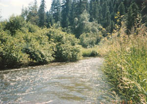
The Okanogan River is a tributary of the Columbia River, approximately 115 mi (185 km) long, in southern British Columbia and north central Washington. It drains a scenic plateau region called the Okanagan Country east of the Cascade Range and north and west of the Columbia, and also the Okanagan region of British Columbia. The Canadian portion of the river has been channelized since the mid-1950s.
The Confederated Tribes of the Colville Reservation is the federally recognized tribe that controls the Colville Indian Reservation, which is located in northeastern Washington, United States. It is the government for its people.
Brian Franklin Atwater is a geologist who works for the United States Geological Survey and is also a research professor at the University of Washington.

The Keller Ferry or Clark Ferry, is a ferry crossing on Franklin D. Roosevelt Lake in the US state of Washington. The crossing connects the northern and southern segments of State Route 21, between The Colville Indian Reservation in Ferry County and Clark in Lincoln County. The ferry run has been in operation since the 1890s and under state control since 1930. During that time, five vessels have served the crossing, including the Martha S., which operated from 1948 to 2013, and the current ferry, the M/V Sanpoil.

State Route 21 (SR 21) is a 191.34-mile (307.93 km) long state highway in the U.S. state of Washington that traverses four counties: Franklin, Adams, Lincoln and Ferry. The highway extends from an intersection with SR 260 in Kahlotus north through Lind, Odessa, Clark, Keller, Republic and Curlew before becoming Highway 41 (BC 41) at the Canada–US border in Danville. SR 21 is concurrent with U.S. Route 2 (US 2) in Wilbur and SR 20 in Republic and has two diamond interchanges: at US 395 in Lind and Interstate 90 (I-90) south of Odessa. Between Lincoln and Ferry counties, the roadway crosses Franklin D. Roosevelt Lake on the Keller Ferry, operated fare free by the Washington State Department of Transportation (WSDOT) and the Department of Highways (DoH) since 1930.

Fort Okanogan was founded in 1811 on the confluence of the Okanogan and Columbia Rivers as a fur trade outpost. Originally built for John Jacob Astor’s Pacific Fur Company, it was the first American-owned settlement within Washington State, located in what is now Okanogan County. The North West Company, the PFC's primary competitor, purchased its assets and posts in 1813. In 1821 the North West Company was merged into Hudson's Bay Company, which took over operation of Fort Okanogan as part of its Columbia District. The fort was an important stop on the York Factory Express trade route to London via Hudson Bay.

Keller is an unincorporated community and census-designated place (CDP) in southwestern Ferry County in the northeastern part of the U.S. state of Washington. As of the 2010 census, the population was 234.
The Okanagan Highland is an elevated hilly plateau area in British Columbia, Canada, and the U.S. state of Washington. Rounded mountains with elevations up to 8,000 feet above sea level and deep, narrow valleys are characteristic of the region.

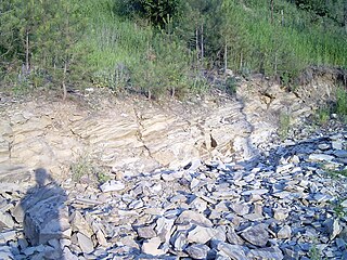
The Touchet Formation or Touchet beds consist of large quantities of gravel and fine sediment which overlay almost a thousand meters of volcanic basalt of the Columbia River Basalt Group in south-central Washington and north-central Oregon. The beds consist of between 6 and 40 distinct rhythmites - horizontal layers of sediment, each clearly demarcated from the layer below. These Touchet beds are often covered by windblown loess soils which were deposited later; the number of layers varies with location. The beds vary in depth from 330 ft (100 m) at lower elevations where a number of layers can be found to a few extremely thin layers at the maximum elevation where they are observed.

The Nespelem people belong to one of twelve aboriginal Confederated Tribes of the Colville Indian Reservation in eastern Washington. They lived primarily near the banks of the Nespelem River, an Upper Columbia River tributary, in an area now known as Nespelem, Washington, located on the Colville Indian Reservation. Alternate spellings include Nespelim or Nespilim.
The Entiat are a Native American tribe who exclusively used and occupied an area extending from the Columbia River to the Cascade Mountains along the drainage system of the Entiat River.
The Colville people are a Native American people of the Pacific Northwest. The name Colville comes from association with Fort Colville, named after Andrew Colvile of the Hudson's Bay Company. Earlier, outsiders often called them Scheulpi or Chualpay; the French traders called them Les Chaudières in reference to Kettle Falls.

Glacial Lake Columbia was the lake formed on the ice-dammed Columbia River behind the Okanogan lobe of the Cordilleran Ice Sheet when the lobe covered 500 square miles (1,300 km2) of the Waterville Plateau west of Grand Coulee in central Washington state during the Wisconsin glaciation. Lake Columbia was a substantially larger version of the modern-day lake behind the Grand Coulee Dam. Lake Columbia's overflow – the diverted Columbia River – drained first through Foster Coulee, and as the ice dam grew, through first Moses Coulee, and finally, the Grand Coulee.

Plateau Sign Language, or Old Plateau Sign Language, is a poorly attested, extinct sign language historically used across the Columbian Plateau. The Crow Nation introduced Plains Sign Talk, which replaced Plateau Sign Language among the eastern nations that used it, with western nations shifting instead to Chinook Jargon.
The Klondike Mountain Formation is an early Eocene geological formation located in the northeast central area of Washington State. The formation, named for the type location designated in 1962, Klondike Mountain north of Republic, Washington, is composed of volcanic rocks in the upper unit and volcanics plus lacustrine (lakebed) sedimentation in which a lagerstätte with exceptionally well-preserved plant and insect fossils has been found, along with fossil epithermal hot springs.
Pine Grove is a census-designated place located in Ferry County, Washington, United States.
Twin Lakes is a census-designated place in Ferry County, Washington, United States.
Torboy is a census-designated place in Ferry County, Washington, United States.