Schinkel (Osnabrück district)

Last updated

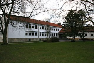
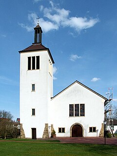
Schinkel is a district of Osnabrück, Germany, first mentioned in records in 1332. It is situated in the east of the city, into which it was incorporated on 1 April 1914. There are roughly 13,300 people in Schinkel.

Osnabrück Place in Lower Saxony, Germany

Osnabrück is a city in the federal state of Lower Saxony in north-west Germany. It is situated in a valley penned between the Wiehen Hills and the northern tip of the Teutoburg Forest. With a population of 168,145 Osnabrück is one of the four largest cities in Lower Saxony. The city is the centrepoint of the Osnabrück Land region as well as the District of Osnabrück.

Germany Federal parliamentary republic in central-western Europe

Germany, officially the Federal Republic of Germany, is a country in Central and Western Europe, lying between the Baltic and North Seas to the north, and the Alps to the south. It borders Denmark to the north, Poland and the Czech Republic to the east, Austria and Switzerland to the south, France to the southwest, and Luxembourg, Belgium and the Netherlands to the west.

Contents

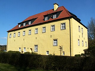
The name Schinkel is possibly a reference to the flank-like (Schenkel) form of the Schinkelberg (Schinkel Hill); however the exact meaning and origin of the name are unknown. Contrary to some claims it is unlikely that the district was named after the Prussian builder Karl Friedrich Schinkel. Colloquially and among local residents, the district tends to be referred to as “der” (the) Schinkel.

Prussia state in Central Europe between 1525–1947

Prussia was a historically prominent German state that originated in 1525 with a duchy centred on the region of Prussia on the southeast coast of the Baltic Sea. It was de facto dissolved by an emergency decree transferring powers of the Prussian government to German Chancellor Franz von Papen in 1932 and de jure by an Allied decree in 1947. For centuries, the House of Hohenzollern ruled Prussia, successfully expanding its size by way of an unusually well-organised and effective army. Prussia, with its capital in Königsberg and from 1701 in Berlin, decisively shaped the history of Germany.

Karl Friedrich Schinkel Prussian architect, city planner, and painter

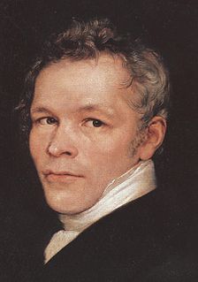
Karl Friedrich Schinkel was a Prussian architect, city planner, and painter who also designed furniture and stage sets. Schinkel was one of the most prominent architects of Germany and designed both neoclassical and neogothic buildings. His most famous buildings are found in and around Berlin.

Geography

The Schinkel district’s original boundaries originally encompassed today’s districts of Schinkel, Schinkel-Ost, Widukindland, the southern part of Dodesheide, the western part of Darum/Gretesch/Lüstringen and the north-west corner of Voxtrup; in the city of Osnabrück districts were not arranged based on the boundaries of former areas or communities.

Schinkel-Ost is a district of Osnabrück, Germany. It originally lay within the former boundaries of Schinkel, which was incorporated into Osnabrück in 1914. Schinkel-Ost is home to roughly 3,500 residents. The evangelical Jakobuskirche, Catholic Rosenkranzkirche, “Blau-Weiß” (blue-white) sports team, Diesterwegschule and the Gesamtschule Schinkel are located in this district.

Widukindland human settlement in Germany

Widukindland is a district of Osnabrück, Germany. It is situated in the north-east of the city, on the slopes of the Schinkelberg. It arose from the former boundaries of Schinkel.

Dodesheide human settlement in Germany

Dodesheide is a town in the borough of Osnabrück, Germany; with a population of roughly 7,900 residents it is located to the north-east of the city. Its boundaries are delineated in the north by the Vehrter Landstraße, in the west by the landwehr – a former defensive line around the town consisting of a bank and ditches – in the south by the Sandbach and the Osnabrück-Bremen railway line; the city boundary itself marks its eastern border. It is made up of sections of the former districts of Schinkel and Haste.

Next to the district of Schinkel there is also the district of Schinkel-Ost, which is home to about 3,500 people. The district of Gartlage is also commonly regarded as being part of Schinkel, even though it never actually lay within Schinkel's boundaries.

Gartlage human settlement in Germany

Gartlage is a district of the city of Osnabrück, Lower Saxony, Germany. It is situated next to the Innenstadt.

Infrastructure

Pauluskirche (St. Paul's Church) Osnabruck Schinkel Pauluskirche.jpg
Pauluskirche (St. Paul’s Church)
Heilig-Kreuz-Kirche (Church of the Holy Cross) Osnabruck Schinkel Heilig-Kreuz-Kirche.jpg
Heilig-Kreuz-Kirche (Church of the Holy Cross)
Gnadenkirche (Church of Mercy) Osnabruck Schinkel Gnadenkirche.jpg
Gnadenkirche (Church of Mercy)

During World War II most of the residential houses in Osnabrück were destroyed in air raids. The first attack on the Schinkel area, on 23 June 1940, was directed at the Osnabrücker Kupfer- und Drahtwerk (Osnabrück Copper and Wire Works, abbreviated OKD, today KM Europa Metal) – by the time the war finished in May 1945, 65% of it had been destroyed.

World War II 1939–1945 global war

World War II, also known as the Second World War, was a global war that lasted from 1939 to 1945. The vast majority of the world's countries—including all the great powers—eventually formed two opposing military alliances: the Allies and the Axis. A state of total war emerged, directly involving more than 100 million people from over 30 countries. The major participants threw their entire economic, industrial, and scientific capabilities behind the war effort, blurring the distinction between civilian and military resources. World War II was the deadliest conflict in human history, marked by 50 to 85 million fatalities, most of whom were civilians in the Soviet Union and China. It included massacres, the genocide of the Holocaust, strategic bombing, premeditated death from starvation and disease, and the only use of nuclear weapons in war.

Today’s Schinkel is characterized by its integration of numerous nationalities. The district is home to numerous primary schools and kindergartens; however the local library had to close in 2010 due to the city’s troubled economic situation. The district is also popular among older citizens. Around the Schützenstraße area lies the beating heart of Schinkel: numerous shops, pharmacies, doctors and bank branches. Every Wednesday there is a Wochenmarkt (weekly market) on Ebertallee, located between the Heilig-Kreuz-Kirche and the Pauluskirche. On Buerschen Straße there are several new facilities for senior citizens as well as the “Junger Schinkel” (Young Schinkel) project. A residential area with terraced houses has encouraged many families to live in Schinkel. Sports clubs (such as VfL Osnabrück, SC Türkgücü, VfB Schinkel, Blau-Weiß Schinkel, Sportfreunde Schinkel-Ost), a citizens’ association, numerous choirs and a convivial atmosphere also define this district's character. Its spacious indoor swimming pool – the Schinkelbad – attracts many visitors. Schinkel is also the location of the osnatel-Arena, located by the Bremer bridge – the stadium of VfL Osnabrück.

Kindergarten preschool educational approach traditionally based on playing

Kindergarten is a preschool educational approach based on playing, singing, practical activities such as drawing, and social interaction as part of the transition from home to school. Such institutions were originally created in the late 18th century in Bavaria and Strasbourg to serve children whose parents both worked outside home. The term was coined by the German Friedrich Fröbel, whose approach globally influenced early-years education. Today, the term is used in many countries to describe a variety of educational institutions and learning spaces for children ranging from two to seven years of age, based on a variety of teaching methods.

VfL Osnabrück sports club in Germany

VfL Osnabrück is a German multi-sport club in Osnabrück, Lower Saxony. It currently fields teams in basketball, gymnastics, swimming, table tennis, and tennis, but is by far best known for its football section.

Schinkel is the home of the 1. Osnabrücker Nachbarschaftsverein (First Neighbourhood Association).

There are also two Evangelical/Protestant churches – the Pauluskirche and the Jakobuskirche (Jacobus Church) – two Catholic churches – the Heilig-Kreuz-Kirche and the St. Maria Rosenkranzkirche (St. Mary’s Rosary Church) – and two mosques (Fatih Camii and Takwa). The Reformed Protestant Gnadenkirche (Church of Mercy), built in 1960, was completely pulled down apart from its bell tower due to financial difficulties, to make way for a day care centre for children. [1]

The Schinkelberg and Gartlage are two green belts, which offer their residents particularly good opportunities for recreation. Two bunkers are situated on Oststraße – the Ostbunker and a round bunker on the site of the railway repair works. It is colloquially referred to as “Otto Bunker”; this name is even visible on the bunker itself. [2]

The railway depot in Schinkel, which was established in 1876, was in earlier times colloquially referred to as “Kamerun” (Cameroon). [3] The depot was demolished in April 2009; since then a discount food and clothing store has been built on the site. Schinkel is a district rich in tradition, with developed residential and business infrastructure. Its roots stretch back to the 19th century. Leasers and traders live and work here – some have done for generations. This cultural image is more pronounced here than in any other district of Osnabrück.

Personalities

The pastor Richard Karwehl was active in the evangelical Pauluskirche during the period of Nazi rule – having taken up opposition to [Nazi Party|National Socialism]] due to his Christian convictions, he was also an active figure in the Confessing Church. The square in front of the church is named after him (Richard-Karwehl-Platz).

The journalist and author Harald Wehmeier (born 1953) was born in Schinkel.

Transportation

Osnabrück’s tram line 3 operated in Schinkel until 1958, running from the terminus station “Schinkel” on the corner between Schützenstraße and Bremer Straße and passing through Schützenstraße and Buersche Straße towards Neumarkt-Martiniplatz (today Heinrich-Lübke-Platz, named after Germany’s second Federal President) in the Weststadt district.

Today the district is served by bus lines 11/12/13, 71/72, 91/92 – each running every ten minutes – connecting it to the nearby Innenstadt (city centre) and surrounding districts.

The construction of a regional train station in the Bremer Brücke/Halle Gartlage area is being considered – earlier a platform for special trips was situated here. The police have given support to this idea in the citizens’ forum, with regards to football matches and visitors to the stadium.

Related Research Articles

Holy Cross Church, Frankfurt-Bornheim Church in Frankfurt-Bornheim, Germany

The Holy Cross Church is a Catholic church in the Bornheim district of Frankfurt am Main (Germany). It is similar in design to the Frauenfriedenskirche in Frankfurt-Bockenheim. It was built by Martin Weber from 1928 to 1929, on a rise then known as Bornheimer Hang. The church is an unusual example of interwar modernism as sacred Bauhaus architecture.

Schölerberg human settlement in Germany

Schölerberg is a district of Osnabrück, Germany, with approximately 13,900 residents.

Wüste is a district of the city of Osnabrück, Lower Saxony, Germany. With almost 14,000 residents it is the most populous district of Osnabruck. It is made up of the two subdivisions “Vordere Wüste” and “Hintere Wüste”. Its central location and good infrastructure make it an appealing residential area.

Weststadt (Osnabrück district) human settlement in Germany

Weststadt is a district of the city of Osnabrück with around 9,000 residents. It is located to the west of the Innenstadt district, on which it borders along with the districts of Westerberg, Wüste and Hellern.

Westerberg (Osnabrück district) human settlement in Germany

Westerberg is a district of Osnabrück, Lower Saxony, Germany, with roughly 8,700 residents. It is situated in the west of the city between Lotter Straße and Pagenstecherstraße. The districts bordering it are Eversburg, Hafen, Sonnenhügel, Innenstadt, Weststadt, Hellern and Atter. The border with Atter passes through the Rubbenbruchsee, part of a large local recreation area.

Hafen (Osnabrück) human settlement in Germany

Hafen (Harbour) is a district of Osnabrück, Lower Saxony. Germany. It is located in the north-west of the city and had a population of roughly 2,358 residents in 1,454 households as of late 2008. One year earlier the city had 2,372 residents. It covers an area of 407.2 hectares.

Sonnenhügel is a district of Osnabrück, Germany, located over the northern border of the Innenstadt district.

Hellern human settlement in Germany

Hellern is a district of Osnabrück with roughly 6,800 residents, located on the western and south-western borders of the city. It is bordered by the Atter, Westernerg, Weststadt, Wüste and Sutthausen districts; on its west and south-west it borders on the municipality of Lotte in North Rhine-Westphalia and also Hasbergen in the surrounding district of Osnabrück. Hellern is located in the valley of the small Düte river.

Fledder human settlement in Germany

Fledder is a district in the east of Osnabrück, Germany, characterised by its large prevalence of industrial estates. Despite being the location of numerous businesses and large supermarkets the district has comparatively few residential buildings; its population is roughly 2,400.

Kalkhügel human settlement in Germany

Kalkhügel is a district of Osnabrück, Germany with a population of roughly 5,900 residents. It is home to both a Protestant and a Catholic church. There is also a school centre (Schulzentrum) located in the district.

Haste is a district in the north-east of Osnabrück, Germany. It is the fifth-largest district in the city on the River Hase, with a total land area of 788.8 hectares. Currently it has a population of about 6,600.

Sutthausen is a district of Osnabrück, Germany, with a population of about 4,500 residents. It is located in the south of the city, close to the Teutoburg Forest; it originally arose from two separate estates, Gut Sutthausen and Gut Wulften. The district has both Protestant and Catholic churches - respectively the Apostelkirche and the Marienkirche.

Atter (Osnabrück) human settlement in Germany

Atter is a district in the west of Osnabrück, Lower Saxony, Germany, with a population of 4,135 residents across 2,030 households. Covering an area of 1,075.9 hectares, it was incorporated into the city of Osnabrück on 1 July 1972. The districts on which it borders are Eversburg (NE), Westerberg (SE), and Hellern (S). On the west it borders on the municipality of Lotte in North Rhine-Westphalia; Autobahn 1 also passes through this area. The border with Westerberg runs through the Rubbenbruchsee, a local recreation area.

Voxtrup is a district in the south-east of Osnabrück, Germany, with a population of roughly 7,000 residents. It is home to the Evangelical Margaretenkirche and the Catholic St. Antonius Kirche.

Nahne is a district in the south of Osnabrück, Germany with a population of 2,241 residents, thus making it the city’s smallest district in terms of population. It covers an area of 4.854 km2.

Centre for Christian Meditation and Spirituality of the Diocese of Limburg

The Centre for Christian Meditation and Spirituality is an institution of the Diocese of Limburg, Germany. It is based at the Holy Cross Church in Frankfurt-Bornheim and is dedicated to services, contemplation, meditation, retreats, counseling, and other events such as concerts.

References

  1. Neue Osnabrücker Zeitung, 7 May 2011, p.27
  2. Luftschutz, Bunker und Stollen in Osnabrück (Air Raid Protection, Bunkers and Tunnels in Osnabrück) (in German)
  3. “Unser Schinkel” (Our Schinkel) newspaper (in German)

Coordinates: 52°16′45″N8°04′50″E / 52.2792°N 8.0806°E / 52.2792; 8.0806