Schnega | |
|---|---|
 Schnega  Schnega | |
| Coordinates: 52°53′N10°53′E / 52.883°N 10.883°E Coordinates: 52°53′N10°53′E / 52.883°N 10.883°E | |
| Country | Germany |
| State | Lower Saxony |
| District | Lüchow-Dannenberg |
| Municipal assoc. | Lüchow (Wendland) |
| Government | |
| • Mayor | Annegret Gerstenkorn (CDU) |
| Area | |
| • Total | 53.95 km2 (20.83 sq mi) |
| Elevation | 45 m (148 ft) |
| Population (2017-12-31) [1] | |
| • Total | 1,326 |
| • Density | 25/km2 (64/sq mi) |
| Time zone | CET/CEST (UTC+1/+2) |
| Postal codes | 29465 |
| Dialling codes | 05842 |
| Vehicle registration | DAN |
Schnega is a municipality in the district Lüchow-Dannenberg, in Lower Saxony, Germany.
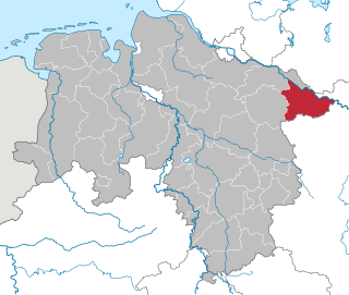
Lüchow-Dannenberg is a district in Lower Saxony, Germany, which is usually referred to as Hanoverian Wendland or Wendland. It is bounded by the districts of Uelzen and Lüneburg and the states of Mecklenburg-Western Pomerania, Brandenburg and Saxony-Anhalt.

Lower Saxony is a German state (Land) situated in northwestern Germany. It is the second-largest state by land area, with 47,624 km2 (18,388 sq mi), and fourth-largest in population among the 16 Länder federated as the Federal Republic of Germany. In rural areas, Northern Low Saxon and Saterland Frisian are still spoken, but the number of speakers is declining.

Germany, officially the Federal Republic of Germany, is a country in Central and Western Europe, lying between the Baltic and North Seas to the north, and the Alps to the south. It borders Denmark to the north, Poland and the Czech Republic to the east, Austria and Switzerland to the south, France to the southwest, and Luxembourg, Belgium and the Netherlands to the west.

Towns and municipalities in Lüchow-Dannenberg (district) | ||
|---|---|---|
 | ||