
Osmaniye Province is a province in south-central Turkey. It was named Cebel-i Bereket in the early republic until 1933, when it was incorporated into Adana Province. It was made a province again in 1996. Its area is 3,320 km2, and its population is 559,405 (2022). The province is situated in Çukurova, a geographical, economical and cultural region. The capital of the province is Osmaniye. Other major towns include Kadirli and Düziçi.

Bilecik is a city in northwestern Anatolia, Turkey. It is the seat of Bilecik Province and Bilecik District. Its population is 74,457 (2021). The mayor is Melek Mızrak Subaşı (CHP).

Osmaniye is a city on the eastern edge of the Çukurova plain in southern Turkey. It is the seat of Osmaniye Province and Osmaniye District. Its population is 252,186 (2022).
Dinar is a town of Afyonkarahisar Province in the Aegean region of Turkey, 106 km from the city of Afyon. It is the seat of Dinar District. Its population is 26,300 (2021). The mayor is Saffet Acar (MHP).

Dursunbey, formerly Balat, is a municipality and district of Balıkesir Province, Turkey. Its area is 1,719 km2, and its population is 33,333 (2022). The mayor is Ramazan Bahçavan (AKP). Dursunbey is noted for its wood and apples.
Tefenni is a town in Burdur Province in the Mediterranean region of Turkey. It is the seat of Tefenni District. Its population is 7,381 (2021). It consists of 10 quarters: Kır, Yenice, Yokuş, Zafer, Esentepe, Eceköy, Eşeler, Fatih, Pazar and Göktürk.
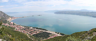
Eğirdir is a town in Isparta Province in the Mediterranean Region of Turkey. It is the seat of Eğirdir District. Its population is 16,759 (2022).

Ilgın is a municipality and district of Konya Province, Turkey. Its area is 1,636 km2, and its population is 53,489 (2022). Its elevation is 1,030 m (3,380 ft).
İslahiye is a municipality and district of Gaziantep Province, Turkey. Its area is 865 km2, and its population is 67,650 (2022). It is a railway border crossing into Syria. Near İslahiye is the site of ancient Nicopolis.

İpsala is a town in Edirne Province in northwestern Turkey. It is the seat of İpsala District. Its population is 8,546 (2022). It is the location of one of the main border checkpoints between Greece and Turkey. The Greek town opposite İpsala is Kipoi.

Karaisalı is a municipality and district of Adana Province, Turkey. Its area is 1,165 km2, and its population is 22,042 (2022).

Köyceğiz is a municipality and district of Muğla Province, Turkey. Its area is 1,329 km2, and its population is 39,242 (2022).
Simav is a town in Kütahya Province in the Aegean region of Turkey. It is the seat of Simav District. Its population is 26,872 (2022). The town is located on the Simav River.
Tavşanlı is a city in Kütahya Province in the Aegean region of Turkey. It is the seat of Tavşanlı District. Its population is 73,306 (2022).

Ulukışla is a town in Niğde Province in the Central Anatolia region of Turkey. It is the seat of Ulukışla District. Its population is 5,696 (2022). Its altitude is 1,427 m.

Yunak is a municipality and district of Konya Province, Turkey. Its area is 2,101 km2, and its population is 20,991 (2022).

Acıpayam is a municipality and district of Denizli Province, Turkey. Its area is 1,772 km2, and its population is 54,888 (2022). It lies in high country between the Aegean and Mediterranean regions. A plain, watered by two reservoirs, known for growing melons and watermelons, on the road between the city of Denizli and Antalya. Its altitude is 895 m.

Demre is a municipality and district of Antalya Province, Turkey. Its area is 329 km2, and its population is 27,691 (2022). It was named after the river Demre.
Yatağan is a neighbourhood of the municipality and district of Serinhisar, Denizli Province, Turkey. Its population is 2,534 (2022). Before the 2013 reorganisation, it was a town (belde).
Gediz is a town in Kütahya Province in the Aegean region of Turkey. It is the seat of Gediz District. Its population is 26,662 (2022).
