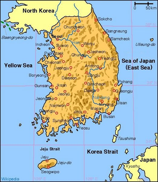
South Korea is located in East Asia,on the southern portion of the Korean Peninsula located out from the far east of the Asian landmass. The only country with a land border to South Korea is North Korea,lying to the north with 238 kilometres (148 mi) of the border running along the Korean Demilitarized Zone. South Korea is mostly surrounded by water and has 2,413 kilometres (1,499 mi) of coast line along three seas;to the west is the Yellow Sea,to the south is the East China Sea,and to the east is the Sea of Japan. Geographically,South Korea's landmass is approximately 100,032 square kilometres (38,623 sq mi). 290 square kilometres (110 sq mi) of South Korea are occupied by water. The approximate coordinates are 37°North,128°East.

The Los Angeles River,historically known as Paayme Paxaayt by the Tongva and the Río Porciúncula by the Spanish,is a major river in Los Angeles County,California. Its headwaters are in the Simi Hills and Santa Susana Mountains,and it flows nearly 51 miles (82 km) from Canoga Park through the San Fernando Valley,Downtown Los Angeles,and the Gateway Cities to its mouth in Long Beach,where it flows into San Pedro Bay. While the river was once free-flowing and frequently flooding,forming alluvial flood plains along its banks,it is currently notable for flowing through a concrete channel on a fixed course,which was built after a series of devastating floods in the early 20th century.

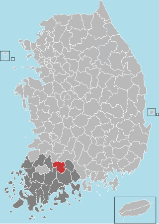
South Jeolla Province,also known as Jeonnam,is a province in the Honam region,South Korea,and the southernmost province in mainland Korea. South Jeolla borders the provinces of North Jeolla to the north,South Gyeongsang to the northeast,and Jeju to the southwest in the Korea Strait.

The Geum River is a major river of South Korea that originates in Jangsu-eup,North Jeolla Province. It flows northward through North Jeolla and North Chungcheong Provinces and then changes direction in the vicinity of Greater Daejeon and flows southwest through South Chungcheong Province before emptying into the Yellow Sea near Gunsan city.

The Calumet River is a system of heavily industrialized rivers and canals in the region between the south side of Chicago,Illinois,and the city of Gary,Indiana. Historically,the Little Calumet River and the Grand Calumet River were one,the former flowing west from Indiana into Illinois,then turning back east to its mouth at Lake Michigan at Marquette Park in Gary. Now the system is part of the Chicago Area Waterway System and through the use of locks flows away from Lake Michigan to the Cal-Sag Channel.

Hwacheon County is a county in Gangwon Province,South Korea. The northern border is,in some places,within nine kilometres of the Korean Demilitarized Zone. Neighboring counties are Cheorwon to the northwest and north,Yanggu to the east,Chuncheon to the south,and the Gyeonggi-do province to the southwest. The county consists largely of mountains and rivers,between which are small farming communities,military bases and military training grounds. The area is renowned for its rivers,lake trout,indigenous otters,and natural scenery.
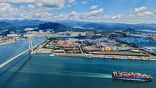
Gwangyang is a city in South Jeolla Province,South Korea. Gwangyang city is the home of POSCO's Gwangyang Steel Works,the largest facility of its kind in the world. The city is also home to K League Classic football side Jeonnam Dragons.
Gokseong County is a county in Jeollanam-do,South Korea and the least densely populated subdivision of the province.

Imsil County is a county in North Jeolla Province,South Korea. Imsil County is a county in central South Jeolla Province,South Korea. It is an area upstream of the Seomjingang River in the Noryeong Mountains,and there is a basin that runs southeast to Namwon. The county office is located in Imsil-eup,and the administrative district is 11 myeon,1eup.

Jinan County (Jinan-gun) is a county in North Jeolla Province,South Korea.

Hadong County is a county in South Gyeongsang Province,South Korea. It is on the far-west side of the province,bordering South Jeolla Province. The county office is located at Hadeong-eup.

The River Dodder is one of the three main rivers in Dublin,Ireland,the others being the Liffey,of which the Dodder is the largest tributary,and the Tolka.

Korea comprises the Korean Peninsula and 3,960 nearby islands. The peninsula is located in Northeast Asia,between China and Japan. To the northwest,the Amnok River separates Korea from China and to the northeast,the Duman River separates Korea from China and Russia. The Yellow Sea lies to the west,the East China Sea and Korea Strait to the south,and the Korean East Sea to the east. Notable islands include Jeju Island (Jejudo),Ulleung Island (Ulleungdo),and the Liancourt Rocks.
The Shellmouth Reservoir is a man-made reservoir on the Assiniboine River in Manitoba and Saskatchewan,Canada.
The Sincheon is a stream flowing through eastern Daegu,South Korea. It rises from the Naengcheon and other streams in Gachang-myeon,Dalseong-gun,in the rural south of the city,and flows north through the east side of the city center to reach the Geumho River. For much of its length it is bordered by a riverwalk on either side. In addition,the west bank is the site of the Sincheon Expressway.

The River Mease is a lowland clay river in the Midlands area of England. It flows through the counties of Leicestershire,Derbyshire and Staffordshire and forms the administrative border between these counties for parts of its length.
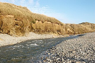
The Red River is a small river in north-west Cornwall,England,United Kingdom which issues into St Ives Bay at Godrevy on Cornwall's Atlantic coast. The Red River is about 8 miles (13 km) long and was given its name from the mineral deposits associated with tin mining,particularly oxides of Iron,which formerly coloured its water red. The river's gradient is relatively steep;the stream falls 170 metres (560 ft) from source to sea.
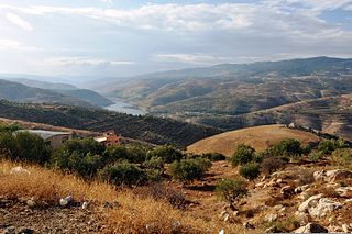
The Zarqa River is the second largest tributary of the lower Jordan River,after the Yarmouk River. It is the third largest river in the region by annual discharge and its watershed encompasses the most densely populated areas east of the Jordan River. The Zarqa rises in springs near Amman,and flows through a deep and broad valley into the Jordan,at an elevation 1,090 metres (3,580 ft) lower.

The Marismas de Isla Cristina are located at the mouth of the river Carreras in the province of Huelva,Andalusia,in southern Spain. Created in 1989,the natural park has a surface area of 21.45 square kilometres (8.28 sq mi),shared between the municipalities of Ayamonte and Isla Cristina.

