Serejeqa

Last updated

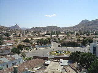
Serejeqa (Arabic : سيريجاكا, Tigrinya : ሰረጃቓ) is a town in the Anseba Region of Eritrea. It is located about 20 km northwest of Asmara on the asphalt road to Keren, which in turn lies roughly 75 km away. The town is situated on the ridge of the Eritrean highlands. It is the upper endpoint of a gravel-road that traverses the eastern escarpments and has its other endpoint in Shebah, on the low-lying plains at the foot of escarpments. With this gravel road, Serejeqa connects the north-western part of the highlands, including the city of Keren (Eritrea's third largest city) with the Red Sea and the port of Massawa (the second largest city). This route can be traveled without having to pass through the congested capital and largest city Asmara or use the equally congested mountain-segment of the Asmara-Massawa asphalt road. Instead, the gravel road beginning in Serejeqa on one end, connects to the She'eb-Gahtelai asphalt road, which in turn unites with the less congested lowland part of the Massawa asphalt road, just 35 km from Massawa itself. Due to its proximity and connections to Asmara, Serejeqa also functions as a suburb of the capital, although it is not part of the metropolitan region of the capital (i.e. Maekel or Central Region).

Tigrinya, often written as Tigrigna is an Afro-Asiatic language, belonging to the family's Semitic branch. It is spoken by ethnic Tigray-Tigrinya in the Horn of Africa. Tigrinya speakers primarily inhabit the Tigray Region in northern Ethiopia (96%), where its speakers are called Tigrawot, as well as the contiguous borders of southern and central Eritrea (57%), where speakers are known as the Tigrinya. Tigrinya is also spoken by groups of emigrants from these regions, including some Beta Israel.

Anseba Region Regions in Eritrea

Anseba Region is one of the six administrative regions, located in northern Eritrea. The capital and the most populous city in the region is Keren. The region is named after Anseba River, which passed through most parts of the region. The average elevation in the region is around 1,800 m (5,900 ft) to 2,100 m (6,900 ft). The hottest month is May recording temperatures up to 30 °C (86 °F), while the coldest month is December to February when it reaches freezing temperature. The region received around 508 mm (20.0 in) of rainfall and the soil is conducive for agriculture.
Eritrea country in the Horn of Africa

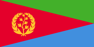
Eritrea, officially the State of Eritrea is a country in the Horn of Africa, with its capital at Asmara. It is bordered by Sudan in the west, Ethiopia in the south, and Djibouti in the southeast. The northeastern and eastern parts of Eritrea have an extensive coastline along the Red Sea. The nation has a total area of approximately 117,600 km2 (45,406 sq mi), and includes the Dahlak Archipelago and several of the Hanish Islands. Its toponym Eritrea is based on the Greek name for the Red Sea, which was first adopted for Italian Eritrea in 1890.
Related Research Articles

Transport in Eritrea

Transport in Eritrea includes highways, airports and seaports, in addition to various forms of public and private vehicular, maritime and aerial transportation.

Asmara Capital in Maekel, Eritrea

Asmara, or Asmera, is the capital and most populous city of Eritrea and the Central Region. It sits at an elevation of 2,325 metres (7,628 ft), making it the sixth highest capital in the world by altitude. The city is located at the tip of an escarpment that is both the northwestern edge of the Eritrean highlands and the Great Rift Valley in neighbouring Ethiopia. In 2017, the city was declared as a UNESCO World Heritage Site for its well-preserved modernist architecture. Asmara was first settled in 800 BC with a population ranging from 100 to 1000. The city was then founded in the 12th century CE after four separate villages unified to live together peacefully after long periods of conflict.

Eritrean Railway

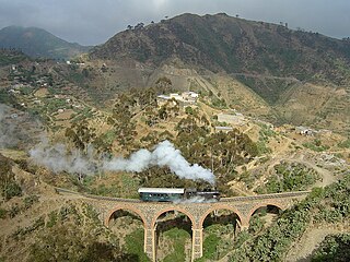
The Eritrean Railway is the only railway system in Eritrea. It was constructed between 1887 and 1932 by the Kingdom of Italy for the Italian Eritrea colony and connected the port of Massawa with Asmara and Bishia near the Sudan border. The line was destroyed by warfare in subsequent decades, but has been rebuilt between Massawa and Asmara. Vintage equipment is still used on the line.

Massawa City in Northern Red Sea, Eritrea

Massawa is a city on the Red Sea coast of Eritrea located at the northern end of the Gulf of Zula beside the Dahlak Archipelago. As a historical and important port for many centuries, it was ruled by a succession of polities, including the Axumite Empire, Medri Bahri Kingdom, the Umayyad Caliphate, various Beja sultanates, the Ottoman Empire, the Khedivate of Egypt, Italy, Britain, and Ethiopia, until Eritrea's independence in 1991. Massawa was the capital of the Italian Colony of Eritrea until it was moved to Asmara in 1897.

Asmara-Massawa Cableway Aerial lift in Asmara, Eritrea

The Asmara-Massawa Cableway was a cableway built in Italian Eritrea before World War II.The Eritrean Ropeway, completed in 1937, ran 71.8 km from the south end of Asmara until the city-port of Massawa.

Keren, Eritrea City in Anseba, Eritrea

Keren, formerly known as Cheren and Sanhit, is the second-largest city in Eritrea. It is situated around 91 kilometres (57 mi) northwest of Asmara at an elevation of 1,390 metres (4,560 ft) above sea-level. The town sprawls on a wide basin surrounded by granitic mountains on all sides. It serves as the capital of the Anseba region, and is home to the Bilen people.

Arkiko Town in Northern Red Sea, Eritrea

Arkiko is a town in the Northern Red Sea region of Eritrea. Situated on the Red Sea, it lies on the mainland across from the island of Massawa.

Asmara International Airport airport

Asmara International Airport, formerly known as Yohannes IV International Airport, is the international airport of Asmara, the capital of Eritrea. It is the country's largest airport and, as of Spring 2017, the only one receiving regularly scheduled services.

Barentu, Eritrea Place in Gash-Barka, Eritrea

Barentu is a town in north-western Eritrea, lying south of Agordat, and is the capital of Gash-Barka Region. The town is integrated with different types of tribes: Kunama, Nara, Tigre and Tigrigna being the dominant.

Modern banking in Eritrea started with the arrival of the Italian colonizers. However, from 1974 on, the banking sector became a government monopoly. This situation continued after Eritrea achieved its independence. The Bank of Eritrea is the central bank of Eritrea.

Articles related to Eritrea include:

Battle of Keren 1941 battle in Africa

The Battle of Keren was fought as part of the East African Campaign during the Second World War. The engagement took place from 5 February to 1 April 1941, between a mixed Italian army of regular and colonial troops and British and Free French forces. The town of Keren, in the colony of Italian Eritrea, was of strategic importance to both sides in 1941. The road and railway through Keren were the main routes to the colonial capital at Asmara and the Red Sea port of Massawa, which surrendered to the British after the battle.

Gahtelai is the name of a river, town and plain situated in the Northern Red Sea administrative region of Eritrea. It is not the correct meaning of Gahtelai written in Tigrinya. Because the word is of Saho "gahte" means is back and "lai" means water. Gahtelai Means back water, because the river is seasonal . In addition the region is mainly inhabited by the Saho people.

She'eb is a town in the Northern Red Sea region of Eritrea. It lies on the fertile plain at the foot of the eastern escarpment of the Eritrean Highlands.

Shebah is an agricultural settlement on the plains beneath and east of the eastern escarpment of the Eritrean highlands which forms part of the Northern Red Sea administrative region with its capital in Massawa. It is situated about halfway on the She'eb-Gahtelai road and is also the end-point of a gravel road which traverses the eastern escarpment and has its other end-point at the highland town of Serejeqa on the Asmara-Keren asphalt road. Shebah like She'eb was the site of a massacre at the hands of Ethiopian occupational troops in 1988, but has since largely recovered, with its exiled population returning and engaging in agriculture.

Massawa Subregion is a subregion in the Northern Red Sea region of Eritrea. Its capital lies at Massawa.

The 2009 Tour of Eritrea was the 10th edition of the Tour of Eritrea. It started on 16 December ended on December 20. This latest Tour of Eritrea 2009 edition invited 6 national teams in recognition of its acceptance by International Cycling Union (UCI) as one Africa’s internationally recognized tours.

Italian Eritrea Italian 1890-1947 possession in East Africa

Italian Eritrea was a colony of the Kingdom of Italy in the territory of present-day Eritrea. Although it was formally created in 1890, the first Italian settlements in the area were established in 1882 around Assab. The colony officially lasted until 1947.

The following is a timeline of the history of the city of Asmara, Eritrea. Asmara was under Italian colonial rule from 1889 until 1941.

References