Shalersville Township, Portage County, Ohio

Last updated

Shalersville Township
Shalersville Town Hall 7-18-22 (2).jpg
Shalersville Town Hall
Portage County Shalersville.png
Location within Portage County
Coordinates: 41°14′44″N81°15′37″W / 41.24556°N 81.26028°W / 41.24556; -81.26028
Country United States
State Ohio
County Portage
Area
  Total27.6 sq mi (71.5 km2)
  Land27.5 sq mi (71.3 km2)
  Water0.1 sq mi (0.2 km2)
Elevation
[1]
1,119 ft (341 m)
Population
 (2020) [2]
  Total5,245
  Density190.7/sq mi (73.6/km2)
Time zone UTC-5 (Eastern (EST))
  Summer (DST) UTC-4 (EDT)
ZIP code
44255, 44266, 44241
Area code(s) 330, 234
FIPS code 39-71731 [3]
GNIS feature ID1086839 [1]
Website Township website

Shalersville Township is one of the eighteen townships of Portage County, Ohio, United States. The 2020 census found 5,245 people in the township.

Contents

Geography

Located in the northwestern part of the county, it borders the following other townships and cities:

No municipalities are located in Shalersville Township.

Formed from the Connecticut Western Reserve, Shalersville Township covers an area of 28 sq mi (73 km2).

Historic population figures

Name and history

Shalersville takes its name from its original proprietor, General Nathaniel Shaler and was originally known as "Middletown" as Shaler was a native of Middletown, Connecticut. [4] It is the only Shalersville Township statewide. [5] The first settlers, the family of Joel Baker of Tolland County, Connecticut, arrived in 1806 and the township government was organized in 1812. The township was formed from town 4, range 8 of the Connecticut Western Reserve. [6] A post office called Shalersville was established in 1824, and remained in operation until 1904. [7]

Government

The township is governed by a three-member board of trustees, who are elected in November of odd-numbered years to a four-year term beginning on the following January 1. Two are elected in the year after the presidential election and one is elected in the year before it. There is also an elected township fiscal officer, [8] who serves a four-year term beginning on April 1 of the year after the election, which is held in November of the year before the presidential election. Vacancies in the fiscal officership or on the board of trustees are filled by the remaining trustees.

Transportation

Ohio State Routes 303 and 44 pass through Shalersville and intersect at the middle of the township. The Ohio Turnpike also cuts through Shalersville, and in the 1990s the exit at State Route 44 was added. The Portage County Airport is located in the southern part of the township.

Notable residents

Related Research Articles

<span class="mw-page-title-main">Brimfield Township, Portage County, Ohio</span> Civil township in Portage County, Ohio, United States

Brimfield Township is one of the eighteen townships in Portage County, Ohio, United States. The 2020 census found 11,352 people in the township.

<span class="mw-page-title-main">Franklin Township, Warren County, Ohio</span> Township in Ohio, United States

Franklin Township is one of the eleven townships of Warren County, Ohio, United States. It is located in the northwest corner of the county. The population was 31,676 as of the 2020 census.

<span class="mw-page-title-main">Nelson Township, Portage County, Ohio</span> Civil township in Ohio, United States

Nelson Township is one of the eighteen townships of Portage County, Ohio, United States. The 2020 census found 3,101 people in the township.

<span class="mw-page-title-main">Hiram Township, Portage County, Ohio</span> Civil township in Ohio, United States

Hiram Township is one of the eighteen townships of Portage County, Ohio, United States. The 2020 census listed 2,396 people in the township.

<span class="mw-page-title-main">Freedom Township, Portage County, Ohio</span> Civil township in Ohio, United States

Freedom Township is one of the eighteen townships of Portage County, Ohio, United States. The 2020 census found 2,649 people in the township.

<span class="mw-page-title-main">Mantua Township, Portage County, Ohio</span> Civil township in Ohio, United States

Mantua Township is one of the eighteen townships of Portage County, Ohio, United States. The 2020 census found 4,576 people in the township.

<span class="mw-page-title-main">Palmyra Township, Portage County, Ohio</span> Township in Ohio, United States

Palmyra Township is one of the eighteen townships of Portage County, Ohio, United States. The 2020 census found 2,780 people in the township.

<span class="mw-page-title-main">Charlestown Township, Portage County, Ohio</span> Civil township in Ohio, United States

Charlestown Township is one of the eighteen townships of Portage County, Ohio, United States. The 2020 census found 1,735 people in the township.

<span class="mw-page-title-main">Rootstown Township, Portage County, Ohio</span> Township in Ohio, United States

Rootstown Township is one of the eighteen civil townships of Portage County, Ohio, United States. The 2020 census found 8,602 people in the township.

<span class="mw-page-title-main">Edinburg Township, Portage County, Ohio</span> Civil township in Ohio, United States

Edinburg Township is one of the eighteen townships of Portage County, Ohio, United States. The 2020 census found 2,351 people in the township.

<span class="mw-page-title-main">Deerfield Township, Portage County, Ohio</span> Civil township in Ohio, United States

Deerfield Township is one of the eighteen townships of Portage County, Ohio, United States. The 2020 census found 2,838 people in the township.

<span class="mw-page-title-main">Atwater Township, Portage County, Ohio</span> Civil township in Ohio, United States

Atwater Township is one of the eighteen townships of Portage County, Ohio, United States. As of the 2020 census there were 2,564 people living in the township.

<span class="mw-page-title-main">Suffield Township, Portage County, Ohio</span> Township in Ohio, United States

Suffield Township is one of the eighteen townships of Portage County, Ohio, United States. The 2020 census found 5,973 people in the township.

<span class="mw-page-title-main">Newton Township, Trumbull County, Ohio</span> Township in Ohio, United States

Newton Township is one of the twenty-four townships of Trumbull County, Ohio, United States. The 2000 census found 9,524 people in the township, 4,522 of whom lived in the unincorporated portions of the township.

<span class="mw-page-title-main">Pleasant Township, Hancock County, Ohio</span> Township in Ohio, United States

Pleasant Township is one of the seventeen townships of Hancock County, Ohio, United States. As of the 2020 census, the population was 2,377.

<span class="mw-page-title-main">Portage Township, Hancock County, Ohio</span> Township in Ohio, United States

Portage Township is one of the seventeen townships of Hancock County, Ohio, United States. As of the 2020 census, the population was 734.

<span class="mw-page-title-main">Blanchard Township, Hancock County, Ohio</span> Township in Ohio, United States

Blanchard Township is one of the seventeen townships of Hancock County, Ohio, United States. As of the 2020 census the population was 1,130.

<span class="mw-page-title-main">Troy Township, Geauga County, Ohio</span> Township in Ohio, United States

Troy Township is one of the sixteen townships of Geauga County, Ohio, United States. As of the 2020 census the population was 2,778, up from 2,567 at the 2000 census.

<span class="mw-page-title-main">Auburn Township, Geauga County, Ohio</span> Township in Ohio, United States

Auburn Township is one of the sixteen townships of Geauga County, Ohio, United States. As of the 2020 census the population was 6,574.

<span class="mw-page-title-main">Randolph Township, Portage County, Ohio</span> Civil township in Ohio, United States

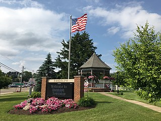
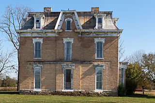
Randolph Township is one of the eighteen townships of Portage County, Ohio, United States. The 2020 census found 5,276 people in the township.

References

  1. 1 2 "US Board on Geographic Names". United States Geological Survey. October 25, 2007. Retrieved January 31, 2008.
  2. "Shalersville township, Portage County, Ohio - Census Bureau Profile". United States Census Bureau. Retrieved August 9, 2023.
  3. "U.S. Census website". United States Census Bureau . Retrieved January 31, 2008.
  4. History of Portage County, Ohio: Containing a History of the County, Its Townships, Towns, Villages, Schools, Churches, Industries, Etc. Warner, Beers & Company. 1885. pp.  552.
  5. "Detailed map of Ohio" (PDF). United States Census Bureau. 2000. Retrieved February 16, 2007.
  6. Brown, R.C; Norris, J.E. (1972) [1885]. History of Portage County Ohio. Chicago, Illinois: Warner, Beers, and Company. pp. 552–554.
  7. "Portage County". Jim Forte Postal History. Retrieved January 13, 2016.
  8. §503.24, §505.01, and §507.01 of the Ohio Revised Code. Accessed 4/30/2009.