
The geography of Antarctica is dominated by its south polar location and, thus, by ice. The Antarctic continent, located in the Earth's southern hemisphere, is centered asymmetrically around the South Pole and largely south of the Antarctic Circle. It is washed by the Southern Ocean or, depending on definition, the southern Pacific, Atlantic, and Indian Oceans. It has an area of more than 14 million km².

Victoria Land is a region of Antarctica which fronts the western side of the Ross Sea and the Ross Ice Shelf, extending southward from about 70°30'S to 78°00'S, and westward from the Ross Sea to the edge of the Antarctic Plateau. It was discovered by Captain James Clark Ross in January 1841 and named after the UK's Queen Victoria. The rocky promontory of Minna Bluff is often regarded as the southernmost point of Victoria Land, and separates the Scott Coast to the north from the Hillary Coast of the Ross Dependency to the south.
Skelton Glacier is a large glacier flowing from the polar plateau into the Ross Ice Shelf at Skelton Inlet on the Hillary Coast, south of Victoria Land, Antarctica.

Commonwealth Glacier is a glacier which flows in a southeasterly direction and enters the northern side of Taylor Valley immediately west of Mount Coleman, in Victoria Land, Antarctica. It was charted by the British Antarctic Expedition, 1910–13, under Robert Falcon Scott, and named by them for the Commonwealth of Australia, which made a financial grant to the BrAE and contributed two members to the Western Geological Party which explored this area. The north end of the glacier is bounded by Flint Ridge.
Bowers Mountains is a group of north-south trending mountains in Antarctica, about 145 km (90 mi) long and 56 km (35 mi) wide, bounded by the coast on the north and by the Rennick, Canham, Black and Lillie glaciers in other quadrants. The seaward end was first sighted in February 1911 from the Terra Nova, under Lt. Harry L.L. Pennell, RN, and was subsequently named "Bowers Hills" in honour of Henry Robertson Bowers who perished with Captain Robert Falcon Scott on their return from the South Pole in 1912. The mountain range is one of the most extensive topographical features within Victoria Land.

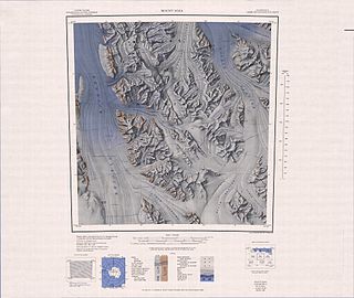
Mount Melbourne is a massive stratovolcano that makes up the projection of the coast between Wood Bay and Terra Nova Bay, in Victoria Land of Antarctica. It was discovered in 1841 by James Clark Ross, who named it for Lord Melbourne, British prime minister when the expedition was being planned.

Aviator Glacier is major valley glacier in Antarctica that is over 60 miles (97 km) long and 5 miles (8.0 km) wide, descending generally southward from the plateau of Victoria Land along the west side of Mountaineer Range, and entering Lady Newnes Bay between Cape Sibbald and Hayes Head where it forms the Aviator Glacier Tongue.

Cape Hallett is a snow-free area on the northern tip of the Hallett Peninsula on the Ross Sea coast of Victoria Land, East Antarctica. Cape Adare lies 100 km (62 mi) to the north.

East Antarctica, also called Greater Antarctica, constitutes the majority (two-thirds) of the Antarctic continent, lying on the Indian Ocean side of the continent, separated from West Antarctica by the Transantarctic Mountains. It lies almost entirely within the Eastern Hemisphere and its name has been accepted for more than a century. It is generally higher than West Antarctica and includes the Gamburtsev Mountain Range in the centre.

Crescent Glacier is a small alpine glacier in Antarctica. It is located just east of Howard Glacier in the Kukri Hills, flowing north into Taylor Valley in Victoria Land. The glacier was studied by U.S. geologist Troy L. Pewe in December 1957, and was so named by him because of its crescent shape when viewed from the floor of Taylor Valley.
The following lists events that happened during 1844 in New Zealand.
Ironside Glacier is a glacier, about 30 mi (48 km) long, originating at the south side of Mount Minto in the Admiralty Mountains and draining southeast between Mount Whewell and Mount Herschel into Moubray Bay, Victoria Land, Antarctica. At its mouth it is joined by the Honeycomb Glacier flowing in from the north.
Adams Ridge is a sharp-crested rock ridge, 4 miles (6 km) long and rising to 800 metres (2,625 ft), forming a part of the west margin of Bowers Mountains just south of where Sheehan Glacier enters Rennick Glacier. Named by New Zealand Antarctic Place-Names Committee (NZ-APC) in 1983 after Chris Adams, New Zealand geologist who worked in northern Victoria Land, 1981–82. The ridge is situated on the Pennell Coast, a portion of Antarctica lying between Cape Williams and Cape Adare.
Alvarez Glacier is a tributary glacier in the Explorers Range of the Bowers Mountains in Antarctica. It flows from the southwest side of Stanwix Peak into Rennick Glacier, to the north of Sheehan Glacier. It was mapped by United States Geological Survey from surveys and U.S. Navy air photos, 1960–62, and was named by the Advisory Committee on Antarctic Names for Lieutenant Commander Jose A. Alvarez, Argentine Navy, an International Geophysical Year Weather Central meteorologist at Little America V in 1957. The glacier is situated on the Pennell Coast, a portion of Antarctica lying between Cape Williams and Cape Adare.
Baker Glacier is a small tributary glacier that enters Whitehall Glacier just north of Martin Hill, in the Victory Mountains of Victoria Land, Antarctica. It was mapped by the United States Geological Survey from surveys and from U.S. Navy air photos, 1960–62, and named by the Advisory Committee on Antarctic Names for John R. Baker, biologist at Hallett Station in 1967–68 and 1968–69.
Barber Glacier is a glacier rising just east of Mount Bruce in the Bowers Mountains and flowing north to the coast between Stuhlinger Ice Piedmont and Rosenau Head, Victoria Land, Antarctica. The glacier was mapped by the United States Geological Survey from surveys and from U.S. Navy air photos, 1960–65, and named by the Advisory Committee on Antarctic Names for Captain Don W. Barber, CE, USA, construction and equipment officer, U.S. Naval Support Force, Antarctica, 1967 and 1968. The glacier lies on the Pennell Coast, a portion of Antarctica lying between Cape Williams and Cape Adare.
The Mesa Range is a range of flat-topped mesas comprising the Sheehan, Pain, Tobin and Gair Mesas, situated at the head of the Rennick Glacier in Victoria Land, Antarctica. it was given this descriptive name by the northern party of the New Zealand Geological Survey Antarctic Expedition of 1962–63.
Clarke Glacier is a 5 mile long glacier, which drains east to the coast of Victoria Land, immediately north of Lewandowski Point. The seaward extremity of this glacier merges with the flow of Davis Glacier and other glaciers from the south and contributes to the floating tongue of ice between Cape Reynolds and Lamplugh Island.