Shepherd's Bush railway station

Last updated

Shepherd's Bush Overground roundel (no text).svg National Rail logo.svg
Shepherd's Bush Overground stn entrance.JPG
Greater London UK location map 2.svg
Red pog.svg
Shepherd's Bush
Location of Shepherd's Bush in Greater London
Location Shepherd's Bush
Local authority London Borough of Hammersmith and Fulham
Managed by London Overground
Owner Network Rail
Station codeSPB
DfT category D
Number of platforms2
AccessibleYes [1] [2]
Fare zone 2
OSI Shepherd's Bush Underground no-text.svg
National Rail annual entry and exit
2018–19Increase2.svg 7.955 million [3]
– interchange Increase2.svg 27,703 [3]
2019–20Decrease2.svg 7.647 million [3]
– interchange Decrease2.svg 15,125 [3]
2020–21Decrease2.svg 2.272 million [3]
– interchange Decrease2.svg 3,749 [3]
2021–22Increase2.svg 5.009 million [3]
– interchange Increase2.svg 6,712 [3]
2022–23Increase2.svg 5.705 million [3]
– interchange Increase2.svg 15,841 [3]
Railway companies
Original company Network Rail
Key dates
29 September 2008Opened [4]
Other information
External links
WGS84 51°30′18″N0°13′03″W / 51.505128°N 0.217561°W / 51.505128; -0.217561
Underground sign at Westminster.jpg  London transportportal

Shepherd's Bush station is a station located in the district of Shepherd's Bush in Greater London for London Overground and National Rail services.

Contents

It opened on 29 September 2008 and is served by the Overground's West London line and Southern rail services. It lies within Travelcard Zone 2.

A number of stations in the area both past and present have borne the name Shepherd's Bush; today the National Rail station shares its name with the adjacent Central line Shepherd's Bush, with which it shares a surface-level interchange.

An entirely separate London Underground station, Shepherd's Bush Market on the Circle line and Hammersmith & City line located approximately 500 metres (0.3 miles) away was originally called Shepherd's Bush. This station was renamed on 12 October that year to Shepherd's Bush Market to avoid confusion. [5]

History

Map showing layout of current and former railways and stations around Shepherd's Bush Underground Stations in Shepherd's Bush.svg
Map showing layout of current and former railways and stations around Shepherd's Bush
Original Silverlink signage installed in 2007. Shepherd's Bush stn Overground signage pre-open Silverlink 07.JPG
Original Silverlink signage installed in 2007.

Previously a station existed almost on the same site as the present Shepherd's Bush station. Uxbridge Road station was opened in 1869 by London & North Western Railway and the Great Western Railway on the Middle Circle route. In 1905 the line became branch of the Metropolitan Railway, and later London Underground's Metropolitan line. Uxbridge Road was closed in 1940 after the line was bombed several times during the Blitz.

In 2005, construction began on a major redevelopment project in the White City area, including the large-scale Westfield Shopping Centre, developed by the Westfield Group. [6] Shepherd's Bush station was designed and funded by the Westfield Group as part of a Section 106 redevelopment contribution, and construction was project-managed by Capita Symonds; this project also included the provision of an integrated bus interchange and the reconstruction of the London Underground Central line station.

Building work on the West London line station began in early 2006 and it was due to open in summer 2007. [7] Although largely completed on time, the station was unable to open due to the northbound platform being 460 millimetres (18 in) too narrow to comply with railway safety regulations, based on the anticipated number of passengers using the station. [8] Following remedial reconstruction work on the platform, the station opened on 29 September 2008. [9]

The three-letter station code SPB and location code 9587 appear on ticketing systems, and train times for the station began appearing on timetables from May 2007. [10]

With a 2007 opening date in mind, the station was to have been served by Silverlink trains, and it was fitted out with Silverlink-branded signage. By the time the station actually opened to passenger service, the rail franchise had passed to London Overground, and the station signage was rebranded.

In April 2015 the station platforms were extended to accommodate longer, 8-car Southern trains, and a footbridge and a new entrance were constructed at the northern end of the station to ease passenger flows. The £1.35m station upgrade work was supported with £3.9 million from the Westfield Shopping Centre and the platform lengthening was part of a nine-month, £25 million project funded by Network Rail to extend platforms along the West London line. [11] [12]

Services

Services at Shepherd's Bush are operated by Southern and London Overground using Class 377 and 378 EMUs.

The typical off-peak service in trains per hour is: [13] [14]

The station is also served by four trains per day that extend beyond Watford Junction to and from Hemel Hempstead.

During the late evenings, London Overground services at the station run between Clapham Junction and Willesden Junction only.

Preceding station National Rail logo.svg National Rail Following station
Southern
Preceding station  Overground notextroundel.svg National Rail logo.svg London Overground  Following station
Willesden Junction
towards Stratford
  West London Line   Kensington (Olympia)

Connections

London Buses routes 31, 49, 72, 94, 95, 148, 207, 220, 228, 237, 260, 272, 283, 295, 316, C1 and SL8 and night routes N72 and N207 serve the station. [15]

See also

Related Research Articles

<span class="mw-page-title-main">Silverlink</span> Former train operating company in England

Silverlink was a train operating company in the United Kingdom owned by National Express that operated the North London Railways franchise from March 1997 until November 2007. At the end of 2007 Silverlink Metro services were taken over by London Overground and Silverlink County services were taken over by London Midland.

<span class="mw-page-title-main">Clapham Junction railway station</span> Major railway station in London, England

Clapham Junction railway station is a major railway station and transport hub near St John's Hill in southwest Battersea in the London Borough of Wandsworth. It is 2 miles 57 chains from London Victoria and 3 miles 74 chains from London Waterloo; it is on both the South West Main Line and Brighton Main Line as well as numerous other routes and branch lines passing through or diverging from the main lines at this station. Despite its name, Clapham Junction is not located in Clapham, a district situated approximately 1 mile (1.6 km) to the southeast and is instead sited in Battersea.

<span class="mw-page-title-main">Kew Gardens station (London)</span> London Underground and London Overground station

Kew Gardens is a Grade II–listed London Underground and London Overground station in Kew, in the London Borough of Richmond upon Thames. It first opened in 1869 and is now managed by London Underground. The station, which is in Travelcard Zones 3 and 4, is served by both the District line on the London Underground and the North London line on the London Overground, and is situated midway between Gunnersbury and Richmond stations.

<span class="mw-page-title-main">Queen's Park station (England)</span> London Underground and London Overground station

Queen's Park is an interchange station on the Watford DC line and Bakerloo line served by London Overground and London Underground respectively. It lies at the southern end of Salusbury Road, near the south-east corner of the public park from which the area now known as Queen's Park has taken its modern name. The station is in Travelcard Zone 2.

<span class="mw-page-title-main">Willesden Junction station</span> London Underground and London Overground station

Willesden Junction is an interchange station located in Harlesden, north-west London, for London Underground and London Overground services. The station also borders the London Borough of Ealing, near the Old Oak Lane conservation area in the East Acton ward.

<span class="mw-page-title-main">Wembley Central station</span> London Underground and railway station

Wembley Central is an interchange station in Wembley, North West London for London Underground and London Overground services on the Watford DC line and National Rail services on the West Coast Main Line.

<span class="mw-page-title-main">Brondesbury railway station</span> London Overground station

Brondesbury is on the North London line, on a viaduct crossing Kilburn High Road in the Brondesbury area of Kilburn in the London Borough of Brent in north-west London.

<span class="mw-page-title-main">Queens Road Peckham railway station</span> British railway station

Queens Road Peckham railway station is in the London Borough of Southwark and also serves the area to the east of Peckham, in the London Borough of Lewisham. It is on the South London Line, 2 miles 58 chains (4.4 km) from London Bridge, and trains also go to Croydon via various routes and beyond. It is on the road of that name and is in Travelcard Zone 2.

<span class="mw-page-title-main">Gospel Oak railway station</span> London Overground station

Gospel Oak railway station is in the London Borough of Camden in north-west London. It is situated the North London line, served by Mildmay line services between Clapham Junction/Richmond and Stratford, and is also the western passenger terminus of the Gospel Oak to Barking Line, served by Suffragette line services to/from Barking Riverside. Passengers using Oyster cards are required to tap on interchange Oyster card readers when changing between the two lines. The station is in Travelcard Zone 2, and is managed by London Overground which runs all passenger trains at the station.

<span class="mw-page-title-main">Kensington (Olympia) station</span> London Underground, London Overground and National rail station

Kensington (Olympia) is an interchange station located in Kensington, in West London for London Overground and National Rail services. Limited London Underground services also run here.

<span class="mw-page-title-main">Acton Central railway station</span> London Overground station

Acton Central railway station is on the London Overground, between South Acton and Willesden Junction, in Travelcard Zone 3. It is also where trains change power supply from overhead line equipment to third rail, or vice versa, depending on direction of travel.

<span class="mw-page-title-main">Brondesbury Park railway station</span> London Overground station

Brondesbury Park railway station is a National Rail station in Brondesbury Park in the London Borough of Brent on the North London line in Travelcard Zone 2 which is managed by London Overground. It is close to the Queen's Park area.

<span class="mw-page-title-main">West London line</span> Clapham Junction-Willesden Junction rail route

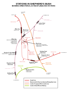
The West London line (WLL) is a short railway in inner West London that links Willesden Junction in the north to Clapham Junction in the south. The line has always been an important cross-London link, especially for freight services. Southern and London Overground provide regular passenger services; detailed below.

<span class="mw-page-title-main">Hackney Central railway station</span> London Overground station

Hackney Central is a London Overground station on the North London line in Hackney Central, north-east London. It lies between Dalston Kingsland and Homerton and is in Travelcard Zone 2. The station and all trains serving it are operated by London Overground services which are managed by Transport for London. However, there is no standard red National Rail "double arrow" logo signage at the station, instead only the Overground roundel.

<span class="mw-page-title-main">West Brompton station</span> London Underground, London Overground and National Rail station

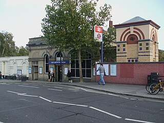
West Brompton is a station located on Old Brompton Road (A3218) in West Brompton, West London for London Underground, London Overground and National Rail services. It is immediately south of the demolished Earls Court Exhibition Centre and west of Brompton Cemetery in the Royal Borough of Kensington and Chelsea.

<span class="mw-page-title-main">Gunnersbury station</span> London Underground and London Overground station

Gunnersbury is a London Overground and London Underground station in Gunnersbury in London, England on the North London line. The station opened on 1 January 1869 and is served by District line trains to and from Richmond, and by Arriva Rail London on the London Overground network. On the District line the station is between Turnham Green and Kew Gardens, and on the North London line it is between South Acton and Kew Gardens.

<span class="mw-page-title-main">Norwood Junction railway station</span> National rail station in London, England

Norwood Junction railway station is a National Rail station in South Norwood in the London Borough of Croydon, south London, and is in Travelcard Zone 4. It is 8 miles 55 chains down the line from London Bridge.

<span class="mw-page-title-main">Kensal Rise railway station</span> London Overground station

Kensal Rise is a London Overground station on the North London line on Chamberlayne Road, Kensal Rise in north-west London. The station is in Fare Zone 2.

<span class="mw-page-title-main">Dalston Junction railway station</span> Railway station in London, England

Dalston Junction is an inter-modal rail and bus transport interchange in Dalston, London. It is located at the crossroads of Dalston Lane, Kingsland Road and Balls Pond Road. The station served by London Overground East London line and is in Zone 2. The station is located in a short section of cut and cover tunnel north of the Kingsland Viaduct.

<span class="mw-page-title-main">West Hampstead railway station</span> London Overground station

West Hampstead railway station is a London Overground station on the North London Line between Brondesbury and Finchley Road & Frognal in the London Borough of Camden and is in Travelcard Zone 2.

References

  1. Standard Tube Map (PDF) (Map). Not to scale. Transport for London. November 2022. Archived (PDF) from the original on 7 November 2022. Retrieved 12 November 2022.
  2. National Rail Enquiries: Station facilities for Shepherd's Bush (SPB) Accessed 23 July 2010]
  3. 1 2 3 4 5 6 7 8 9 10 "Estimates of station usage". Rail statistics. Office of Rail Regulation. Please note: Some methodology may vary year on year.
  4. "Shepherd's Bush Overground Station Welcomes Passengers". Transport for London. 29 September 2008. Retrieved 15 January 2017.
  5. "Wood Lane and Shepherd's Bush Market to join Tube map" (Press release). Transport for London. 6 November 2006. Retrieved 28 October 2007.
  6. "Westfield London". Structural Systems. Archived from the original on 22 June 2008. Retrieved 14 February 2010.
  7. "White City Development" (PDF) (Press release). Transport for London. 1 August 2007. Retrieved 28 October 2007.
  8. Barney, Katharine. "New railway station over budget...and undersized". Evening Standard. London. Archived from the original on 21 December 2008. Retrieved 12 October 2007.
  9. "New railway station set to open" (Press release). BBC. 16 September 2008. Retrieved 16 September 2008.
  10. Silverlink. "Current Timetables: Sunday 20 May to 8 December 2007" . Retrieved 28 October 2007.
  11. "New London Overground entrance at Shepherd's Bush". Transport for London. 27 April 2015. Archived from the original on 3 October 2015. Retrieved 3 October 2015.
  12. "Westfield extension plans approved". London Borough of Hammersmith & Fulham. 17 February 2012. Archived from the original on 9 May 2015. Retrieved 3 October 2015.
  13. Table 59, 66, 170, 176 National Rail timetable, December 2023
  14. "London Overground Timetable: Stratford to Richmond and Clapham Junction" (PDF). Transport for London . Retrieved 12 December 2023.
  15. "Buses from Shepherd's Bush" (PDF). TfL. 15 July 2023. Retrieved 14 July 2023.