Shire of Burdekin

Last updated

Shire of Burdekin
Queensland
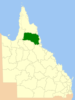
Burdekin LGA Qld 2008.png
Location within Queensland
Population17,077 (2018) [1]
 • Density3.3856/km2 (8.7687/sq mi)
Established1888
Area5,044 km2 (1,947.5 sq mi) [1]
Mayor Lyn McLaughlin
Council seat Ayr
Region North Queensland
State electorate(s) Burdekin
Federal division(s) Dawson, Kennedy
BurdekinShireCouncilLogo.png
Website Shire of Burdekin
LGAs around Shire of Burdekin:
City of Townsville Coral Sea Coral Sea
City of Townsville Shire of Burdekin Coral Sea
Charters Towers Charters Towers Whitsunday

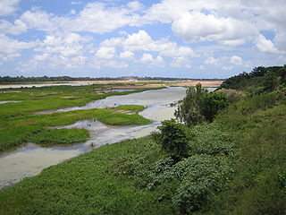
The Shire of Burdekin is a local government area located in North Queensland, Australia in the Dry Tropics region. The district is located between Townsville and Bowen in the delta of the Burdekin River.

Contents

It covers an area of 5,044 square kilometres (1,947.5 sq mi), and has existed as a local government entity since 1888.

History

Yuru (also known as Juru, Euronbba, Juru, Mal Mal, Malmal) is an Australian Aboriginal language spoken on Yuru country. The Yuru language region includes the landscape within the local government boundaries of the Shire of Burdekin, including the town of Home Hill. [2]

Map of Ayr Division and its adjacent local government areas, March 1902 Ayr Division, March 1902.jpg
Map of Ayr Division and its adjacent local government areas, March 1902

On 16 January 1888, the Ayr Division was created out of Subdivision 3 of the Thuringowa Division in 1888 under the Divisional Boards Act 1887. [3]

With the passage of the Local Authorities Act 1902, Ayr Division became the Shire of Ayr on 31 March 1903. [4]

On 12 June 1982, the Shire of Ayr was renamed the Shire of Burdekin, a change long desired by the residents of Home Hill. [4] [5]

Council members were elected to represent different divisions within the shire until the election of March 1994 at which all council members are elected by all shire residents. The title of Mayor replaced the former title of Shire Chairman and the title of Shire Clerk was replaced by Chief Executive Officer from that same election. [5]

New shire chambers were opened on 9 October 1999. The cost was $2.8 million. [5]

From 2000, council elections were held every four years to elect a mayor and ten councillors. From 2008, this was reduced to a mayor and six councillors. [5]

Facilities

The public library headquarters of the Burdekin Shire Council Library Services is located at 108 Graham Street, Ayr. [6] The Burdekin Shire also operate a public library in Home Hill at 77-79 Ninth Avenue. [7] Both libraries opened in 1984. [8]

Towns and localities

The Shire of Burdekin includes the following settlements:

Population

YearPopulation
193312,073
194712,462
195415,208
196116,758
196618,693
197117,443
197618,421
198118,477
198618,337
199118,148
199618,870
200118,234
200617,297
201617,047
202116,692

Council

Burdekin Shire Council
Type
Type
Leadership
Mayor
Lyn McLaughlin, Independent
Deputy Mayor
Sue Perry, Independent
Structure
Seats7 elected representatives, including a Mayor and 6 councillors
Political groups
  • Majority:
  •   Independent (6)
Elections
Last election
28 March 2020
Next election
16 March 2024

Below is the current council, elected in 2020: [9]

CouncillorPartyNotes
Kaylee Boccolatti Liberal National
John Bonanno Independent
Michael Detenon Independent
John Furnell Independent
Lyn McLaughlin Independent Mayor
Max Musumeci Independent
Sue Perry Independent Deputy Mayor

Chairmen and mayors

DatesChairman / MayorsNotes
1896James Henry Rae [10]
1888Charles Young [11]
1896J. H. Rae [12]
1927Herbert Barsby [13]
1952–1970E.W. Ford [5]
1970–1976R. W. Rossiter [5]
1976–1982F.J. Mills [5]
1982–1991J.W. Trace [5]
1991–1994E.N. Honeycombe [5]
1994–2004John F. WoodsFirst to use the title "Mayor" [5] [14]
2004–2012Lynette Angela (Lyn) McLaughlin [5] [15]
2012–2016William Charles (Bill) Lowis [5]
2016–presentLynette Angela (Lyn) McLaughlin [16] [17]

Related Research Articles

<span class="mw-page-title-main">Burdekin River</span> River in Queensland, Australia

The Burdekin River is a river in North and Far North Queensland, Australia. The river rises on the northern slopes of Boulder Mountain at Valley of Lagoons, part of the western slope of the Seaview Range, and flows into the Coral Sea at Upstart Bay over 200 kilometres (124 mi) to the southeast of the source, with a catchment area of approximately 130,000 square kilometres (50,000 sq mi). The Burdekin River is Australia's largest river by (peak) discharge volume.

<span class="mw-page-title-main">City of Thuringowa</span> Local government area in Queensland, Australia

The City of Thuringowa was a city and local government area in North Queensland, Australia covering the northern and western parts of what is now Townsville. The suburb of Thuringowa Central is the main business centre in this area.

<span class="mw-page-title-main">Ayr, Queensland</span> Town in Queensland, Australia

Ayr is a rural town and locality in the Shire of Burdekin, Queensland, Australia. It is the centre of a sugarcane-growing region and the administrative centre for the Burdekin Shire Council. In the 2016 census, the locality of Ayr had a population of 8,738 people.

<span class="mw-page-title-main">Upstart Bay</span>

Upstart Bay is a bay in the Burdekin Shire, Queensland, Australia. It is part of the Coral Sea and is the mouth of the Burdekin River.

<span class="mw-page-title-main">Home Hill, Queensland</span> Town in Queensland, Australia

Home Hill is a rural town and locality in the Shire of Burdekin, Queensland, Australia. In the 2016 census, the locality of Home Hill had a population of 2,954 people.

<span class="mw-page-title-main">North Queensland</span> Region in Queensland, Australia

North Queensland or the Northern Region is the northern part of the Australian state of Queensland that lies just south of Far North Queensland. Queensland is a massive state, larger than many countries, and its tropical northern part has been historically remote and undeveloped, resulting in a distinctive regional character and identity.

<span class="mw-page-title-main">Shire of Mareeba</span> Local government area in Queensland, Australia

The Shire of Mareeba is a local government area at the base of Cape York Peninsula in Far North Queensland, inland from Cairns. The shire, administered from the town of Mareeba, covered an area of 53,491 square kilometres (20,653.0 sq mi), and existed as a local government entity from 1879 until 2008, when it amalgamated with several councils in the Atherton Tableland area to become the Tablelands Region.

<span class="mw-page-title-main">Shire of Hinchinbrook</span> Local government area in Queensland, Australia

The Shire of Hinchinbrook is a local government area in North Queensland, Queensland, Australia. The shire, administered from the town of Ingham, covers an area of 2,807 square kilometres (1,083.8 sq mi), and has existed since its creation on 11 November 1879 as one of 74 divisions around Queensland under the Divisional Boards Act 1879.

<span class="mw-page-title-main">City of Redcliffe</span> Local government area in Queensland, Australia

The City of Redcliffe is a former local government area in South East Queensland, Australia. In 2008 it was amalgamated with the Shires of Pine Rivers and Caboolture to create Moreton Bay Region, later renamed City of Moreton Bay. It is in the northern part of the County of Stanley, with a total area of 38.1 square kilometres (14.7 sq mi) and a population of 51,174 in the 2006 census.

<span class="mw-page-title-main">City of Ipswich</span> Local government area in Queensland, Australia

The City of Ipswich is a local government area in Queensland, Australia, located within the southwest of the Brisbane metropolitan area, including the urban area surrounding the city of Ipswich and surrounding rural areas.

<span class="mw-page-title-main">City of Moreton Bay</span> Local government area in Queensland, Australia

The City of Moreton Bay, known until July 2023 as the Moreton Bay Region, is a local government area in the north of the Brisbane metropolitan city in South East Queensland, Australia. Established in 2008, it replaced three established local government areas, the City of Redcliffe and the Shires of Pine Rivers and Caboolture.

<span class="mw-page-title-main">South Burnett Region</span> Local government area in Queensland, Australia

The South Burnett Region is a local government area in the South Burnett district of Queensland, Australia.
<span class="mw-page-title-main">Tablelands Region</span> Local government area in Queensland, Australia

The Tablelands Region is a local government area in Far North Queensland, Australia inland from the city of Cairns. Established in 2008, it was preceded by four previous local government areas which dated back more than a century. On 1 January 2014, one of those local government areas, the Shire of Mareeba, was re-established independent of the Tablelands Region.

<span class="mw-page-title-main">Blackall-Tambo Region</span> Local government area in Queensland, Australia

The Blackall-Tambo Region is a local government area in Central West Queensland, Australia. Established in 2008, it was preceded by two previous local government areas dating from the 1870s.

<span class="mw-page-title-main">Charters Towers Region</span> Local government area in Queensland, Australia

The Charters Towers Region is a local government area in North Queensland, Australia southwest of, and inland from the city of Townsville, based in Charters Towers. Established in 2008, it was preceded by two previous local government areas which dated back to the 1870s.

<span class="mw-page-title-main">Fraser Coast Region</span> Local government area in Queensland, Australia

The Fraser Coast Region is a local government area in the Wide Bay–Burnett region of Queensland, Australia, about 250 kilometres (160 mi) north of Brisbane, the state capital. It is centred on the twin cities of Hervey Bay and Maryborough and also contains Fraser Island (K'gari). It was created in 2008 from a merger of the Cities of Maryborough and Hervey Bay and the Shires of Woocoo and most of Tiaro. In June 2018 it had a population of 105,463.

<span class="mw-page-title-main">Whitsunday Region</span> Local government area in Queensland, Australia

The Whitsunday Region is a local government area located in North Queensland, Australia. Established in 2008, it was preceded by two previous local government areas with a history extending back to the establishment of regional local government in Queensland in 1879.

<span class="mw-page-title-main">Cairns Region</span> Local government area of Queensland, Australia

The Cairns Region is a local government area in Far North Queensland, Queensland, Australia, centred on the regional city of Cairns. It was established in 2008 by the amalgamation of the City of Cairns and the Shires of Douglas and Mulgrave. However, following public protest and a referendum in 2013, on 1 January 2014, the Shire of Douglas was de-amalgamated from the Cairns Region and re-established as a separate local government authority.

<span class="mw-page-title-main">Burdekin Shire Council Chambers</span> Historic site in Queensland, Australia

Burdekin Shire Council Chambers is a heritage-listed town hall at 145 Young Street, Ayr, Shire of Burdekin, Queensland, Australia. It was designed by Frederick Smith and built in 1937 by local builder AS Wight. It is also known as Ayr Shire Council Chambers. It was added to the Queensland Heritage Register on 13 October 1997.

The Juru people, also known as Yuru, are a group of Aboriginal people of the state of Queensland, Australia.

References

  1. 1 2 "3218.0 – Regional Population Growth, Australia, 2017-18: Population Estimates by Local Government Area (ASGS 2018), 2017 to 2018". Australian Bureau of Statistics. Australian Bureau of Statistics. 27 March 2019. Archived from the original on 27 March 2019. Retrieved 25 October 2019. Estimated resident population, 30 June 2018.
  2. CC BY icon-80x15.png This Wikipedia article incorporates CC-BY-4.0 licensed text from: "Yuru". Queensland Aboriginal and Torres Strait Islander languages map. State Library of Queensland . Retrieved 23 January 2020.
  3. "Proclamation [Ayr Division]". Queensland Government Gazette . 21 January 1888. p. 43:170.
  4. 1 2 "Agency ID 6068, Burdekin Shire Council". Queensland State Archives . Retrieved 18 September 2013.
  5. 1 2 3 4 5 6 7 8 9 10 11 12 Scott, Laura A; Lower Burdekin Historical Society (2014), Mastering the dream : Home Hill : jubilee to centenary, Home Hill, Q The Lower Burdekin Historical Society Inc, ISBN   978-0-9871987-1-6
  6. "Burdekin Library Directory of Public Libraries". Public Libraries Connect. 26 July 2017. Archived from the original on 1 February 2018. Retrieved 1 February 2018.
  7. "Home Hill Library Directory of Public Libraries". Public Libraries Connect. 28 July 2015. Archived from the original on 19 January 2018. Retrieved 1 February 2018.
  8. "Queensland Public Libraries Statistical Bulletin 2016-2017" (PDF). Public Libraries Connect. November 2017. Archived (PDF) from the original on 30 January 2018. Retrieved 1 February 2018.
  9. https://www.burdekin.qld.gov.au/mayor-councillors
  10. Consolidated Index to Queensland Government Gazette 1859-1919. Queensland Family History Society. 2004. ISBN   1-876613-79-3.
  11. "History of the Burdekin - Burdekin Shire Council" . Retrieved 23 September 2015.
  12. "Queensland Government Gazette consolidated index 1859-1919 - Details - Trove". trove.nla.gov.au. Archived from the original on 23 September 2015. Retrieved 23 September 2015.
  13. Pugh, Theophilus Parsons (1927). Pugh's Almanac for 1927. Archived from the original on 4 March 2014. Retrieved 13 June 2014.
  14. "Former councillor ousts Burdekin mayor". ABC News. 27 March 2004. Archived from the original on 23 September 2015. Retrieved 23 September 2015.
  15. "Mayor Candidate Profile : 2012 Burdekin Shire - Mayoral Election". results.ecq.qld.gov.au. Archived from the original on 23 September 2015. Retrieved 23 September 2015.
  16. "2016 Burdekin Shire Council - Mayoral Election - Election Summary". Electoral Commission of Queensland. 19 April 2016. Archived from the original on 15 May 2016. Retrieved 30 May 2016.
  17. "2020 Local Government Elections: Saturday, 28 March 2020". Electoral Commission of Queensland. 2020. Retrieved 16 June 2020.

19°34′32.97″S147°24′18.21″E / 19.5758250°S 147.4050583°E / -19.5758250; 147.4050583