Howell County is a county located in the southern portion of the U.S. state of Missouri. As of the 2010 census, the population was 40,400. The largest city and county seat is West Plains. The county was officially organized on March 2, 1851, and is named after Josiah Howell, a pioneer settler in the Howell Valley.
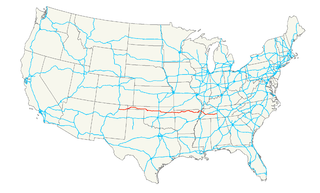
U.S. Route 412 is an east–west United States highway, first commissioned in 1982. Its route number is a "violation" of the usual AASHTO numbering scheme, as it comes nowhere near its implied "parent", US 12. U.S. 412 overlaps expressway-grade Cimarron Turnpike from Tulsa west to Interstate 35 and the Cherokee Turnpike from 5 miles (8.0 km) east of Chouteau, Oklahoma, to 8 miles (13 km) west of the Arkansas state line. A curiosity of this highway is that it runs the entire length of the Oklahoma Panhandle and traverses the Missouri Bootheel.
Highway 43 is a designation for three north–south state highways in northwest Arkansas. One segment of 27.1 miles (43.6 km) runs from Highway 59 in Siloam Springs north into Delaware County, Oklahoma along Oklahoma State Highway 20 (SH-20) to terminate at Missouri Route 43 (Route 43) at the Missouri/Oklahoma/Arkansas tri-point near Southwest City, Missouri. A second segment of 20.0 miles (32.2 km) runs northeast from Highway 21 at Boxley to Highway 7 in Harrison. The third segment runs 1.8 miles (2.9 km) north in Harrison from US Route 65 (US 65) to Highway 7.

Arkansas Highway 59 is a north–south state highway in Northwest Arkansas. The route runs 93.24 miles (150.06 km) from Arkansas Highway 22 in Barling north to the Missouri state line through Van Buren, the county seat of Crawford County. Highway 59 parallels US 59 between Siloam Springs and Fort Smith. Since US 59 goes through Arkansas, AR 59 is the only Arkansas state highway to share its numbering with a federal highway that goes through Arkansas.
The Arkansas State League was an American minor league baseball league. Several leagues of this name operated at different times. The first version was in operation in 1894, followed by an 1897 league. Class "D" leagues of this name operated from 1908–1909 in Arkansas and Louisiana and also in 1934–1935 in Arkansas and Missouri. In 1936, the league was renamed the Arkansas-Missouri League.

KIGL, known as "93.3 The Eagle", is a classic rock radio station licensed in Seligman, Missouri but based in Fayetteville, Arkansas. KIGL is owned by iHeartMedia, Inc.. KIGL serves the Northwest Arkansas, extreme Southwest Missouri, and extreme Northeast Oklahoma region with an ERP of 100,000 watts.
The Arkansas–Missouri League was a "Class D" league in Minor League Baseball that operated from 1936–1940. It was formerly known as the Arkansas State League.
KUOA is a radio station. Licensed to Siloam Springs, Arkansas, United States, it serves the Fayetteville area. The station is currently owned by Hog Radio, Inc.

Raymond Reath Powell, was a professional baseball player who played outfielder in the Major Leagues from 1913-1924. He would play for the Detroit Tigers and Boston Braves.

Harps Food Stores, Inc., based in Springdale, Arkansas, is a chain of 91 supermarkets located across Arkansas, Oklahoma, Missouri, and Kansas.
The company sells both groceries and sporting goods in some larger stores. They also operate stores under the Food4Less and 10-Box Banner. Harps Food Stores was founded in 1930 by Harvard and Floy Harp. In 2001, Harps became employee-owned after buying company shares from the Harp family. The stores are supplied by Kansas City, Kansas based Associated Wholesale Grocers. The company is valued around $550 million, and employed 4,450 people in 2017.
Siloam Springs High School is a comprehensive public high school for grades nine through twelve serving the community of Siloam Springs, Arkansas, United States. Located in the foothill of the Ozark Mountains and within the Fayetteville–Springdale–Rogers Metropolitan Area, Siloam Springs High School is the sole high school managed in Benton County by the Siloam Springs School District.
Mathew W. Pitsch, also known as Mat Pitsch, is a businessman in Fort Smith, Arkansas, who is a Republican member of the Arkansas House of Representatives for District 76 in a portion of Sebastian County in the western portion of his state.
Grimmet is an unincorporated community in western Howell County, Missouri. The community is located about one mile north of Tabor Creek, south of Missouri Route 14 and about 3.5 miles east of Siloam Springs.
Horton is an unincorporated community in northwest Howell County, in the Ozarks of southern Missouri. The community is within the Mark Twain National Forest west of Missouri Route AP and about one-half mile east of the Douglas - Howell county line. The Noblett Lake recreation area on Noblett Creek is just to the northwest in Douglas County.
Siloam Springs Township is an inactive township in Howell County, in the U.S. state of Missouri.
Spring Creek is a stream in Douglas and Howell counties in the Ozarks of southern Missouri.
Tabor Creek is a stream in Douglas and Howell counties in the Ozarks of southern Missouri.