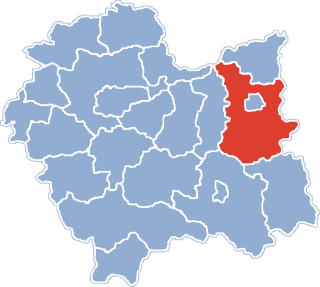
Gmina Ryglice is an urban-rural gmina in Tarnów County, Lesser Poland Voivodeship, in southern Poland. Its seat is the town of Ryglice, which lies approximately 20 kilometres (12 mi) south-east of Tarnów and 88 km (55 mi) east of the regional capital Kraków.
Gmina Skrzyszów is a rural gmina in Tarnów County, Lesser Poland Voivodeship, in southern Poland. Its seat is the village of Skrzyszów, which lies approximately 7 kilometres (4 mi) south-east of Tarnów and 81 km (50 mi) east of the regional capital Kraków.
Gmina Tarnów is a rural gmina in Tarnów County, Lesser Poland Voivodeship, in southern Poland. Its seat is the city of Tarnów, although the city is not part of the territory of the gmina.
Gmina Tuchów is an urban-rural gmina in Tarnów County, Lesser Poland Voivodeship, in southern Poland. Its seat is the town of Tuchów, which lies approximately 16 kilometres (10 mi) south of Tarnów and 82 km (51 mi) east of the regional capital Kraków.

Ostrusza is a village in the administrative district of Gmina Ciężkowice, within Tarnów County, Lesser Poland Voivodeship, in southern Poland. It lies approximately 5 kilometres (3 mi) south-east of Ciężkowice, 28 km (17 mi) south of Tarnów, and 84 km (52 mi) east of the regional capital Kraków.
Joniny is a village in the administrative district of Gmina Ryglice, within Tarnów County, Lesser Poland Voivodeship, in southern Poland. It lies approximately 5 kilometres (3 mi) north-east of Ryglice, 20 km (12 mi) south-east of Tarnów, and 91 km (57 mi) east of the regional capital Kraków.
Lubcza is a village in the administrative district of Gmina Ryglice, within Tarnów County, Lesser Poland Voivodeship, in southern Poland. It lies approximately 10 kilometres (6 mi) east of Ryglice, 25 km (16 mi) south-east of Tarnów, and 97 km (60 mi) east of the regional capital Kraków.
Rzepiennik Strzyżewski is a village in Tarnów County, Lesser Poland Voivodeship, in southern Poland. It is the seat of the gmina called Gmina Rzepiennik Strzyżewski. It lies approximately 27 kilometres (17 mi) south of Tarnów and 85 km (53 mi) east of the regional capital Kraków.
Turza is a village in the administrative district of Gmina Rzepiennik Strzyżewski, within Tarnów County, Lesser Poland Voivodeship, in southern Poland. It lies approximately 5 kilometres (3 mi) south of Rzepiennik Strzyżewski, 31 km (19 mi) south of Tarnów, and 88 km (55 mi) east of the regional capital Kraków.
Ładna is a village in the administrative district of Gmina Skrzyszów, within Tarnów County, Lesser Poland Voivodeship, in southern Poland. It lies approximately 7 kilometres (4 mi) east of Tarnów and 83 km (52 mi) east of the regional capital Kraków.
Łękawica is a village in the administrative district of Gmina Skrzyszów, within Tarnów County, Lesser Poland Voivodeship, in southern Poland. It lies approximately 10 kilometres (6 mi) south-east of Tarnów and 83 km (52 mi) east of the regional capital Kraków.
Pogórska Wola is a village in the administrative district of Gmina Skrzyszów, within Tarnów County, Lesser Poland Voivodeship, in southern Poland.
Szynwałd is a village in the administrative district of Gmina Skrzyszów, within Tarnów County, Lesser Poland Voivodeship, in southern Poland. It lies approximately 14 kilometres (9 mi) south-east of Tarnów and 86 km (53 mi) east of the regional capital Kraków.

Jodłówka-Wałki is a village in the administrative district of Gmina Tarnów, within Tarnów County, Lesser Poland Voivodeship, in southern Poland.
Dąbrówka Tuchowska is a village in the administrative district of Gmina Tuchów, within Tarnów County, Lesser Poland Voivodeship, in southern Poland. It lies approximately 4 kilometres (2 mi) south of Tuchów, 19 km (12 mi) south of Tarnów, and 83 km (52 mi) east of the regional capital Kraków.
Jodłówka Tuchowska is a village in the administrative district of Gmina Tuchów, within Tarnów County, Lesser Poland Voivodeship, in southern Poland. It lies approximately 10 kilometres (6 mi) south of Tuchów, 25 km (16 mi) south of Tarnów, and 87 km (54 mi) east of the regional capital Kraków.
Karwodrza is a village in the administrative district of Gmina Tuchów, within Tarnów County, Lesser Poland Voivodeship, in southern Poland. It lies approximately 3 kilometres (2 mi) north-east of Tuchów, 14 km (9 mi) south of Tarnów, and 83 km (52 mi) east of the regional capital Kraków.
Łowczów is a village in the administrative district of Gmina Tuchów, within Tarnów County, Lesser Poland Voivodeship, in southern Poland. It lies approximately 5 kilometres (3 mi) north-west of Tuchów, 13 km (8 mi) south of Tarnów, and 78 km (48 mi) east of the regional capital Kraków.
Zagórze is a village in the administrative district of Gmina Niepołomice, within Wieliczka County, Lesser Poland Voivodeship, in southern Poland. It lies approximately 6 kilometres (4 mi) south-west of Niepołomice, 9 km (6 mi) east of Wieliczka, and 20 km (12 mi) south-east of the regional capital Kraków.
Tuczępy is a village in Busko County, Świętokrzyskie Voivodeship, in south-central Poland. It is the seat of the gmina called Gmina Tuczępy. It lies approximately 21 kilometres (13 mi) east of Busko-Zdrój and 49 km (30 mi) south-east of the regional capital Kielce.