Related Research Articles

Moscow Township is a civil township of Hillsdale County in the U.S. state of Michigan. The population was 1,467 at the 2020 census.

Lyon Township is a civil township of Roscommon County in the U.S. state of Michigan. The population was 1,252 at the 2020 census.

Gifford is a town in Hampton County, South Carolina, United States. The population was 288 at the 2010 census, down from 370 at the 2000 census.
New Hill is an unincorporated community located in southwestern Wake County, North Carolina, United States, at the crossroads of old U.S. 1, New Hill Olive Chapel Road and New Hill Holleman Road. New Hill is located along the original alignment of the New Hope Valley Railway between Durham and Bonsal. The ZIP Code for New Hill is 27562.
Leicester is an unincorporated community in Buncombe County, North Carolina United States; although incorporating was proposed in 2007 and an incorporation bill was briefly filed in the North Carolina General Assembly, no measure has been adopted. Leicester is part of the Asheville Metropolitan Statistical Area. As of 2007, Leicester's population is 12,514 people. Since 2000, it has had a population growth of 16.26 percent.
Silk Hope, in Chatham County, North Carolina, United States, is a farm community centered on a school, a volunteer fire department, several country churches, and many historical farmsteads. Some residents who work in Cary, Chapel Hill, and Research Triangle Park have established "country" homes here. Its ZIP Code is 27344.
Blounts Creek is a small unincorporated rural community in Beaufort County, North Carolina, United States, situated near a creek with the same name. The ZIP Code for Blounts Creek is 27814.

Cedar Island is an island and unincorporated community in Carteret County, North Carolina, United States. In 2005, the population was estimated to be 350. The ZIP Code for Cedar Island is 28520.
Bear Creek is an unincorporated community in southwestern Chatham County, North Carolina, United States. It is named for a nearby creek that eventually flows into the Rocky River. The community lies along Old US Highway 421 and is situated between Siler City and Goldston. The ZIP Code for Bear Creek is 27207.

Bonlee is an unincorporated community in western Chatham County, North Carolina, United States. It is located south of Siler City and north of Bear Creek along Old U.S. Route 421. Bonlee sits at an elevation of 518 feet (158 m). The community is home to several poultry feed mills and a K-8 school. The ZIP Code for Bonlee is 27213.

Thurmond is an unincorporated community in north eastern Wilkes County, North Carolina, United States, along the border with Surry County.
Kipling is an unincorporated community located along U.S. Route 401 in the Hectors Creek Township of Harnett County, North Carolina, United States, situated between the communities of Cape Fear and Chalybeate Springs north of Lillington. It is a part of the Dunn Micropolitan Area, which is also a part of the greater Raleigh–Durham–Cary Combined Statistical Area (CSA) as defined by the United States Census Bureau.
Skyland is an unincorporated community in Buncombe County, North Carolina, United States. It is on U.S. Route 25, where North Carolina Highway 146 starts, east of Interstate 26. It is north of Royal Pines, south of Biltmore Forest, and a suburb of Asheville. The ZIP Code for Skyland is 28776.

Eagle Springs is an unincorporated community in Moore County, North Carolina, United States, situated near the southern terminus of North Carolina Highway 705, on North Carolina Highway 211, west of Elberta, the southern terminus of North Carolina Highway 705. It lies at an elevation of 673 feet. The ZIP Code for Eagle Springs is 27242.
Scottville is an unincorporated community in both Ashe and Alleghany counties, North Carolina, United States, on U.S. Route 221. It lies at an elevation of 2,854 feet. The ZIP Code for Scottville is 28672.
Warrensville is an unincorporated community at the intersection of North Carolina Highways 88 and 194 in Ashe County, North Carolina, United States, east of Comet. It lies at an elevation of 2,707 feet. The ZIP Code for Warrensville is 28693.

Ether is an unincorporated community in the northeastern part of Montgomery County, North Carolina, United States. The ZIP Code for Ether is 27247. The building pictured is the Ether Roller mill, a site that tax records place as being built in 1800. This has been used as a local spooky attraction. The building has lost integrity since 2017 when it was left to the elements.

Ridgecrest is an unincorporated community in eastern Buncombe County, North Carolina, United States, off Interstate 40/U.S. Route 70. The community is part of the Asheville Metropolitan Statistical Area. It is home to Ridgecrest Conference Center, Camp Ridgecrest for Boys and Camp Crestridge for Girls. All three facilities are operated by the newly founded Ridgecrest Foundation and are affiliated with the Southern Baptist Convention. The conference center and summer camps were purchased by the Ridgecrest Foundation on December 30, 2020. Both summer camps are run under the direction of Phil Berry.
DeBordieu Colony, DeBordieu Beach or simply DeBordieu is a private, unincorporated community and census-designated place (CDP) in Georgetown County, South Carolina, United States. It consists of approximately 2,700 acres (11 km2) of land, of which roughly 800 acres is inaccessible wildlife preserve. Parts of DeBordieu lie on Debidue Island. DeBordieu is located south of Pawleys Island and north of Georgetown east of U.S. Route 17. It is an oceanfront gated community with a private golf and country club.
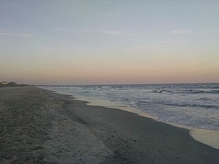
Litchfield Beach, also known simply as Litchfield, is an unincorporated community and census-designated place (CDP) in South Carolina, United States. It was first listed as a CDP in the 2020 census with a population of 8,370.
References
- ↑ U.S. Geological Survey Geographic Names Information System: Sophia, North Carolina
- ↑ "Sophia ZIP Code". zipdatamaps.com. 2022. Retrieved November 11, 2022.
35°49′23″N79°51′39″W / 35.82306°N 79.86083°W
Municipalities and communities of Randolph County, North Carolina, United States | ||
|---|---|---|
| Cities |  | |
| Towns | ||
| Unincorporated communities | ||
| Footnotes | ‡This populated place also has portions in an adjacent county or counties | |
| International | |
|---|---|
| National | |