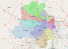
Bhiwani district is one of the 22 districts of the northern Indian state of Haryana. Created on 22 December 1972, the district was the largest district of the state by area, before the creation of Charkhi Dadri as a separate district, as it occupied an area of 4,778 square kilometres (1,845 sq mi) and administered 442 villages with a population of 1,634,445. Sirsa is now the largest district of the state.

Najafgarh is a town in the South West Delhi district of National Capital Territory of Delhi, India. It is one of the three subdivisions of the Southwest Delhi district. Najafgarh is located in south western part of Delhi sharing its territory with Gurgaon and Bahadurgarh, Haryana.

Jhajjar district is one of the 22 districts of Haryana state in northern India. Carved out of Rohtak district on 15 July 1997 and with its headquarters in Jhajjar, it lies 29 kilometres (18 mi) from Delhi and had developed into an important industrial center. Other towns in the district are Bahadurgarh and Badli and Beri. Bahadurgarh is the major city of the district and state. Bahadurgarh is known as 'The City of Destiny'. Beri used to be a village fifty years ago.

Dhar district is a district of Madhya Pradesh state in central India. The historic town of Dhar is administrative headquarters of the district.

Gurgaon district, officially known as Gurugram district, is one of the 22 districts of Haryana in northern India. The city of Gurgaon is the administrative headquarters of the district. The population is 1,514,432. It is one of the southern districts of Haryana. On its north, it is bounded by the district of Jhajjar and the Union Territory of Delhi. Faridabad district lies to its east. On its south, lie the districts of Palwal and Nuh. To its west lies Rewari district.

Kaithal district is one of the 22 districts of Haryana, a state in northern India. Kaithal town is the district headquarters. The district occupies an area of 2317 km2. It has a population of 1,074,304. It is part of Karnal division. Kaithal was notified as district by Haryana Govt. on 16 October 1989 and carved out of Kurukshetra and Jind districts, comprising Guhla and Kaithal sub-divisions of Kurukshetra district, Kalayat sub-tahsil and 6 villages of Jind district.

Karnal district is one of the 22 districts of Haryana, a state in North India which constitutes the National Capital Region (NCR) of the country. The city of Karnal is a part of the National Capital Region (NCR) and is the administrative headquarters of the district.

Panipat district is one of the 22 districts of Haryana in north India. The historical city of Panipat is the administrative headquarters of the district. The district occupies an area of 1,268 km2 (490 sq mi), making it the nineteenth largest in the state with Gurugram and Panchkula following it.

Yamunanagar district is one of the 22 districts of the Indian state of Haryana. The district came into existence on 1 November 1989 and occupies an area of 1,756 square kilometres (678 sq mi). Yamunanagar town is the district headquarters.

Kurukshetra district is one of the 22 districts of Haryana state in northern India. The town of Kurukshetra, a sacred place for the Hindus, is the administrative headquarters of this district. The district occupies an area of 1530.00 km². The district has a population of 964,655. This district is part of Ambala division. Kurukshetra is also the land of Srimad Bhagawad Gita. Jyotisar is the place in Kurukshetra where Krishna is believed to deliver the sermon of Gita to Arjuna in the Mahabharata.
Kapashera is the administrative headquarters and one of the three sub-division of the South West district of Delhi NCT, India. The office of deputy commissioner is located at Old Tax Terminal building.
Dwarka is a neighborhood located in Southwestern edge of Indian Capital New Delhi in South West Delhi district of NCT Delhi. The district court that functions under the Delhi High Court for South West Delhi is located in Dwarka.

North East Delhi is one of the eleven administrative district of Delhi, India. The district was established in 1997. North East Delhi borders the Yamuna River on the west, Ghaziabad District to the north and east, East Delhi to the south, and North Delhi to the west across the Yamuna. Karawal Nagar, Seelampur and Yamuna Vihar are 3 sub-divisions of this district.
North West Delhi is an administrative district of the National Capital Territory of Delhi in India.

West Delhi is one of the 11 administrative districts of the National Capital Territory of Delhi in India. Administratively, the district is divided into three subdivisions, Patel Nagar, Rajouri Garden and Punjabi Bagh.

South Delhi is an administrative district of the National Capital Territory of Delhi in India with its headquarters in Saket. Administratively, the district is divided into three subdivisions, Saket, Hauz Khas, and Mehrauli. It is bounded by the Yamuna River to the east, the districts of New Delhi to the north, Faridabad District of Haryana state to the southeast, Gurgaon District of Haryana to the southwest, and South West Delhi to the west.
According to Census 2011 information the location code or village code of Kharkhari Nahar village is 064009. Kharkhari Nahar village is located in Najafgarh Tehsil of South West Delhi district in Delhi, India. It is situated 4 km away from sub-district headquarter Najafgarh and 30 km away from district headquarter Kapashera.
Babupur is a village in Gurgaon Mandal, near sun in Haryana. Babupur is 2940 km from its district main city Gurgaon near Palam Vihar and 252 km from its state main city Chandigarh. It has a population of about 953 persons living in around 185 households.
YADAV ZONE Kanganheri village is in Kapashera sub division of South West District in Delhi of the Indian state. It is located 12 km west of the District headquarters in kapashera. It is 9 km from Dwarka sub city and 1.5 km from Chhawla BSF camp.


