Springfield, New Zealand

Last updated

Springfield
Tawera (Māori)
Village
Springfield VS Snow!.jpg
Springfield wakes up to several inches of snow
Springfield, New Zealand
Coordinates: 43°20′07″S171°55′39″E / 43.33528°S 171.92750°E / -43.33528; 171.92750
Country New Zealand
Region Canterbury
Territorial authority Selwyn District
WardMalvern
CommunityMalvern
Electorates
Government
  Territorial Authority Selwyn District Council
  Regional council Environment Canterbury
   Mayor of Selwyn Sam Broughton
   Selwyn MP Nicola Grigg
   Te Tai Tonga MP Tākuta Ferris
Area
[1]
  Total1.89 km2 (0.73 sq mi)
Population
 (June 2022) [2]
  Total380
  Density200/km2 (520/sq mi)
Time zone UTC+12 (New Zealand Standard Time)
  Summer (DST) UTC+13 (New Zealand Daylight Time)
Postcode
7681
Area code 03

Springfield (until 1880 Kowai Pass) is a small town in the Selwyn District of Canterbury, in the South Island, of New Zealand. The Maori name for Springfield is Tawera.

Contents

Springfield is situated in the foothills of the Southern Alps as the most westerly town of the Canterbury Plains. Springfield is 65 kilometres (40 mi) west of Christchurch on State Highway 73 (The Great Alpine Highway), 9.7 kilometres (6.0 mi) northwest of Sheffield and 22.7 kilometres (14.1 mi) from Darfield.

It is located close to Porters Ski Area, Mount Cheeseman, Broken River, Temple Basin and Craigieburn ski fields. [3]

Springfield has a long association with the Midland railway line.

History

Springfield Hotel (2021) Springfield Hotel 27.jpg
Springfield Hotel (2021)

The development of the town started around 1860. With the discovery of gold on the West Coast, Springfield saw more traffic. [4] The Springfield Hotel was first built in 1862. Rooms were added to it on a number of occasions enlarging the hotel so that it had 40 rooms. [4] The hotel was an important coaching stop on the route to the west coast. [5]

In the 1870s, water from the nearby Kowai river was used to develop one of the earliest stock water races in Canterbury. [5]

St Peter's Church Springfield NZ Anglican Church 002.JPG
St Peter's Church

The town has a Gothic Revival architecture church dedicated to Saint Peter, designed by the architect Cyril Mountfort. It was the birthplace of Rewi Alley, notable for his work in China in the mid 20th century. There is an extensive memorial dedicated to him, located in a small reserve off the main road. It includes a large stone carving and a number of panels giving details of his life.

On 15 July 2007, a statue of a giant pink doughnut was erected to promote the upcoming movie, The Simpsons Movie . It was subsequently set alight and destroyed by an arsonist on 25 September 2009. A tyre painted pink was used as a substitute until it was replaced with a concrete version unveiled on 1 July 2012. [6] [7]

In 2016, the start of a new subdivision called Alpine View Estate began. A new road, called Princes Street was built next to Queen and King St with a link to Victoria St.

In 2019, the town gained unwanted attention in the national and international media when the Springfield Store and Café was dubbed the rudest café in New Zealand and the police visited offering customer service advice. [8] [9] [10] It is now under new ownership. [11] [12]

On 29 May 2021, most of the township of Springfield was evacuated due to flooding from continuous heavy rain. Bishops Gully, in the centre of the town overflowed as well as the water race. A number of properties were flooded. [13] [14]

Midland Line

A Mainline Steam KA Class Locomotive at Springfield Railway Station for the 2013 Midland Mountaineer, with the Torlesse Mountain range in the background. KA942 at Springfield.png
A Mainline Steam KA Class Locomotive at Springfield Railway Station for the 2013 Midland Mountaineer, with the Torlesse Mountain range in the background.

Springfield is a significant stop on the TranzAlpine train journey across the Southern Alps on the Midland Line. The town is also home to the Midland Rail Heritage Trust a rail preservation group that has established a base in the former NZR locomotive depot opposite the railway station. [15] The Springfield Hotel was a stop on the road west from Christchurch for horse-drawn coaches. When trains became the usual way to travel between Canterbury and the West Coast, the train station refreshment rooms were a popular stop. [16]

As of 2021, the Mainline Steam Heritage Trust's Christchurch depot will be moving to the Midland Rail Heritage Trust's land and will build a new depot from there.

Demographics

Springfield is described by Statistics New Zealand as a rural settlement, and covers 1.89 km2 (0.73 sq mi). [1] It had an estimated population of 380 as of June 2022, [2] with a population density of 201 people per km2. It is part of the statistical area of Torlesse.

Historical population
YearPop.±% p.a.
2006213    
2013234+1.35%
2018318+6.33%
Source: [17]

Springfield had a population of 318 at the 2018 New Zealand census, an increase of 84 people (35.9%) since the 2013 census, and an increase of 105 people (49.3%) since the 2006 census. There were 120 households, comprising 171 males and 147 females, giving a sex ratio of 1.16 males per female, with 78 people (24.5%) aged under 15 years, 48 (15.1%) aged 15 to 29, 150 (47.2%) aged 30 to 64, and 39 (12.3%) aged 65 or older.

Ethnicities were 91.5% European/Pākehā, 15.1% Māori, 0.9% Pasifika, 1.9% Asian, and 1.9% other ethnicities. People may identify with more than one ethnicity.

Although some people chose not to answer the census's question about religious affiliation, 63.2% had no religion, 29.2% were Christian and 1.9% had other religions.

Of those at least 15 years old, 39 (16.2%) people had a bachelor's or higher degree, and 45 (18.8%) people had no formal qualifications. 33 people (13.8%) earned over $70,000 compared to 17.2% nationally. The employment status of those at least 15 was that 123 (51.2%) people were employed full-time, 45 (18.8%) were part-time, and 9 (3.8%) were unemployed. [17]

Torlesse

Torlesse statistical area, which also includes Sheffield and Waddington, covers 413.96 km2 (159.83 sq mi). [1] It had an estimated population of 1,320 as of June 2022, [18] with a population density of 3.2 people per km2.

Historical population
YearPop.±% p.a.
2006900    
20131,014+1.72%
20181,164+2.80%
Source: [19]

Torlesse had a population of 1,164 at the 2018 New Zealand census, an increase of 150 people (14.8%) since the 2013 census, and an increase of 264 people (29.3%) since the 2006 census. There were 447 households, comprising 618 males and 543 females, giving a sex ratio of 1.14 males per female. The median age was 41.2 years (compared with 37.4 years nationally), with 255 people (21.9%) aged under 15 years, 174 (14.9%) aged 15 to 29, 579 (49.7%) aged 30 to 64, and 153 (13.1%) aged 65 or older.

Ethnicities were 92.8% European/Pākehā, 10.1% Māori, 0.3% Pasifika, 3.6% Asian, and 3.1% other ethnicities. People may identify with more than one ethnicity.

The percentage of people born overseas was 15.2, compared with 27.1% nationally.

Although some people chose not to answer the census's question about religious affiliation, 55.7% had no religion, 33.5% were Christian, 0.3% were Hindu and 1.5% had other religions.

Of those at least 15 years old, 138 (15.2%) people had a bachelor's or higher degree, and 183 (20.1%) people had no formal qualifications. The median income was $33,600, compared with $31,800 nationally. 120 people (13.2%) earned over $70,000 compared to 17.2% nationally. The employment status of those at least 15 was that 489 (53.8%) people were employed full-time, 171 (18.8%) were part-time, and 18 (2.0%) were unemployed. [19]

Government

Springfield is part of the Selwyn Electorate. [20] The Selwyn District Council provides local government services for Springfield. [21]

Education

Springfield School is a contributing primary school catering for years 1 to 6. [22] It had a roll of 34 as of April 2023. [23] The school opened in 1872. [24]

Etymology

There are a number of accounts where the name Springfield may have come. It may have been named after an American Civil War battlefield by J Bell in 1868. It might have also been named in a similar style to Darfield and Sheffield and the final suggestion is that the post office was named in 1870 after a spring in the field beside the local hotel. [25]

Related Research Articles

<span class="mw-page-title-main">Darfield, New Zealand</span> Town in Canterbury, New Zealand

Darfield is a town in the Selwyn District of the South Island of New Zealand. It is 35 kilometres west of Christchurch. Its population is 3,120 as of June 2022.

<span class="mw-page-title-main">Waipā District</span> Territorial authority district in Waikato, New Zealand

Waipa District is a municipality in the Waikato region of New Zealand that is administered by the Waipa District Council. Its most populous town is Cambridge. The seat of the council is at the second most populous town, Te Awamutu. The district is south and south-east of the city of Hamilton. It has five wards: Te Awamutu, Cambridge, Pirongia, Maungatautari and Kakepuku.

<span class="mw-page-title-main">Riwaka</span> Town in Tasman, New Zealand

Riwaka is a small settlement in the Tasman District of New Zealand's South Island. It lies beside Tasman Bay / Te Tai-o-Aorere, five kilometres north of Motueka, and close to the mouth of the Riuwaka River. The land where the town is based was a swamp known as Tureauraki. Europeans first settled in Riwaka in May 1842. The Riwaka economy has been based around growing tobacco and hops.

<span class="mw-page-title-main">Leeston</span> Town in South Island, New Zealand

Leeston is a town on the Canterbury Plains in the South Island of New Zealand. It is located 30 kilometres southwest of Christchurch, between the shore of Lake Ellesmere / Te Waihora and the mouth of the Rakaia River. The town is home to a growing number of services which have increased and diversified along with the population. Leeston has a supermarket, schools, churches, hospital, gym, cafes, restaurants, medical centre, pharmacy and post office. The Selwyn District Council currently has a service office in Leeston, after the headquarters was shifted to Rolleston.

<span class="mw-page-title-main">Feilding</span> Settlement in Manawatū-Whanganui Region, New Zealand

Feilding is a town in the Manawatū District of the North Island of New Zealand. It is located on State Highway 54, 20 kilometres north of Palmerston North. The town is the seat of the Manawatū District Council.

<span class="mw-page-title-main">Selwyn District</span> Territorial authority district in Canterbury, New Zealand

Selwyn District is a predominantly rural district in central Canterbury, on the east coast of New Zealand's South Island. It is named after the Selwyn River / Waikirikiri, which is in turn named after Bishop George Selwyn, the first Anglican bishop of New Zealand who, in 1843 and 1844, travelled the length of the country by horse, foot, boat and canoe, leaving in his wake a sprinkling of locations that now bear his name.

<span class="mw-page-title-main">Rolleston, New Zealand</span> Town in the South Island of New Zealand

Rolleston is the seat and largest town in the Selwyn District, in the Canterbury region of New Zealand's South Island. It is located on the Canterbury Plains 22 kilometres (14 mi) south-west of Christchurch, and is part of the wider Christchurch metropolitan area. The town has a population of 28,000, making it New Zealand's 24th-largest urban area and the third-largest in Canterbury.

Waharoa is a rural community in the Waikato region of New Zealand's North Island. It is located 7 km north of Matamata, and is part of the Matamata-Piako District. It is located at the junction of the Kinleith Branch railway and the East Coast Main Trunk Railway. State Highway 27 runs through the town, which is serviced by several shops and cafes and by a petrol station. Matamata Airport is just over 3 km (1.9 mi) north of Waharoa.

<span class="mw-page-title-main">West Melton, New Zealand</span> Minor urban area in Canterbury, New Zealand

West Melton is a town in the Selwyn District, in the Canterbury region of New Zealand's South Island. It is located 24 kilometres (15 mi) west of Christchurch and is part of the Christchurch metropolitan area. The town has a population of 2,640, making it the 124th-largest urban area in New Zealand, the 16th-largest in Canterbury and fifth-largest in the Selwyn District.

<span class="mw-page-title-main">Sheffield, New Zealand</span> Settlement in Canterbury, New Zealand

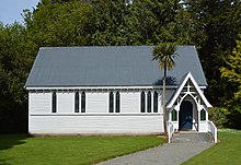
Sheffield is a small village located in the Selwyn District of the Canterbury region of New Zealand's South Island, near the Waimakariri Gorge.

<span class="mw-page-title-main">Kirwee</span> Minor urban area in Canterbury, New Zealand

Kirwee is a town located west of Christchurch in the Canterbury region of New Zealand's South Island. It was named after Karwi in India by retired British Army colonel De Renzie Brett. Kirwee is also home to the South Island Agricultural Field Days, held biennially.

<span class="mw-page-title-main">Glentunnel</span> Village in Canterbury, New Zealand

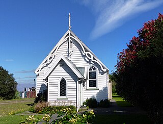
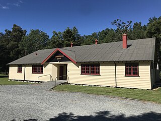
Glentunnel is a village located in the Selwyn District of the Canterbury region of New Zealand's South Island.

<span class="mw-page-title-main">Waddington, New Zealand</span> Settlement in Canterbury, New Zealand

Waddington is a small village located in the Selwyn District of the Canterbury region of New Zealand's South Island, near the Waimakariri Gorge.

<span class="mw-page-title-main">Winchester, New Zealand</span> Town in Canterbury, New Zealand

Winchester is a small town in the South-Canterbury region of New Zealand's South Island. Winchester is 6.9 kilometres north of Temuka and 51 kilometres southwest of Ashburton.

<span class="mw-page-title-main">Waikuku</span> Town in Canterbury, New Zealand

Waikuku is a small town in the Canterbury region of New Zealand, which sits 28 km north of central Christchurch. Waikuku lies 11.8 km (7.3 mi) south of Leithfield on state highway 1 and 3 km (1.9 mi) north of Woodend. In 1901 there were 86 people resident in Waikuku according to that year's census. Waikuku settlement had a population of 156 people at the time of the 2018 Census. It is popular with both those that commute into work in Christchurch each day and with owners of holiday houses. Waikuku was home to rope and twine works. This business started off using flax from local swamps. It closed in 1987. The nearby sandy beach and pine forests are popular with surfers, swimmers, campers and horse-riders, and the large estuary of the Ashley River hosts many species of birds.

<span class="mw-page-title-main">Castle Hill Village</span> Settlement in Canterbury, New Zealand

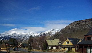
Castle Hill Village is an alpine village in Canterbury, New Zealand that started in 1982.

<span class="mw-page-title-main">Peel Forest</span> Rural community in Canterbury, New Zealand

Peel Forest is a small community in the Canterbury region of New Zealand. It is located near the Peel Forest Park Scenic Reserve and about 23 kilometres (14 mi) north of Geraldine. The town features a Cafe & Bar, a camping ground and an outdoor recreation facility. Popular activities include camping and tramping in the area, rafting and kayaking on the nearby Rangitata and Orari rivers and four-wheel-drive tours to nearby Lord of the Rings film locations.

<span class="mw-page-title-main">Hororata</span> Village in Canterbury, New Zealand

Hororata is a village at the northwestern edge of the Canterbury Plains in the South Island of New Zealand. It is located 15 kilometres southwest of Darfield, five kilometres south of Glentunnel, and 50 kilometres west of Christchurch, on the banks of the Hororata River. Hororata, when translated from Maori means "drooping rata". There are a large number of rata growing in the district.

<span class="mw-page-title-main">Selwyn Heights</span> Suburb of Rotorua, New Zealand

Selwyn Heights is a suburb of Rotorua in the Bay of Plenty Region of New Zealand's North Island.

Springfield is a suburb of Rotorua in the Bay of Plenty Region of New Zealand's North Island.

References

  1. 1 2 3 "ArcGIS Web Application". statsnz.maps.arcgis.com. Archived from the original on 14 February 2021. Retrieved 16 October 2021.
  2. 1 2 "Subnational population estimates (RC, SA2), by age and sex, at 30 June 1996-2022 (2022 boundaries)". Statistics New Zealand . Retrieved 25 October 2022. (regional councils); "Subnational population estimates (TA, SA2), by age and sex, at 30 June 1996-2022 (2022 boundaries)". Statistics New Zealand . Retrieved 25 October 2022. (territorial authorities); "Subnational population estimates (urban rural), by age and sex, at 30 June 1996-2022 (2022 boundaries)". Statistics New Zealand . Retrieved 25 October 2022. (urban areas)
  3. "Four of New Zealand's most underrated ski towns". Stuff. 18 June 2021. Archived from the original on 18 June 2021. Retrieved 19 June 2021.
  4. 1 2 "Springfield | NZETC". nzetc.victoria.ac.nz. Archived from the original on 8 November 2021. Retrieved 8 November 2021.
  5. 1 2 Taonga, New Zealand Ministry for Culture and Heritage Te Manatu. "Darfield district". teara.govt.nz. Archived from the original on 28 October 2020. Retrieved 8 November 2021.
  6. Eleven, Beck (28 September 2009). "D'oh! Springfield's giant Simpsons doughnut gets toasted". The Press . Archived from the original on 25 November 2009. Retrieved 22 November 2009. Wikinews-logo.svg Doughnut on display in Springfield, New Zealand at Wikinews
  7. "New doughnut for Springfield". The Press . 1 July 2012. Archived from the original on 4 July 2012. Retrieved 8 January 2013.
  8. kurt.bayer@nzherald.co.nz @KurtBayerNZME, Kurt Bayer NZ Herald reporter based in Christchurch (1 July 2019). "Owners of NZ's 'rudest cafe' Springfield Store and Cafe in hiding". NZ Herald. ISSN   1170-0777. Archived from the original on 5 January 2020. Retrieved 21 September 2020.
  9. "Police called over complaints about the café labelled New Zealand's rudest". au.news.yahoo.com. July 2019. Archived from the original on 22 September 2021. Retrieved 21 September 2020.
  10. "Police visit 'rudest cafe in New Zealand' after multiple complaints". Newshub. Archived from the original on 26 February 2021. Retrieved 21 September 2020.
  11. "'Rudest' cafe, Springfield Store & Cafe, under new ownership". Otago Daily Times Online News. 16 October 2019. Archived from the original on 22 October 2019. Retrieved 21 September 2020.
  12. "New Zealand's 'rudest' cafe gets new owners". Newshub. Archived from the original on 22 October 2019. Retrieved 21 September 2020.
  13. "Contracting firm saves Springfield homes after digging out raging water race". Stuff. 31 May 2021. Archived from the original on 3 June 2021. Retrieved 3 June 2021.
  14. "Selwyn District Council". Selwyn District Council. Archived from the original on 14 December 2021. Retrieved 3 June 2021.
  15. "Midland Rail Heritage Trust Website". Archived from the original on 14 May 2010. Retrieved 8 January 2013.
  16. Wilson, John (17 August 2015). "Te Ara, the encyclopedia of New Zealand". Te Ara. Archived from the original on 28 October 2020. Retrieved 21 September 2020.
  17. 1 2 "Statistical area 1 dataset for 2018 Census". Statistics New Zealand. March 2020. 7026673 and 7026674.
  18. "Population estimate tables - NZ.Stat". Statistics New Zealand . Retrieved 25 October 2022.
  19. 1 2 "Statistical area 1 dataset for 2018 Census". Statistics New Zealand. March 2020. Torlesse (333700). 2018 Census place summary: Torlesse
  20. "Selwyn Electorate Profile – New Zealand Parliament". www.parliament.nz. Archived from the original on 14 December 2021. Retrieved 13 October 2020.
  21. "Selwyn District Council". Selwyn District Council. Archived from the original on 14 December 2021. Retrieved 13 October 2020.
  22. Education Counts: Springfield School
  23. "New Zealand Schools Directory". New Zealand Ministry of Education. Retrieved 12 December 2022.
  24. "Welcome - 150th Jubilee". Springfield School. Archived from the original on 16 October 2021. Retrieved 16 October 2021.
  25. "Springfield | NZHistory, New Zealand history online". nzhistory.govt.nz. Archived from the original on 8 November 2021. Retrieved 8 November 2021.

Commons-logo.svg Media related to Springfield, New Zealand at Wikimedia Commons