Milk River is a tributary of the Missouri River, 729 miles (1,173 km) long, in the U.S. state of Montana and the Canadian province of Alberta. Rising in the Rocky Mountains, the river drains a sparsely populated, semi-arid watershed of 23,800 square miles (62,000 km2), ending just east of Fort Peck, Montana.

The Saskatchewan River is a major river in Canada. It stretches about 550 kilometres (340 mi) from where it is formed by the joining of the North Saskatchewan River and South Saskatchewan River just east of Prince Albert, Saskatchewan, to Lake Winnipeg. It flows roughly eastward across Saskatchewan and Manitoba to empty into Lake Winnipeg. Through its tributaries the North Saskatchewan and South Saskatchewan, its watershed encompasses much of the prairie regions of Canada, stretching westward to the Rocky Mountains in Alberta and north-western Montana in the United States.

The South Saskatchewan River is a major river in the Canadian provinces of Alberta and Saskatchewan. The river begins at the confluence of the Bow and Oldman Rivers in southern Alberta and ends at the Saskatchewan River Forks in central Saskatchewan. The Saskatchewan River Forks is the confluence of the South and North Saskatchewan Rivers and is the beginning of the Saskatchewan River.

Alberta is one of the thirteen provinces and territories of Canada. Located in Western Canada, the province has an area of 661,190 km2 (255,290 sq mi) and is bounded to the south by the United States state of Montana along 49° north for 298 km (185 mi); to the east at 110° west by the province of Saskatchewan for 1,223 km (760 mi); and at 60° north the Northwest Territories for 644 km (400 mi). The southern half of the province borders British Columbia along the Continental Divide of the Americas on the peaks of the Rocky Mountains, while the northern half borders British Columbia along the 120th meridian west. Along with Saskatchewan it is one of only two landlocked provinces or territories.

Battle Creek is a river that begins in the south-eastern region of the Canadian province of Alberta, near the border with Saskatchewan, in the Cypress Hills Interprovincial Park. From Alberta, Battle Creek flows east and across the border into Saskatchewan. It flows south out of Saskatchewan across the Canada–United States border into Montana, where it joins the Milk River in Blaine County, Montana.

The Bow River is a river in Alberta, Canada. It begins within the Canadian Rocky Mountains and winds through the Alberta foothills onto the prairies, where it meets the Oldman River, the two then forming the South Saskatchewan River. These waters ultimately flow through the Nelson River into Hudson Bay. The Bow River runs through the city of Calgary, taking in the Elbow River at the historic site of Fort Calgary near downtown. The Bow River pathway, developed along the river's banks, is considered a part of Calgary's self-image.

The Kootenay River or Kootenai River is a major river of the Northwest Plateau in southeastern British Columbia, Canada, and northern Montana and Idaho in the United States. It is one of the uppermost major tributaries of the Columbia River, the largest North American river that empties into the Pacific Ocean. The Kootenay River runs 781 kilometres (485 mi) from its headwaters in the Kootenay Ranges of the Canadian Rockies, flowing from British Columbia's East Kootenay region into northwestern Montana, then west into the northernmost Idaho Panhandle and returning to British Columbia in the West Kootenay region, where it joins the Columbia at Castlegar.

The Oldman River is a river in southern Alberta, Canada. It flows roughly west to east from the Rocky Mountains, through the communities of Fort Macleod, Lethbridge, and on to Grassy Lake, where it joins the Bow River to form the South Saskatchewan River, which eventually drains into the Hudson Bay.

Alberta Provincial Highway No. 3, commonly referred to as Highway 3 and officially named the Crowsnest Highway, is a 324-kilometre (201 mi) highway that traverses southern Alberta, Canada, running from the Crowsnest Pass through Lethbridge to the Trans-Canada Highway in Medicine Hat. Together with British Columbia Highway 3 which begins in Hope, it forms an interprovincial route that serves as an alternate to the Trans-Canada from the Lower Mainland to the Canadian Prairies.
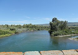
Hays is a hamlet in southern Alberta, Canada within the Municipal District of Taber. It is located at the intersection of Highway 524 and Highway 875 between Vauxhall and Redcliff. The Bow River is 3.3 kilometres (2.1 mi) to the north of the hamlet and the Oldman River is approximately 19 kilometres (12 mi) to the south. These two rivers converge to form the South Saskatchewan River approximately 20 kilometres (12 mi) to the southeast.
The North Western Coal and Navigation Company, also known as Alberta Railway and Coal Company or Alberta Railway and Irrigation Company, was a coal mining company formed in London, England in 1882 by Sir Alexander Tilloch Galt, one of Canada's Fathers of Confederation. As part of his vision for Canada, Galt was committed to finding industries that would bring settlers to the District of Alberta of the Northwest Territories. The company was founded to create a coal mining industry that could bring settlers to the Northwest Territories. It was based in Lethbridge, Alberta, with his son Elliott Torrance Galt, managing day-to-day operations. The company's superintendent was William Stafford. Money for this company came from a consortium of investors from Canada, England, and the United States.
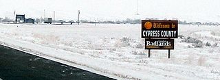
Cypress County is a municipal district in southeastern Alberta, Canada that surrounds the City of Medicine Hat and the Town of Redcliff. The municipality is part of Census Division 1, Alberta. The first farm in the area was settled in 1890.

Waterton Lake is a mountain lake in southern Alberta, Canada, and northern Montana, United States. The lake is composed of two bodies of water, connected by a shallow channel known locally as the Bosporus. The two parts are referred to as Middle Waterton Lake, and Upper Waterton Lake, the latter of which is divided by the Canada–United States border with Canada containing about two thirds of the lake while the southern third falls in the United States. The Boundary Commission Trail ends at the lake as the last border marker was placed there on 8 August 1874. The United States Geological Survey gives the geocoordinates of 49°03′00″N113°54′03″W for Upper Waterton Lake. Lower Waterton Lake is north of Middle Waterton Lake and is separated by a channel known as the Dardanelles.

Southern Alberta is a region located in the Canadian province of Alberta. In 2016, the region's population was approximately 291,112. The primary cities are Lethbridge and Medicine Hat. The region is known mostly for agricultural production, but other sectors, such as alternative energy, film production and tourism, are emerging.
Babb is a small unincorporated farming and ranching community in Glacier County, Montana, United States, on the Blackfeet Indian Reservation. The community experiences a large influx of tourists in the summer months as it is the gateway to the Many Glacier area of Glacier National Park. For statistical purposes, the United States Census Bureau has defined Babb as a census-designated place (CDP). It had a population of 174 at the 2010 census.
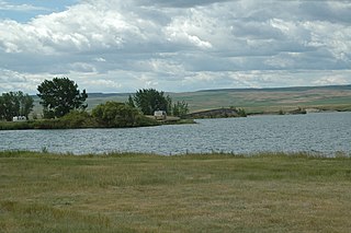
Milk River Ridge Reservoir is an artificial lake in southern Alberta, Canada. It is located about 44 kilometres (27 mi) south-east of Lethbridge, along Highway 506, west of Highway 4 and is a popular spot for summer activities.

Interbasin transfer or transbasin diversion are terms used to describe man-made conveyance schemes which move water from one river basin where it is available, to another basin where water is less available or could be utilized better for human development. The purpose of such water resource engineering schemes can be to alleviate water shortages in the receiving basin, to generate electricity, or both. Rarely, as in the case of the Glory River which diverted water from the Tigris to Euphrates River in modern Iraq, interbasin transfers have been undertaken for political purposes. While ancient water supply examples exist, the first modern developments were undertaken in the 19th century in Australia, India and the United States, feeding large cities such as Denver and Los Angeles. Since the 20th century many more similar projects have followed in other countries, including Israel and China, and contributions to the Green Revolution in India and hydropower development in Canada.

Belly River is a river in northwest Montana, United States and southern Alberta, Canada. It is a tributary of the Oldman River, itself a tributary of the South Saskatchewan River.
The Little Bow River is a tributary of the Oldman River in southern Alberta, Canada. It is about 190 kilometres (120 mi) long. From its headwaters near High River, it flows south, then turns east and flows into Travers Reservoir. Afterwards, it flows southeast into the Oldman River near Picture Butte. The Little Bow is related to the Bow River as they both ultimately feed the South Saskatchewan River.
The Oldman River Dam is a dam on the Oldman River in southwestern Alberta, Canada. The dam is north of Pincher Creek in the Municipal District of Pincher Creek No. 9.