Stanton, Gloucestershire

Last updated

Stanton
Stanton cottage 8348.jpg
A cottage and wall in Stanton, both built with Cotswold stone
Gloucestershire UK location map.svg
Red pog.svg
Stanton
Location within Gloucestershire
Population198 (2011 Census)
OS grid reference SP0634
Civil parish
  • Stanton
District
Shire county
Region
Country England
Sovereign state United Kingdom
Post town Broadway
Postcode district WR12
Dialling code 01386
Police Gloucestershire
Fire Gloucestershire
Ambulance South Western
UK Parliament
Website Stanton Parish Council
List of places
UK
England
Gloucestershire
52°00′23″N1°53′48″W / 52.0064°N 1.8968°W / 52.0064; -1.8968

Stanton is a village and civil parish in Tewkesbury Borough, Gloucestershire, England. The village is a spring line settlement at the foot of the Cotswold escarpment, about 2+12 miles (4 km) southwest of Broadway in neighbouring Worcestershire. Broadway is Stanton's postal town. The 2011 Census recorded the parish's population as 198. [1]

Contents

The parish is about 3 miles (5 km) long on a northwest – southeast axis, embracing both low-lying land northwest of the village and high Cotswold land to the southeast. On the opposite northeast – southwest axis the parish is about 1+12 miles (2.4 km) across at its widest point. Its highest point is Shenberrow Hill on the escarpment in the southeast of the parish, 994 feet (303 m) above sea level. The low-lying northwestern part of the parish is bounded mostly by two streams, which converge and then join the River Isbourne about 12 mile (800 m) outside the parish. A report in 1712 indicated that the village consisted of 60 houses and 300 inhabitants, including 29 freeholders. [2]

Much of the area of the village was owned by the Stott family from 1906 to 1949. In addition to restoring the properties, these owners built a reservoir in 1907, added lighting to the main street, improved the church, extended the school, built a swimming pool and cricket field. [3] Today, the village has no school, post office or shops. [4]

The village is built almost completely of Cotswold stone, a honey-coloured Jurassic limestone. Several cottages have thatched roofs. It has a high street, with a pub, The Mount, at the end. [5] David Verey calls it "architecturally, the most distinguished of the smaller villages in the North Cotswolds". [6] The Daily Telegraph described Stanton in 2017 as "arguably the most beautiful Cotswold village of them all" [7] while the Huffington Post said that it's "one of the prettiest and idyllic unspoilt villages of the Cotswolds". [8]

The Cotswold Way long-distance footpath passes through the village. [9]

Archaeology

Shenberrow, on the hill southeast of the village, is a hill fort enclosing about 2+12 acres (1 ha). It is bivallate, meaning that its defences include two concentric ditches. It was excavated in 1935, when Iron Age pottery, iron artefacts and a bronze bracelet were found. Romano-British pottery from the second century AD was also found. [10] The fort is a Scheduled Ancient Monument. [11]

Manor

Built in 1557 by Thomas Warren, the manor belonged to Winchcombe Abbey until the Dissolution of the Monasteries [12] and then to a series of owners, including Sir Philip Sidney Stott in the early 1900s. [13] The English architect, civil engineer and surveyor, is credited with rescuing Stanton village from oblivion after he bought the estate in 1906. [6] He put his fortune and skills into restoring Stanton Court and other historic buildings in the village.

Parish church

St Michael and All Angels' parish church Stanton church, Gloucestershire - geograph.org.uk - 991331.jpg
St Michael and All Angels' parish church

A church was built on this site circa 1100; [3] the earliest remaining features are three Norman columns from about 1200 which form the north arcade. The south arcade was rebuilt with Early English Gothic pointed arches, a bay longer than the previous arcade, together with a new tower of cut stone at the West end. There are hagioscopes (squints) in both transepts, an aumbry is in the north and two more in the south transept and aisle.

The village's web site provides this comment about its early history. "It seems possible that a Saxon church on the present site was served in early times by the monks of Winchcombe Benedictine Abbey, as the Manor, tithes and patronage of Stanton were bestowed on the Abbey by Kenulf, King of Mercia in 811 AD. Unfortunately, most records were destroyed in the disastrous fire at Winchcombe Benedictine Abbey in 1151 AD." [14]

The font, porch and parvise are 15th-century. The original pulpit and lectern date from about 1375 and were restored in 1982. There is a second pulpit added in 1684. There are medieval encaustic tiles at the east end.

One of Stanton's two First World War memorials. This one is in St Michael's parish churchyard and was designed by Sir Ninian Comper. "Lest we forget" - geograph.org.uk - 991355.jpg
One of Stanton's two First World War memorials. This one is in St Michael's parish churchyard and was designed by Sir Ninian Comper.

Fragments of ancient painted decoration survive. There are fragments of medieval stained glass in the east window, the south transept and the west window, which also shows the White Rose of York. The reredos of 1915, the rood screen and the east windows of the chancel and transepts are by Sir Ninian Comper and Squire Stott. In the north transept are murals of the Annunciation and Purification, fragments of the medieval screen.

Still visible on the south wall is evidence of stone benches for the old and infirm, dating from when most of the congregation would stand during the parts of the service that did not require kneeling. There are medieval benches at the back of the nave: "their poppy heads ringed with the chains of shepherds' dogs". [15] There is a wooden roundel of Mauritius Wrabury. [16]

The west tower has a ring of six bells. Humphrey and James Keene of Woodstock, Oxfordshire cast the second, third, fourth and fifth bells in 1640. John I Martin of Worcester cast the tenor bell in 1659 and the treble in 1660. [17] Sir Philip Stott hired designer Ninian Comper to improve the church with reredos and stained glass. [13]

The church is a Grade I listed building. [16]

Historic buildings

Old Manor Farmhouse Old Manor Farm, Stanton - geograph.org.uk - 229134.jpg
Old Manor Farmhouse

The Manor (also known as Warren House) [18] and Warne Cottage, [19] also called Warren House, is Elizabethan, with the year 1577 on a datestone. This was formerly manor house, and is now one house and an attached cottage. [20] Old Manor Farmhouse, built circa 1678, [21] is also Elizabethan. [20] [22]

A full 43 of the buildings in this village are Listed, all as Grade II. [23] Some of the noteworthy properties include the following.

Wormington Grange

Wormington Grange Wormington Grange, early autumn - geograph.org.uk - 1520362.jpg
Wormington Grange

Wormington Grange was built in the 1770s. [24] Its stables were designed by Henry Hakewill and completed in 1827. [25] It is Grade II listed. [26]

Sheppey Corner

Sheppey Corner Cottage Thatch stanton c 8333.jpg
Sheppey Corner Cottage

Sheppey Corner is a thatched cottage built about 1650 at the top of the High Street. [27] Like the rest of the village it is built of Cotswold stone. It was built as one large house and barn but was altered in the mid 18th century and then, extensively altered in 1922 for then-owner Sir P. Stott. It is now divided into three cottages that are Grade II Listed: [28] Little Sheppey House, No 3 and Pixie Cottage. [29]

Stanton Court

A Grade II listed building Stanton Court is a 14,644 square feet (1,360.5 m2) Jacobean manor house built for the Izod family in the "early and later part" of 17th Century. [30] It passed to their relatives, the Wynniatt family, in the early 18th century, who then extended the house adding a wing with Georgian sitting room. The house was extensively restored for Sir Philip Stott in the 20th century. [6] As of 2023, it is for sale with a guide price of £14 million. [31]

The Mount Inn

Though not listed, this very quaint 17th-century inn, atop a steep hill at the end of the village, is a popular spot for tourists because of its views over the Vale of Evesham and the Malvern Hills to the Black Mountains in Wales. It has an interesting history. [32] The building was originally a farmhouse, [4] known as "The Bank" until 1897 when it became a pub owned by Donnington Brewery and Richard Arkell. It was operated by the Troughton family until 1962. It was an off-licence facility for decades, known as "The Five Elms"; since alcoholic beverages could not be sold inside, the inn operator made cider in an outbuilding. Finally in 1947, the inn received its licence. [33]

Railway

New track being laid for the restoration of the Gloucestershire Warwickshire Railway through Stanton parish New line being laid for the Gloucestershire and Warwickshire railway near Stanton - geograph.org.uk - 750252.jpg
New track being laid for the restoration of the Gloucestershire Warwickshire Railway through Stanton parish

The Great Western Railway's main line between Stratford-upon-Avon and Cheltenham Spa Malvern Road was built through the parish between 1900 and 1904, [3] passing about 12 mile (800 m) west of the village. The nearest station was Laverton Halt about 1 mile (1.6 km) north of Stanton. British Railways closed the line to passenger trains in 1960 and freight in 1976. The Gloucestershire Warwickshire Railway heritage railway is currently rebuilding the line.

By 2018, the line had reached beyond the Stanton Lane bridge. [34]

Notable residents

Stanton has a 17th-century sundial on the base of its former village cross. It is a Scheduled Ancient Monument. The cottages behind it are 17th- and 18th-century. War memorial cross, Stanton - geograph.org.uk - 1468611.jpg
Stanton has a 17th-century sundial on the base of its former village cross. It is a Scheduled Ancient Monument. The cottages behind it are 17th- and 18th-century.

Related Research Articles

<span class="mw-page-title-main">Deerhurst</span> Human settlement in England

Deerhurst is a village and civil parish in Gloucestershire, England, about 2 miles (3 km) southwest of Tewkesbury. The village is on the east bank of the River Severn. The parish includes the village of Apperley and the hamlet of Deerhurst Walton. The 2011 Census recorded the parish's population as 906, the majority of whom live in Apperley.

<span class="mw-page-title-main">Kelmscott</span> Human settlement in England

Kelmscott is a village and civil parish on the River Thames in West Oxfordshire, about 2 miles (3 km) east of Lechlade in neighbouring Gloucestershire. Since 2001 it has absorbed Little Faringdon, which had been a separate civil parish. The 2011 Census recorded the merged parish's population as 198.

<span class="mw-page-title-main">Bibury</span> Human settlement in England

Bibury is a village and civil parish in Gloucestershire, England. It is on the River Coln, a Thames tributary that rises in the same (Cotswold) District. The village centre is 6+12 miles northeast of Cirencester. Arlington Row is a nationally notable architectural conservation area depicted on the inside cover of some British passports. It is a major destination for tourists visiting the traditional rural villages, tea houses and many historic buildings of the Cotswold District; it is one of six places in the country featured in Mini-Europe, Brussels.

<span class="mw-page-title-main">Adlestrop</span> Human settlement in England

Adlestrop is a village and civil parish in the Cotswolds, 3 miles (5 km) east of Stow-on-the-Wold, Gloucestershire, England, on the county boundary with Oxfordshire. The River Evenlode forms the southwest boundary of the parish. The village is on a stream that flows southwest to join the river.

<span class="mw-page-title-main">Stanway, Gloucestershire</span> Human settlement in England

Stanway is a small village and civil parish in the county of Gloucestershire, England, and about 1 mile south of Stanton: both villages are on the Cotswold Way. The parish includes the villages of Didbrook, Hailes, Taddington and Wood Stanway. The population of the parish at the 2011 census was 343. It is part of the Tewkesbury Borough Council area.

<span class="mw-page-title-main">Barnsley, Gloucestershire</span> Human settlement in England

Barnsley is a village and civil parish in the Cotswold district of Gloucestershire, England, 3.7 miles (6.0 km) northeast of Cirencester. It is 125 kilometres (78 mi) (geodesically) west of London.

<span class="mw-page-title-main">Broadwell, Cotswold</span> Human settlement in England

Broadwell is a village and civil parish in the English county of Gloucestershire. It is about 1.5 miles (2.4 km) north of Stow-on-the-Wold, In the 2001 United Kingdom census, the parish had a population of 384. decreasing to 355 at the 2011 census.

<span class="mw-page-title-main">Dumbleton</span> Human settlement in England

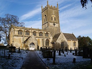
Dumbleton is a village and civil parish in the Tewkesbury district, in the county of Gloucestershire, England. The village is roughly 20 miles from the city of Gloucester. The village is known to have existed in the time of Æthelred I who granted land to Abingdon Abbey, and it is mentioned in the Domesday Book.

<span class="mw-page-title-main">Guy Dawber</span> English architect (1861–1938)

Sir Edward Guy Dawber, RA was an English architect working in the late Arts and Crafts style, whose work is particularly associated with the Cotswolds.

<span class="mw-page-title-main">Owlpen</span> Human settlement in England

Owlpen is a small village and civil parish in the Stroud district of Gloucestershire, England, set in a valley in the Cotswold hills. It is about one mile (1.6 km) east of Uley, and three miles (4.8 km) east of Dursley. The Owlpen valley is set around the settlement like an amphitheatre of wooded hills open to the west. The landscape falls within the Cotswold Area of Outstanding Natural Beauty, so designated in 1966. The population of the parish in mid-2010 was 29 (est.), the smallest in Gloucestershire.

<span class="mw-page-title-main">Withington, Gloucestershire</span>

Withington is a Cotswold village and civil parish in Gloucestershire, England, about 7 miles (11 km) southeast of Cheltenham and 8 miles (13 km) north of Cirencester. The River Coln runs through the village. The parish includes the hamlets of Hilcot, Foxcote and Cassey Compton. The parish population taken at the 2011 census was 532.

<span class="mw-page-title-main">Arlington, Gloucestershire</span> Community in South West England

Arlington is a Cotswold village in the parish of Bibury, Gloucestershire, England.

<span class="mw-page-title-main">Miserden</span> Human settlement in England

Miserden is a village and civil parish in Stroud District, Gloucestershire, England, 4 miles north east of Stroud. The parish includes Whiteway Colony and the hamlets of Sudgrove and The Camp. In the 2001 census the parish had a population of 420, increasing to 449 at the 2011 census.

<span class="mw-page-title-main">Church of St Mary the Virgin, Meysey Hampton</span> Church in Gloucestershire, England

The Church of St Mary the Virgin is a Church of England parish church in Meysey Hampton, Gloucestershire. It is in the Diocese of Gloucester and the archdeaconry of Cheltenham. It is a Grade II* listed building.

<span class="mw-page-title-main">St Peter's Church, Southrop</span> Church in Gloucestershire, England

St Peter's Church is an Anglican church in Southrop, a Cotswolds village in the English county of Gloucestershire. It is an active parish church in the Diocese of Gloucester and the archdeaconry of Cheltenham. It has been designated a Grade I listed building by English Heritage. The church—on the site of an older structure—dates from the 12th century.

<span class="mw-page-title-main">Elkstone</span> Human settlement in England

Elkstone is a village and civil parish in the English county of Gloucestershire. In the 2001 United Kingdom census, the parish had a population of 203, increasing to 248 at the 2011 census

<span class="mw-page-title-main">Wormington Grange</span> Country house in Stanton, Gloucestershire, England

Wormington Grange is a Grade II* listed country house in the civil parish of Stanton, Gloucestershire, England. It lies one mile (1.6 km) south of the village of Wormington.

<span class="mw-page-title-main">Wormington</span> Human settlement in England

Wormington is a village civil parish in the Tewkesbury district, in Gloucestershire, England. It lies on the River Isbourne, 5 miles (8 km) north of Winchcombe and 6 miles (10 km) south of Evesham. In 1931 the parish had a population of 67.

<span class="mw-page-title-main">Church of St Andrew, Eastleach Turville</span> Church

The Anglican Church of St Andrew at Eastleach Turville in the Cotswold District of Gloucestershire, England, was built in the 12th century. It is a grade I listed building.

<span class="mw-page-title-main">Lechlade Manor</span> Grade II listed house in Gloucestershire, United Kingdom

Lechlade Manor in Lechlade, Gloucestershire, England, is a Victorian country house built for George Milward, a lawyer, by John Loughborough Pearson. Primarily an ecclesiastical architect, working on over 200 church buildings in his fifty-year career, the manor represents one of Pearson's rare forays into secular building. Dating from 1872 to 1873, Lechlade was subsequently sold to the Sisters of St Clotilde and operated as a convent for much of the 20th century. In the 1990s, it was converted back to a private residence, with some enabling development in the grounds. Lechlade Manor is a Grade II listed building.

References

  1. "Area: Stanton (Parish): Key Figures for 2011 Census: Key Statistics". Neighbourhood Statistics. Office for National Statistics. Archived from the original on 26 November 2015. Retrieved 26 November 2015.
  2. Glover, Susan Paterson (19 January 2018). The Hardships of the English Laws in Relation to Wives by Sarah Chapone. Routledge. ISBN   9781317029281. Archived from the original on 2 July 2018. Retrieved 28 April 2019 via Google Books.
  3. 1 2 3 "Stanton Village - History and People". stantonvillage.uk. Archived from the original on 3 April 2019. Retrieved 28 April 2019.
  4. 1 2 Avery, Alison (29 September 2016). "Stanton, Gloucestershire". Beautiful England Photos. Archived from the original on 21 November 2018. Retrieved 28 April 2019.
  5. "The Mount Inn, Stanton - Village Pub near Broadway, Worcestershire UK". themountatstanton. Archived from the original on 28 April 2019. Retrieved 28 April 2019.
  6. 1 2 3 Verey 1970, p. 413.
  7. Madden, Richard (3 October 2017). "10 perfect pub walks in the Cotswolds". Archived from the original on 27 June 2019. Retrieved 28 April 2019 via www.telegraph.co.uk.
  8. "Five Magical Cotswolds Towns for the Winter". HuffPost UK. 16 December 2014. Archived from the original on 26 July 2018. Retrieved 28 April 2019.
  9. "Cotswold Way Circular Walk: 3. Stanton, Snowshill and the Edge - National Trails". www.nationaltrail.co.uk. Archived from the original on 25 June 2018. Retrieved 28 April 2019.
  10. RCHME 1976, pp. 109–110.
  11. Historic England. "Shenberrow hill camp (1004867)". National Heritage List for England . Retrieved 26 November 2015.
  12. Pilbeam, Alan (3 October 2011). Gloucestershire 300 Years Ago. The History Press. ISBN   9780752496733. Archived from the original on 2 July 2018. Retrieved 28 April 2019 via Google Books.
  13. 1 2 Elder, David (15 July 2015). 50 Gems of the Cotswolds: The History & Heritage of the Most Iconic Places. Amberley Publishing Limited. ISBN   9781445646718. Archived from the original on 2 July 2018. Retrieved 28 April 2019 via Google Books.
  14. "Stanton Village - Church of St Michael". stantonvillage.uk. Archived from the original on 7 April 2019. Retrieved 28 April 2019.
  15. Church leaflet, circa 1990s
  16. 1 2 Historic England. "Church of St Michael and All Angels (Grade I) (1091828)". National Heritage List for England . Retrieved 26 November 2015.
  17. Higson, Andrew (19 April 2006). "Stanton S Michael & All Angels". Dove's Guide for Church Bell Ringers . Central Council for Church Bell Ringers. Archived from the original on 6 September 2020. Retrieved 26 November 2015.
  18. Elder, David (15 July 2015). 50 Gems of the Cotswolds: The History & Heritage of the Most Iconic Places. Amberley Publishing Limited. ISBN   9781445646718. Archived from the original on 25 June 2018. Retrieved 28 April 2019 via Google Books.
  19. Historic England. "The Manor and Warne Cottage (Grade II*) (1091838)". National Heritage List for England . Retrieved 26 November 2015.
  20. 1 2 Verey 1970, p. 414.
  21. Stuff, Good. "Manor Farmhouse, Stanton, Gloucestershire". britishlistedbuildings.co.uk. Archived from the original on 28 April 2019. Retrieved 28 April 2019.
  22. Historic England. "Old Manor Farmhouse (Grade II*) (1154068)". National Heritage List for England . Retrieved 26 November 2015.
  23. "Listed Buildings in Stanton, Tewkesbury, Gloucestershire". britishlistedbuildings.co.uk. Archived from the original on 28 April 2019. Retrieved 28 April 2019.
  24. Historic England. "Wormington Grange (Grade II*) (1340084)". National Heritage List for England . Retrieved 26 November 2015.
  25. Historic England. "Stables, Wormington Grange (Grade II*) (1091824)". National Heritage List for England . Retrieved 26 November 2015.
  26. Stuff, Good. "Wormington Grange, Stanton, Gloucestershire". britishlistedbuildings.co.uk. Archived from the original on 28 April 2019. Retrieved 28 April 2019.
  27. Elder, David (15 July 2015). 50 Gems of the Cotswolds: The History & Heritage of the Most Iconic Places. Amberley Publishing Limited. ISBN   9781445646718. Archived from the original on 25 June 2018. Retrieved 28 April 2019 via Google Books.
  28. Historic England. "LITTLE SHEPPEY HOUSE, NO 3 AND PIXIE COTTAGE, Stanton (1340088)". National Heritage List for England . Retrieved 28 April 2019.
  29. Historic England. "Little Sheppey House, No 3 and Pixie Cottage (Grade II) (1340088)". National Heritage List for England . Retrieved 26 November 2015.
  30. Stuff, Good. "Stanton Court, Stanton, Gloucestershire". britishlistedbuildings.co.uk. Archived from the original on 28 April 2019. Retrieved 28 April 2019.
  31. "9 bedroom house for sale in Stanton, Broadway, Gloucestershire, WR12". Knight Frank. Retrieved 17 December 2023.
  32. "The Mount Inn, Stanton". www.lovingthecotswolds.com. Archived from the original on 25 June 2018. Retrieved 28 April 2019.
  33. "About The Mount at Stanton". themountatstanton. Archived from the original on 25 June 2018. Retrieved 28 April 2019.
  34. "Goucestershire Warwickshire Steam Railway (GWR)in the Cotswolds". www.cotswolds.info. Archived from the original on 28 April 2019. Retrieved 28 April 2019.
  35. Historic England. "Village cross at Stanton (1014398)". National Heritage List for England . Retrieved 26 November 2015.

Sources