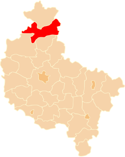
Blękwit is a village in the administrative district of Gmina Złotów, within Złotów County, Greater Poland Voivodeship, in west-central Poland.

Potulice is a village in the administrative district of Gmina Nakło nad Notecią, within Nakło County, Kuyavian-Pomeranian Voivodeship, in north-central Poland. It lies approximately 7 kilometres (4 mi) south-east of Nakło nad Notecią and 22 km (14 mi) west of Bydgoszcz. It is best known as the site of the World War II Potulice concentration camp, also known as Lebrechtsdorf.
Piesno is a village in the administrative district of Gmina Łobżenica, within Piła County, Greater Poland Voivodeship, in west-central Poland.
Rataje is a village in the administrative district of Gmina Łobżenica, within Piła County, Greater Poland Voivodeship, in west-central Poland.
Witrogoszcz-Osada is a settlement in the administrative district of Gmina Łobżenica, within Piła County, Greater Poland Voivodeship, in west-central Poland.
Ostrówek is a village in the administrative district of Gmina Wyrzysk, within Piła County, Greater Poland Voivodeship, in west-central Poland. It lies approximately 6 kilometres (4 mi) south-east of Wyrzysk, 41 km (25 mi) east of Piła, and 86 km (53 mi) north of the regional capital Poznań.
Zielona Góra is a village in the administrative district of Gmina Wyrzysk, within Piła County, Greater Poland Voivodeship, in west-central Poland. It lies approximately 2 kilometres (1 mi) south of Wyrzysk, 36 km (22 mi) east of Piła, and 86 km (53 mi) north of the regional capital Poznań.
Buntowo is a village in the administrative district of Gmina Złotów, within Złotów County, Greater Poland Voivodeship, in west-central Poland. It lies approximately 14 kilometres (9 mi) south of Złotów and 96 km (60 mi) north of the regional capital Poznań.
Dzierzążenko is a village in the administrative district of Gmina Złotów, within Złotów County, Greater Poland Voivodeship, in west-central Poland.
Gajek is a former settlement in the administrative district of Gmina Złotów, within Złotów County, Greater Poland Voivodeship, in west-central Poland. It lies approximately 13 kilometres (8 mi) south-east of Złotów and 101 km (63 mi) north of the regional capital Poznań.
Kleszczyna is a village in the administrative district of Gmina Złotów, within Złotów County, Greater Poland Voivodeship, in west-central Poland.
Kleszczynka is a village in the administrative district of Gmina Złotów, within Złotów County, Greater Poland Voivodeship, in west-central Poland. It lies approximately 9 kilometres (6 mi) south-east of Złotów and 101 km (63 mi) north of the regional capital Poznań.
Międzybłocie is a village in the administrative district of Gmina Złotów, within Złotów County, Greater Poland Voivodeship, in west-central Poland.
Nowa Święta-Osada is a settlement in the administrative district of Gmina Złotów, within Złotów County, Greater Poland Voivodeship, in west-central Poland.
Nowy Dwór is a village in the administrative district of Gmina Złotów, within Złotów County, Greater Poland Voivodeship, in west-central Poland.
Płosków is a village in the administrative district of Gmina Złotów, within Złotów County, Greater Poland Voivodeship, in west-central Poland.
Sławianowo is a village in the administrative district of Gmina Złotów, within Złotów County, Greater Poland Voivodeship, in west-central Poland. It lies approximately 13 kilometres (8 mi) south-east of Złotów and 98 km (61 mi) north of the regional capital Poznań.
Stare Dzierząźno is a village in the administrative district of Gmina Złotów, within Złotów County, Greater Poland Voivodeship, in west-central Poland.
Święta is a village in the administrative district of Gmina Złotów, within Złotów County, Greater Poland Voivodeship, in west-central Poland. It lies approximately 4 kilometres (2 mi) south-east of Złotów and 105 km (65 mi) north of the regional capital Poznań.
Stawno is a settlement in the administrative district of Gmina Złotów, within Złotów County, Greater Poland Voivodeship, in west-central Poland. It lies approximately 4 kilometres (2 mi) north-east of Złotów and 109 km (68 mi) north of the regional capital Poznań.