Sterling Heights, Michigan

Last updated
Sterling Heights, Michigan
Sterling Heights City Hall.jpg
Sterling Heights City Hall
Sterling Heights, Michigan logo.svg
Motto: 
To Strive on Behalf of All
Sterling Heights, MI location.png
Location within Macomb County
Relief map of USA Michigan.png
Red pog.svg
Sterling Heights
Usa edcp relief location map.png
Red pog.svg
Sterling Heights
Coordinates: 42°34′47″N83°01′41″W / 42.57972°N 83.02806°W / 42.57972; -83.02806
Country United States
State Michigan
County Macomb
Incorporated1968 (city)
Government
  Type Council–manager
   Mayor Michael C. Taylor (I)
   City manager Mark D. Vanderpool
   City Council
Members
  • Liz Sierawski - Mayor Pro Tem
  • Deanna Koski - At Large
  • Michael V. Radtke Jr - At Large
  • Maria G. Schimidt - At Large
  • Henry Yanez - At Large
  • Barbara A. Ziarko - At Large
Area
[1]
  Total36.72 sq mi (95.10 km2)
  Land36.45 sq mi (94.40 km2)
  Water0.27 sq mi (0.70 km2)
Elevation
614 ft (187 m)
Population
 (2020) [2]
  Total134,346
  Density3,686.06/sq mi (1,423.18/km2)
Time zone UTC−5 (Eastern (EST))
  Summer (DST) UTC−4 (EDT)
ZIP Codes
48310, 48311, 48312, 48313, 48314
Area code 586
FIPS code26-76460 [3]
GNIS feature ID0638798 [4]
Website www.sterling-heights.net

Sterling Heights is a city in Macomb County of the U.S. state of Michigan, and a suburb of Detroit. As of the 2020 census, the city had a total population of 134,346. [5] It is the second largest suburb in Metro Detroit, and the fourth largest city in Michigan.

Contents

History

As a result of the War of 1812 and the 1817 Treaty of Fort Meigs, the area of the Michigan Territory which now makes up Sterling Heights was first surveyed by Deputy Surveyor Joseph Wampler; his survey was approved on February 20, 1818. [6] Wampler had been one of two deputy surveyors of Perrysburg, Ohio, in 1816.

Acts which created & modified Sterling Township SterlingHeightsNameChanges.png
Acts which created & modified Sterling Township

Originally created as part of Shelby Township in April 1827, [7] it was broken off as Jefferson Township in March 1835. [8] In March 1838, it was renamed Sterling Township. [9]

Until the 1950s, Sterling Township was an agricultural area, largely devoted to growing rhubarb and other crops sold in Detroit. [10] Road improvements led to decreased commute times and lower costs for the delivery of goods and services to and from businesses. The population increased when suburban homes were built for the workers in metropolitan Detroit's booming automobile industry. When Sterling Township was incorporated as a city in 1968, "Heights" was added to the name to satisfy a state law that prevents incorporated municipalities from having the same name, as there was already a small village named Sterling in Arenac County. [11]

Gerald Donovan became the first mayor of the city and F. James Dunlop became the first mayor pro-tempore. In the 1960s and 1970s, many residents came to live in Sterling Heights to work in automobile plants operated by Chrysler and Ford. Lakeside Mall opened in Sterling Heights in 1976.

The city is home to many groups of immigrants. It has received many people of eastern European origins, including ethnic Albanians, Bosnians, Croatians, Macedonians, Montenegrins, Poles, Serbians and Slovenians. [12] After the 2003 U.S.-Iraqi War, millions of Iraqi citizens were displaced, particularly Iraqi Christians (Chaldean Catholics and Assyrians). Of these, 30,000-50,000 resettled in Sterling Heights, giving parts of the city the nickname "Little Nineveh", especially around 15 Mile Road and Ryan. [13] [14]

Geography

Sterling Heights is a second-ring suburb, 14 to 20 miles (23 to 32 km) north of downtown Detroit. The city's southern border is 6 miles (10 km) from Detroit's northern border. The shape of the city is six miles long and miles wide. [12] It is bordered to the south by the city of Warren, at its southwest corner by Madison Heights, to the west by Troy, to the north by Utica and Shelby Township, at its northeast corner by Macomb Township, to the east by Clinton Township, and to the southeast by Fraser.

According to the U.S. Census Bureau, Sterling Heights has a total area of 36.72 square miles (95.10 km2), of which 36.45 square miles (94.41 km2) are land and 0.27 square miles (0.70 km2), or 0.74%, are water. [1] The Clinton River crosses the northeast part of the city, flowing east to Lake St. Clair east of Mount Clemens.

Climate

Sterling Heights features a humid continental climate (Köppen: Dfa). Summers are somewhat hot with temperatures exceeding 90 °F (32 °C) on average 8.6 days. Winters are cold, with temperatures not rising above freezing on 39.1 days annually, while dropping to or below 0 °F (−18 °C) on average 1.2 days a year.

Climate data for Sterling Heights (Eastpointe station)
MonthJanFebMarAprMayJunJulAugSepOctNovDecYear
Mean daily maximum °C (°F)0.4
(32.8)
2.1
(35.8)
7.1
(44.7)
14.6
(58.3)
20.9
(69.7)
26.7
(80.0)
29.0
(84.2)
27.6
(81.7)
23.8
(74.8)
16.8
(62.3)
9.4
(49.0)
2.5
(36.5)
15.1
(59.1)
Daily mean °C (°F)−3.6
(25.5)
−2.6
(27.3)
1.7
(35.0)
8.4
(47.2)
14.8
(58.6)
20.5
(68.9)
22.9
(73.3)
21.8
(71.3)
17.7
(63.9)
11.2
(52.1)
4.9
(40.8)
−1.3
(29.7)
9.7
(49.5)
Mean daily minimum °C (°F)−7.7
(18.2)
−7.3
(18.8)
−3.7
(25.3)
2.2
(36.0)
8.6
(47.5)
14.3
(57.7)
16.8
(62.3)
16.0
(60.8)
11.6
(52.9)
5.5
(41.9)
0.3
(32.5)
−5.1
(22.9)
4.3
(39.7)
Average precipitation mm (inches)47
(1.86)
46
(1.82)
58
(2.27)
78
(3.07)
82
(3.23)
86
(3.38)
82
(3.22)
86
(3.38)
88
(3.45)
70
(2.75)
77
(3.05)
63
(2.49)
863
(33.97)
Source: NOAA (normals 1981–2010)

Neighboring cities/towns

Main highways

Sterling Heights sits on two main thoroughfares:

State highways

  • M-53.svg M-53 commonly called Van Dyke Avenue or the Van Dyke Freeway (they split in the city, however, and rejoin to its north), which leads north into The Thumb of Michigan.
  • M-59.svg M-59, commonly called Hall Road once the freeway ends—which is the east–west connector from just north of Mount Clemens, through Utica as a surface road, and then becomes a limited access freeway to Pontiac, being the main northern connector between Macomb County and Oakland County. In Sterling Heights, large areas are devoted to retail and commercial development (e.g., Lakeside Mall).

Other main roads

  • Mound Road is an important north–south artery that runs continuously through the city. Overall, the road starts south in Hamtramck and runs up to 32 Mile Road in Romeo. The road ends briefly at River Bends Park in Shelby Township (becoming Auburn Road), and continues just north of 22 Mile Road.
  • East-west travel is mainly on the "mile roads," beginning at 14 Mile Road through 20 Mile Road (M-59). 16 Mile Road, also known as Metro Parkway, is another major "mile road". See Roads and freeways in metropolitan Detroit.
  • Utica Road is an important diagonal connector that crisscrosses the city from southeast to northwest, going through the intersection of Dodge Park Road (across from the Sterling Heights city hall) via the first roundabout in Macomb County.
  • Dequindre Road is the border between the city of Sterling Heights and the city of Troy. It is also the border between the counties of Macomb and Oakland.
  • Hayes Road is the divider between Clinton Township (Between Utica Road and South of M59) and Fraser (Between Masonic and Moravian).

Demographics

Historical population
CensusPop.Note
1940 3,648
1950 6,50978.4%
1960 14,622124.6%
1970 61,365319.7%
1980 108,99977.6%
1990 117,8108.1%
2000 124,4715.7%
2010 129,6994.2%
2020 134,3463.6%
U.S. Decennial Census
2018 Estimate [15]

2020 census

Sterling Heights, Michigan – Racial and ethnic composition
Note: the US Census treats Hispanic/Latino as an ethnic category. This table excludes Latinos from the racial categories and assigns them to a separate category. Hispanics/Latinos may be of any race.
Race / Ethnicity (NH = Non-Hispanic)Pop 2000 [16] Pop 2010 [17] Pop 2020 [18] % 2000% 2010% 2020
White alone (NH)111,743108,750106,14989.77%83.85%79.01%
Black or African American alone (NH)1,6026,6388,7091.29%5.12%6.48%
Native American or Alaska Native alone (NH)2392462000.19%0.19%0.15%
Asian alone (NH)6,1008,71310,9354.90%6.72%8.14%
Pacific Islander alone (NH)3516130.03%0.01%0.01%
Other race alone (NH)1221583370.10%0.12%0.25%
Mixed race or Multiracial (NH)2,9652,6554,7282.38%2.05%3.52%
Hispanic or Latino (any race)1,6652,5233,2751.34%1.95%2.44%
Total124,471129,699134,346100.00%100.00%100.00%

2010 census

As of the census [19] of 2010, there were 129,699 people, 49,451 households, and 34,515 families living in the city. The population density was 3,552.4 inhabitants per square mile (1,371.6/km2). There were 52,190 housing units at an average density of 1,429.5 per square mile (551.9/km2). The racial makeup of the city was 85.1% White, 5.2% African American, 0.2% Native American, 6.7% Asian, 0.5% from other races, and 2.2% from two or more races. Hispanic or Latino of any race were 1.9% of the population.

There were 49,451 households, of which 31.0% had children under the age of 18 living with them, 55.0% were married couples living together, 10.5% had a female householder with no husband present, 4.3% had a male householder with no wife present, and 30.2% were non-families. 26.5% of all households were made up of individuals, and 10.7% had someone living alone who was 65 years of age or older. The average household size was 2.61 and the average family size was 3.20.

The median age in the city was 40.4 years. 21.7% of residents were under the age of 18; 8.8% were between the ages of 18 and 24; 25.8% were from 25 to 44; 28.6% were from 45 to 64; and 15.2% were 65 years of age or older. The gender makeup of the city was 48.5% male and 51.5% female.

2000 census

As of the census [3] of 2000, there were 124,471 people, 46,319 households, and 33,395 families living in the city. The population density was 3,397.0 inhabitants per square mile (1,311.6/km2). There were 47,547 housing units at an average density of 1,297.6 per square mile (501.0/km2). The racial makeup of the city was 90.70% White, 1.30% African American, 0.21% Native American, 4.92% Asian, 0.04% Pacific Islander, 0.34% from other races, and 2.50% from two or more races. 1.34% of the population were Hispanic or Latino of any race.

Ancestries: Polish (19.0%), German (14.4%), Italian (12.5%), Macedonian (5.7%), English (5.0), Chaldo-Assyrians (20.7%), American/US (4.0%) and Irish(4.0).

In 2000, there were more people in Sterling Heights born in Iraq than any other foreign country. In that year there were 5,059 people in Sterling Heights born in Iraq. The next three largest nations of foreign birth were North Macedonia at 1,723, Italy at 1,442 and Poland at 1,427. Now in 2020, there are an estimated 50,000 Chaldeans in the city. [20]

There were 46,319 households, out of which 32.9% had children under the age of 18 living with them, 60.4% were married couples living together, 8.5% had a female householder with no husband present, and 27.9% were non-families. 24.1% of all households were made up of individuals, and 8.5% had someone living alone who was 65 years of age or older. The average household size was 2.66 and the average family size was 3.21.

In the city, the population was spread out, with 24.1% under the age of 18, 8.5% from 18 to 24, 30.4% from 25 to 44, 25.2% from 45 to 64, and 11.8% who were 65 years of age or older. The median age was 37 years. For every 100 females, there were 96.0 males. For every 100 females age 18 and over, there were 92.6 males.

The median income for a household in the city was $60,494, and the median income for a family was $70,140. Males had a median income of $51,207 versus $31,489 for females. The per capita income for the city was $24,958. About 4.0% of families and 5.2% of the population were below the poverty line, including 6.6% of those under age 18 and 7.5% of those age 65 or over.

Law and government

The city has a council-manager form of government. The mayor, along with six other council members, is directly elected to council by the city residents. Prior to 2021, city council and Mayor positions had two-year terms. Following the approval of a ballot proposal in the November 2020 election the positions were changed to be four-year terms starting with the 2021 election cycle. As of January 2021, the Mayor is Michael C. Taylor. Taylor was the Mayor Pro Tem when the current Mayor at the time, Richard Notte, died while in office in December 2014. [21] Notte was the city's longest-serving mayor, winning 11 consecutive elections beginning in 1993, and the city's first mayor to be elected by popular vote. [22] Following his death, the municipal building was renamed the Richard J. Notte Sterling Heights City Center. [23]

The current City Manager, Mark D. Vanderpool, has served as the city manager since 2004. In December 2020, the City Council voted to increase Vanderpool's salary by 23%, making him the third highest-paid city administrator of similar cities in Michigan. [24]

Sterling Heights is located in Michigan's 25th House of Representatives district and Michigan's 30th House of Representatives district, District 25 is represented by Democrat Nate Shannon and District 30 is represented by Republican Diana Farrington, Sterling Heights is located in Michigan's 10th Senate district, represented by Republican Michael D. MacDonald.

Nationally, Sterling Heights is situated in both Michigan's 10th congressional district, represented by Republican John James.

In the 2020 presidential election, 70,204 ballots were cast, with incumbent Donald Trump receiving 38,451 votes (54.77%) to Joe Biden's 30,587 votes (43.56%). [25]

Crime

Sterling Heights
Crime rates* (2019)
Violent crimes
Homicide 0
Rape 18.74
Robbery 12.75
Aggravated assault 93.72
Total violent crime 125.21
Property crimes
Burglary 68.98
Larceny-theft 713.77
Arson 5.25
Total property crime 854.72
Notes

*Number of reported crimes per 100,000 population.

The Sterling Heights Police Department serves as the main law enforcement agency in the city.

Sterling Height's crime rate for 2018 was 180.38 per 100,000 population, a 2.16% decrease from 2017. [26] Sterling Heights' crime rate is lower than both the Michigan (449 [26] ) and United States (381 [26] ) averages. Sterling Heights had the fourth lowest crime rate per 100,000 population in 2018, compared to surrounding cities [26] Sterling Heights was beat by Rochester (61.19 [27] ), Troy (61.74 [28] ), and Fraser (157.25 [29] ). Sterling Heights has a lower crime rate than Utica (222.27 [30] ), Madison Heights (295.68 [31] ), Clinton Township (317.93 [32] ) and Warren (509.03 [33] ).

Education

Sterling Heights is served by two public school districts: Utica Community Schools, which serves the northern half of the city, and Warren Consolidated Schools, which serves the southern half of the city. Utica operates two high schools in the city, Stevenson High School and Henry Ford II High School, while Warren Consolidated only operates one in Sterling Heights High School. Additionally, Parkway Christian School, a private K-12 Christian school, is also located in the city.

Media

The city of Sterling Heights has three local newspapers, The Macomb Daily with daily and Sunday delivery (owned by the Journal Register Company), the Sterling Heights Sentry (C and G Newspapers), and the Sterling Heights Source (owned by Advisor & Source Newspapers), the last two are delivered to city residences free of charge. The city also has two local channels. SHTV is run by the city's community relations department and usually features locally produced programming (including City Council meetings) and community announcements. [34] Another channel is used for the Sterling Heights Public Library, which usually features educational programs as well as library announcements and important outreach programs for the thriving LGBT community in Sterling Heights. SHTV is found locally on Comcast channel 5, on Wide Open West channel 10 and online. The public library channel is found on Comcast channel 12 and WOW channel 20. The city's official radio station is AM 1700. [35] The city also releases a seasonal magazine and a city calendar free of charge to each city household and business.

WKEG, affiliated with Relevant Radio, is also based in Sterling Heights.

Sister cities

Sister City initiatives give opportunities for the cities' residents to come to know each other's cultures. The initiatives will facilitate the cultural, educational, municipal, business, professional and technical exchanges and projects among the sister cities. Sterling Heights' sister cities are: [36]

Notable people

Related Research Articles

<span class="mw-page-title-main">Warren, Michigan</span> City in Michigan, United States

Warren is a city in Macomb County in the U.S. state of Michigan. Warren borders Detroit, roughly 13 miles (20.9 km) north of downtown Detroit. As of the 2020 census, the city had a population of 139,387, making it the largest community in Macomb County and the third-largest city in Michigan, after Detroit and Grand Rapids.

<span class="mw-page-title-main">Oakland County, Michigan</span> County in Michigan, United States

Oakland County is a county in the U.S. state of Michigan. It is a principal county of the Detroit metropolitan area, containing the bulk of Detroit's northern suburbs. Due to the county's government complex spanning 2 municipalities, its county seat is shared between Pontiac and Waterford. Its largest city is Troy. As of the 2020 Census, its population was 1,274,395, making it the second-most populous county in Michigan, and the largest county in the United States without a city of 100,000 residents.

<span class="mw-page-title-main">Macomb County, Michigan</span> County in Michigan, United States

Macomb County is a county located in the eastern portion of the U.S. state of Michigan, bordering Lake St. Clair, and is part of northern Metro Detroit. As of the 2020 Census, the population was 881,217, making it the third-most populous county in the state. The county seat is Mt. Clemens. Macomb County is part of the Detroit-Warren-Dearborn, MI Metropolitan Statistical Area. The city of Detroit is located on the county's southern border. Macomb County contains 27 cities, townships and villages, including three of the top ten most-populous municipalities in Michigan as of the 2020 census: Warren (#3), Sterling Heights (#4) and Clinton Township (#8). Most of this population is concentrated south of Hall Road (M-59), one of the county's main thoroughfares.

<span class="mw-page-title-main">Ferndale, Michigan</span> City in Michigan, United States

Ferndale is a city in Oakland County in the U.S. state of Michigan. An inner-ring suburb of Detroit on the Woodward Corridor, Ferndale borders Detroit to the north, roughly 10 miles (16.1 km) northwest of downtown Detroit. As of the 2020 census, the city had a population of 19,190.

<span class="mw-page-title-main">Center Line, Michigan</span> City in Michigan, United States

Center Line is a city in Macomb County in the U.S. state of Michigan. An inner-ring suburb of Detroit, Center Line is located roughly 11 miles (17.7 km) north of downtown Detroit, and is completely surrounded by the larger city of Warren. As of the 2020 census, the city had a population of 8,552.

<span class="mw-page-title-main">Clinton Township, Macomb County, Michigan</span> Charter township in Michigan, United States

Clinton Township is a charter township in Macomb County in the U.S. state of Michigan. A northern suburb of Detroit, Clinton Township is located about 22 miles (35 km) northeast of downtown Detroit. As of the 2020 census, the township had a population of 100,513, making it the most populous township in Michigan, and the state's 8th-most populous community overall.

<span class="mw-page-title-main">Eastpointe, Michigan</span> City in Michigan, United States

Eastpointe is a city in Macomb County in the U.S. state of Michigan. An inner-ring suburb of Detroit, Eastpointe borders Detroit to the north, roughly 11 miles (17.7 km) northeast of Downtown Detroit. The population was 34,318 at the 2020 census.

<span class="mw-page-title-main">Fraser, Michigan</span> City in Michigan, United States

Fraser is a city in Macomb County in the U.S. state of Michigan. A northern suburb of Detroit, Fraser is located roughly 15 miles (24.1 km) northeast of downtown Detroit. As of the 2020 census, the city had a population of 14,726.

<span class="mw-page-title-main">Macomb Township, Michigan</span> Civil township in Michigan, United States

Macomb Township is a civil township of Macomb County in the U.S. state of Michigan. The population was 91,663 at the 2020 census, up from 79,580 in 2010. As of 2020 it was the most-populous civil township in the state and the third most-populous township overall after the charter townships of Clinton and Canton.

<span class="mw-page-title-main">Mount Clemens, Michigan</span> City in Michigan, United States

Mount Clemens is a city in the U.S. state of Michigan. The population was 15,697 at the 2020 census. It is the seat of government of Macomb County.

<span class="mw-page-title-main">Ray Township, Michigan</span> Civil township in Michigan, United States

Ray Township is a civil township of Macomb County in the U.S. state of Michigan. As of the 2020 census, the township population was 3,780.

<span class="mw-page-title-main">Roseville, Michigan</span> City in Michigan, United States

Roseville is a city in Macomb County in the U.S. state of Michigan. A northern suburb of Detroit, Roseville is located roughly 13 miles (20.9 km) northeast of downtown Detroit. As of the 2020 census, the city had a population of 47,710.

<span class="mw-page-title-main">Shelby Charter Township, Michigan</span> Charter township in Michigan, United States

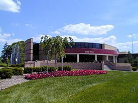
Shelby Charter Township, officially the Charter Township of Shelby, is a charter township located in Macomb County in the U.S. state of Michigan. The township is an affluent northern suburb of Detroit. As of the 2020 census, the population was 79,408, up from 73,804 in 2010. Shelby Charter Township is one of the fastest-growing communities in Metro Detroit.

<span class="mw-page-title-main">Utica, Michigan</span> City in Michigan, United States

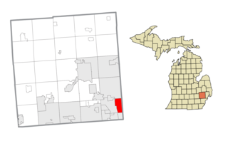
Utica is a city in Macomb County in the U.S. state of Michigan. The population was 5,245 at the 2020 census, up from 4,757 in 2010.

<span class="mw-page-title-main">Hazel Park, Michigan</span> City in Michigan, United States

Hazel Park is a city in Oakland County in the U.S. state of Michigan. An inner-ring suburb of Detroit, Hazel Park borders Detroit to the north, roughly 10 miles (16.1 km) north of downtown Detroit. As of the 2020 census, the city had a population of 14,983.

<span class="mw-page-title-main">Rochester Hills, Michigan</span> City in Michigan, United States

Rochester Hills is a city in Oakland County in the U.S. state of Michigan. As of the 2020 census, the city had a total population of 76,300. It is the 14th-largest city in Michigan.

<span class="mw-page-title-main">Madison Heights, Michigan</span> City in Michigan, United States

Madison Heights is a city in Oakland County in the U.S. state of Michigan. An inner-ring suburb of Detroit, Madison Heights is located roughly 12 miles (19.3 km) north of downtown Detroit. As of the 2020 census, the city had a population of 28,468.

<span class="mw-page-title-main">Harper Woods, Michigan</span> City in Michigan, United States

Harper Woods is a city in Wayne County in the U.S. state of Michigan. An inner ring suburb of Detroit, Harper Woods borders Detroit to the north and east, roughly 9 miles (14.5 km) northeast of downtown Detroit. As of the 2020 census, the city had a population of 15,492.

Michigan's 14th congressional district was a congressional district that stretched from eastern Detroit westward to Farmington Hills, then north to the suburb of Pontiac. From 1993 to 2013, it was based entirely in Wayne County.

<span class="mw-page-title-main">Washington Township, Macomb County, Michigan</span> Charter township in Michigan, United States

Washington Charter Township, located within Metro Detroit, is a charter township of Macomb County in the U.S. state of Michigan. The population was 28,165 at the 2020 census, up from 25,139 in 2010.

References

  1. 1 2 "2022 U.S. Gazetteer Files: Michigan". United States Census Bureau. Archived from the original on June 16, 2023. Retrieved June 16, 2023.
  2. "P1. Race – Sterling Heights city, Michigan: 2020 DEC Redistricting Data (PL 94-171)". U.S. Census Bureau. Archived from the original on June 16, 2023. Retrieved June 16, 2023.
  3. 1 2 "U.S. Census website". United States Census Bureau. Archived from the original on 2021-07-09. Retrieved 2008-01-31.
  4. "Sterling Heights". Geographic Names Information System . United States Geological Survey, United States Department of the Interior.
  5. "U.S. Census Bureau QuickFacts: Sterling Heights city, Michigan". Census.gov. Archived from the original on 2022-08-15. Retrieved 2022-07-19.
  6. "Survey Details - BLM GLO Records". glorecords.blm.gov. Archived from the original on 2022-08-15. Retrieved 2022-05-16.
  7. "An act to divide the several counties in this Territory into Townships, and for other purposes" - Laws of the Territory of Michigan, Volume 2, Pgs. 478-479
  8. "An Act organizing certain townships" - Laws of the Territory of Michigan, Volume 3, pgs. 1367-1369
  9. "An Act to organize certain townships and for other purposes" - Acts of the Michigan Legislature adjourned session of 1837, regular session of 1838; pgs. 76-84
  10. "Sterling Heights, MI - Official Website". www.sterling-heights.net. Archived from the original on 2021-01-22. Retrieved 2021-01-12.
  11. Pre-City History Archived 2014-06-28 at the Wayback Machine , The Official Site of the City of Sterling Heights
  12. 1 2 Murray, Dublin. "Teen-age strife in Detroit suburb reflects ethnic conflicts of Yugoslavia's civil war." Baltimore Sun . December 22, 1991. p. 1. (Archive). Retrieved on September 28, 2014.
  13. Rupersburg, Nicole (October 6, 2011). "Little Baghdad in Sterling Heights". Metromode. Archived from the original on 2021-05-29. Retrieved 2020-04-25.
  14. Namou, Weam (2019-11-26). "The Story Iraqi-American Author Weam Namou Almost Did Not Tell". Hour Detroit Magazine . Archived from the original on 2020-08-20. Retrieved 2020-04-25.
  15. "Population Estimates". United States Census Bureau. Archived from the original on March 28, 2019. Retrieved June 8, 2018.
  16. "P004: Hispanic or Latino, and Not Hispanic or Latino by Race – 2000: DEC Summary File 1 – Sterling Heights city, Michigan". United States Census Bureau . Retrieved January 26, 2024.
  17. "P2: Hispanic or Latino, and Not Hispanic or Latino by Race – 2010: DEC Redistricting Data (PL 94-171) – Sterling Heights city, Michigan". United States Census Bureau . Retrieved January 26, 2024.
  18. "P2: Hispanic or Latino, and Not Hispanic or Latino by Race – 2020: DEC Redistricting Data (PL 94-171) – Sterling Heights city, Michigan". United States Census Bureau . Retrieved January 26, 2024.
  19. "U.S. Census website". United States Census Bureau. Archived from the original on 2021-07-09. Retrieved 2012-11-25.
  20. PCT18. ANCESTRY (TOTAL CATEGORIES TALLIED) FOR PEOPLE WITH ONE OR MORE ANCESTRY CATEGORIES REPORTED [109] - Universe: Total ancestry categories tallied for people with one or more ancestry categories reported, U.S. Census Bureau, 2000 census[ dead link ]
  21. "Sterling Heights, MI - Official Website". www.sterling-heights.net. Archived from the original on 2021-01-22. Retrieved 2021-01-29.
  22. "Longtime Sterling Heights mayor Richard Notte dies". The Detroit News. Archived from the original on 2018-02-26. Retrieved 2023-07-12.
  23. "Sterling Heights city center renamed for late mayor". Detroit Free Press. Archived from the original on 2022-08-17. Retrieved 2023-07-12.
  24. Hall, Christina. "Sterling Heights city manager gets nearly $38,000 raise". Detroit Free Press. Archived from the original on 2021-01-25. Retrieved 2021-01-29.
  25. Jr, Dave Bartkowiak (2020-11-10). "How Detroit's Macomb County suburbs voted in 2020 presidential election". WDIV. Archived from the original on 2023-04-25. Retrieved 2023-07-12.
  26. 1 2 3 4 "Sterling Heights MI Crime Rate 2001-2018". www.macrotrends.net. Archived from the original on 2021-01-23. Retrieved 2021-01-29.
  27. "Rochester MI Crime Rate 1999-2018". www.macrotrends.net. Archived from the original on 2021-02-09. Retrieved 2021-01-29.
  28. "Troy MI Crime Rate 1999-2018". www.macrotrends.net. Archived from the original on 2021-02-08. Retrieved 2021-01-29.
  29. "Fraser MI Crime Rate 1999-2018". www.macrotrends.net. Archived from the original on 2021-06-17. Retrieved 2021-01-29.
  30. "Utica MI Crime Rate 2005-2018". www.macrotrends.net. Archived from the original on 2021-01-24. Retrieved 2021-01-29.
  31. "Madison Heights MI Crime Rate 1999-2018". www.macrotrends.net. Archived from the original on 2021-02-03. Retrieved 2021-01-29.
  32. "Clinton Township MI Crime Rate 1999-2018". www.macrotrends.net. Archived from the original on 2021-03-04. Retrieved 2021-01-29.
  33. "Warren MI Crime Rate 2001-2018". www.macrotrends.net. Archived from the original on 2021-02-03. Retrieved 2021-01-29.
  34. "SHTV Programs | Sterling Heights, MI - Official Website". www.sterling-heights.net. Archived from the original on 2021-01-15. Retrieved 2021-01-12.
  35. "Sterling Heights Radio 1700 | Sterling Heights, MI - Official Website". www.sterling-heights.net. Archived from the original on 2020-12-03. Retrieved 2021-01-12.
  36. "Jaffna becomes a Sister City of Sterling Heights, United States". Daily FT . November 23, 2016. Archived from the original on November 23, 2016. Retrieved November 23, 2016.
  37. Hinds, Julie (2013-02-02). "'Grosse Pointe Blank' writer Tom Jankiewicz found a place in film history". Detroit Free Press . Archived from the original on 2013-02-07. Retrieved 2013-02-04.
  38. "'Grounded' Lucas soaring". 3 April 2009. Archived from the original on 10 August 2022. Retrieved 11 May 2022.

42°34′49″N83°1′49″W / 42.58028°N 83.03028°W / 42.58028; -83.03028