
Queensland is the second-largest and third-most populous state in the Commonwealth of Australia. Situated in the north-east of the country, it is bordered by the Northern Territory, South Australia and New South Wales to the west, south-west and south respectively. To the east, Queensland is bordered by the Coral Sea and Pacific Ocean. To its north is the Torres Strait, with Papua New Guinea located less than 200 km across it from the mainland. The state is the world's sixth-largest sub-national entity, with an area of 1,852,642 square kilometres (715,309 sq mi).

Cunnamulla is a small town that lies on the Warrego River in South West Queensland, Australia, 206 kilometres (128 mi) south of Charleville, and approximately 750 kilometres (470 mi) west of the state capital, Brisbane.

The Myall Creek massacre at Myall Creek near the Gwydir River, in the central New South Wales district of Namoi, involved the brutal killing of at least twenty-eight unarmed Indigenous Australians by eleven colonists on 10 June 1838 at the Myall Creek near Bingara, Murchison County, in northern New South Wales. After two trials, seven of the eleven colonists were found guilty of murder and hanged.

The Shire of Paroo is a local government area in South West Queensland, Australia. The administrative centre is the town of Cunnamulla. The Paroo Shire covers an area of 47,714.5 square kilometres (18,422.7 sq mi). At the 2006 census, 1,217 of Paroo's 1,928 residents lived in Cunnamulla.
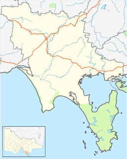
Foster is a dairying and grazing town 174 kilometres (108 mi) south-east of Melbourne on the South Gippsland Highway in Victoria, Australia. At the 2016 census Foster had an urban population of 1,164. It is about 20 kilometres (12 mi) north of the Gippsland coastline which includes Shallow Inlet, Corner Inlet, Waratah Bay, Yanakie and Wilsons Promontory.

Carina is a suburb of Brisbane, Australia. It is located 7 kilometres (4.3 mi) east of the CBD, and borders Carindale, Carina Heights, Cannon Hill and Camp Hill.

The Albert River is a perennial river located in the South East region of Queensland, Australia. Its catchment lies within the Gold Coast and Scenic Rim Region local government areas and covers an area of 782 square kilometres (302 sq mi). The river provides potable water for the town of Beaudesert.

Newmarket is an inner north-west suburb of Brisbane, Queensland, Australia. It is located approximately 5 kilometres (3.1 mi) from the Brisbane central business district (CBD) and is surrounded by the suburbs of Alderley to the north, Ashgrove to the west, Kelvin Grove to the south, and Wilston to the east. It is an older, mostly residential suburb containing pre-war and post-war homes, including many fine examples of the Queenslander style of home. Over the last few years, some medium-density townhouses and unit blocks have appeared as well.

Linville is a town and locality in the Somerset Region of south east Queensland, Australia. In the 2011 census, Linville had a population of 431 people.
Abbot Point is the most northerly deepwater coal port of Australia, situated approximately 25 kilometres north-west of the township of Bowen, Queensland. Established in 1984, it consists of a rail in-loading facility, coal handling and stockpile areas, and a single trestle jetty and conveyor connected to a berth and shiploader, located 2.75 km off-shore. Coal reaches the port via the GAP railway line from the Bowen Basin Coalfields.
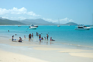
Whitehaven Beach is a 7 km stretch along Whitsunday Island, Australia. The island is accessible by boat, seaplane & helicopter from Airlie Beach, as well as Hamilton Island. It lies across from Stockyard Beach, better known as Chalkie's Beach, on Haslewood Island. The beach is known for its crystal white silica sands and turquoise coloured waters. The beach has barbeque and camping facilities.

The Chicago Stockyarders are a semi-professional rugby league football team based in Chicago, Illinois. The team was established in 2010, and played two exhibition rugby league sevens games while preparing for a fuller exhibition schedule for the 2011 AMNRL season. They originally planned to join the American National Rugby League (AMNRL), however the league has since folded and plans are currently being made to join the current first grade U.S. competition, the USA Rugby League.
Stockyard Hill Wind Farm is a wind farm project being developed and constructed by Goldwind Australia, in Victoria (Australia).
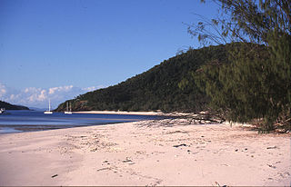
Chalkie's Beach is located on the western coast of Haslewood Island in the Whitsunday Islands of Queensland, Australia. It lies across from the more popular Whitehaven Beach on the main Whitsunday Island.

Stockyard Creek is a locality between Hamley Bridge and Owen, South Australia in the Mid North region of South Australia. It was established on the Hamley Bridge to Balaklava railway at the site of stockyards used by CB Fisher, 51 3⁄4 miles (83.3 km) north of Adelaide railway station. A private subdivision was surveyed, and there was a post office near the station, but very little remains now.
