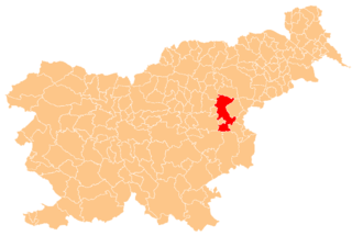
Šentjur is a town in eastern Slovenia. It is the seat of the Municipality of Šentjur. The town lies on the Voglajna River east of Celje. The area was part of the traditional region of Styria. The municipality is now included in the Savinja Statistical Region.

Roginska Gorca is a settlement in the Municipality of Podčetrtek in eastern Slovenia. The area around Podčetrtek was traditionally part of the region of Styria. It is now included in the Savinja Statistical Region.
Polžanska Gorca is a settlement west of Sladka Gora and north of Polžanska Vas in the Municipality of Šmarje pri Jelšah in eastern Slovenia. The area was historically part of the Styria region. The municipality is now included in the Savinja Statistical Region.
Botričnica is a settlement north of Šentjur in eastern Slovenia. The area is part of the historical Styria region. The Municipality of Šentjur is now included in the Savinja Statistical Region.
Črnolica is a settlement in the Municipality of Šentjur in eastern Slovenia. It lies on the right bank of the Voglajna River southeast of Šentjur. The area is part of the historical region of Styria. The municipality is now included in the Savinja Statistical Region.
Dole is a settlement in the Municipality of Šentjur in eastern Slovenia. It lies on the road leading north from Šentjur towards Dramlje. The area is part of the historical region of Styria. The municipality is now included in the Savinja Statistical Region.
Hrastje is a settlement east of Dobrina in the Municipality of Šentjur in eastern Slovenia. Traditionally the entire area was part of the region of Styria. The Municipality of Šentjur is now included in the Savinja Statistical Region.
Žegar is a settlement in the Municipality of Šentjur in eastern Slovenia. It lies just off the regional road leading southeast of Šentjur towards Kozje. The area is part of the historical region of Styria. The municipality is now included in the Savinja Statistical Region.
Jelce is a dispersed settlement in the hills south of Slivnica pri Celju in the Municipality of Šentjur in eastern Slovenia. Traditionally the area belonged to the Styria region. The municipality is now included in the Savinja Statistical Region.
Krajnčica is a settlement in the Municipality of Šentjur in eastern Slovenia. It lies in the hills above the left bank of the Voglajna River southwest of Šentjur. The area is part of the historical region of Styria. The municipality is now included in the Savinja Statistical Region.
Krivica is a settlement in the Municipality of Šentjur in eastern Slovenia. It lies in the hills either side of the regional road leading south from Šentjur towards Kozje, just east of Lopaca. The area is part of the historical Styria region. The municipality is now included in the Savinja Statistical Region.
Lutrje is a settlement north of Ponikva in the Municipality of Šentjur in eastern Slovenia. The area is part of the historical region of Styria. The municipality is now included in the Savinja Statistical Region.
Paridol is a settlement in the Municipality of Šentjur in eastern Slovenia. It lies off the regional road leading south out of Šentjur towards Planina. The entire Municipality of Šentjur is included in the Savinja Statistical Region. Traditionally it was part of the Styria region.
Podgrad is a settlement in the Municipality of Šentjur in eastern Slovenia. It lies northwest of the town of Šentjur. The area is part of the historical region of Styria. The municipality is now included in the Savinja Statistical Region.
Podlešje is a small settlement in the hills south of Šentjur in eastern Slovenia. The area is part of the historical Styria region. The Municipality of Šentjur is now included in the Savinja Statistical Region.
Prapretno is a settlement in the Municipality of Šentjur in eastern Slovenia. It lies in the hills southwest of Planina pri Sevnici. The municipality is included in the Savinja Statistical Region. The entire area is part of the historical region of Styria.

Stopče is a village in the Municipality of Šentjur in eastern Slovenia. It lies on the regional road leading east from Šentjur to Grobelno. The area is part of the historical Styria region. The municipality is now included in the Savinja Statistical Region.
Trnovec pri Dramljah is a settlement in the Municipality of Šentjur in eastern Slovenia. It lies south of Dramlje, just off the regional road to Šentjur. The area is part of the historical region of Styria. The municipality is now included in the Savinja Statistical Region.
Trška Gorca is a small settlement in the Municipality of Šentjur in eastern Slovenia. It lies just off the regional road leading south from Šentjur to Planina pri Sevnici. The area is part of the historical Styria region. The municipality is now included in the Savinja Statistical Region.