Katowice Voivodeship was a unit of administrative division and local government in Poland in the years 1975–1998, superseded by the Silesian Voivodeship. Its capital city was Katowice.
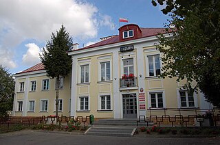
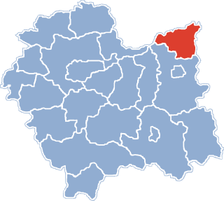
Dąbrowa Tarnowska is a town in Poland, in Lesser Poland Voivodeship, about 16 kilometres (10 mi) north of Tarnów. It is the capital of Dąbrowa County. Before reorganization Dąbrowa Tarnowska was part of Tarnów Voivodeship (1975–1998). Population is 11,402 (2008). Dąbrowa Tarnowska has a rail station on the minor line which joins Tarnów and Szczucin.

Morzychna is a village in the administrative district of Gmina Dąbrowa Tarnowska, within Dąbrowa County, Lesser Poland Voivodeship, in southern Poland. It lies approximately 3 kilometres (2 mi) west of Dąbrowa Tarnowska and 74 km (46 mi) east of the regional capital Kraków.
Bieniaszowice is a village in the administrative district of Gmina Gręboszów, within Dąbrowa County, Lesser Poland Voivodeship, in southern Poland. It lies approximately 17 kilometres (11 mi) west of Dąbrowa Tarnowska and 62 km (39 mi) east of the regional capital Kraków.

Gręboszów is a village in Dąbrowa County, Lesser Poland Voivodeship, in southern Poland. It is the seat of the gmina called Gmina Gręboszów. It lies approximately 18 kilometres (11 mi) north-west of Dąbrowa Tarnowska and 64 km (40 mi) east of the regional capital Kraków.
Kozłów is a village in the administrative district of Gmina Gręboszów, within Dąbrowa County, Lesser Poland Voivodeship, in southern Poland. It lies approximately 4 kilometres (2 mi) north-east of Gręboszów, 17 km (11 mi) north-west of Dąbrowa Tarnowska, and 67 km (42 mi) east of the regional capital Kraków.
Okręg is a village in the administrative district of Gmina Gręboszów, within Dąbrowa County, Lesser Poland Voivodeship, in southern Poland. It lies approximately 18 kilometres (11 mi) west of Dąbrowa Tarnowska and 61 km (38 mi) east of the regional capital Kraków.
Wójcina is a village in the administrative district of Gmina Mędrzechów, within Dąbrowa County, Lesser Poland Voivodeship, in southern Poland. It lies approximately 15 kilometres (9 mi) north of Dąbrowa Tarnowska and 80 km (50 mi) east of the regional capital Kraków.
Adamierz is a village in the administrative district of Gmina Olesno, within Dąbrowa County, Lesser Poland Voivodeship, in southern Poland. It lies approximately 3 kilometres (2 mi) south-west of Olesno, 8 km (5 mi) north-west of Dąbrowa Tarnowska, and 71 km (44 mi) east of the regional capital Kraków.
Ćwików is a village in the administrative district of Gmina Olesno, within Dąbrowa County, Lesser Poland Voivodeship, in southern Poland. It lies approximately 4 kilometres (2 mi) north-west of Olesno, 10 km (6 mi) north-west of Dąbrowa Tarnowska, and 72 km (45 mi) east of the regional capital Kraków.
Niwki is a village in the administrative district of Gmina Olesno, within Dąbrowa County, Lesser Poland Voivodeship, in southern Poland. It lies approximately 6 kilometres (4 mi) west of Olesno, 12 km (7 mi) north-west of Dąbrowa Tarnowska, and 68 km (42 mi) east of the regional capital Kraków.

Olesno is a village in Dąbrowa County, Lesser Poland Voivodeship, in southern Poland. It is the seat of the gmina called Gmina Olesno. It lies approximately 7 kilometres (4 mi) north-west of Dąbrowa Tarnowska and 74 km (46 mi) east of the regional capital Kraków.
Swarzów is a village in the administrative district of Gmina Olesno, within Dąbrowa County, Lesser Poland Voivodeship, in southern Poland. It lies approximately 3 kilometres (2 mi) south-east of Olesno, 5 km (3 mi) north-west of Dąbrowa Tarnowska, and 74 km (46 mi) east of the regional capital Kraków.
Dąbrowica is a village in the administrative district of Gmina Szczucin, within Dąbrowa County, Lesser Poland Voivodeship, in southern Poland. It lies approximately 5 kilometres (3 mi) north-east of Szczucin, 20 km (12 mi) north-east of Dąbrowa Tarnowska, and 89 km (55 mi) east of the regional capital Kraków.
Delastowice is a village in the administrative district of Gmina Szczucin, within Dąbrowa County, Lesser Poland Voivodeship, in southern Poland. It lies approximately 3 kilometres (2 mi) west of Szczucin, 16 km (10 mi) north of Dąbrowa Tarnowska, and 83 km (52 mi) east of the regional capital Kraków.
Łęka Szczucińska is a village in the administrative district of Gmina Szczucin, within Dąbrowa County, Lesser Poland Voivodeship, in southern Poland. It lies approximately 7 kilometres (4 mi) north-east of Szczucin, 22 km (14 mi) north-east of Dąbrowa Tarnowska, and 91 km (57 mi) east of the regional capital Kraków.
Lubasz is a village in the administrative district of Gmina Szczucin, within Dąbrowa County, Lesser Poland Voivodeship, in southern Poland. It lies approximately 16 kilometres (10 mi) north of Dąbrowa Tarnowska and 85 km (53 mi) east of the regional capital Kraków.
Maniów is a village in the administrative district of Gmina Szczucin, within Dąbrowa County, Lesser Poland Voivodeship, in southern Poland. It lies approximately 7 kilometres (4 mi) north-east of Szczucin, 22 km (14 mi) north-east of Dąbrowa Tarnowska, and 91 km (57 mi) east of the regional capital Kraków.
Dąbrowa is a village in the administrative district of Gmina Pawłów, within Starachowice County, Świętokrzyskie Voivodeship, in south-central Poland. It lies approximately 3 kilometres (2 mi) east of Pawłów, 10 km (6 mi) south-east of Starachowice, and 39 km (24 mi) east of the regional capital Kielce.
Narok is a village in the administrative district of Gmina Dąbrowa, within Opole County, Opole Voivodeship, in south-western Poland. It lies approximately 8 kilometres (5 mi) north-east of Dąbrowa and 14 km (9 mi) north-west of the regional capital Opole.