Suffolk, Virginia

Last updated

Suffolk, Virginia
Downtown Suffolk, VA.jpg
A view of North Main Street in downtown Suffolk
Suffolk Virginia Seal.png
Suffolk-Location.svg
Location in the Commonwealth of Virginia.
USA Virginia relief location map.svg
Red pog.svg
Suffolk
Usa edcp relief location map.png
Red pog.svg
Suffolk
Coordinates: 36°44′28″N76°36′35″W / 36.74111°N 76.60972°W / 36.74111; -76.60972
CountryUnited States
State Virginia
County None (Independent city)
Founded1742
Area
[1]
   Independent city 428.91 sq mi (1,110.86 km2)
  Land399.16 sq mi (1,033.82 km2)
  Water29.75 sq mi (77.05 km2)
Elevation
39 ft (12 m)
Population
 (2020)
   Independent city 94,324
  Density220/sq mi (85/km2)
   Metro
1,799,674
Time zone UTC−5 (EST)
  Summer (DST) UTC−4 (EDT)
ZIP codes
23432-23439
Area code(s) 757, 948
FIPS code 51-76432 [2]
GNIS feature ID1500187 [3]
Website http://www.suffolkva.us/

Suffolk is an independent city in Virginia, United States. As of 2020, the population was 94,324. [4] It is the 10th-most populous city in Virginia, the largest city in Virginia by boundary land area as well as the 14th-largest in the country. [5] Suffolk is located in the Hampton Roads metropolitan area. This also includes the independent cities of Chesapeake, Hampton, Newport News, Norfolk, Portsmouth, and Virginia Beach, and smaller cities, counties, and towns of Hampton Roads. With miles of waterfront property on the Nansemond and James rivers, present-day Suffolk was formed in 1974 after consolidating with Nansemond County and the towns of Holland and Whaleyville. The current mayor (as of 2021) is Mike Duman. [6]

Contents

History

Prior to colonization, the region was inhabited by the indigenous Nansemond people. The settlement of Suffolk was established in 1742 by Virginian colonists as a port town on the Nansemond River. It was originally named Constant's Warehouse (for John Constant, one of the first founders of the settlement) before being renamed after Royal Governor of Virginia Sir William Gooch's home county of the same name in England. During the colonial era, Virginian colonists in the region cultivated tobacco with enslaved labor as a cash crop, before transitioning to mixed farming. Suffolk was designated as the county seat of Nansemond County in 1750.

Early in its history, Suffolk became a land transportation gateway to the areas east of it in South Hampton Roads. Before the American Civil War, both the Portsmouth and Roanoke Railroad and the Norfolk and Petersburg Railroad were built through Suffolk, early predecessors of 21st-century Class 1 railroads operated by CSX Transportation and Norfolk Southern, respectively. Other railroads and later major highways followed after the war.

Suffolk became an incorporated town in 1808. Suffolk became a stop on the Atlantic and Danville Railway in 1890. [7] In 1910, it incorporated as a city and separated from Nansemond County. However, it remained the seat of Nansemond County until 1972, when its former county became the independent city of Nansemond. In 1974, the independent cities of Suffolk and Nansemond merged under Suffolk's name and charter.

Peanuts grown in the surrounding areas became a major agricultural industry for Suffolk. Notably, Planters' Peanuts was established in Suffolk beginning in 1912. Suffolk was the 'birthplace' of Mr. Peanut, the mascot of Planters' Peanuts. For many years, the call-letters of local AM radio station WLPM stood for World's Largest Peanut Market. (WLPM's license was cancelled in 1996 [8] )

Geography

Suffolk is located at 36°44′29″N76°36′36″W / 36.741347°N 76.609881°W / 36.741347; -76.609881 (36.741347, 76.609881).

According to the United States Census Bureau, the city has a total area of 429 square miles (1,110 km2), of which 400 square miles (1,000 km2) is land and 29 square miles (75 km2) (6.7%) is water. [9] It is the largest city in Virginia by land area and second largest by total area. Part of the Great Dismal Swamp is located in Suffolk.

Demographics

Historical population
CensusPop.Note
1860 1,395
1870 930−33.3%
1880 1,963111.1%
1890 3,35470.9%
1900 3,82714.1%
1910 7,00883.1%
1920 9,12330.2%
1930 10,27112.6%
1940 11,34310.4%
1950 12,3398.8%
1960 12,6092.2%
1970 9,858−21.8%
1980 47,621383.1%
1990 52,1419.5%
2000 63,67722.1%
2010 84,58532.8%
2020 94,32411.5%
U.S. Decennial Census [10]
1790-1960 [11] 1900-1990 [12]
1990-2000 [13] 2010-2020 [14]

2020 census

Suffolk city, Virginia – Racial and ethnic composition
Note: the US Census treats Hispanic/Latino as an ethnic category. This table excludes Latinos from the racial categories and assigns them to a separate category. Hispanics/Latinos may be of any race.
Race / Ethnicity (NH = Non-Hispanic)Pop 2000 [15] Pop 2010 [16] Pop 2020 [14] % 2000% 2010% 2020
White alone (NH)33,94043,03443,83753.30%50.88%46.47%
Black or African American alone (NH)27,52435,77139,19443.22%42.29%41.55%
Native American or Alaska Native alone (NH)1852322550.29%0.27%0.27%
Asian alone (NH)4871,3241,6720.76%1.57%1.77%
Pacific Islander alone (NH)1550680.02%0.06%0.07%
Some Other Race alone (NH)641095430.10%0.13%0.58%
Mixed Race or Multi-Racial (NH)6531,6504,5031.03%1.95%4.77%
Hispanic or Latino (any race)8092,4154,2521.27%2.86%4.51%
Total63,67784,58594,324100.00%100.00%100.00%

2010 Census

Age distribution in Suffolk. USA Suffolk city, Virginia age pyramid.svg
Age distribution in Suffolk.

As of the census [17] of 2010, there were 84,585 people, 23,283 households, and 17,718 families residing in the city. The population density was 159.2 inhabitants per square mile (61.5/km2). There were 24,704 housing units at an average density of 61.8 per square mile (23.9/km2). The racial makeup of the city was 50.1% White, 42.7% Black or African American, 0.3% Native American, 1.6% Asian, 0.1% Pacific Islander, 0.8% from other races, and 2.3% from two or more races. Hispanics or Latinos of any race were 2.9% of the population.

There were 23,283 households, out of which 36.6% had children under the age of 18 living with them, 55.1% were married couples living together, 16.8% had a female householder with no husband present, and 23.9% were non-families. 20.2% of all households were made up of individuals, and 8.1% had someone living alone who was 65 years of age or older. The average household size was 2.69 and the average family size was 3.09.

The age distribution was 27.8% under the age of 18, 7.1% from 18 to 24, 31.1% from 25 to 44, 22.5% from 45 to 64, and 11.4% who were 65 years of age or older. The median age was 36 years. For every 100 females, there were 91.4 males. For every 100 females aged 18 and over, there were 87.4 males.

The median income for a household in the city was $41,115, and the median income for a family was $47,342. Males had a median income of $35,852 versus $23,777 for females. The per capita income for the city was $18,836. About 10.8% of families and 13.2% of the population were below the poverty line, including 18.2% of those under age 18 and 11.2% of those age 65 or over.

As of 2005, the city's median income jumped to $60,484. A number of government-related, contractor high-tech jobs had developed with new businesses in the city's northern corridor, bringing in wealthier residents. Suffolk ranked a close second in median income to its neighbor Chesapeake in South Hampton Roads. [18]

Adjacent counties and cities

National protected areas

2008 tornado

The city was hit by an EF3 tornado which produced a large swath of extensive damage through the city and nearby communities during the late afternoon of April 28, 2008. [19] After 4:00 PM EDT on April 28, a tornado touched down multiple times, causing damage and leaving more than 200 injured in Suffolk. the path of the storm passed north and west of the downtown area, striking near Sentara Obici Hospital and in the unincorporated town of Driver. The storm seriously damaged more than 120 homes and 12 businesses. The subdivisions of Burnett's Mill and Hillpoint Farms were severely damaged, as were several older historic structures in Driver. Near Driver, the large radio and television broadcast towers, which were located in an antenna farm serving most of Hampton Roads, were spared serious damage.

Governor Tim Kaine declared a state of emergency and directed state agencies to assist the recovery and cleanup efforts. Police officers and firefighters from across Hampton Roads were sent to Suffolk to help in a quarantine and cleanup of the damaged areas. On May 1, the state estimated property damages at $20 million.

Video of the tornado.

Education

Suffolk Public Schools, the local public school system, operates 12 elementary schools, four middle schools, three high schools, and one alternative school. Nansemond-Suffolk Academy is a private college preparatory school located on Pruden Blvd.

Paul D. Camp Community College has a campus in Suffolk.

Transportation

Suffolk's early growth depended on its waterfront location, with access to the waterways for power and transportation. Subsequent transportation infrastructure upgraded its connections with other markets. These continue to be major factors in the 21st century.

Bike trails

The Dismal Swamp National Wildlife Refuge includes dozens of miles of trails accessible via White Marsh Road at Washington Ditch and other entry sites. Additional bike trails can be found at Lone Star Lakes City Park off Godwin Blvd. This city park provides over 4 miles (6.4 km) of rock trails. There are many rural roads with light traffic available for road riding. Adjacent to Suffolk is Isle of Wight County, where a county facility called Nike Park includes a bike trail approximately 212 miles in a loop.

Waterways

The Nansemond River is a major waterway in the city of Suffolk, Virginia. Nansemond River is a major waterway in Suffolk, Virginia.jpg
The Nansemond River is a major waterway in the city of Suffolk, Virginia.

Suffolk was initially a port at the head of navigation of the Nansemond River. The Nansemond flows into the James River near its mouth and the ice-free harbor of Hampton Roads.

Railroads

The two railroads completed through Suffolk before the American Civil War were later joined by four more. These were eventually consolidated during the modern merger era of North American railroads which began around 1960. Suffolk was served by several passenger lines, concluding with Amtrak's Mountaineer , which ended in 1977. At least two former passenger stations are still standing, the Seaboard Coast Line station, now the Seaboard Station Railroad Museum, and the Norfolk and Western Railway station at 100 Hollady Street. The N&W station was used by Amtrak (as "Holiday Street" [20] ) until 1977 when the Mountaineer was replaced by a bus connection to the Hilltopper. [21] Currently, Amtrak's Northeast Regional between Norfolk and Petersburg passes by the N&W station without stopping.

Today, Suffolk is served by three freight railroads. It is located on a potential branch line for the Southeast High Speed Rail Corridor between Petersburg, Virginia and South Hampton Roads, being studied by the Virginia Department of Rail and Public Transportation.

Highways

Suffolk is served by U.S. Highways 17, 13, 58, 258, and 460. Interstate 664, part of the Hampton Roads Beltway, crosses through the northeastern edge of the city. State Route 10 is also a major highway in the area.

In 2006, Suffolk assumed control of its road system from the Virginia Department of Transportation, which is customary among Virginia's independent cities. Since the Byrd Road Act of 1932 created Virginia's Secondary Roads System, the state maintains the roads in most counties and towns. An exception was made by the General Assembly when the former Nansemond County became an independent city and consolidated Suffolk in the 1970s. The state maintained the primary and secondary routes in Suffolk until July 1, 2006.

Bridges, bridge-tunnel

The Monitor–Merrimac Memorial Bridge–Tunnel connects Suffolk to the independent city of Newport News on the Virginia Peninsula from South Hampton Roads. It is part of the Hampton Roads Beltway, a circumferential interstate highway that links the seven largest cities of Hampton Roads. Completed in 1992, it provided a third major vehicle crossing of the Hampton Roads harbor area and cost $400 million to build.

The city and VDOT have had disputes over ownership and responsibility for the Kings Highway Bridge (circa 1928) across the Nansemond River on State Route 125. VDOT closed it in 2005 for safety reasons. [22] [23]

About 3,300 motorists a day used the bridge that connected Chuckatuck and Driver. The closure forced detours of as much as 19 miles (31 km). The cost of a new bridge for the King's Highway crossing is estimated at $48 million, far more than could be recovered through collection of tolls at that location. [24] In 2007, VDOT announced that it would contract for demolition and removal of the bridge. According to newspaper accounts, this was the first time in VDOT's history that it did not plan for a replacement facility. [25]

Virginia is reviewing proposals under a public-private partnership for a major realignment and upgrade of U.S. 460 from Suffolk west to Interstate 295 near Petersburg. In 1995, the Virginia General Assembly passed the Public-Private Transportation Act, allowing private entities to propose innovative solutions for designing, constructing, financing, and operating transportation improvements. The new roadway would be funded through collection of tolls.

As part of the Suffolk 2026 Comprehensive Plan, the city plans to bypass the crossroads community of Whaleyville in southwestern Suffolk City. US 13 (along with NC Highway 11) is a strategic highway corridor in North Carolina toward Greenville. [26] [27]

Public transportation

The City of Suffolk operates Suffolk Transit, which provides local bus service. [28]

Economy

A RailBox boxcar exporting peanuts. RBOX 30437.jpg
A RailBox boxcar exporting peanuts.

In modern times, Suffolk remains a major peanut processing center and railroad and highway transportation hub. It hosts a diverse combination of industrial, manufacturing, distribution, retail, and hospitality businesses, as well as active farming.

In 2002, the new Louise Obici Memorial Hospital was completed and dedicated. It was acquired in 2005 by the Sentara Health System. Planters' Peanuts has been a major employer, now owned by Kraft Foods. Each fall since 1977, the City of Suffolk hosts Suffolk Festivals Incorporated's annual Peanut Fest.

Other large employers in the City of Suffolk include Unilever, Lipton Tea, Massimo Zanetti Beverage Group, Wal-Mart, Target, QVC, and two major modeling and simulation companies, Lockheed Martin and Raytheon. Lockheed Martin built its "Center for Innovation" around a lighthouse in Suffolk, for which the campus is called 'The Lighthouse'. Raytheon won a DoD contract to manufacture 'Miniature Air-Launched Decoy Jammers'(MALD-J), which it has been producing with Cobham Composite Products: 202 vehicles for a price of $81 million. [29]

The U.S. Joint Forces Command (JFCOM) facility, near the intersection of US 17 and Interstate 664, has resulted in a growth in defense contracting and high-tech jobs since 1999. Through the following decade, JFCOM employed a growing number of defense contractors until it reached over 3,000. [ citation needed ] By September 2010, US Secretary of Defense Robert Gates recommended to decommission JFCOM, as a matter of reallocating and rebalancing the U.S. Department of Defense budget, to better address changing needs and fiscal demands.

The announcement led to speculation about the effects the loss of JFCOM would have on the Hampton Roads economy in general and (more specifically), on the future of related businesses located in the Harborview section of Suffolk. In August 2011 JFCOM was disestablished. But many critical JFCOM functions, such as joint training, joint exercises, and joint development were retained in the buildings vacated by JFCOM, under the auspices of the Joint Staff J7 Directorate, referred to as either "Pentagon South" [29] or "Joint and Coalition Warfighting".

By summer 2013, city officials expected the Naval Network Warfare Command, NNWC Global Network Operations Center Detachment, Navy Cyber Defense Operations Command and Navy Cyber Forces to occupy buildings vacated by JFCOM. These commands have been considered a boon to north Suffolk, bringing an estimated 1,000 additional employees, counting military, civilians and contractors, with an estimated annual payroll of $88.9 million. [29] The buildup in these defense functions resulted in Suffolk's median income increasing markedly in this period.

Media

Suffolk's daily newspapers are the local Suffolk News-Herald , the Virginian-Pilot from Norfolk and the Daily Press of Newport News. Other papers include the New Journal and Guide , and Inside Business . [30] Coastal Virginia Magazine serves as a bi-monthly regional magazine for Suffolk and the Hampton Roads area. [31] Hampton Roads Times serves as an online magazine for all the Hampton Roads cities and counties. Suffolk is served by a variety of radio stations on the AM and FM dials, with towers located around the Hampton Roads area. [32]

Suffolk is also served by several television stations. The Hampton Roads designated market area (DMA) is the 42nd largest in the U.S. with 712,790 homes (0.64% of the total U.S.). [33] The major network television affiliates are WTKR-TV 3 (CBS), WAVY 10 (NBC), WVEC-TV 13 (ABC), WGNT 27 (CW), WTVZ 33 (MyNetworkTV), WVBT 43 (FOX), and WPXV 49 (ION Television). The Public Broadcasting Service station is WHRO-TV 15. Suffolk residents also can receive independent stations, such as WSKY broadcasting on channel 4 from the Outer Banks of North Carolina and WGBS-LD broadcasting on channel 11 from Hampton. Suffolk is served by Charter Communications. [34] The City of Suffolk Media & Community Relations Department operates Municipal Channel 8 on the local Charter Cable television system. Programming includes television coverage of many City activities and events, including live Government-access television (GATV) broadcasts of all regular City Council meetings, and special features including "On The Scene", "Suffolk Seniorcize", and "Suffolk Business Today". DirecTV and Dish Network are also popular as an alternative to cable television in Suffolk.

Boroughs

Suffolk is divided politically into seven boroughs, [35] one corresponding to the former city of Suffolk and one corresponding to each of the six magisterial districts of the former Nansemond County. [36] The boroughs are Chuckatuck, [37] Cypress, [38] Holy Neck, [39] Nansemond, [40] Sleepy Hole, [41] Suffolk, [42] and Whaleyville. [43]

Sister cities

In 1981, the county of Suffolk in England became Suffolk's first sister city as a result of the personal interest in the Sister Cities concept by Virginia's Governor, Mills E. Godwin. A native of the city, Governor Godwin believed that Sister Cities would benefit the community culturally and educationally. Suffolk's second sister city relationship with Oderzo, Italy, began in 1995 because of one man, Amedeo Obici. Mr. Obici was a native of Oderzo and the founder of Planters Nut and Chocolate Company in Suffolk.

Suffolk Sister Cities International, Inc. (SSCI) is a 501 (c)(3) nonprofit established to promote international relationships as directed by Suffolk City Council through its appointed Suffolk Sister Cities Commission. Its membership is open to all who are interested in fostering the goals of the organization.

SSCI and its international youth association, SIYA, have won national awards for Youth and Education and for the Best Overall Program for cities with populations less than 100,000. [44]

Notable people

Attractions

Suffolk's boundaries include many rural areas and towns, as well central Suffolk itself. For historic districts throughout Suffolk, see National Register of Historic Places listings in Suffolk, Virginia.

Climate

The climate in this area is characterized by hot, humid summers and generally mild to cool winters. According to the Köppen Climate Classification system, Suffolk has a humid subtropical climate, abbreviated "Cfa" on climate maps. [46]

Climate data for Suffolk, Virginia (1991–2020 normals, extremes 1945–present)
MonthJanFebMarAprMayJunJulAugSepOctNovDecYear
Record high °F (°C)79
(26)
81
(27)
88
(31)
94
(34)
98
(37)
105
(41)
103
(39)
103
(39)
101
(38)
98
(37)
85
(29)
80
(27)
105
(41)
Mean daily maximum °F (°C)49.3
(9.6)
52.4
(11.3)
59.4
(15.2)
69.2
(20.7)
76.1
(24.5)
83.4
(28.6)
86.8
(30.4)
85.1
(29.5)
79.6
(26.4)
70.5
(21.4)
60.5
(15.8)
52.7
(11.5)
68.8
(20.4)
Daily mean °F (°C)40.2
(4.6)
42.7
(5.9)
49.1
(9.5)
58.6
(14.8)
66.4
(19.1)
74.2
(23.4)
78.3
(25.7)
76.8
(24.9)
71.3
(21.8)
61.0
(16.1)
50.6
(10.3)
43.7
(6.5)
59.4
(15.2)
Mean daily minimum °F (°C)31.1
(−0.5)
32.9
(0.5)
38.9
(3.8)
48.0
(8.9)
56.7
(13.7)
65.1
(18.4)
69.7
(20.9)
68.6
(20.3)
63.0
(17.2)
51.5
(10.8)
40.8
(4.9)
34.8
(1.6)
50.1
(10.1)
Record low °F (°C)−5
(−21)
4
(−16)
14
(−10)
24
(−4)
30
(−1)
40
(4)
49
(9)
46
(8)
39
(4)
23
(−5)
18
(−8)
4
(−16)
−5
(−21)
Average precipitation inches (mm)3.66
(93)
2.96
(75)
4.07
(103)
3.62
(92)
3.95
(100)
4.70
(119)
5.69
(145)
5.77
(147)
5.80
(147)
4.26
(108)
3.65
(93)
3.69
(94)
51.82
(1,316)
Average snowfall inches (cm)3.1
(7.9)
1.5
(3.8)
0.3
(0.76)
0.0
(0.0)
0.0
(0.0)
0.0
(0.0)
0.0
(0.0)
0.0
(0.0)
0.0
(0.0)
0.0
(0.0)
0.0
(0.0)
0.9
(2.3)
5.8
(15)
Average precipitation days (≥ 0.01 in)10.79.511.210.311.111.211.610.99.58.29.110.4123.7
Average snowy days (≥ 0.1 in)1.20.70.30.00.00.00.00.00.00.00.00.42.6
Source: NOAA [47] [48]

Politics

United States presidential election results for Suffolk, Virginia [49]
Year Republican Democratic Third party
No.%No.%No.%
2020 20,08240.45%28,67657.77%8841.78%
2016 18,00641.64%23,28053.84%1,9544.52%
2012 17,82041.86%24,26757.01%4791.13%
2008 17,16543.01%22,44656.24%2970.74%
2004 16,76352.08%15,23347.32%1930.60%
2000 11,83647.99%12,47150.57%3541.44%
1996 8,57241.30%10,82752.17%1,3556.53%
1992 8,69743.01%9,19645.47%2,33011.52%
1988 9,74254.27%8,08045.01%1280.71%
1984 10,12852.97%8,84246.25%1490.78%
1980 7,17942.82%9,06454.07%5223.11%
1976 6,06638.86%9,24659.24%2971.90%
1972 2,13769.54%89829.22%381.24%
1968 1,27737.95%1,04431.03%1,04431.03%
1964 1,46348.06%1,57951.87%20.07%
1960 1,40649.61%1,41950.07%90.32%
1956 1,61757.50%1,10339.22%923.27%
1952 1,62257.17%1,20942.62%60.21%
1948 74135.80%1,03049.76%29914.44%
1944 56929.73%1,34270.11%30.16%
1940 38323.97%1,21576.03%00.00%
1936 28117.12%1,36082.88%00.00%
1932 26520.59%1,01378.71%90.70%
1928 57347.36%63752.64%00.00%
1924 17923.55%55773.29%243.16%
1920 30228.12%76170.86%111.02%
1916 15826.16%43772.35%91.49%
1912 7111.22%48075.83%8212.95%
Suffolk City Council Members
BoroughIncumbentTitle
At LargeMichael D. DumanMayor
CypressLeroy BennettCouncil Member
ChuckatuckShelley Butler BarlowCouncil Member
NansemondLue R. Ward Jr.Vice Mayor
Sleepy HoleRoger W. FawcettCouncil Member
Holy NeckTimothy J. JohnsonCouncil Member
SuffolkJohn RectorCouncil Member
WhaleyvilleLeOtis WilliamsCouncil Member
Suffolk City School Board Members
BoroughIncumbentTitle
CypressKaren JenkinsSchool Board Member
ChuckatuckKimberly A. SlingluffSchool Board Member
NansemondDr. Judith Brooks-BuckSchool Board Member
Sleepy HoleHeather S. HowellVice Chair
Holy NeckDr. DawnMarie BrittinghamSchool Board Member
SuffolkTyron RiddickChairman
WhaleyvillePhyllis C. ByrumSchool Board Member
City of Suffolk Constitutional Officers
TitleIncumbent
Clerk of the Circuit CourtW. Randolph Carter Jr.
Commonwealth AttorneyC. Phillips Ferguson
Commissioner of the RevenueSusan L. Draper
SheriffEverett "E.C." Harris
City TreasurerRonald H. Williams
City of Suffolk State Elected Officials
IncumbentLegislative BodyDistrictParty
Clint Jenkins House of Delegates 76th Democrat
Emily M. Brewer 64th Republican
C.E. "Cliff" Hayes Jr. 77th Democrat
Don Scott 80th
John Cosgrove Senate 14th Republican
Thomas K. "Tommy" Norment 3rd
T. Montgomery "Monty" Mason 1st Democrat
L. Louise Lucas 18th
Jen Kiggans House of Representatives 2nd Republican

See also

Related Research Articles

<span class="mw-page-title-main">Portsmouth, Virginia</span> Independent city in Virginia, United States

Portsmouth is an independent city in southeast Virginia, United States. It lies across the Elizabeth River from Norfolk. As of the 2020 census, the population was 97,915. It is the 9th-most populous city in Virginia and is part of the Hampton Roads metropolitan area.

<span class="mw-page-title-main">Chesapeake, Virginia</span> Independent city in Virginia, United States

Chesapeake is an independent city in Virginia, United States. At the 2020 census, the population was 249,422, making it the second-most populous city in Virginia, the tenth largest in the Mid-Atlantic, and the 89th-most populous city in the United States.

<span class="mw-page-title-main">Hampton Roads</span> Body of water and metropolitan area in the U.S. states of Virginia and North Carolina

Hampton Roads is the name of both a body of water in the United States that serves as a wide channel for the James, Nansemond, and Elizabeth rivers between Old Point Comfort and Sewell's Point where the Chesapeake Bay flows into the Atlantic Ocean, and the surrounding metropolitan region located in the southeastern Virginia and northeastern North Carolina portions of the Tidewater Region.

<span class="mw-page-title-main">South Hampton Roads</span> Region in southeast Virginia

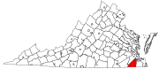
South Hampton Roads is a region located in the extreme southeastern portion of Virginia's Tidewater region in the United States with a total population of 1,191,937. It is part of the Virginia Beach-Norfolk-Newport News, VA-NC MSA, which itself has a population of 1,724,876.

<span class="mw-page-title-main">James River Bridge</span> Bridge in VA to Newport News, VA

The James River Bridge (JRB) is a four-lane divided highway lift bridge across the James River in the Commonwealth of Virginia. Owned and operated by the Virginia Department of Transportation, it carries U.S. Route 17 (US 17), US 258, and State Route 32 across the river near its mouth at Hampton Roads. The bridge connects Newport News on the Virginia Peninsula with Isle of Wight County in the South Hampton Roads region, and is the easternmost such crossing without a tunnel component.

<span class="mw-page-title-main">History of Suffolk, Virginia</span>

The area around Suffolk, Virginia, which is now an independent city in the Hampton Roads region in the southeastern part of the state, was originally inhabited by Native Americans. At the time of European contact, the Nansemond people lived along the river later known by the same name. The area was first explored by Jamestown colonists led by explorer John Smith soon after the settlements founding in 1607, seeking means to survive the inhospitable environment at Jamestown Island.

<span class="mw-page-title-main">Bower's Hill, Virginia</span> Community in Virginia, United States

Bower's Hill is a community located in the independent city of Chesapeake, Virginia in the United States. It is located in the South Hampton Roads region at the northeastern edge of the Great Dismal Swamp, an area consisting of generally low-lying sandy terrain of the coastal plain.

<span class="mw-page-title-main">Nansemond County, Virginia</span> Former county in Virginia, United States (1646–1974)

Nansemond is an extinct jurisdiction that was located south of the James River in Virginia Colony and in the Commonwealth of Virginia in the United States, from 1646 until 1974. It was known as Nansemond County until 1972. From 1972 to 1974, a period of eighteen months, it was the independent city of Nansemond. It is now part of the independent city of Suffolk.

<span class="mw-page-title-main">Virginia State Route 10</span> State highway in eastern Virginia, US

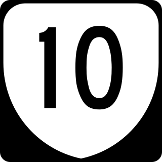
State Route 10 is a primary state highway in the U.S. state of Virginia. The state highway runs 93.58 miles (150.60 km) from U.S. Route 360 in Richmond east to SR 337 in Suffolk. SR 10 is a major suburban highway through Chesterfield County between the Southside of Richmond and Hopewell. Between Hopewell and Smithfield, which is served by SR 10 Business, the state highway passes through rural Prince George, Surry, and Isle of Wight counties, following the route of an old stagecoach road through an area that features many of the preserved James River plantations. SR 10 runs concurrently with US 258 and SR 32 between Smithfield and Suffolk.

<span class="mw-page-title-main">Virginia State Route 32</span> State highway in eastern Virginia, US

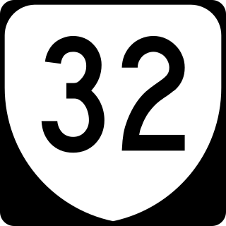
State Route 32 is a primary state highway in the U.S. state of Virginia. The state highway runs 38.89 miles (62.59 km) from the North Carolina state line in Suffolk north to U.S. Route 17, US 258, and SR 143 in Newport News. The southernmost part of SR 32 connects Suffolk with the Albemarle Region of North Carolina via North Carolina Highway 32. The remainder of SR 32 runs concurrently with at least one other state or U.S. Highway between Suffolk and Newport News, including US 13, SR 10, US 258, and US 17. The last two highways run together with SR 32 on the James River Bridge.

<span class="mw-page-title-main">State highways in Virginia</span> Highway system in Virginia, United States

The state highway system of the U.S. state of Virginia is a network of roads maintained by the Virginia Department of Transportation (VDOT). As of 2006, the VDOT maintains 57,867 miles (93,128 km) of state highways, making it the third-largest system in the United States.

<span class="mw-page-title-main">Transportation in Virginia</span> Overview of land sea and air transport systems in Virginia

Transportation in the Commonwealth of Virginia is by land, sea and air. Virginia's extensive network of highways and railroads were developed and built over a period almost 400 years, beginning almost immediately after the founding of Jamestown in 1607, and often incorporating old established trails of the Native Americans.

<span class="mw-page-title-main">U.S. Route 13 in Virginia</span> Segment of American highway

U.S. Route 13 (US 13) is a north–south United States Numbered Highway established in 1926 that runs for 518 miles (834 km) from Interstate 95 (I-95) just north of Fayetteville, North Carolina, north to US 1 in Morrisville, Pennsylvania, a northeastern suburb of Philadelphia. In the U.S. state of Virginia, US 13 runs north–south through the Hampton Roads and Eastern Shore regions of the state, using the Chesapeake Bay Bridge–Tunnel to get between the two. In the Hampton Roads area, it uses Military Highway to bypass the city centers. It is most usually a four-lane highway, sometimes up to freeway or expressway standards with controlled access.

<span class="mw-page-title-main">U.S. Route 17 in Virginia</span> Section of U.S. highway in Virginia

U.S. Route 17 (US 17) is a part of the United States Numbered Highway System that runs from Punta Gorda, Florida, to Winchester, Virginia. In Virginia, the U.S. Highway runs 255.83 miles (411.72 km) from the North Carolina state line in Chesapeake north to its northern terminus at US 11, US 50, and US 522 in Winchester. US 17 is a major highway in the eastern half of Virginia. The U.S. Highway connects the Albemarle Region of North Carolina with the Hampton Roads metropolitan area. Within the urban area, US 17 passes through the South Hampton Roads cities of Chesapeake, Portsmouth, and Suffolk and the Virginia Peninsula city of Newport News. Between Yorktown and Fredericksburg, the U.S. Highway serves as the primary highway of the Middle Peninsula. At Fredericksburg, US 17 leaves the Atlantic Plain; the highway passes through the Piedmont town of Warrenton and crosses the Blue Ridge Mountains on its way to Winchester in the Shenandoah Valley. The route from Tappahannock to Winchester roughly follows the Confederate march during the Civil War to Gettysburg.

<span class="mw-page-title-main">Virginia State Route 125</span> State highway in Suffolk, Virginia, United States

State Route 125 is a primary state highway in the U.S. state of Virginia. Known as Kings Highway, the state highway has two sections that run a total of 5.73 miles (9.22 km) from SR 10 and SR 32 at Chuckatuck east to SR 337 at Driver within the independent city of Suffolk. SR 125 consists of a 2.69-mile (4.33 km) western section and a 3.04-mile (4.89 km) eastern section separated by a gap at the Nansemond River. This gap arose when the Kings Highway Bridge across the river was removed in 2008.

<span class="mw-page-title-main">Interstate 64 in Virginia</span> Highway in Virginia

Interstate 64 (I-64) in the US state of Virginia runs east–west through the middle of the state from West Virginia to the Hampton Roads region, for a total of 299 miles (481 km). From the West Virginia state line to Chesapeake, it passes through the major cities of Lexington, Staunton, Charlottesville, the state capital of Richmond, Newport News, Hampton, and Norfolk. It is notable for crossing the mouth of the harbor of Hampton Roads on the Hampton Roads Bridge–Tunnel (HRBT), the first bridge–tunnel to incorporate artificial islands, concurrent with U.S. Route 60 (US 60). Also noteworthy is a section through Rockfish Gap, a wind gap in the Blue Ridge Mountains, which was equipped with an innovative system of airport-style runway lighting embedded into the pavement to aid motorists during periods of poor visibility due to fog or other conditions.

<span class="mw-page-title-main">Driver, Suffolk, Virginia</span>

Driver is a neighborhood in the independent city of Suffolk, Virginia, United States. It is located at the junction of State Route 337, State Route 125, and State Route 627.

<span class="mw-page-title-main">Byrd Road Act</span>

The Byrd Road Act was an Act of Assembly passed in February 1932 by the Virginia General Assembly. Named for former Governor Harry F. Byrd, the legislation was originally presented as measure to relieve the financial pressures of the Great Depression upon the counties, as the state offered to take over responsibility and control of most county roads, creating the Virginia Secondary Roads System.

Whaleyville is a neighborhood of Suffolk, Virginia, United States. It was formerly an incorporated town located in southern Nansemond County, Virginia. Whaleyville is located midway between the former county seat at downtown Suffolk and the North Carolina border along U.S. Route 13.

References

  1. "2019 U.S. Gazetteer Files". United States Census Bureau. Retrieved August 7, 2020.
  2. "U.S. Census website". United States Census Bureau . Retrieved January 31, 2008.
  3. "US Board on Geographic Names". United States Geological Survey. October 25, 2007. Retrieved January 31, 2008.
  4. "Suffolk population increases 5.1% in 26-month period; Check out your city's report". WTKR . July 4, 2023. Retrieved July 4, 2023.
  5. "Suffolk has officially surpassed Portsmouth in population. But Hampton Roads as a whole is lagging in growth". The Virginian-Pilot . July 18, 2023. Retrieved July 18, 2023.
  6. "Suffolk, Virginia". City of Suffolk, Virginia. Archived from the original on February 28, 2015. Retrieved August 30, 2014.
  7. Burns, Adam. "American Rails" . Retrieved June 18, 2020.
  8. "Station Search Details".
  9. "US Gazetteer files: 2010, 2000, and 1990". United States Census Bureau. February 12, 2011. Retrieved April 23, 2011.
  10. "Census of Population and Housing from 1790". US Census Bureau . Retrieved January 24, 2022.
  11. "Historical Census Browser". University of Virginia Library. Retrieved January 6, 2014.
  12. "Population of Counties by Decennial Census: 1900 to 1990". United States Census Bureau. Retrieved January 6, 2014.
  13. "Census 2000 PHC-T-4. Ranking Tables for Counties: 1990 and 2000" (PDF). United States Census Bureau. Retrieved January 6, 2014.
  14. 1 2 "P2 Hispanic or Latino, and Not Hispanic or Latino by Race – 2020: DEC Redistricting Data (PL 94-171) - Suffolk city, Virginia". United States Census Bureau .
  15. "P004: Hispanic or Latino, and Not Hispanic or Latino by Race – 2000: DEC Summary File 1 – Suffolk city, Virginia". United States Census Bureau.
  16. "P2 Hispanic or Latino, and Not Hispanic or Latino by Race – 2010: DEC Redistricting Data (PL 94-171) - Suffolk city, Virginia". United States Census Bureau .
  17. "U.S. Census website". United States Census Bureau . Retrieved May 14, 2011.
  18. "Content.hamptonroads.com". Archived from the original on September 26, 2007. Retrieved August 25, 2007.
  19. Erh.noaa.gov
  20. "The Museum of Railway Timetables (timetables.org)".
  21. "Suffolk VA Railfan Guide".
  22. Aaron Applegate, VDOT, city of Suffolk battle over closed Kings Highway Bridge Archived 2006-09-28 at the Wayback Machine , The Virginian-Pilot, May 1, 2006
  23. John Warren, Flooding blamed on clogged ditches [ permanent dead link ], The Virginian-Pilot, July 11, 2006
  24. Content.hamptonroads.com Archived 2007-03-26 at the Wayback Machine
  25. Contant.hamptronroads.com Archived 2007-09-26 at the Wayback Machine
  26. "City of Suffolk, Virginia". Archived from the original on October 26, 2012. Retrieved August 15, 2012.
  27. Archived May 19, 2012, at the Wayback Machine
  28. "Suffolk Transit | Suffolk, VA" . Retrieved January 20, 2020.
  29. 1 2 3 "'Pentagon South'". Suffolk News Herald. July 12, 2012. Retrieved August 4, 2014.
  30. "Coastal Virginia Magazine". Vista Publishing. Retrieved March 31, 2015.
  31. Holmes, Gary. "Nielsen Reports 1.1% increase in U.S. Television Households for the 2006–2007 Season Archived July 5, 2009, at the Wayback Machine ." Nielsen Media Research. September 23, 2006. Retrieved on September 28, 2007.
  32. Charter Communications Archived 2009-02-02 at the Wayback Machine
  33. Sheler, Jeff (July 21, 2011). "Redrawn Suffolk boroughs would shift racial makeup". The Virginian-Pilot.
  34. "Approved Borough Plan". City of Suffolk, Virginia. October 5, 2011. Archived from the original on August 26, 2012. Retrieved August 25, 2012.
  35. "City Council: Chuckatuck Borough". City of Suffolk, Virginia. Archived from the original on May 27, 2012. Retrieved August 25, 2012.
  36. "City Council: Cypress Borough". City of Suffolk, Virginia. Archived from the original on May 27, 2012. Retrieved August 25, 2012.
  37. "City Council: Holy Neck Borough". City of Suffolk, Virginia. Archived from the original on May 27, 2012. Retrieved August 25, 2012.
  38. "City Council: Nansemond Borough". City of Suffolk, Virginia. Archived from the original on May 27, 2012. Retrieved August 25, 2012.
  39. "City Council: Sleepy Hole Borough". City of Suffolk, Virginia. Archived from the original on May 27, 2012. Retrieved August 25, 2012.
  40. "City Council: Suffolk Borough". City of Suffolk, Virginia. Archived from the original on May 27, 2012. Retrieved August 25, 2012.
  41. "City Council: Whaleyville Borough". City of Suffolk, Virginia. Archived from the original on May 27, 2012. Retrieved August 25, 2012.
  42. [ dead link ]
  43. Zabitka, Matt (July 30, 1952). "UC's Doc Bea Shoots Pool to Sharpen Batting Eye; Triple Off Satchel Paige Brought Words of Warning". Chester Times. p. 16. Retrieved June 25, 2021.
  44. "Suffolk, Virginia Köppen Climate Classification (Weatherbase)". Weatherbase.
  45. "NowData – NOAA Online Weather Data". National Oceanic and Atmospheric Administration. Retrieved July 5, 2021.
  46. "Station: Suffolk Lake Kilby, VA". U.S. Climate Normals 2020: U.S. Monthly Climate Normals (1991-2020). National Oceanic and Atmospheric Administration. Retrieved July 5, 2021.
  47. David Leip. "Dave Leip's Atlas of U.S. Presidential Elections". Uselectionatlas.org. Retrieved December 8, 2020.