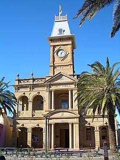
Stanthorpe is a town situated in south east Queensland, Australia. The town lies on the New England Highway near the New South Wales border 223 kilometres (139 mi) from Brisbane via Warwick, 56 kilometres (35 mi) north of Tenterfield and 811 m above sea level. The area surrounding the town is known as the Granite Belt. At the 2016 census, Stanthorpe had an urban population of almost 5,000.

Sippy Downs is a suburb of the Sunshine Coast Region, Queensland, Australia, and is part of the Buderim urban centre. It contains the locality of Chancellor Park, and Australia's newest university, the University of the Sunshine Coast.

Moonie is a rural town in the Western Downs Region and a locality split between the Western Downs Region and the Goondiwindi Region in Queensland, Australia.

Goondi is a locality in the Cassowary Coast Region, Queensland, Australia.

Spring Creek is a locality split between the Toowoomba Region and the Southern Downs Region, Queensland, Australia. In the 2011 census, Spring Creek had a population of 354 people.

Bony Mountain is a locality in the Southern Downs Region, Queensland, Australia.

Columboola is a town and a locality in the Western Downs Region, Queensland, Australia.

The Falls is a rural locality in the Southern Downs Region, Queensland, Australia.

Wyberba is a locality in the Southern Downs Region, Queensland, Australia.

Bunya Mountains is a locality split between the Western Downs Region and the South Burnett Region, Queensland, Australia. It completes encloses the locality of Mowbullan and the town of Mount Mowbullan is located on the boundary of Bunya Mountains and Mowbullan.

St Ruth is a locality split between the Western Downs Region and the Toowoomba Region in Queensland, Australia.

Upper Pilton is a locality split between the Toowoomba Region and the Southern Downs Region, both in Queensland, Australia. In the 2016 census, Upper Pilton had a population of 63 people.

Glen Niven is a locality in the Southern Downs Region, Queensland, Australia. It is within the Granite Belt on the Darling Downs and adjacent to the border with New South Wales. In the 2016 census, Glen Niven had a population of 80 people.

Irvingdale is a locality split between the Toowoomba Region and the Western Downs Region, both in Queensland, Australia. In the 2016 census, Irvingdale had a population of 194 people.

Millmerran Downs is a locality in the Toowoomba Region, Queensland, Australia. In the 2016 census, Millmerran Downs had a population of 89 people.

Passchendaele is a rural locality in the Southern Downs Region, Queensland, Australia. In the 2016 census, Passchendaele had a population of 30 people. The undeveloped town of Messines is officially located within the locality.
Sugarloaf, Queensland may refer to:
This page is based on this
Wikipedia article Text is available under the
CC BY-SA 4.0 license; additional terms may apply.
Images, videos and audio are available under their respective licenses.


