Sydney Road, Melbourne

Last updated

Sydney Road

D2-class -5008 tram on Sydney Road, Brunswick.jpg
Sydney Road, Brunswick, looking south to the CBD
General information
Type Road
Length24 km (15 mi) [1]
Route number(s)
  • Australian state route 55.svg State Route 55 (2005-present)
    Entire route
  • Concurrencies:
  • AUS Alphanumeric Route C722.svg C722 (1998-present)
    (through Craigieburn)
Former
route number
  • Australian national highway M31.svg National Highway M31 (1997-2005)
    (Craigieburn-Fawkner)
  • Australian national highway 31.svg National Highway 31 (1974–2005)
    (Fawkner-Brunswick)
  • Australian national highway 31.svg National Highway 31 (1974-1997)
    (Craigieburn-Fawkner)
  • Australian national route 31.svg National Route 31 (1954-1974)
    Entire route
Major junctions
North endAUS Alphanumeric Route M31.svg Hume Freeway
Craigieburn, Melbourne
 
South endAustralian state route 55.svg Royal Parade
Brunswick, Melbourne
Location(s)
LGA(s)
Major suburbs Craigieburn, Somerton, Campbellfield, Coburg
Sydney Road in July 2004 Sydney Rd 14 S Brunswick from Hope St.jpg
Sydney Road in July 2004

Sydney Road (in its northernmost part also known as the Hume Highway) is a major urban arterial in the northern suburbs of Melbourne, Victoria, Australia.

Contents

Geography

Sydney Road starts at the northern end of Royal Parade at the boundary of Parkville and Brunswick and continues north through Brunswick, Coburg, Coburg North, Hadfield, Fawkner, Campbellfield, Somerton and Craigieburn, where it joins the Hume Freeway.

The section passing through Brunswick and Coburg, between Park Street at its southern end and Bell Street near the site of the former Pentridge prison, at its northern end, is Melbourne's longest continuous shopping strip, with an abundance of small businesses and a variety of restaurants and coffee shops, clothing stores, places of worship, and community services. It is well known for its wedding fashion shops, discount shopping and a number of specialist food stores.

History

Previously part of Hume Highway, the road was bypassed as the main route through northern Melbourne when the Craigieburn bypass opened in 2005; the road name was devolved back to its original identity as Sydney Road as a consequence.

As a part of the Hume Highway, the road was signed as National Route 31 in 1954. The Whitlam Government introduced the federal National Roads Act 1974, [2] where roads declared as a National Highway were still the responsibility of the states for road construction and maintenance, but were fully compensated by the Federal government for money spent on approved projects. [2] :S7 As an important interstate link between the capitals of Victoria and New South Wales, the Hume Highway was declared a National Highway in 1974.

With Victoria's conversion to the newer alphanumeric system in the late 1990s, the section between Craigieburn and Fawkner (where it met the Western Ring Road) was upgraded to National Highway M31; it was left as National Highway 31 south of the ring road along its original alignment into central Melbourne. Once the Craigieburn bypass was opened in 2005 and National Route M31 was re-routed onto the new bypass, the old route was replaced with State Route 55 from Craigieburn to the central suburb of Docklands.

The passing of the Road Management Act 2004 [3] granted the responsibility of overall management and development of Victoria's major arterial roads to VicRoads: VicRoads declared this road as Sydney Road (Arterial #5733), beginning from Bell Street in Coburg and ending at Brunswick Road, Brunswick in 2004, [4] and as Coburg-Craigieburn Road (Arterial #5500), from Bell Street to where it meets Hume Freeway in Craigieburn in 2006; [5] the road in its entirety is still presently known (and signposted) as Sydney Road.

Community

North end of the road, in Fawkner at the Western Ring Road interchange. Fawkner-Melbourne-aerial.jpg
North end of the road, in Fawkner at the Western Ring Road interchange.

In February 1841, George Jones opened a retail store on Sydney Road in Pentridge. [6]

The Victorian gold rush in the 1850s caused businesses to flourish on Sydney Road. Many were established to supply the miners on their trek north to the gold fields. Numerous hotels were built along Sydney Road in this period including the Brunswick Hotel, the Cornish Arms Hotel, the Sarah Sands Hotel, the Cumberland Arms Hotel, the Edinburgh Castle Hotel and the Court House Hotel. It was originally called Pentridge Road, as it connected the city with Pentridge prison. It was renamed Sydney Road in 1859.

The early hub of business activity was between Weston Street and Albert Street in Brunswick, but by the 1880s businesses were rapidly being established beyond Albion Street. In the 1920s the clothing and textile industries grew; evidence of their presence in the area can still be seen in the existence of tailors shops, fabric shops and an abundance of wedding gown shops.

During the 1930s the Unemployed Workers Movement held street meetings on the corner of Sydney Road and Phoenix Street. These meetings were harassed and suppressed by the police, under the direct orders of Police Commissioner, General Thomas Blamey. Young Australian artist Noel Counihan played a significant part in this campaign. The State Government, concerned about the public sympathy being generated, eventually changed the law in regard to obstruction, with no requirement of permits to speak. A Free Speech memorial was built outside the Mechanics' Institute on the corner of Sydney and Glenlyon Roads to commemorate the success of the free speech fights. Counihan's work as an artist and local resident is also commemorated by the Counihan Gallery on Sydney Road run by the City of Moreland Council.

During the second world war and in the 1950s, Sydney Road came alive with late night shopping. This included late night shopping parades with floats. The construction of the Barkly Square shopping complex immediately to the east of Sydney Road in the 1980s coincided with a decline in the success of the strip. The Sydney Road Brunswick Association was formed in the early 1990s to provide a focus for action to revive the strip, utilising a range of community development and marketing techniques.

With postwar immigration, many migrant families established businesses. The multicultural nature of business on Sydney Road is reflected in the cuisines offered by its restaurants and cafes. Italian, Greek and Balkan cuisines were once the dominant non-Anglo fare, but since the 1980s Sydney Road's eateries have diversified and increased in number, so that the food available now includes Lebanese, Afghan, Thai, Chinese, Vietnamese, Japanese, North and East African, Balinese, Indian, Pakistani, Sri Lankan and Nepali cuisines. In the early 2000s, several hotels (pubs) were renovated and have become very popular live music venues. Property prices in Brunswick and Coburg (south of Bell Street) rose sharply in the 1990s and early 2000s. The signs of gentrification are increasingly evident in the southern quarter of Sydney Road, with a rising number of clothing boutiques and many new eateries serving eclectic and contemporary Australian 'fusion' cuisine in stylish, designer environments, producing an increasingly diversified street life.

As a major activity centre in Moreland, Sydney Road is a key component in any strategies of urban intensification to meet the requirements of the Victorian Government's metropolitan strategy, Melbourne 2030. In his first speech in December 2006, newly elected Moreland Mayor Mark O'Brien proposed turning the entire 4.5 km commercial strip between Brunswick Road and Bell Street into a promenade, which would transform the usually congested Sydney Road into one of the longest pedestrian streets in the world. [7]

Landmarks

Sydney Road contains many historical landmarks. Many of the hotels date from the 1850s, including the Cornish Arms hotel and the Sarah Sands Hotel on the corner of Brunswick Road. The Bombay Rock at the corner of Phoenix Street, was one of the pre-eminent rock music venues in Melbourne in the 1970s and 80s.

Brunswick Town Hall, built in 1876 on the corner of Dawson Street, is an imposing Victorian edifice. It was saved from planned destruction by the municipal council in 1973-1974 when Vic and Vida Little, along with the Brunswick Progress Association, led a successful campaign to preserve it. The building was significantly extended and renovated in the early 1990s to upgrade the library, offices and public assembly spaces.

Diagonally opposite from the Town Hall stands the Mechanics Institute, built in 1868, and used for worker education and social activities. A monument to the Free Speech fights of the 1930s stands near the corner. The history of many of the single and double story shop fronts can be seen in the names and years moulded into the upper portions of the building facades. The Mechanics Institute now provides a popular performance space and offices for local arts administrators.

Notable institutions

Sydney Road has a number of institutions that are notable for their contribution to the broader cultural life of Melbourne. The Mediterranean supermarket, between Victoria and Blyth Streets is a long-established, large and well-known source of Italian and other European foodstuffs. The A1 Middle Eastern Bakery, at the top of Brunswick Hill is the most high-profile of a number of such bakeries in the area, well known for products such as flat bread that are supplied across Melbourne. A tour of these bakeries forms part of Melbourne's annual Food and Wine festival. Savers is a very popular supermarket-sized second-hand clothing store, located between Albert Street and Glenlyon Road. Well known for its bridal shops, a recent arrival in Sydney Road is Mariana Hardwick's emporium in the eponymously (re)named building between Sparta Place and Ballarat Street.

Transport

Tram route 19 runs along the inner section of Sydney Road, starting at Bakers Road in Coburg North and ending in Elizabeth Street at Flinders Street station in the city. The Upfield railway line from the city loop runs parallel to Sydney Road about 200m to the west, with stations at Jewell, Brunswick, Anstey, Moreland and Coburg. The road has historically been signed as Route 31, but since the opening of the Craigieburn Bypass has been relegated to Route 55.

Major Intersections & Suburbs

LGALocation [1] [4] [5] km [1] miDestinationsNotes
Hume Craigieburn 0.00.0AUS Alphanumeric Route M31.svg Hume Freeway (M31 north)  Seymour, Shepparton, Wodonga Northbound exit and southbound entrance ramps only
Northern terminus of road and State Route 55
2.11.3Grand Boulevard (west)  Craigieburn
Amaroo Road (east) - to City via AUS Alphanumeric Route M31.svg Hume Freeway (M31 south)
3.52.2AUS Alphanumeric Route C722.svg Craigieburn Road West (C722)  Craigieburn, Mickleham Concurreny with route C722 over North East railway bridge
3.82.4 North East railway line
4.32.7AUS Alphanumeric Route C722.svg Craigieburn Road East (C722)  Wollert, Epping, City via AUS Alphanumeric Route M31.svg Hume Freeway
5.83.6Grasslands Avenue
Somerton 8.75.4Australian state route 35.svgAustralian state route 58.svg Somerton Road (State Route 35/58 west)  Roxburgh Park, Bulla
Australian state route 58.svg Cooper Street (State Route 58 east)  Epping, South Morang
Campbellfield 11.47.1Barry Road  Broadmeadows
13.98.6Australian state route 48.svg Camp Road (State Route 48 west)  Broadmeadows, Tullamarine
Australian state route 48.svg Mahoneys Road (State Route 48 east)  Thomastown, Greensborough
Fawkner 14.28.8AUS Alphanumeric Route M80.svg Western Ring Road   Greensborough, Derrimut Single-point urban interchange
Moreland 14.59.0Anderson Road  Fawkner
15.29.4Jukes Road  Fawkner
15.69.7Box Forest Road  Glenroy
17.210.7Boundary Road (west)  Hadfield
Queens Parade (east)  Fawkner
Coburg North 18.211.3Bakers Road  Coburg North
18.911.7Gaffney Street (west)  Pascoe Vale
Murray Road (east)  Preston
Coburg 19.312.0Ohea Street (west)  Pascoe Vale South
Pentridge Boulevard (east)  Coburg, to Australian state route 40.svg Bell Street eastbound  Heidelberg
19.712.2Australian state route 40.svg Bell Street (State Route 40)  Heidelberg, Strathmore No left turn southbound to Bell Street eastbound; no right turn northbound from Bell Street westbound
23.714.7Moreland Road   Thornbury, Essendon
Brunswick 23.714.7Australian state route 38.svg Brunswick Road (State Route 38)  Northcote, Moonee Ponds
Australian state route 55.svg Royal Parade (State Route 55)  Parkville, City Southern terminus of road, State Route 55 continues south along Royal Parade
1.000 mi = 1.609 km; 1.000 km = 0.621 mi

See also

Australia road sign W5-29.svg   Australian roadsportal

Related Research Articles

Hume Highway Major national highway in Australia

The Hume Highway, inclusive of the sections now known as the Hume Freeway and Hume Motorway, is one of Australia's major inter-city national highways, running for 840 kilometres (520 mi) between Melbourne in the southwest and Sydney in the northeast. Upgrading of the route from Sydney's outskirts to Melbourne's outskirts to dual carriageway was completed on 7 August 2013.

Craigieburn, Victoria Suburb of Melbourne, Victoria, Australia

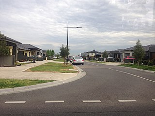
Craigieburn is a satellite suburb, located on the edge of Melbourne, Victoria, Australia, 25 km north of Melbourne's central business district. Its local government area is the City of Hume. At the 2016 Census, Craigieburn had a population of 50,347.

Brunswick, Victoria Suburb of Melbourne, Victoria, Australia

Brunswick is an inner-city suburb of Melbourne, Victoria, Australia, 6 kilometres (3.7 mi) north of Melbourne's central business district. Its local government area is the City of Moreland. At the 2016 Census, Brunswick had a population of 24,473.

Coburg, Victoria Suburb of Melbourne, Victoria, Australia

Coburg is a suburb of Melbourne, Victoria, Australia, 8 km north of Melbourne's central business district. Its local government area is the City of Moreland, although a handful of properties on Coburg's eastern boundary are located in the City of Darebin. At the 2016 Census, Coburg had a population of 26,185.

Fawkner, Victoria Suburb of Melbourne, Victoria, Australia

Fawkner is a suburb of Melbourne, Victoria, Australia, 12 km north of Melbourne's central business district. Its local government areas are the City of Moreland and the City of Hume. At the 2016 Census, Fawkner had a population of 14,043.

Glenroy, Victoria Suburb of Melbourne, Victoria, Australia

Glenroy is a suburb of Melbourne, Victoria, Australia, 13 km north of Melbourne's central business district. Its local government area is the City of Moreland. At the 2016 Census, Glenroy had a population of 22,245.

Pascoe Vale, Victoria Suburb of Melbourne, Victoria, Australia

Pascoe Vale is a suburb of Melbourne, Victoria, Australia, 10 km north of Melbourne's Central Business District. Its local government area is the City of Moreland. At the 2016 Census, Pascoe Vale had a population of 17,051.

Upfield Bike Path

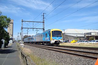
The Upfield Shared Path is a shared use path for cyclists and pedestrians, which follows Upfield railway line through the inner northern suburbs of Melbourne, Victoria, Australia.

Hoddle Highway Highway in Melbourne, Victoria

Hoddle Highway is an urban highway in Melbourne linking CityLink and the Eastern Freeway, itself a sub-section of Hoddle Main Road. Both these names are not widely known to most drivers, as the entire allocation is still best known as by the names of its constituent parts: Hoddle Street, Punt Road and Barkly Street. This article will deal with the entire length of the corridor for sake of completion, as well to avoid confusion between declarations.

Coburg North, Victoria Suburb of Melbourne, Victoria, Australia

Coburg North is a suburb of Melbourne, Victoria, Australia, 11 km north of Melbourne's central business district. Its local government area is the City of Moreland. At the 2016 Census, Coburg North had a population of 7,601.

The Brunswick Progress Association is a community organisation active in the City of Moreland Council area, and in particular the suburbs of Brunswick and Coburg, inner northern suburbs of Melbourne, Victoria, Australia. It was first established in 1905 and celebrated its centenary of community activism in 2005.

Pascoe Vale South, Victoria Suburb of Melbourne, Victoria, Australia

Pascoe Vale South is a suburb of Melbourne, Victoria, Australia, 10 km north of Melbourne's central business district. Its local government area is the City of Moreland. At the 2016 Census, Pascoe Vale South had a population of 10,069.

Brunswick Town Hall

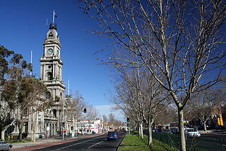
Brunswick Town Hall is located on the corner of Sydney Road and Dawson Street in the inner northern Melbourne suburb of Brunswick, Victoria, Australia.

Melbourne tram route 19

Melbourne tram route 19 is operated by Yarra Trams on the Melbourne tram network. It operates from North Coburg to Flinders Street station. The 10.2 kilometre route is operated by B and D class trams from Brunswick depot.

Pascoe Vale Road, Melbourne Road in Melbourne, Victoria

Pascoe Vale Road is a major thoroughfare through the northern suburbs of Melbourne, connecting the outer northern fringe to the inner northern suburbs.

City of Brunswick Local government area in Victoria, Australia

The City of Brunswick was a local government area in the inner-northern suburbs of Melbourne, Victoria, Australia. It comprised the suburbs of Brunswick, Brunswick East and West Brunswick. It ceased to exist on 22 June 1994, when its council was disbanded by the Kennett Government and replaced with appointed commissioners, who oversaw its amalgamation with the City of Coburg and parts of the City of Broadmeadows, to create the City of Moreland.

State (Bell/Springvale) Highway Highway in Melbourne, Victoria

The State (Bell/Springvale) Highway, also known as Route 40 or the Bell Street/Springvale Road State Highway, is the longest self-contained urban highway in Melbourne, Australia, linking Tullamarine Freeway and Nepean Highway through Melbourne's north-eastern suburbs. These names are not widely known to most drivers, as the entire allocation is still best known as by the names of its constituent parts: Bell Street, Banksia Street, Manningham Road, Williamsons Road, Doncaster Road, Mitcham Road, Springvale Road and Edithvale Road. This article will deal with the entire length of the corridor for sake of completion, as well to avoid confusion between declarations.

City of Coburg Local government area in Victoria, Australia

The City of Coburg was a local government area about 10 kilometres (6 mi) north of Melbourne, the state capital of Victoria, Australia. The city covered an area of 19.44 square kilometres (7.51 sq mi), and existed from 1859 until 1994.

Royal Parade, Melbourne Road in Melbourne, Victoria

Royal Parade is a major urban road in Victoria, Australia, linking Melbourne City to Brunswick and the northern suburbs. It is the site of major educational and sporting facilities as well as several buildings of heritage significance.

The Melbourne, Brunswick & Coburg Tramway Trust was a tram operator in Melbourne, Australia

References

  1. 1 2 3 Google (19 October 2021). "Sydney Road" (Map). Google Maps . Google. Retrieved 19 October 2021.
  2. 1 2 National Roads Act 1974 (Cth)
  3. State Government of Victoria. "Road Management Act 2004" (PDF). Government of Victoria. Archived (PDF) from the original on 19 October 2021. Retrieved 19 October 2021.
  4. 1 2 VicRoads. "VicRoads – Register of Public Roads (Part A)" (PDF). Government of Victoria. p. 676. Archived from the original on 1 May 2020. Retrieved 19 October 2021.
  5. 1 2 VicRoads. "VicRoads – Register of Public Roads (Part A)" (PDF). Government of Victoria. pp. 543–4. Archived from the original on 1 May 2020. Retrieved 19 October 2021.
  6. Donati 2005, pp. 53.
  7. Sydney Road boulevard of dreams, The Age, 6/1/07

Cited text