This page is based on this
Wikipedia article Text is available under the
CC BY-SA 4.0 license; additional terms may apply.
Images, videos and audio are available under their respective licenses.
Limestone County is a county located in the U.S. state of Texas. As of the 2010 census, the population was 23,384. Its county seat is Groesbeck. The county was created in 1846.

Freestone County is a county located in the east central part of the U.S. state of Texas. As of the 2010 census, the population was 19,816. Its county seat is Fairfield. The county was created in 1850 and organized the next year.

Falls County is a county located in the U.S. state of Texas. As of the 2010 census, its population was 17,866. The county seat is Marlin. It is named for the original 10-foot-tall waterfall on the Brazos River, which existed until the river changed course during a storm in 1866. The present falls can be found two miles northeast of the original falls, at the Falls on the Brazos Park, a camping site located only a few miles out of Marlin on Farm to Market Road 712.

Anderson County is a county in the U.S. state of Texas. As of the 2010 United States Census, the population was 58,458. Its county seat is Palestine. Anderson County was organized in 1846, and was named for Kenneth L. Anderson, who had been the final Vice President of the Republic of Texas.

Quinlan is a rural city in the southern part of Hunt County, Texas, United States, within the Dallas–Fort Worth metropolitan area. As of the 2010 census it had a population of 1,394. It is 5 miles (8 km) west of Lake Tawakoni.

West Tawakoni is a city in Hunt County, Texas, United States. The population was 1,576 at the 2010 census, and the estimated population in 2016 was 1,852. West Tawakoni is located on the west side of Lake Tawakoni, while its twin city East Tawakoni is located on the east side of the lake in Rains County.

Point is a city in Rains County, Texas, United States. The population was 820 at the 2010 census.

The Wichita people or Kitikiti'sh are a confederation of Southern Plains Native American tribes. Historically they spoke the Wichita language and Kichai language, both Caddoan languages. They are indigenous to Oklahoma, Texas, and Kansas.
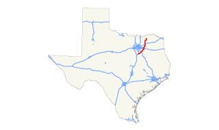
State Highway 34 is a route that runs from Honey Grove to Italy just east of the Dallas/Fort Worth Metroplex.

The Tawakoni are a Southern Plains Native American tribe, closely related to the Wichitas. They historically spoke a Wichita language of the Caddoan language family. Currently, they are enrolled in the Wichita and Affiliated Tribes, a federally recognized tribe.

State Highway 276 or SH 276 is a Texas state highway that runs from Rockwall east to Emory. This route was designated on July 25, 1960 between Rockwall and Quinlan, replacing FM 1143 and part of FM 35. SH 276 was extended to its current terminus on October 25, 1990, replacing most of FM 35.
Farm to Market Road 2101 is a highway located in Hunt County, Texas.
Mexico is a historical unincorporated community, in Hunt County, Texas, now inundated by Lake Tawakoni.

The Waco of the Wichita people is a Southern Plains Native American tribe that inhabited northeastern Texas. Today, they are enrolled members of the federally recognized Wichita and Affiliated Tribes, headquartered in Anadarko, Oklahoma.
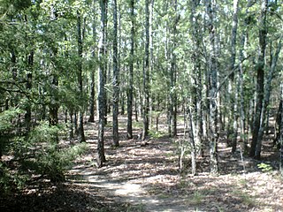
The Tehuacana Hills are a series of hills in Limestone County, Texas.