
Summit County is one of the 64 counties in the U.S. state of Colorado. As of the 2010 census, the population was 27,994. The county seat is Breckenridge.

Mt. Crested Butte is a home rule municipality in Gunnison County, Colorado, United States. Mount Crested Butte is the home of the Crested Butte Mountain Resort. The population was 801 at the 2010 census. ZIP code 81225 serves post office boxes for Mount Crested Butte and for neighboring Crested Butte; mail must be addressed to Crested Butte.

The Sawatch Range is a high and extensive mountain range in central Colorado which includes eight of the twenty highest peaks in the Rocky Mountains, including Mount Elbert, at 14,440 feet (4,401 m) elevation, the highest peak in the Rockies.
Castle Peak is the ninth highest summit of the Rocky Mountains of North America and the U.S. state of Colorado. The prominent 14,279-foot (4352.2 m) fourteener is the highest summit of the Elk Mountains and the Maroon Bells-Snowmass Wilderness. The peak is located 11.6 miles (18.7 km) northeast by north of the Town of Crested Butte, Colorado, United States, on the drainage divide separating Gunnison National Forest and Gunnison County from White River National Forest and Pitkin County. The summit of Castle Peak is the highest point of both counties.
Ptarmigan Pass is a high mountain pass in the Rocky Mountains of central Colorado in the United States.

Monarch Pass, elevation 11,312 feet (3,448 m), is a high mountain pass in the Rocky Mountains of south-central Colorado in the United States.
Heeney is a census-designated place in northern Summit County, Colorado, United States. The population as of the 2010 Census was 76. It is situated on the hillside along the west side of Green Mountain Reservoir, in the valley of the Blue River, between Kremmling and Silverthorne. It is accessible by a county road from State Highway 9. The community consists of a cluster of vacation homes and permanent residences perched above the reservoir, which is a destination for recreational boating and fishing. The businesses of the town include a liquor/bait and tackle store oriented towards sportsmen. The U.S. Post Office at Silverthorne now serves Heeney postal addresses.
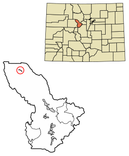
Copper Mountain is a census-designated place (CDP) in Summit County, Colorado, United States. Its elevation is 9,695 feet (2,955 m), and it is located at 39°30′24″N106°8′32″W.

During the Oligocene epoch, a series of caldera building eruptions of titanic proportions, some as large as VEI-8, devastated what is now Colorado and raised up the mountain chain, part of the San Juan Mountains. The La Garita supervolcano's mega-colossal eruption created 5000 km3 of tephra, the largest eruption known. The volcanic hotspot has been extinct for tens for millions of years and is of no danger to anyone.

The Cochetopa Hills are a ridge of uplands on the Continental Divide in Saguache County, southern Colorado, United States.
New York Mountain Trail is in the northwestern Sawatch Range, part of the Rocky Mountains in the U.S. state of Colorado. It is located in the Holy Cross Wilderness Area within Eagle County. New York Mountain Trail is south of Interstate 70, near Eagle and very close to Fulford, Colorado. New York Mountain is the site of mining ruins from the late nineteenth century. Gold Dust Peak, 13,365 feet, lies south of New York Mountain. There are two main routes to NY Mtn, one from the Polar Star Hut area and one from Fulford. The Polar Star to New York Mountain trailhead is well-marked with a sign at 11,250 feet. New York Mountain Trail ascends to New York Mountain ridge, a half-mile from the trailhead at 11,787 feet. New York Lake lies east of the ridge. New York Mountain Trail follows the ridge south to the summit of New York Mountain at an elevation of 12,450 feet. Hiking Colorado: Holy Cross Wilderness, a hiking guide by Kim Fenske, provides a description of New York Mountain Trail.
Buffalo Mountain Trail is in the southern Gore Range, part of the Rocky Mountains in the U.S. state of Colorado. It is located in the Eagles Nest Wilderness, Summit County. Buffalo Mountain Trail is north of Interstate 70, west of Highway 9, in Silverthorne. Buffalo Mountain Trail ascends the east ridge of Buffalo Mountain from a trailhead in Wildernest subdivision, west of Silverthorne and Dillon Reservoir.
Pitkin Creek Trail is in the southern Gore Range, part of the Rocky Mountains in the U.S. state of Colorado. It is located in the Eagles Nest Wilderness, Holy Cross Ranger District, White River National Forest, Eagle County. Pitkin Creek Trail is north of Interstate 70 in Vail. The Gore Range extends from Grand County in the north to Summit County and Eagle County in the south, with many watersheds divided by steep and rugged mountain ridges. Near the middle of the western slope of the Gore Range is the Pitkin Creek Valley.
Garfield is a census-designated place (CDP) in Chaffee County, Colorado, United States. The population as of the 2010 Census was 15.

Smeltertown is a census-designated place (CDP) in Chaffee County, Colorado, United States. The population as of the 2010 Census was 120.

Mount Rosa is a mountain summit of the Pikes Peak Massif in the southern Front Range of the Rocky Mountains of North America. The 11,504-foot (3,506 m) peak is located in Pike National Forest, 12.8 miles (20.6 km) southwest by west of downtown Colorado Springs in Teller County, Colorado, United States.

South Park National Heritage Area is a U.S. National Heritage Area encompassing the South Park of Colorado. Established on March 30, 2009 by the Omnibus Public Land Management Act of 2009, the South Park NHA is managed by the Park County, Colorado Office of Tourism to promote and interpret the area's natural, scenic, and cultural resources. The National Heritage Area designation funds promotion of the area's mining, recreation, and ranching heritage.
Grannys Nipple is a summit in Grand County, Colorado, in the United States. With an elevation of 8,238 feet (2,511 m), Grannys Nipple is the 3257th tallest mountain in Colorado.

Part of the Uncompahgre Project located on the western slope of central Colorado, the Taylor Park Dam was engineered by the Bureau of Reclamation. It is located on the Taylor River, a tributary of the Gunnison River, and the dam is used to create the Taylor Park Reservoir in Gunnison County, Colorado.
Lead Mountain is a summit in Custer County, Colorado, in the United States. It is in the Wet Mountain Range. With an elevation of 9,731 feet (2,966 m), Lead Mountain is the 2343rd highest summit in the state of Colorado.


