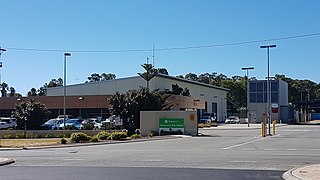
Karrinyup is a suburb of Perth, the capital city of Western Australia, and is located 12 km north of Perth's central business district. Its local government area is the City of Stirling.

Bassendean is a north-eastern suburb of Perth, Western Australia. Its local government area is the Town of Bassendean.

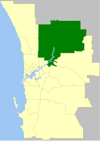
The City of Swan is a local government area of Western Australia. It is in the eastern metropolitan region of Perth and includes the Swan Valley and 42 suburbs. It is centred approximately 20 km north-east of the Perth central business district. The City covers an area of 1,042 km² and had an estimated population of 155,653 in 2020.

Currambine is a northern suburb of Perth, the capital city of Western Australia, 29 km north of Perth's central business district. Its local government area is the City of Joondalup.

Bicton is an affluent riverside suburb of Perth, Western Australia, located 10 kilometres (6.2 mi) south-west of the central business district. The suburb is mostly residential, and falls within the City of Melville local government area. Bicton borders the Swan River to the north, with the northern third of the suburb taken up by a Class-A reserve at Point Walter.

Burswood is an inner southeastern suburb of Perth, Western Australia, located immediately across the Swan River from Perth's central business district (CBD). Its local government area is the Town of Victoria Park. Burswood is the location of the State Tennis Centre, Perth Stadium, Belmont Park Racecourse, and the Crown Perth casino and hotel complex.
Eden Hill is an eastern suburb of Perth, Western Australia, located within the Town of Bassendean. The origin of its name is unknown, either coming from a farm in the area or an estate name used by Henry Brockman when he subdivided the area in 1892. It was approved as a suburb in 1954. The Swan Valley Nyungah Community was in the area.
Embleton is a suburb of Perth, the capital city of Western Australia, located 7 kilometres (4.3 mi) north-east of the central business district, between the suburbs of Morley and Bayswater. Its local government area is the City of Bayswater.
Gnangara is a suburb of Perth, Western Australia, located within the City of Wanneroo. Gnangara is also the name for an underground water mound with a 117-hectare surface feature called Lake Gnangara.
Landsdale is a northern suburb of Perth, Western Australia located within the local government area of the City of Wanneroo. It is mixed use, with residential, commercial and light manufacturing areas.

Wangara is a light industrial suburb of Perth, Western Australia, located within the City of Wanneroo.

Ellenbrook is a northeastern suburb of Perth, Western Australia, about 30 km (19 mi) from Perth's central business district (CBD), located within the City of Swan. Ellenbrook, and its neighbouring suburbs of The Vines and Aveley, are unusual for Perth in being a significant distance from neighbouring suburbs. Given this relative isolation and the distance from the CBD, Ellenbrook has been designed and developed as a self-sustainable community. Since the upgrade of Gnangara Road and the completion of the Tonkin Highway Northlink, access to Ellenbrook has improved. The Morley–Ellenbrook railway line is well underway as at June 2021 and this will enable better public transport. At the time of the 2016 census there were 22,681 people living in the gazetted suburb, by June 2018, it was estimated that the urban population for Ellenbrook and surrounds had grown to 41,382. It is envisioned that Ellenbrook will eventually become a satellite city, with a population of 80,000.

Whiteman Park is a 4,000-hectare bushland area located 22 km (14 mi) north of Perth, Western Australia. The park is in the suburb of Whiteman, in the Swan Valley in the upper reaches of the Swan River.

Henley Brook is an outer rural suburb of Perth, Western Australia, part of the Swan Valley wine region. The Ellen brook and Swan River meet in the northeastern corner of the suburb. This is also the farthest upstream Captain Stirling's 1827 exploration reached before deciding on the settlement site of the new colony in 1829. The All Saints Church, the oldest church in Western Australia, is also at this site.

Whiteman, Western Australia is a suburb in the north eastern part of the Perth, metropolitan area in Western Australia.
Aveley is a suburb of Perth, Western Australia, east of Ellenbrook and south of The Vines. In 1897 George Hardey Barrett Lennard, grandson of Edward Pomeroy Barrett-Lennard, purchased a property in the area of which is now Aveley, naming it "Belhus" after his family's estate in Belhus, Essex, England. The name "Aveley", deriving from the eponymous town where the estate was located, was approved as a suburb name on 6 September 2006, before which the area was part of Ellenbrook. It is bordered by Gnangara Road and Lake Yakine to the south, a small part of West Swan Road, the Ellen Brook and Chateau Place to the east, The Broadway, Doig Road, and Cashman Avenue to the north, and Henley Brook Avenue to the west. The suburb is accessible from Henley Brook Avenue, The Promenade, Gnangara Road, and West Swan Road.

Fremantle is a Western Australian suburb located in Perth at the mouth of the Swan River, and is situated 18 kilometres (11 mi) from the Perth central business district. One of the original settlements of the Swan River Colony established in 1829 is within the area known today as this suburb.

Ellen Brook is an ephemeral stream which runs from south of Gingin to the Swan River in Western Australia.

Henley Brook bus station is a Transperth bus station located on the corner of Henley Street and Starflower Road, in Henley Brook, Perth, Western Australia. It has six stands served by six regular Transperth routes operated by Swan Transit.

Aveley Secondary College is an Independent public co-educational high day school, located in the Perth suburb of Ellenbrook, just north of Aveley, Western Australia.


