Thelikada

Last updated
Thelikada
Village
Brisk-cutting-japuraalwisyahoojpegcom.jpg

Thelikada is a rural village situated in Galle District, in the southern part of Sri Lanka.

Galle District Administrative District in Southern Province, Sri Lanka

Galle is a district in Southern Province, Sri Lanka. It is one of 25 districts of Sri Lanka, the second level administrative division of the country. The district is administered by a District Secretariat headed by a District Secretary appointed by the central government of Sri Lanka.
Sri Lanka Island country in South Asia

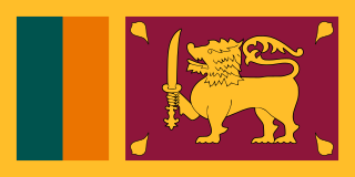
Sri Lanka, officially the Democratic Socialist Republic of Sri Lanka, is an island country in South Asia, located in the Indian Ocean to the southwest of the Bay of Bengal and to the southeast of the Arabian Sea. The island is historically and culturally intertwined with the Indian subcontinent, but is geographically separated from the Indian subcontinent by the Gulf of Mannar and the Palk Strait. The legislative capital, Sri Jayawardenepura Kotte, is a suburb of the commercial capital and largest city, Colombo.

The Gin River (Gin Ganga) flows near the village. Also the Gin Dam (Bund) is lying inside the village. The Wakwella Bridge (Wakwalla Palama) is nearby.

Wakwella Bridge is a bridge situated in Galle District near Thelikada, Sri Lanka. It is around 152.5 m (500 ft) long and crosses the Gin River. Built on the Gin Ganga Dam, the bridge links the villages of Kudagoda and Gonapura. It was constructed in 1999 and at the time was the longest bridge in the country.

Thelikada is situated 116 km (72 mi) away from the capital Colombo. It is a 2.30 hours drive from the Capital. Access points to the village from Galle Road are Hickkaduwa, Rathgama, Boossa, Pintaliya, Gintota and Galle.

Colombo Commercial Capital in Western Province, Sri Lanka

Colombo is the commercial capital and largest city of Sri Lanka. According to the Brookings Institution, Colombo metropolitan area has a population of 5.6 million, and 752,993 in the city proper. It is the financial centre of the island and a popular tourist destination. It is located on the west coast of the island and adjacent to the Greater Colombo area which includes Sri Jayawardenepura Kotte, the legislative capital of Sri Lanka and Dehiwala-Mount Lavinia. Colombo is often referred to as the capital since Sri Jayawardenepura Kotte is within the urban area of, and a suburb of, Colombo. It is also the administrative capital of the Western Province and the district capital of Colombo District. Colombo is a busy and vibrant place with a mixture of modern life and colonial buildings and ruins. It was the legislative capital of Sri Lanka until 1982.

Thelikada Village Sri Lanka.jpg

There are over 2,000 residents in the village. Thelikada Sunandaramaya is an old temple which can be seen some old drawings over 100 years old Wall painting. Also there is a school called Thelikada Maha Vidyalaya. Currently there are over 300 students and 30 teachers. Thelikada Post Office, Sanasa Bank, and Thelikada Police station provide services to the village.

Since the nineteenth century, brickmaking has been a key local industry although today its importance has declined with sand mining replacing it to a degree. Another important economic activity is agriculture, with cultivation of rubber, coconut, tea, cinnamon and rice.

Brick Block or a single unit of a ceramic material used in masonry construction

A brick is building material used to make walls, pavements and other elements in masonry construction. Traditionally, the term brick referred to a unit composed of clay, but it is now used to denote any rectangular units laid in mortar. A brick can be composed of clay-bearing soil, sand, and lime, or concrete materials. Bricks are produced in numerous classes, types, materials, and sizes which vary with region and time period, and are produced in bulk quantities. Two basic categories of bricks are fired and non-fired bricks.

Agriculture Cultivation of plants and animals to provide useful products

Agriculture is the science and art of cultivating plants and livestock. Agriculture was the key development in the rise of sedentary human civilization, whereby farming of domesticated species created food surpluses that enabled people to live in cities. The history of agriculture began thousands of years ago. After gathering wild grains beginning at least 105,000 years ago, nascent farmers began to plant them around 11,500 years ago. Pigs, sheep and cattle were domesticated over 10,000 years ago. Plants were independently cultivated in at least 11 regions of the world. Industrial agriculture based on large-scale monoculture in the twentieth century came to dominate agricultural output, though about 2 billion people still depended on subsistence agriculture into the twenty-first.

Coconut species of plant

The coconut tree is a member of the palm tree family (Arecaceae) and the only living species of the genus Cocos. The term "coconut" can refer to the whole coconut palm, the seed, or the fruit, which botanically is a drupe, not a nut. The term is derived from the 16th-century Portuguese and Spanish word coco meaning "head" or "skull" after the three indentations on the coconut shell that resemble facial features.

Related Research Articles

Scott, Louisiana City in Louisiana, United States

Scott is the fourth largest municipality in Lafayette Parish, Louisiana, United States. The population rose to over 8,000 according to the 2010 census results. Scott is a suburb of Lafayette and is part of the Lafayette Metropolitan Statistical Area.

Spring Valley, Wisconsin Village in Wisconsin, United States

Spring Valley is a village in Pierce and St. Croix Counties in the U.S. state of Wisconsin. The population was 1,352 at the 2010 census. Of this, 1,346 were in Pierce County, and only 6 were in St. Croix County. The village is located mostly within the Town of Spring Lake in Pierce County. Small portions also lie in the Town of Gilman, also in Pierce County, and the Town of Cady in St. Croix County.

Galle International Stadium

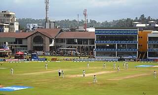
Galle International Stadium is a cricket stadium in Galle, Sri Lanka, situated near the Galle fort and fringed on two sides by the Indian Ocean. It is considered to be one of the most picturesque cricket grounds in the world. Before being brought up to international cricket standards, it was known as ‘The Esplanade’, and is the home ground of the Galle Cricket Club. This Stadium is identified as one of the luckiest venues for the Sri Lankan national cricket team.

National Maritime Museum (Galle) Maritime Archaeology Museum, Galle, Sri Lanka

The National Maritime Museum in Galle, Sri Lanka is situated within Galle Fort. It was first opened to the public on 9 May 1992 and is located in a 1671 Dutch Warehouse above the Old Gate of Galle Fort. Whilst the building housing the museum survived the impact of the 26 December 2004 tsunami, the adjoining UNESCO Maritime Archaeology Unit was completely destroyed and all the exhibitions were flood damaged and the majority of maritime archeological artifacts were lost. Under Sri Lanka – Netherlands Cultural Co-operation Program, the Royal Government of Netherlands provided financial assistance for reconstruction of the Maritime Museum. After 3 years period of reconstruction, the Maritime Museum was re-opened to the public.

Badulla City in Sri Lanka

Badulla is the main city of Uva Province situated in the lower central hills of Sri Lanka. It is the capital city of Uva Province and the Badulla District.

Moratuwa suburb in Colombo District, Western Province, Sri Lanka

Moratuwa is a large suburb of Colombo city, on the southwestern coast of Sri Lanka, near Dehiwala-Mount Lavinia. It is situated on the Galle–Colombo main highway, 18 km south of Colombo city centre. Moratuwa is surrounded on three sides by water, except in the north of the city, by the Indian Ocean on the west, the Bolgoda lake on the east and the Moratu river on the south. According to the 2012 census, the suburb had a population of 168,280.

Galle Face Green

Galle Face is a 5 ha ocean-side urban park, which stretches for 500 m (1,600 ft) along the coast, in the heart of Colombo, the financial and business capital of Sri Lanka. The promenade was initially laid out in 1859 by Governor Sir Henry George Ward, although the original Galle Face Green extended over a much larger area than is seen today. The Galle Face Green was initially used for horse racing and as a golf course, but was also used for cricket, polo, football, tennis and rugby.

World Heritage sites of Sri Lanka Wikimedia list article

Eight sites of Sri Lanka have been inscribed in the UNESCO World Heritage, namely, the ancient city of Polonnaruwa (1982), the ancient city of Sigiriya (1982), the Golden Temple of Dambulla (1991), the old town of Galle and its fortifications (1988), the sacred city of Anuradhapura (1982), the sacred city of Kandy (1988), Sinharaja Forest Reserve (1988) and the Central Highlands of Sri Lanka (2010).

St. Aloysius College, Galle

St. Aloysius' College is a boys' high school located in Galle, the capital city of Southern Province in Sri Lanka. The school was established in 1895 by recently arrived Belgian Jesuit missionaries, led by fr:Joseph Van Reeth, first bishop of Galle. St. Aloysius' College is a national school, which provides primary and secondary education. In 2012, it had 4,000 students on its roll.

Gin Ganga river in Sri Lanka

The Gin Ganga, is a 115.9 km (72 mi) long river situated in Galle District of Sri Lanka. Its water source arrives from the Gongala Mountains in Deniyaya. The Gin River flows past the villages of Baddegama, Nagoda, Thelikada and Hegoda. The Wakwella Bridge, which is the longest bridge in Sri Lanka, is built over this river. The river is also dammed at the Thelikada village.

Sri Lankan Parliament Building

The Sri Lankan Parliament Complex is a public building and landmark that houses the Parliament of Sri Lanka. Situated in Sri Jayawardenepura Kotte, the administrative capital, it is built on an island, surrounded by the Diyawanna Oya. It was designed by Deshamanya Geoffrey Bawa.

Amangalla

Amangalla is a 5-star franchise hotel belonging to the international group of Aman Resorts, located in Galle, Sri Lanka built within Galle Fort, the 17th-century Dutch fort, inscribed as a UNESCO World Heritage Site. Just to its north is the Galle International Stadium and roundabout. The oldest part of the hotel dates to 1684, and the complex was completed in 1715. It was known as the New Oriental Hotel for 140 years from 1865. In 2005 it became Amangalla resort complex. Aman means "peace" and galla is the Sinhalese name for Galle.

Galle Fort

Galle Fort, in the Bay of Galle on the southwest coast of Sri Lanka, was built first in 1588 by the Portuguese, then extensively fortified by the Dutch during the 17th century from 1649 onwards. It is a historical, archaeological and architectural heritage monument, which even after more than 423 years maintains a polished appearance, due to extensive reconstruction work done by Archaeological Department of Sri Lanka.

The Galle Municipal Council is the local council for Galle, the capital city of Southern Province of Sri Lanka, the third level administrative division of the country. The council was established under the Municipalities Ordinance of 1865 as the third municipal council of Sri Lanka. Wijeyananda Dahanayake was the first elected mayor of the city, who was appointed in 1939. He later went on to become the fifth Prime Minister of Ceylon. The current mayor of Galle is Priyantha Godagama Sahabandu.

Ahungalla Town in Southern Province, Sri Lanka

Ahungalla is a small coastal town, located in Galle District, Southern Province, Sri Lanka, governed by an Urban Council. It is approximately 76.6 kilometres (47.6 mi) south of Colombo and is situated at an elevation of 12 metres (39 ft) above the sea level.

Boossa Place in Southern Province, Sri Lanka

Boossa is a small town on the south coast of Sri Lanka, located in the Galle District of the Southern Province. It is approximately 123 kilometres (76 mi) south of Colombo and 12 kilometres (7.5 mi) north of Galle, immediately north of the mouth of the Gin Gaga. It is situated at an elevation of 5 metres (16 ft) above the sea level.

References