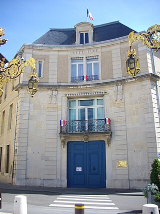
Thorey-Lyautey

Last updated

Thorey-Lyautey
Thorey-Lyaute-le chateau-WP 20160921 069.jpg
The chateau in Thorey-Lyautey
Blason ville fr Thorey-Lyautey (Meurthe-et-Moselle).svg
Location of Thorey-Lyautey
Thorey-Lyautey
France location map-Regions and departements-2016.svg
Red pog.svg
Thorey-Lyautey
Grand Est region location map.svg
Red pog.svg
Thorey-Lyautey
Coordinates: 48°26′38″N6°01′46″E / 48.4439°N 6.0294°E / 48.4439; 6.0294
Country France
Region Grand Est
Department Meurthe-et-Moselle
Arrondissement Nancy
Canton Meine au Saintois
Government
  Mayor (20202026) Philippe Lepape [1]
Area
1
6.19 km2 (2.39 sq mi)
Population
 (2021) [2]
129
  Density21/km2 (54/sq mi)
Time zone UTC+01:00 (CET)
  Summer (DST) UTC+02:00 (CEST)
INSEE/Postal code
54522 /54115
Elevation274–357 m (899–1,171 ft)
(avg. 300 m or 980 ft)
1 French Land Register data, which excludes lakes, ponds, glaciers > 1 km2 (0.386 sq mi or 247 acres) and river estuaries.

Thorey-Lyautey (French pronunciation: [tɔʁɛljotɛ] ) is a commune in the Meurthe-et-Moselle department in north-eastern France.

Contents

Demographics

Historical population
YearPop.±% p.a.
1968 115    
1975 95−2.69%
1982 81−2.25%
1990 111+4.02%
1999 118+0.68%
2007 129+1.12%
2012 138+1.36%
2017 143+0.71%
Source: INSEE [3]

See also

Related Research Articles

<span class="mw-page-title-main">Meurthe-et-Moselle</span> Department of France

Meurthe-et-Moselle is a département in the Grand Est region of France, named after the rivers Meurthe and Moselle. Its prefecture and largest city is Nancy and it borders the departments of Meuse to the west, Vosges to the south, Moselle and Bas-Rhin and it borders the Belgian province of Luxembourg and the country of Luxembourg by the canton of Esch-sur-Alzette to the north. It had a population of 733,760 in 2019.

<span class="mw-page-title-main">Arrondissement of Nancy</span> Arrondissement in Grand Est, France

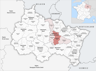
The arrondissement of Nancy is an arrondissement of France in the Meurthe-et-Moselle department in the Grand Est region. It has 188 communes. Its population is 419,699 (2016), and its area is 1,509.4 km2 (582.8 sq mi).
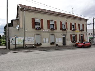
<span class="mw-page-title-main">Avril, Meurthe-et-Moselle</span> Commune in Grand Est, France

Avril is a commune in the Meurthe-et-Moselle department in northeastern France. It is the site of the former Augustinian abbey of Saint-Pierremont.

<span class="mw-page-title-main">Amance, Meurthe-et-Moselle</span> Commune in Grand Est, France

Amance is a commune in the Meurthe-et-Moselle department in northeastern France. The commune covers an area of 13.5 km2. The current mayor is Stéphane Laurent.

<span class="mw-page-title-main">Aboncourt, Meurthe-et-Moselle</span> Commune in Grand Est, France

Aboncourt is a commune in the Meurthe-et-Moselle department in northeastern France.

<span class="mw-page-title-main">Belleau, Meurthe-et-Moselle</span> Commune in Grand Est, France

Belleau is a commune in the Meurthe-et-Moselle department in northeastern France.

<span class="mw-page-title-main">Boncourt, Meurthe-et-Moselle</span> Commune in Grand Est, France

Boncourt is a commune in the Meurthe-et-Moselle department in northeastern France.

<span class="mw-page-title-main">Crépey</span> Commune in Grand Est, France

Crépey is a commune in the Meurthe-et-Moselle department in north-eastern France.

<span class="mw-page-title-main">Damelevières</span> Commune in Grand Est, France

Damelevières is a commune in the Meurthe-et-Moselle department in north-eastern France.

<span class="mw-page-title-main">Houdemont</span> Commune in Grand Est, France

Houdemont is a commune in the Meurthe-et-Moselle department in north-eastern France.

<span class="mw-page-title-main">Othe</span> Commune in Grand Est, France

Othe is a commune in the Meurthe-et-Moselle department in north-eastern France. It is an exclave of the Meurthe-et-Moselle department, surrounded by the Meuse department.

<span class="mw-page-title-main">Saint-Germain, Meurthe-et-Moselle</span> Commune in Grand Est, France

Saint-Germain is a commune in the Meurthe-et-Moselle department in north-eastern France.

<span class="mw-page-title-main">Saint-Remimont, Meurthe-et-Moselle</span> Commune in Grand Est, France

Saint-Remimont is a commune in the Meurthe-et-Moselle department in north-eastern France.

<span class="mw-page-title-main">Serres, Meurthe-et-Moselle</span> Commune in Grand Est, France

Serres is a commune in the Meurthe-et-Moselle department in north-eastern France.

<span class="mw-page-title-main">Avricourt, Meurthe-et-Moselle</span> Commune in Grand Est, France

Avricourt is a commune in the Meurthe-et-Moselle department in northeastern France.

<span class="mw-page-title-main">Blémerey, Meurthe-et-Moselle</span> Commune in Grand Est, France

Blémerey is a commune in the Meurthe-et-Moselle department in northeastern France.

<span class="mw-page-title-main">Boismont, Meurthe-et-Moselle</span> Commune in Grand Est, France

Boismont is a commune in the Meurthe-et-Moselle department in northeastern France.

<span class="mw-page-title-main">Bures, Meurthe-et-Moselle</span> Commune in Grand Est, France

Bures is a commune in the Meurthe-et-Moselle department in northeastern France.

<span class="mw-page-title-main">Valleroy, Meurthe-et-Moselle</span> Commune in Grand Est, France

Valleroy is a commune in the Meurthe-et-Moselle department in north-eastern France.

The canton of Meine au Saintois is an administrative division of the Meurthe-et-Moselle department, northeastern France. It was created at the French canton reorganisation which came into effect in March 2015. Its seat is in Vézelise.

References

  1. "Répertoire national des élus: les maires" (in French). data.gouv.fr, Plateforme ouverte des données publiques françaises. 4 May 2022.
  2. "Populations légales 2021". The National Institute of Statistics and Economic Studies. 28 December 2023.
  3. Population en historique depuis 1968, INSEE