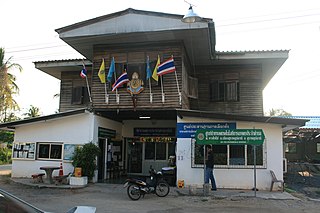
Tambon is a local governmental unit in Thailand. Below district (amphoe) and province (changwat), they form the third administrative subdivision level. As of 2016 there were 7,255 tambons, not including the 180 khwaeng of Bangkok, which are set at the same administrative level, thus every district contains eight to ten tambon. Tambon is usually translated as "township" or "subdistrict" in English — the latter is the recommended translation, though also often used for king amphoe, the designation for a subdistrict acting as a branch of the parent district. Tambon are further subdivided into 74,944 villages (muban) as of 2008. Tambon within cities or towns are not subdivided into villages, but may have less formal communities called chumchon that may be formed into community associations. The average area of a subdistrict in Thailand is about 70.72 km2 (27.31 sq mi), while its average population of a subdistrict in Thailand is about 9,637 people.

An amphoe —usually translated as "district"—is the second level administrative subdivision of Thailand. Groups of amphoe or districts make up the provinces, and are analogous to counties. The chief district officer is Nai Amphoe. Amphoe are divided into tambons,, or sub-districts.

Mueang Nonthaburi is the capital district of Nonthaburi province in Thailand. The city of Nonthaburi has 267,001 inhabitants, while the whole district has 348,553.

Bang Yai is a district (amphoe) in the western part of Nonthaburi province, central Thailand.

Bang Bua Thong is a district (amphoe) of Nonthaburi province, central Thailand.

Pak Kret is a district (amphoe) in the northeastern part of Nonthaburi province, central Thailand.

Sattahip is a district (amphoe) in Chonburi province, Thailand. It is at the southern tip of the province southeast of Bangkok. In 2014, the district had a population of 157,000 in an area of 348.122 km2.

Kuy, also known as Kui, Suay or Kuay, is a Katuic language, part of the larger Austroasiatic family spoken by the Kuy people of Southeast Asia.

Sadao is district (amphoe) on the border of Malaysia in Songkhla province, southern Thailand. The capital of the district is also called Sadao town.
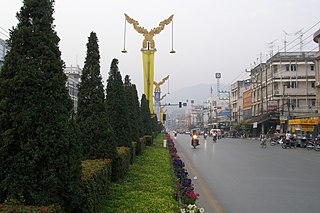
Mae Sai is the northernmost district (amphoe) of Chiang Rai province in northern Thailand. The town of Mae Sai is a major border crossing between Thailand and Myanmar. Asian Highway Network AH2 crosses the Mae Sai River to the town Tachileik in Myanmar.

Muban is the lowest administrative sub-division of Thailand. Usually translated as 'village' and sometimes as 'hamlet', they are a subdivision of a tambon (subdistrict). As of 2008, there were 74,944 administrative mubans in Thailand. As of the 1990 census, the average village consisted of 144 households or 746 persons. The average land area of villages in Thailand is very small, its average area is about 6.84 km2 (2.64 sq mi), and its average population is also very small, at only 932 people.

San Kamphaeng is a district (amphoe) of Chiang Mai province in northern Thailand.

A khwaeng is an administrative subdivision used in the fifty districts of Bangkok and a few other city municipalities in Thailand. Currently, there are 180 khwaeng in Bangkok. A khwaeng is roughly equivalent to a tambon in other provinces of Thailand, smaller than an amphoe (district). With the creation of the special administrative area of Bangkok in 1972 the tambon within the area of the new administrative entity was converted into khwaeng. The common English translation for khwaeng is subdistrict.

Na Thawi is a district (amphoe) in the southern part of Songkhla province, southern Thailand.

Thesaban are the municipalities of Thailand. There are three levels of municipalities: city, town, and sub-district. Bangkok and Pattaya are special municipal entities not included in the thesaban system.

Bang Lamung is a district (amphoe) in the southern part of Chonburi province, Thailand.

Erawan National Park is a protected area in Western Thailand, in the Tenasserim Hills of Kanchanaburi Province. Founded in 1975, it was the 12th national park of Thailand.

Mueang Chiang Rai is the capital district of Chiang Rai province, northern Thailand.
Mpi is a Loloish language of Thailand. The number of speakers is in decline. It is spoken in the following two villages in northern Thailand.

