Gleichen is the name of two groups of castles in Germany, thus named from their resemblance to each other.

The Messeturm Köln is a highrise building which is 80 meters high, in Cologne, Germany. Its top floor features a tower restaurant, that has already been closed.

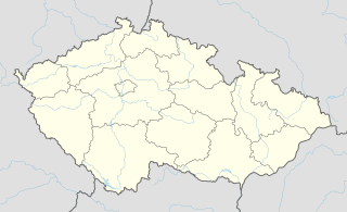
This is a list of the extreme points of the Czech Republic: the points that are farther north, south, east or west than any other location.

Kirchheim is a village and a former municipality in the district Ilm-Kreis, in Thuringia, Germany. Since 1 January 2019, it is part of the municipality Amt Wachsenburg.

Wachsenburggemeinde is a former municipality in the district Ilm-Kreis, in Thuringia, Germany. The municipality was named after the Wachsenburg Castle which is located in its center. It consisted of the five villages named Bittstädt, Haarhausen, Holzhausen, Röhrensee, and Sülzenbrücken. Since 31 December 2012, it is part of the municipality Amt Wachsenburg.

Biskupice is a village in the administrative district of Gmina Jordanów Śląski, within Wrocław County, Lower Silesian Voivodeship, in south-western Poland. Prior to 1945 it was in Germany.

Sycyna is a village in the administrative district of Gmina Biała Podlaska, within Biała Podlaska County, Lublin Voivodeship, in eastern Poland. It lies approximately 12 kilometres (7 mi) west of Biała Podlaska and 91 km (57 mi) north of the regional capital Lublin.
Majdan is a village in the administrative district of Gmina Wojsławice, within Chełm County, Lublin Voivodeship, in eastern Poland.

Wołajowice is a village in the administrative district of Gmina Hrubieszów, within Hrubieszów County, Lublin Voivodeship, in eastern Poland, close to the border with Ukraine. It lies approximately 7 kilometres (4 mi) north of Hrubieszów and 102 km (63 mi) south-east of the regional capital Lublin.

Nowa Wieś is a village in the administrative district of Gmina Skała, within Kraków County, Lesser Poland Voivodeship, in southern Poland. It lies approximately 2 kilometres (1 mi) east of Skała and 20 km (12 mi) north of the regional capital Kraków.

Nowy Jawor is a village in the administrative district of Gmina Pawłów, within Starachowice County, Świętokrzyskie Voivodeship, in south-central Poland. It lies approximately 3 kilometres (2 mi) south of Pawłów, 12 km (7 mi) south of Starachowice, and 35 km (22 mi) east of the regional capital Kielce.

Strugi is a village in the administrative district of Gmina Żelazków, within Kalisz County, Greater Poland Voivodeship, in west-central Poland. It lies approximately 17 kilometres (11 mi) north-east of Kalisz and 105 km (65 mi) south-east of the regional capital Poznań.

Herby is a village in Lubliniec County, Silesian Voivodeship, in southern Poland. It is the seat of the gmina called Gmina Herby. It lies approximately 17 kilometres (11 mi) north-east of Lubliniec and 57 km (35 mi) north of the regional capital Katowice. The village has a population of 2,421.

Jiancaoping District is a district of Taiyuan, the capital of Shanxi province, China.
The Theatre Nuovo Teatro Giuseppe Verdi of Brindisi, Italy was inaugurated on December 20, 2006.
Wachsenburg may refer to:

Wachsenburg Castle is a castle in Amt Wachsenburg in the Ilm-Kreis, Thuringia, Germany. It is one of the Drei Gleichen, three hilltop castles east of Gotha. It was originally built in the 10th century. The castle was extensively reconstructed in the 17th and 19th century. The well-preserved castle now houses a museum, a hotel and a restaurant.

Amt Wachsenburg is a municipality in the district Ilm-Kreis, in Thuringia, Germany. The municipality is named after the Wachsenburg Castle which is located in its center. It was formed on 31 December 2012 from the former municipalities Wachsenburggemeinde and Ichtershausen. The former municipality Kirchheim was merged into Amt Wachsenburg in January 2019. It consists of the villages Bechstedt-Wagd, Bittstädt, Eischleben, Haarhausen, Holzhausen, Ichtershausen, Kirchheim, Rehestädt, Röhrensee, Sülzenbrücken, Thörey and Werningsleben.


