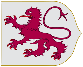
León is a province of northwestern Spain, in the northwestern part of the autonomous community of Castile and León.

In Spain traditionally and historically, some autonomous communities are also divided into comarcas.
Almanza is a municipality located in the province of León, Castile and León, Spain. According to the 2009 census (INE), the municipality has a population of 609 inhabitants.

Alija del Infantado is a municipality which is part of Tierra de La Bañeza comarca, autonomous community of Castile and León, Spain.

Castrillo de la Valduerna, is a municipality located in the province of León, Castile and León, Spain. According to the 2010 census (INE), the municipality has a population of 190 inhabitants.
Hospital de Órbigo is a municipality located in the province of León, Castile and León, Spain. According to the 2010 census (INE), the municipality has a population of 1,031 inhabitants.
Regueras de Arriba is a municipality located in the province of León, Castile and León, Spain. According to the 2004 census (INE), the municipality has a population of 368 inhabitants.
Santa María del Monte de Cea is a municipality located in the province of León, Castile and León, Spain. According to the 2004 census (INE), the municipality has a population of 331 inhabitants.
Carrizo de la Ribera is a town and municipality in the Province of León, Castile and León, Spain. According to the 2008 census (INE), the municipality has a population of 2,554 inhabitants. It is situated in the western bank of the Rio Órbigo. In addition to Carrizo, the municipality includes the villages of Huerga del Río, La Milla del Río, Quiñones del Río and Villanueva de Carrizo.
Cea is a municipality located in the province of León, Castile and León, Spain. According to the 2010 census (INE), the municipality has a population of 530 inhabitants.

Laciana, Tsaciana in Leonese language, is a comarca in the province of León, Spain. It had 11,904 inhabitants in 2005. The rivers of this comarca flow towards the Atlantic Ocean. Local people speak a certain variant of the Leonese language known as Patsuezo.

La Maragatería or País de los Maragatos, is an ancient historical region or traditional comarca in the landlocked Province of León, Spain. It borders with La Cepeda comarca in the north, La Valduerna in the south, with the comarcas of El Bierzo and La Cabrera in the west and southwest, and in the east with La Vega del Tuerto and La Valduerna.
Trasierra/Tierras de Granadilla, traditionally known as Tierras de Granadilla, is a comarca at the northern end of province of Cáceres in Extremadura, one of Spain's seventeen Autonomous Communities.

The region of León or Leonese region is a historic territory defined by the 1833 Spanish administrative organisation. The Leonese region encompassed the provinces of Salamanca, Zamora, and León, now part of the modern Spanish autonomous community of Castile and León. As is the case with other historical regions, and continuing with centuries of history, the inhabitants of the Leonese region are still called Leonese. Even today, according with official autonomous government, the historical territorial adjective is used in addition with the modern annexed territory, the rest of Old Castile, being "Castilians and Leonese".

Aliste is a comarca located in the west of the province of Zamora, Castile and León, Spain, bordering with Portugal in the west and in the south. It covers 193,883 hectares. Aliste is an area that has preserved a rich cultural and ethnological tradition through years of isolation. Aliste is perhaps the poorest zone within the province, the economy of this deeply rural comarca is based on cattle rearing. The origin of the name Aliste appears as Alesti in a 9th Century manuscript, referring to the trees (alisos) which can be seen on the banks of what is now called the Aliste River.

La Cepeda is an ancient historical region in the landlocked Province of León, Spain. It borders with La Maragatería, El Bierzo, Omaña and La Vega del Órbigo. It is a traditional comarca without administrative recognition.

La Carballeda is a comarca located in the northwest of the province of Zamora, Castilla y León, western Spain. Its area is 1,216.54 km².

Tierra de Campos is a large historical and natural region or greater comarca that straddles the provinces of León, Zamora, Valladolid and Palencia, in Castile and León, Spain. It is a vast, desolate plain with practically no relief, except for some wide undulations of the terrain.