
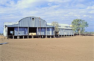
Longreach is a town and a locality in the Longreach Region, Queensland, Australia. In the 2016 census, Longreach had a population of 2,970 people. It is the administrative centre of the Longreach Regional Council, which was established in 2008 as a merger of the former Longreach, Ilfracombe, and Isisford shires.

The Thomson River is a perennial river that forms part of the Lake Eyre Basin, situated in the central west and western regions of Queensland, Australia. Much of the course of the river comprises a series of narrow channels synonymous with the Channel Country and the Gailee subregion.

Paterson is a small township in the lower Hunter Region of New South Wales, Australia. Located within Dungog Shire it is situated on the Paterson River. At the 2006 census, Paterson had a population of 345 people. It is in the middle of what was once dairy, timber and citrus country and is now more significantly a feeder town for the nearby mining industry in the Upper Hunter and the city of Newcastle.
The Anglican Diocese of Rockhampton is a diocese in the Province of Queensland and one of the 23 dioceses of the Anglican Church of Australia. The diocese covers an area of approximately 57 million hectares, roughly twice the size of New Zealand and four times the size of England and Wales. The diocese contains nearly the whole central regions of Queensland. The population of the diocese is 216,000 of whom approximately 48,000 indicate that they are Anglicans. The diocese has 20 parishes and ministry districts, with the largest parish bigger than the State of Victoria. The cathedral church of the diocese is St Paul's Cathedral in Rockhampton. The most recent Bishop of Rockhampton was the Right Reverend Godfrey Fryar who retired in December 2013.

The Shire of Longreach was a local government area located in central western Queensland, centred on the town of Longreach, from which the shire was administered. It covered an area of 23,561.4 square kilometres (9,097.1 sq mi), and existed as a local government entity from 1900 until 2008, when it amalgamated with the Shires of Ilfracombe and Isisford to form the Longreach Region.

Brayton is a locality in the Southern Tablelands of New South Wales, Australia, in the Upper Lachlan Shire. At the 2016 census, it had a population of 173.

The Longreach Region is a local government area in Central West Queensland, Australia. Established in 2008, it superseded three previous local government areas that had existed for more than a century.
This is a list of radio stations that broadcast on FM frequency 87.6 MHz:
Morella was a rural locality within Longreach Region, Queensland, Australia. It has been amalgamated into the locality of Longreach.
John Payne was a member of the Queensland Legislative Assembly.
The Matilda Way is an Australian road route from Bourke, New South Wales to Karumba in Queensland. It has been designated by the Queensland Government as a State Strategic Touring Route.

Vergemont was a rural locality in the Longreach Region, Queensland, Australia. It was amalgamated into the locality of Longreach.
Camoola was a rural locality within the Longreach Region, Queensland, Australia, situated between the towns of Longreach and Muttaburra. It has been amalgamated into the locality of Longreach.
Chorregon was a rural locality in the Longreach Region, Queensland, Australia. It is now part of the locality of Longreach.
Ernestina was a rural locality in the Longreach Region, Queensland, Australia. It is now part of Longreach.
Maneroo was a rural locality in the Longreach Region, Queensland, Australia. It is now part of Longreach.
Bangall is a locality in the Barcaldine Region, Queensland, Australia. In the 2016 census, Bangall had a population of 4 people.
This page is based on this
Wikipedia article Text is available under the
CC BY-SA 4.0 license; additional terms may apply.
Images, videos and audio are available under their respective licenses.
