Togulsky District | |
|---|---|
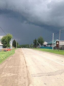 Street view in Togulsky District | |
 Location of Togulsky District in Altai Krai | |
| Coordinates: 53°25′N85°52′E / 53.417°N 85.867°E | |
| Country | Russia |
| Federal subject | Altai Krai [1] |
| Established | 1924  |
| Administrative center | Togul [1] |
| Area | |
• Total | 2,000 km2 (770 sq mi) |
| Population | |
• Total | 8,478 |
| • Density | 4.2/km2 (11/sq mi) |
| • Urban | 0% |
| • Rural | 100% |
| Administrative structure | |
| • Administrative divisions | 5 selsoviet |
| • Inhabited localities [1] | 12 rural localities |
| Municipal structure | |
| • Municipally incorporated as | Togulsky Municipal District [3] |
| • Municipal divisions [3] | 0 urban settlements, 5 rural settlements |
| Time zone | UTC+7 (MSK+4 [4] ) |
| OKTMO ID | 01648000 |
| Website | http://togul.org/ |
Togulsky District (Russian : То́гульский райо́н) is an administrative [1] and municipal [3] district (raion), one of the fifty-nine in Altai Krai, Russia. It is located in the east of the krai. The area of the district is 2,000 square kilometers (770 sq mi).[ citation needed ] Its administrative center is the rural locality (a selo ) of Togul. [1] Population: 8,478 (2010 Census); [2] 10,450 (2002 Census); [5] 11,431 (1989 Soviet census). [6] The population of Togul accounts for 51.3% of the district's total population. [2]

