Budzów is a village in the administrative district of Gmina Gorzów Śląski, within Olesno County, Opole Voivodeship, in south-western Poland. It lies approximately 6 kilometres (4 mi) west of Gorzów Śląski, 19 km (12 mi) north of Olesno, and 51 km (32 mi) north-east of the regional capital Opole.
Zdziechowice is a village in the administrative district of Gmina Gorzów Śląski, within Olesno County, Opole Voivodeship, in south-western Poland. It lies approximately 8 kilometres (5 mi) north of Gorzów Śląski, 25 km (16 mi) north of Olesno, and 59 km (37 mi) north-east of the regional capital Opole.
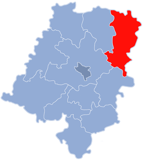
Aleksandrów is a village in the administrative district of Gmina Praszka, within Olesno County, Opole Voivodeship, in south-western Poland. It lies approximately 7 kilometres (4 mi) north-east of Praszka, 26 km (16 mi) north of Olesno, and 62 km (39 mi) north-east of the regional capital Opole.
Brzeziny is a village in the administrative district of Gmina Praszka, within Olesno County, Opole Voivodeship, in south-western Poland. It lies approximately 6 kilometres (4 mi) south-east of Praszka, 17 km (11 mi) north of Olesno, and 56 km (35 mi) north-east of the regional capital Opole.
Kowale is a village in the administrative district of Gmina Praszka, within Olesno County, Opole Voivodeship, in south-western Poland. It lies approximately 5 kilometres (3 mi) north-east of Praszka, 24 km (15 mi) north of Olesno, and 61 km (38 mi) north-east of the regional capital Opole.
Lachowskie is a village in the administrative district of Gmina Praszka, within Olesno County, Opole Voivodeship, in south-western Poland. It lies approximately 9 kilometres (6 mi) north-east of Praszka, 26 km (16 mi) north-east of Olesno, and 65 km (40 mi) north-east of the regional capital Opole.
Prosna is a village in the administrative district of Gmina Praszka, within Olesno County, Opole Voivodeship, in south-western Poland. It lies approximately 6 kilometres (4 mi) south-east of Praszka, 17 km (11 mi) north of Olesno, and 56 km (35 mi) north-east of the regional capital Opole.
Przedmość is a village in the administrative district of Gmina Praszka, within Olesno County, Opole Voivodeship, in south-western Poland. It lies approximately 6 kilometres (4 mi) north of Praszka, 25 km (16 mi) north of Olesno, and 60 km (37 mi) north-east of the regional capital Opole.
Rosochy is a village in the administrative district of Gmina Praszka, within Olesno County, Opole Voivodeship, in south-western Poland. It lies approximately 3 kilometres (2 mi) south-east of Praszka, 19 km (12 mi) north of Olesno, and 57 km (35 mi) north-east of the regional capital Opole.
Skotnica is a village in the administrative district of Gmina Praszka, within Olesno County, Opole Voivodeship, in south-western Poland. It lies approximately 10 kilometres (6 mi) east of Praszka, 22 km (14 mi) north-east of Olesno, and 62 km (39 mi) north-east of the regional capital Opole.
Sołtysy is a village in the administrative district of Gmina Praszka, within Olesno County, Opole Voivodeship, in south-western Poland. It lies approximately 9 kilometres (6 mi) north-east of Praszka, 27 km (17 mi) north of Olesno, and 64 km (40 mi) north-east of the regional capital Opole.
Strojec is a village in the administrative district of Gmina Praszka, within Olesno County, Opole Voivodeship, in south-western Poland. It lies approximately 4 kilometres (2 mi) east of Praszka, 19 km (12 mi) north of Olesno, and 58 km (36 mi) north-east of the regional capital Opole.
Szyszków is a village in the administrative district of Gmina Praszka, within Olesno County, Opole Voivodeship, in south-western Poland. It lies approximately 3 kilometres (2 mi) south-west of Praszka, 18 km (11 mi) north of Olesno, and 54 km (34 mi) north-east of the regional capital Opole.
Wygiełdów is a village in the administrative district of Gmina Praszka, within Olesno County, Opole Voivodeship, in south-western Poland. It lies approximately 4 kilometres (2 mi) south of Praszka, 17 km (11 mi) north of Olesno, and 54 km (34 mi) north-east of the regional capital Opole.
Hajdamaki is a village in the administrative district of Gmina Rudniki, within Olesno County, Opole Voivodeship, in south-western Poland. It lies approximately 5 kilometres (3 mi) south of Rudniki, 19 km (12 mi) north-east of Olesno, and 59 km (37 mi) north-east of the regional capital Opole.
Kuźnica Żytniowska is a village in the administrative district of Gmina Rudniki, within Olesno County, Opole Voivodeship, in south-western Poland. It lies approximately 6 kilometres (4 mi) south-west of Rudniki, 17 km (11 mi) north-east of Olesno, and 57 km (35 mi) north-east of the regional capital Opole.
Żurawie is a village in the administrative district of Gmina Rudniki, within Olesno County, Opole Voivodeship, in south-western Poland. It lies approximately 3 kilometres (2 mi) south of Rudniki, 21 km (13 mi) north-east of Olesno, and 61 km (38 mi) north-east of the regional capital Opole.
Gana is a village in the administrative district of Gmina Praszka, within Olesno County, Opole Voivodeship, in south-western Poland. It lies approximately 7 kilometres (4 mi) east of Praszka, 24 km (15 mi) north of Olesno, and 62 km (39 mi) north-east of the regional capital Opole.