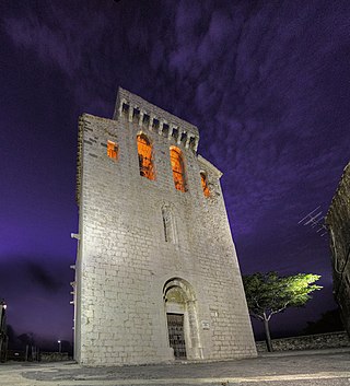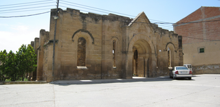
Puigcerdà is the capital of the Catalan comarca of Cerdanya, in the province of Girona, Catalonia, northern Spain, near the Segre River and on the border with France.

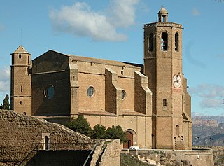
Balaguer is the capital of the comarca of Noguera, in the province of Lleida, Catalonia, Spain. It is located by the river Segre, a tributary to the Ebro. The municipality includes an exclave to the east. Balaguer also has a sister city in the western United States, Pacifica, California.

La Pobla de Segur is a municipality located in the comarca of Pallars Jussà, province of Lleida, Catalonia, in northern Spain. According to the 2013 census (INE), the town has a population of 3,073 inhabitants. It is situated at the confluence of the Flamicell and Noguera Pallaresa rivers in the north of the comarca, above the Sant Antoni reservoir. It is an important local service centre, which has allowed it to escape the depopulation which has affected many municipalities in northwestern Catalonia. The village is served by the C-13 road between Tremp and Sort, the N-260 road to Pont de Suert and by a railway station on a railway line to Lleida.

Olesa de Montserrat is a municipality in the comarca of Baix Llobregat, in Catalonia, Spain.

Sant Vicenç de Castellet is a municipality in the comarca of the Bages in Catalonia, Spain. It is situated near the confluence of the Llobregat river and the Cardener river. The railway station serves both the FGC line R5 between Barcelona and Manresa and the Renfe line between Barcelona and Zaragoza, served by Rodalies lines R4 and R12. The C-1411 road links the municipality with Martorell and Manresa.

Pals is a medieval town in Catalonia, northern Spain, a few kilometres from the sea in the heart of the Bay of Emporda on the Costa Brava. It lies on the C31 Palafrugell–L'Estartit road.

Mont-Ras is a village and rural district situated between the larger towns of Palafrugell and Palamos on the Costa Brava in Baix Emporda, in the province of Girona, Catalonia, Spain. Mont-ras is approximately 40 minutes from Girona, or 80 minutes from Barcelona.

Dosrius is a municipality in the comarca of Maresme in Catalonia, Spain, located in the interior of the comarca on the border with the Eastern Valleys, and is at the head of the Argentona Riera. The original name, first recorded in 963, is "Duos Rios". This literally means "Two Rivers" and refers to the 2 rivers that join to form the Argentona Riera, and is reflected in the coat of arms. These rivers are rarely flowing, though quickly fill during wet weather causing disruption in the village owing to the narrow streets being one way. Newer housing and the school are on the other side of the river, and egress from housing further up the valley frequently takes this route owing to the poor condition of the newly built "Ronda de Dalt". A bridge has been built that would alleviate this problem, though this still hasn't been opened due to the currently suspended construction work that is part of the same development. It is unknown when the bridge will be open to traffic.

Rubí is a municipality in Catalonia (Spain), in the comarca of Vallès Occidental and the province of Barcelona, 15 kilometers from Barcelona. It is bordered on the north by Terrassa and Ullastrell, on the south by Sant Cugat del Vallès, on the west by Castellbisbal and on the east by Sant Quirze del Vallès.

Sudanell is a municipality in the comarca of the Segrià in Catalonia. It is located by the junction of two rivers: the Segre and the Set. Agriculture is Sudanell's principal economic activity. Two canals: Canal de Seròs and Acèquia de Torres irrigate the area.

El Far d'Empordà is a municipality in the comarca of Alt Empordà, Girona, Catalonia, Spain.

Torredembarra, normally called La Torre by its inhabitants, is a town in the comarca of the Tarragonès, in the province of Tarragona, Catalonia, Spain. It is located on the Costa Daurada, it faces Altafulla to the west, La Pobla de Montornès to the north, Creixell to the east and Mediterranean Sea in the south. It is 13 km to Tarragona's northeast and about 100 km southwest Barcelona.
La Torre de Claramunt is a municipality in the comarca of the Anoia in Catalonia, Spain.

Capolat is a municipality in the comarca of Berguedà, Catalonia, Spain.

La Baronia de Rialb is a municipality in the comarca (county) of the Noguera in Catalonia, Spain. The territory is crossed by the river Rialb and the river Segre. The capital city is Gualter; before it had been La Torre de Rialb.

Torrebesses is a municipality in the comarca of the Segrià in Catalonia, Spain.

La Torre de l'Espanyol is a municipality in the comarca of Ribera d'Ebre, Tarragona Province, Catalonia, Spain.

La Torre de Fontaubella is a municipality in the comarca of the Priorat in Catalonia, Spain. It is situated at the southeastern end of the comarca.

La Torre de Cabdella or La Torre de Capdella is a village in the province of Lleida and autonomous community of Catalonia, Spain.

Torres de Segre is a village in the province of Lleida and autonomous community of Catalonia, Spain. It is located by the Segre River.


