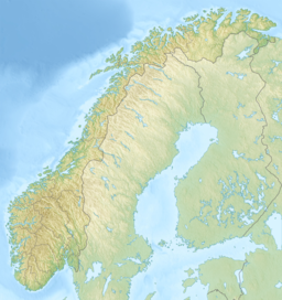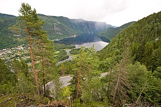
Tokke is a municipality in Telemark county, Norway. It is located in the traditional district of Vest-Telemark. The administrative centre of the municipality is the village of Dalen. Other villages in Tokke include Åmdals Verk, Eidsborg, Høydalsmo, Lårdal, and Øvre Byrte. The Eidsborg Stave Church is one of Norway's old stave churches and it is located in Eidsborg, just north of Dalen.

Mjøsa is the largest lake in Norway and the fourth deepest in Norway and Europe. It is located in the southern part of Norway, about 100 kilometres (62 mi) north of the city of Oslo. Its main tributary is the river Gudbrandsdalslågen flowing in from the north; the only distributary is the river Vorma in the south. Inflows would theoretically need 5.6 years to fill the lake. With an average depth of about 150 metres (490 ft), most of the lake's volume is under sea level. The average outflow of the lake (measured from 1931 to 1982) is 316 cubic metres per second (11,200 cu ft/s) which is about 9,959,000,000 cubic metres per year (1.1145×10¹⁰ cu ft/Ms). Mjøsa contains about 56.2 km3 (13.5 cu mi) of water compared to the 14.8 km3 (3.6 cu mi) in the lake Røssvatnet, the second largest lake by volume in Norway.

Hornindalsvatnet is Norway's and Europe's deepest lake, and the world's fourteenth deepest lake, officially measured to a depth of 514 m (1,686 ft). Its surface is 53 m (174 ft) above sea level, which means that its bottom is 461 m (1,512 ft) below sea level.
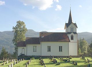
Lårdal is a village in Tokke Municipality in Telemark county, Norway. The village is located on the north shore of the lake Bandak and about 10 kilometres (6.2 mi) south of the village of Høydalsmo and the European route E134 highway. The village is the site of Lårdal Church, a school, and a fast food store. Previously, there was also a grocery store, but it closed because the local population couldn't support it. Lårdal is also home to the former journalist and television presenter Bjørn Honerød. The village was historically the administrative centre of the old Lårdal Municipality from 1838 until its dissolution in 1964.

Høydalsmo is a village in Tokke Municipality in Telemark county, Norway. The village is located along the north shore of the lake Oftevant in the northeastern part of the municipality. The European route E134 highway runs through the village. The village area has about 300 permanent residents. The village of Dalen lies about 15 kilometres (9.3 mi) to the southwest and the village of Åmot lies about 15 kilometres (9.3 mi) to the northwest.

Fyresvatnet or Fyresvatn is a lake in Fyresdal Municipality in Telemark county, Norway. With a depth of 377 metres (1,237 ft), the lake is the fifth-deepest lake in Norway. The 49.7-square-kilometre (19.2 sq mi) lake stretches about 25 kilometres (16 mi) from the village of Kilegrend in the south to Moland in the north.
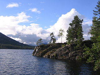
Nisser is a lake in Telemark county, Norway. It is located in Nissedal and Kviteseid municipalities, and is Telemark's largest lake. The lake is the 10th-largest lake in the nation by area with a surface area of 76.07 km2 (29.37 sq mi). The 8th largest by volume at 7.074 km3 (1.697 cu mi). The 16th deepest at 234 m (768 ft). Nisser has the greatest average depth of the Norwegian lakes that is not a cryptodepression. Its entire lakebasin is above sealevel. As part of the Arendal watershed, water enters this lake from the discharge from the nearby lake Vråvatn, and its outlet is the Nisserelva river which later becomes part of the river Nidelva.
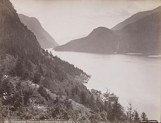
Bandak is a lake in the municipalities of Kviteseid and Tokke in Telemark county, Norway. The lake, which is part of the Telemark Canal route, belongs to the Skien watershed. The river Tokke flows into the lake, and the outlet is via the river Strauman, which flows to the lake Kviteseidvatn.
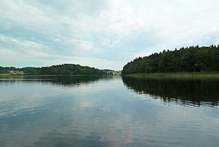
Goksjø is a lake on the border of Larvik Municipality and Sandefjord Municipality in Vestfold county, Norway. The 3.5-square-kilometre (1.4 sq mi) lake is located about 5 kilometres (3.1 mi) to the northwest of the town of Sandefjord and about 2.5 kilometres (1.6 mi) to the south of the village of Kodal.

Dingevatn or Dingevatnet is the 18th deepest lake in Norway, reaching a maximum depth of 220 metres (720 ft). It is located in the municipality of Gulen in Vestland county. The 2.84-square-kilometre (1.10 sq mi) lake is located just east of the village of Dingja, about 1 kilometre (0.62 mi) southeast of the mouth of the Sognefjorden. The lake lies about 4 kilometres (2.5 mi) north of the municipal center of Eivindvik. The lake flows out into the small Dingjaelva river, which runs past the village of Dingja before emptying into the Sognesjøen strait.

Suldalsvatnet is the sixth-deepest lake in Norway. The 376-metre (1,234 ft) deep lake lies in the municipality of Suldal in Rogaland county, Norway. The 29-square-kilometre (11 sq mi) lake is the headwaters of the river Suldalslågen and it sits at an elevation of 69 metres (226 ft) above sea level. The lake has a volume of 4.51 cubic kilometres (1.08 cu mi).
Salvatnet is a lake in Namsos Municipality in Trøndelag county, Norway. With its deepest depth of 482 metres (1,581 ft), it is Norway's and Europe's second-deepest lake, after Hornindalsvatnet. Alternate sources give the depth as either 464 metres (1,522 ft) or 482 metres (1,581 ft) at the deepest point. The lake sits close to the Norwegian Sea, about 9 metres (30 ft) above sea level at the surface and reaches to a depth of 473 metres (1,552 ft) below sea level. It is a large lake with an area of 44.96 square kilometres (17.36 sq mi), a volume of 6.97 cubic kilometres (1.67 cu mi), and a shoreline that is 105.61 kilometres (65.62 mi) around.
Øvre Byrte is a small village in Tokke Municipality in Telemark county, Norway. The village is located at the end of the Byrtedalen valley where the river Byrteåi flows into the lake Byrtevatn. The village lies about 6 kilometres (3.7 mi) south of Vinjesvingen and about 20 kilometres (12 mi) to the northwest of the municipal centre of Dalen.

Dalen is the administrative centre of Tokke Municipality in Telemark county, Norway. The village is located at the flat river delta where the river Tokke flows into the west end of the lake Bandak. The village of Eidsborg lies about 3 kilometres (1.9 mi) north of Dalen and the village of Åmdals Verk lies about 8 kilometres (5.0 mi) to the south of Dalen.
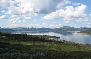
Songavatnet is a lake in Vinje Municipality in Telemark county, Norway. It has a surface area of 29.86 square kilometres (11.53 sq mi) and lies at an elevation of 974 metres (3,196 ft). The lake lies just south of the border of Hardangervidda National Park and just southeast of the mountain Vassdalseggi. The villages of Haukeli and Edland are both located about 9 kilometres (5.6 mi) to the south of the lake and the village of Arabygdi lies about 10 kilometres (6.2 mi) to the southeast of the lake. The lake flows out into the river Songa which flows to the southeast into the nearby lake Totak.
Brandsnutene or Brandsnutane is a 1,496-metre (4,908 ft) tall mountain on the borders of Agder and Telemark counties in southern Norway. It is the second highest mountain of the mountains in Agder with a prominence of at least 50 metres (160 ft). The mountain is located on the borders of the municipalities of Bykle and Tokke. The mountain has a secondary peak of 1,480 metres (4,860 ft) located about 1 kilometre (0.62 mi) east of the municipal/county border inside Tokke.

Tokke is a river in Telemark county, Norway. The river is about 35-kilometre (22 mi) long and it flows through the municipalities of Vinje and Tokke, between the lakes Totak and Bandak. The Tokke river system was regulated for hydroelectric power generation between 1959 and 1979. During this time, seven hydroelectric power stations with a combined installed capacity of 976 megawatts (1,309,000 hp) were constructed along the river and its tributaries. The power stations have an average annual production of 4,492 gigawatt-hours (16,170 TJ).

Vinjevatn is a lake in Vinje Municipality in Telemark county, Norway. The 3.3-square-kilometre (1.3 sq mi) lake lies a short distance to the northwest of the village of Åmot. The village of Vinje lies at the north end of the lake. The main natural influx comes from the river Smørkleppåi, and the lake drains through the river Vinjeåi which meets the river Tokke at Åmot. The lake is part of the Skien watershed. The European route E134 highway runs along the northern shore of the lake.

Byrtevatn is a lake in Tokke Municipality in Telemark county, Norway. The 4.8-square-kilometre (1.9 sq mi) lake is located about 10 kilometres (6.2 mi) northwest of the village of Dalen. The main natural influx comes from the river Byrteåi. Byrtevatn has a dam on the south end of the lake which regulates the surface elevation of the lake. Water from the nearby lake Botnedalsvatn flows through a tunnel into the Byrte Hydroelectric Power Station and the water is then released into this lake.
Vinjeåi is a river in Telemark county, Norway. The 2.6-kilometre (1.6 mi) long river starts at the southeastern end of the lake Vinjevatn where the water flows out into the river. The river flows downstream and end when it joins the river Tokke at the village of Åmot. Vinjeåi was regulated as part of the Tokke hydroelectric power development in the 1960s, and water from Vinjevatn is transferred through tunnel to the Tokke Hydroelectric Power Station.