Uinta County is a county in the U.S. state of Wyoming. As of the 2010 United States Census, the population was 21,118. Its county seat is Evanston. Its south and west boundary lines abut the Utah state line.

Roosevelt is a city in Duchesne County, Utah, United States. The population was 6,046 at the 2010 census, with an estimated population of 6,777 in 2014.

Evanston is a city in and the county seat of Uinta County, Wyoming, United States. The population was 12,359 at the 2010 census. It is located on the border with Utah.

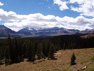
The Uinta Mountains are an east-west trending chain of mountains in northeastern Utah extending slightly into southern Wyoming in the United States. As a subrange of the Rocky Mountains, they are unusual for being the highest range in the contiguous United States running east to west, and lie approximately 100 miles (160 km) east of Salt Lake City. The range has peaks ranging from 11,000–13,528 feet (3,353–4,123 m), with the highest point being Kings Peak, also the highest point in Utah. The Mirror Lake Highway crosses the western half of the Uintas on its way to Wyoming.

Kings Peak is the highest peak in the U.S. state of Utah,
with an elevation of 13,534 feet (4,125 m) NAVD 88 and an isolation of 166 miles.

Uinta National Forest is a national forest located in north central Utah, USA. It was originally part of the Uinta Forest Reserve, created by Grover Cleveland on 2 February 1897. The name is derived from the Ute word Yoov-we-teuh which means pine forest. Because of changes to the boundaries over the years, the Uinta Mountains are now located in the Wasatch-Cache National Forest. In August 2007 it was announced that the Uinta National Forest would merge with the Wasatch-Cache National Forest based in Salt Lake City, Utah, 50 miles (80 km) north of Provo, Utah.

Wasatch-Cache National Forest is a United States National Forest located primarily in northern Utah (81.23%), with smaller parts extending into southeastern Idaho (16.42%) and southwestern Wyoming (2.35%). The name is derived from the Ute word Wasatch for a low place in high mountains, and the French word Cache meaning to hide. The term cache originally referred to fur trappers, the first Europeans to visit the land. The Wasatch-Cache National Forest boundaries include 1,607,177 acres (6,504.01 km2) of land.

Daggett School District is a public school district in Daggett County, Utah, United States. The district provides education for students living in Daggett County, as well as more than two dozen students from adjacent areas in Wyoming. It is the smallest of the 41 school districts in Utah, with a total of three schools and 181 students.
Interstate 80 (I-80) is a part of the Interstate Highway System that runs from San Francisco to Teaneck, New Jersey. In Wyoming, the Interstate Highway runs 402.780 miles (648.212 km) from the Utah state line near Evanston east to the Nebraska state line in Pine Bluffs. I-80 connects Cheyenne, Wyoming's capital and largest city, with several smaller cities along the southern tier of Wyoming, including Evanston, Green River, Rock Springs, Rawlins, and Laramie. The highway also connects those cities with Salt Lake City to the west and Omaha to the east. In Cheyenne, I-80 intersects I-25 and has Wyoming's only auxiliary Interstate, I-180. The Interstate runs concurrently with U.S. Route 30 for most of their courses in Wyoming. I-80 also has shorter concurrencies with US 189 near Evanston, US 191 near Rock Springs, and US 287 and Wyoming Highway 789 near Rawlins. The Interstate has business loops through all six cities along its course as well as a loop serving Fort Bridger and Lyman east of Evanston.

Wasatch National Forest was established as the Wasatch Forest Reserve by the U.S. Forest Service in Utah on August 16, 1906 with 86,440 acres (349.8 km2) to the east of Salt Lake City and Provo. It became a National Forest on March 4, 1907. On July 1, 1908 Grantsville National Forest and Salt Lake National Forest were added. In 1973 Wasatch was combined administratively with Cache National Forest, creating Wasatch-Cache National Forest. In descending order of acreage, the Wasatch National Forest portion is located in Summit, Tooele, Salt Lake, Davis, Uinta (Wyoming), Duchesne, Wasatch, Morgan, Utah, Weber, and Juab counties in Utah except Uinta, which is in southwestern Wyoming. Its total area was 908,731 acres (3,677.50 km2), comprising 56.44% of the combined Wasatch-Cache's 1,610,184 acres (6,516.18 km2) as of 2008. There are local ranger district offices in Kamas and Salt Lake City in Utah, and in Evanston and Mountain View in Wyoming. Administrative headquarters reside with the combined Uinta-Wasatch-Cache National Forest in South Jordan, Utah.
Union Pacific Railroad Depot or
Union Pacific Railroad Complex may refer to:

The High Uintas Wilderness is a wilderness area located in northeastern Utah, United States. The wilderness covers the Uinta Mountains, encompassing parts of Duchesne and Summit counties. Designated as a wilderness in 1984, the area is located within parts of Ashley National Forest and Uinta-Wasatch-Cache National Forest, managed by the U.S. Forest Service. The highest peak in Utah, Kings Peak, lies within the wilderness area along with some of Utah's highest peaks, particularly those over 13,000 feet.
Gordon Lesley Park was a petroleum engineer and geologist for the Chevron Oil Company, who served from 1993 to 1996 as a Republican member of the Wyoming House of Representatives from District 49 in Uinta County.

Humpy Peak is a peak located in the Uinta Mountain Range in northern Utah. It is approximately 27.56 miles (44 km) south of Evanston, Wyoming and 21.29 miles (34 km) east of Coalville, Utah. The summit has an elevation of 10,875 feet (3,315 m).
School Number 6 may refer to:


