Uriarra, Australian Capital Territory

Last updated

Uriarra Village
Canberra,  Australian Capital Territory
Australia Capital Territory location map.svg
Red pog.svg
Uriarra Village
Coordinates 35°17′50″S148°55′20″E / 35.29722°S 148.92222°E / -35.29722; 148.92222 Coordinates: 35°17′50″S148°55′20″E / 35.29722°S 148.92222°E / -35.29722; 148.92222
Population 349 (2016 census) [1]
Established 2012 [2]
Postcode(s) 2611
Territory electorate(s) Murrumbidgee
Federal Division(s) Canberra
Localities around Uriarra Village:
Canberra Nature Park Canberra Nature Park Canberra Nature Park
Canberra Nature Park Uriarra Village Canberra Nature Park
Canberra Nature Park Canberra Nature Park Canberra Nature Park

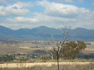
Uriarra Village is a historic forestry settlement in the Australian Capital Territory established in 1928 at the foothills of the Australian Alps. A nearby area to the north of the border in New South Wales is also called Uriarra.

Australian Capital Territory Federal territory of Australia, containing the capital city, Canberra

The Australian Capital Territory is a federal territory of Australia, located in the south-east of the country and enclaved within the state of New South Wales. It contains Canberra, the capital city of Australia.

Uriarra, New South Wales Suburb of Yass Valley Council, New South Wales, Australia

Uriarra is a locality in the Southern Tablelands of New South Wales, Australia in the Yass Valley Shire. It is north of the locality of Uriarra in the Australian Capital Territory and north-east of Canberra. At the 2016 census, it had a population of 30. The locality is mostly located in the Urayarra parish of Cowley County, although part of it in Pabral parish, which lies further west.

Contents

The settlement and surrounding forest was significantly damaged by the 2003 Canberra bushfires with 16 of the original 23 homes being destroyed. [3] In May 2004 the ACT Government considered information on social capital, infrastructure innovation, environmental, planning and financial analysis and found that Uriarra Village should be redeveloped in a sustainable manner. [3] Fifteen of the original families moved away from the settlement with nine choosing to remain. [4]

2003 Canberra bushfires

The 2003 Canberra bushfires caused severe damage to the suburbs and outer areas of Canberra, the capital city of Australia, during 18–22 January 2003. Almost 70% of the Australian Capital Territory's (ACT) pastures, pine plantations, and nature parks were severely damaged, and most of the Mount Stromlo Observatory was destroyed. After burning for a week around the edges of the ACT, the fires entered the suburbs of Canberra on 18 January 2003. Over the next ten hours, four people died, over 490 were injured, and 470 homes were destroyed or severely damaged, requiring a significant relief and reconstruction effort.

In 2007 the ACT Government commenced rebuilding the settlement as a rural village, through the funding of new roads and infrastructure. In mid-2012 the settlement was officially recognised and named as a village within the ACT. [5]

Uriarra Village is the only "community title" village in Australia. The village community independently owns and maintains village services and infrastructure including roads, community lands, the village hall, and stormwater. As such the village receives only minimal services from the ACT Government for the provision of garbage collection. The National Capital Authority advocated community title for the village after the 2003 bushfire to "promote social interaction and a shared community spirit". [3]

Location

Uriarra village is located about 16 km west of Canberra, and about 4 km north of the Cotter Reserve, amidst rolling hilly lands overlooking a broad creek valley. [6]

The village is located in rural ACT off Brindabella Road that connects Canberra to Brindabella and Tumut via the Brindabella Ranges. The village sits at the foothills to the Australian Alps and to the South has views to Mount Ginini, Mount Franklin and the highest mountain in the ACT, Bimberi Peak. To the North the village faces grasslands leading towards the Molonglo River. The village "lies on the boundary between remnant Yellow box/ Red gum grassy woodland and the Uriarra and Pierces Creek pine plantations". [7]

Brindabella Road road in New South Wales and the Australian Capital Territory

Brindabella Road, also known as Tumut Road, links Canberra and Tumut, New South Wales via the Brindabella Ranges. It provides access to the Brindabella National Park, Namadgi National Park and Kosciuszko National Park as well as the Bondo State Forest. Beginning at Cotter Road near the base of the Cotter Dam, the road climbs toward Uriarra Village, forming the primary access between the village and Canberra. Beyond Uriarra, the road continues south-west towards the ACT/NSW border, passing through the localities of Picadilly Circus, Brindabella and Bondo along the route to Tumut. It crosses the Brindabella Range and Fiery Range, with a highest point of 1,300 metres.

Canberra capital city of Australia

Canberra is the capital city of Australia. With a population of 410,301, it is Australia's largest inland city and the eighth-largest city overall. The city is located at the northern end of the Australian Capital Territory, 280 km (170 mi) south-west of Sydney, and 660 km (410 mi) north-east of Melbourne. A resident of Canberra is known as a Canberran. Although Canberra is the capital and seat of government, many federal government ministries have secondary seats in state capital cities, as do the Governor-General and the Prime Minister.

Brindabella, New South Wales New South Wales, Australia

Brindabella is a locality in south-east New South Wales, Australia, mainly in the area of Snowy Valleys Council and partly in Yass Valley Council. It is reached by the Brindabella Road from the Australian Capital Territory over the Brindabella Ranges. It is significant as the early home of Miles Franklin, who wrote a well known book called Childhood at Brindabella. It had a population of 22 at the 2016 census, who live in the Brindabella Valley. The locality also includes a large unpopulated area consisting of parts of the Brindabella National Park, the Kosciuszko National Park and the Bimberi Nature Reserve and of state forests.

To the East lies Mount McDonald providing panoramic 360° views across Canberra, the Australian Alps, and rural farmlands.

One kilometre to the West lies the historic Uriarra Homestead where Mountain Creek Road (to Yass and Wee Jasper) joins Brindabella Road (to Tumut).

Uriarra Forest to the South was destroyed in the 2003 bushfire.

Bushfires

Due to Uriarra's bushfire history and rural location the ACT Government placed stringent development requirements on new buildings within the village. Each house has mandatory rain water storage, sewerage treatment, and firefighting systems. The village has a 300-metre fire abatement zone on three sides that is also used for horse agistment. The village has pressurised non-potable water for fire fighting purposes fed from the Bendora Gravity Main (which connects Bendora Dam with Mount Stromlo Water Treatment Plant). [8]

Due to the remote nature of the village, bushfire assistance is limited. The Lease and Development conditions for the Village highlight that "emergency response times will be longer than normal". [9] The village maintains a 300-metre fire abatement zone to the West, East, and South. There is no fire abatement zone to the North of the village.

In 2001 fires originating in Uriarra threatened the suburbs of Duffy, Holder, Weston, Yarralumla and Curtin and burnt to the shores of Lake Burley Griffin destroying 510 hectares of pine plantation. [10] In 2003 the Canberra bushfires devastated the village destroying 16 of the original 23 homes. The village was again threatened by grass fires in 2013 when a four hectare grass fire threatened the south of the village. [11]

Abandoned Solar Farm Proposal

On 19 August 2013 the ACT Government announced Elementus Energy had been awarded solar Feed in Tariff (FiT) rights [12] based on a proposal to build a 7 megawatt Solar Farm [13] less than 150 metres away from houses in Uriarra Village. [14] [15] The proposal includes 26100 solar panels [16] located in grasslands opposite the village on the northern side. The proposal was met with opposition from residents of the village [17] [18] with multiple letters published in local media opposing the solar farm. [19] [20] [21] [22]

On 18 September 2013 a protest against the development was staged at the ACT Legislative Assembly. [23] The protest was followed by a defeated motion in the Assembly to remove Minister Corbell's power to overrule the planning decision. [24] The opposition at the time (the Canberra Liberals) did not support the proposed location opposite Uriarra Village. [25] Following the dispute the ACT Chief Minister, Katy Gallagher, indicated that for future solar farm proposals ACT government would explore developing best practice guidelines regarding site selection. [26]

The Uriarra location for the solar farm was abandoned in March 2015 [27] . A new site for the solar farm was secured beside the Monaro Highway at Williamsdale in the ACT and the project was taken over and developed by the Impact Investment Group in 2016 [28] .

Heritage

The original Uriarra Forestry Camp was established in 1913-1915 on the Brindabella Road, about three kilometres from the site of the current Uriarra settlement. The camp was established for forestry workers who cleared the existing eucalypt trees and established radiata pine plantations which formed the origins of the ACT plantation forest industry. [29]

In 1928 the Uriarra Forestry Settlement was established in its current location, in recognition of the need to permanently house the forestry workers on site, reflecting their dual role as forestry workers and also as fire surveillance officers. The census for that year showed 30 people living at the Uriarra Settlement. [29]

The village maintains multiple heritage citations including over the historically significant school. Established in 1897 when it was conducted in the local Church of England church, it operated for ten years as a Half Time school with Ledgerton, ten miles further north. This school was located beside the road from Queanbeyan to Urriarra, which crossed the Murrumbidgee River at Uriarra Crossing. After two periods operating as a Subsidised School (1907–10 and 1920-1926), a 'new' Uriarra school opened at the Uriarra Forestry Settlement in 1936 and operated there until 2001. [30]

Uriarra Crossing

Uriarra Crossing is a low level bridge over the Murrumbidgee River on Uriarra Road to the north, providing an alternative route to Weston Creek and Belconnen.

A punt operated the crossing from around 1860. A bridge was constructed and officially opened on 5 October 1901. [31] That bridge was swept away in the floods of 1922, and for a time was not to be rebuilt due to the proximity of the Cotter Bridge. [32] A new bridge was eventually reconstructed, and opened for traffic on 28 March 1936. [33]

Geology

Rocks from the Uriarra area are from the Silurian period. Uriarra Volcanics appear north west of the Winslade fault. It consists of dacite lava flows and pyroclastic deposits of tuff. A fine ashstone bed called Tarpaulin Creek Ashstone Member outcrops in a distorted north south line acts as a marker. Tuff and flows above and below the ashstone member contain obvious pink feldspar crystals. The tuff shows bedding, and the flows have banded flow structure. The Cotter Porphyry to the north of the Cotter Dam is actually a dacite flow. There is a limestone lens north of Uriarra Crossing. The outcrop goes from Mountain Creek Road in the west to the Murrumbidgee River in the east. It extends a few kilometers to the north of the ACT border and south to the Winslade Fault near the Cotter River. A wedge of limestone extends to the south south west including Pierces Creek. [34]

Related Research Articles

Weston Creek Australian Capital Territory

The District of Weston Creek is one of the original eighteen districts of the Australian Capital Territory used in land administration. The district is subdivided into divisions (suburbs), sections and blocks. The district of Weston Creek lies entirely within the bounds of the city of Canberra, the capital city of Australia. The district comprises eight residential suburbs, situated to the west of the Woden Valley district and approximately 13 kilometres (8.1 mi) southwest of the Canberra City centre. Situated adjacent to the district was the large Stromlo Forest pine plantation until the forest was destroyed by bushfires in 2001 and 2003.

Michelago Town in New South Wales, Australia

Michelago is a locality in the Monaro region of New South Wales, Australia. The locality is in the Snowy Monaro Regional Council local government area, 54 kilometres (34 mi) south of Canberra on the Monaro Highway. It was founded in the 1820s, on the main route from Sydney to the Snowy Mountains. At the 2016 census, Michelago had a population of 562.

Queanbeyan River river in Australia

The Queanbeyan River, a perennial stream that is part of the Molonglo catchment within the Murray–Darling basin, is located in the Monaro and Capital Country regions of New South Wales and the Australian Capital Territory, in Australia. The river is 104 kilometres (65 mi) in length with a catchment area of 96,000 hectares. The Queanbeyan River and the Cotter River meet the potable water supply needs of the Canberra and Queanbeyan region and whose water quality is specifically protected under Federal legislation.

Cotter River river in the Australian Capital Territory

The Cotter River, a perennial river of the Murrumbidgee catchment within the Murray-Darling basin, is located in the Australian Capital Territory, Australia. The Cotter River, together with the Queanbeyan River, is one of two rivers that provides potable water to the Canberra and Queanbeyan region.

Tharwa, Australian Capital Territory Town in Australian Capital Territory

Tharwa is a township within the Australian Capital Territory, 35 kilometres (22 mi) south of Canberra, the capital city of Australia. At the 2016 census, Tharwa had a population of 81.

Mount Stromlo mountain

Mount Stromlo is a mountain with an elevation of 770 metres (2,530 ft) AHD  that is situated in the in the Australian Capital Territory, Australia. The mountain is most notable as the location of the Mount Stromlo Observatory. The mountain forms part of the catchment area of the Cotter River which in turn is the primary water supply for part of ACT.

The history of the Australian Capital Territory (ACT) as a separate administrative division began in 1911, when it was transferred from New South Wales to the Australian federal government. The territory contains Australia's capital city Canberra and various smaller settlements. Until 1989, it also administered the Jervis Bay Territory, a small coastal region.

Geology of the Australian Capital Territory

The geology of the Australian Capital Territory includes rocks dating from the Ordovician around 480 million years ago, whilst most rocks are from the Silurian. During the Ordovician period the region—along with most of eastern Australia—was part of the ocean floor. The area contains the Pittman Formation consisting largely of Quartz-rich sandstone, siltstone and shale; the Adaminaby Beds and the Acton Shale.

Williamsdale, Australian Capital Territory Town in Australian Capital Territory

Williamsdale is a township on the New South Wales - Australian Capital Territory border in Australia on the Monaro Highway. The postcode is 2620. The former Bombala railway line passes through the village and a railway station saw service until 1975.

Goodradigbee River river in Australia

Goodradigbee River, a perennial stream that is part of the Murrumbidgee catchment within the Murray–Darling basin, is located in the Snowy Mountains district of New South Wales, Australia.

Brindabella electorate electorate of the Australian Capital Territory

The Brindabella electorate is one of the five electorates for the unicameral 25-member Australian Capital Territory Legislative Assembly. It elects five members, and is the largest of the electorates in geographic area.

Cuppacumbalong is an historic homestead located near the southern outskirts of Canberra in the Australian Capital Territory. It is also the name of a former 4,000-acre (16 km2) sheep and cattle grazing property that surrounded the homestead near the junction of the Murrumbidgee and Gudgenby Rivers. The word Cuppacumbalong is Aboriginal in origin and means 'meeting of the waters'. One of the property's early owners Leopold Fabius Dietegen Fane De Salis made a noteworthy contribution to political life during colonial times and furthermore, Cuppacumbalong has strong connections to the life of William Farrer, the father of the Australian wheat industry.

Jerrabomberra Creek, a partly perennial stream of the Murrumbidgee catchment within the Murray-Darling basin, is located in the Capital Country region spanning both New South Wales and the Australian Capital Territory, Australia.

Paddys River (Australian Capital Territory) river in Australia

Paddys River, a perennial stream that is part of the Murrumbidgee catchment within the Murray-Darling basin, is located in the Australian Capital Territory, Australia.

Royalla Town in New South Wales, Australia

Royalla is a rural locality on the border of New South Wales and the Australian Capital Territory. The area takes its name from the nearby Mount Rob Roy, and was originally a railway settlement on the Bombala railway line known as Rob Roy and changed to the current name in 1905. Modern Royalla is a large rural locality east of the Monaro Highway. The border with the ACT follows the western boundary of the easement of the former railway line to the east of the highway. The town was served by a railway station until 1975. The NSW part of Royalla had a population of 984 at the 2016 census.

Australian Capital Territory Rural Fire Service

The ACT Rural Fire Service is a branch of the Australian Capital Territory Emergency Services Agency. It is responsible for the prevention, detection and extinguishment of all bushfires within the ACT, as well as assisting the other branches of ESA.

Energy in the Australian Capital Territory

Energy produced in the Australian Capital Territory mainly consists of solar electricity. Electricity consumed in the Australian Capital Territory mainly comes from the national power grid through substations at Holt and Fyshwick. The ACT currently mandates that 90 percent of its electricity, amounting to 550 megawatts, will be supplied from renewable sources by 2020. The ACT has four solar farms capable of generating about 36 megawatts. From 1913 until the mid 1950s some power was produced from the Kingston Powerhouse, a thermal power station in Kingston.

References

  1. Australian Bureau of Statistics (27 June 2017). "Uriarra Village (State Suburb)". 2016 Census QuickStats. Retrieved 1 July 2017. Blue pencil.svg
  2. Gallagher, Katy (23 June 2012). "Uriarra Village celebrates naming" (Press release). ACT Government . Retrieved 29 January 2013.
  3. 1 2 3 "Development Control Plan No. 171/04/0004" (RTF). Uriarra Village. National Capital Authority. p. 1. Retrieved 31 August 2013.
  4. "Character test comes with Uriarra's growth". The Canberra Times. 22 January 2012. Retrieved 29 January 2013.
  5. "Uriarra Village celebrates naming". Chief Ministers Department - ACT Government. 23 June 2012. Retrieved 31 August 2013.
  6. "Draft Variation to the Territory Plan No. 151 - Coree Block 5 Uriarra Rural Village" (PDF). Draft Variation to the Territory Plan No. 151 - Coree Block 5 Uriarra Rural Village. ACT Legislative Assembly Standing Committee on Planning and Environment. May 2005. p. 9. Retrieved 31 August 2013.
  7. "Variation to the Territory Plan No.151" (PDF). Variation to the Territory Plan No.151. ACT Planning and Land Authority . Retrieved 31 August 2013.
  8. "The Impact of a Unique Catchment on Uriarra Sewage Treatment Plant" (PDF). Water Industry Operators Association of Australia. 9 April 2013. p. 2. Retrieved 31 August 2013.
  9. "Uriarra Rural Village Lease and Development Conditions" (PDF). ACT Government. 26 August 2008. p. 36. Retrieved 31 August 2013.
  10. "History of Bushfires". ACT Emergency Services Agency. 6 September 2011. Retrieved 31 August 2013.
  11. "Firefighters Battle Uriarra Blaze". City News. 10 May 2013. Retrieved 31 August 2013.
  12. "Canberra's Renewable Energy Future: New Solar Farms Announced" (PDF). Environment ACT. 19 August 2013. Retrieved 31 August 2013.
  13. "Uriarra Village - proposed solar farm motion and petition" (PDF). ACT Legislative Assembly. 18 September 2013. Retrieved 22 November 2013.
  14. "Uriarra residents pleased over potential switch to solar farm site". 2CA News Canberra. 15 November 2013. Retrieved 22 November 2013.
  15. "Solar farm move could mean higher power prices". ABC News. 18 November 2013. Retrieved 21 November 2013.
  16. "OneSun Capital Australian Capital Territory". Elementus Energy. Retrieved 31 August 2013.
  17. Residents angry about solar farm plans. Australian Broadcasting Corporation (Motion picture). 26 August 2013. Retrieved 31 August 2013.
  18. "Burnt by the sun: rural residents blindsided by proposal for solar farm". Canberra Times. 22 September 2013. Retrieved 22 November 2013.
  19. "Canberra Time Letters to The Editor - Corbell Interference". Canberra Times. 12 September 2013. Retrieved 22 November 2013.
  20. "Canberra Time Letters to The Editor - Thin end of the wedge". Canberra Times. 11 September 2013. Retrieved 22 November 2013.
  21. "Canberra Time Letters to The Editor - Solar plan based on flawed process". Canberra Times. 7 September 2013. Retrieved 22 November 2013.
  22. "Canberra Time Letters to The Editor - Concern about values outweighs the view". Canberra Times. 9 September 2013. Retrieved 22 November 2013.
  23. "Consultation process questioned for Uriarra solar farm". ABC news. 18 September 2013. Retrieved 22 November 2013.
  24. "Legislative Assembly for the ACT: 2013 Week 11 Hansard 18 September". ACT Legislative Assembly. 18 September 2013. Retrieved 22 November 2013.
  25. "Canberra Liberals call for rethink on location of large-scale solar at Uriarra". Canberra Liberals (Press release). 11 September 2013. Retrieved 22 November 2013.
  26. "talks may pave way to move solar farm". Canberra Times. 15 November 2013. Retrieved 21 November 2013.
  27. Lawson, Kirsten (2015-03-24). "Uriarra solar farm relocated to Williamsdale". Canberra Times. Retrieved 2018-01-06.
  28. Trask, Steven (2017-10-05). "Government unveils 36,000 new solar panels at Williamsdale". Canberra Times. Retrieved 2018-01-06.
  29. 1 2 "Heritage Decision about Provisional Registration of the Uriarra Forestry Settlement, Coree Notice 2011" (PDF). Environment ACT. 10 March 2011. Retrieved 31 August 2013.
  30. "Uriarra School". Hall School Museum. Retrieved 31 August 2013.
  31. "URIARRA BRIDGE OPENING". Queanbeyan Age. 28 September 1901. p. 2. Retrieved 1 November 2010.
  32. "Uriarra Bridge". Queanbeyan Age and Queanbeyan Observer. 14 November 1922. p. 4.
  33. "URIARRA BRIDGE TO BE OPENED NEXT WEEK". The Canberra Times. 25 March 1936.
  34. Henderson, G. A. M; Matveev, G (1980). Geology of Canberra (Map). Queanbeyan and Environs 1:50000.