
Krasnoyarsk Krai is a federal subject of Russia, with its administrative center in the city of Krasnoyarsk—the third-largest city in Siberia. Comprising half of the Siberian Federal District, Krasnoyarsk Krai is the largest krai in the Russian Federation, the second largest federal subject and the third largest subnational governing body by area in the world, after Sakha and the Australian state of Western Australia. The krai covers an area of 2,339,700 square kilometers (903,400 sq mi), which is nearly one quarter the size of the entire country of Canada, constituting roughly 13% of the Russian Federation's total area and containing a population of 2,828,187, or just under 2% of its population, per the 2010 Census.
Podkamennaya Tunguska may refer to:
Zelenogorsk is the name of several inhabited localities in Russia.
Nikolsk is the name of several inhabited localities in Russia.

Tura is a rural locality and the administrative center of Evenkiysky District of Krasnoyarsk Krai, Russia, located at the confluence of the Kochechum and the Nizhnyaya Tunguska Rivers. Population: 5,535 (2010 Census); 5,836 (2002 Census); 7,474 (1989 Census).
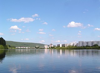
Zelenogorsk is a closed town in Krasnoyarsk Krai, Russia, located on the left bank of the Kan River 180 kilometers (110 mi) above its confluence with the Yenisei River. It was formerly known as Krasnoyarsk-45 (Красноя́рск-45) and was involved in enriching uranium for the Soviet nuclear program. Population: 66,056 (2010 Census); 69,355 (2002 Census).

Lesosibirsk is a town in Krasnoyarsk Krai, Russia, located on the Yenisei River. Population: 61,139 (2010 Census); 65,374 (2002 Census); 68,349 (1989 Census)..

Sukhobuzimsky District is an administrative and municipal district (raion), one of the forty-three in Krasnoyarsk Krai, Russia. It is located in the south of the krai. The area of the district is 5,612 square kilometers (2,167 sq mi). Its administrative center is the rural locality of Sukhobuzimskoye. Population: 20,537 (2010 Census); 23,445 (2002 Census); 25,460 (1989 Census). The population of Sukhobuzimskoye accounts for 21.2% of the district's total population.

Yemelyanovsky District is an administrative and municipal district (raion), one of the forty-three in Krasnoyarsk Krai, Russia. It is located in the southern central part of the krai and borders with Bolshemurtinsky District in the north, Sukhobuzimsky District in the northeast, Beryozovsky District and the territory of the krai city of Krasnoyarsk in the east, Balakhtinsky District in the south, Kozulsky District in the west, and with Birilyussky District in the northwest. The area of the district is 7,441 square kilometers (2,873 sq mi). Its administrative center is the urban locality of Yemelyanovo. Population: 51,159 ; 50,998 (2010 Census); 45,656 ; 48,375 (1989 Census). The population of Yemelyanovo accounts for 23.6% of the district's total population.

Bolsheuluysky District is an administrative and municipal district (raion), one of the forty-three in Krasnoyarsk Krai, Russia. It is located in the southwest of the krai and borders with Birilyussky District in the north, Kozulsky District in the east, Achinsky District in the south, Bogotolsky District in the southwest, and with Tyukhtetsky District in the west. The area of the district is 2,708 square kilometers (1,046 sq mi). Its administrative center is the rural locality of Bolshoy Uluy. Population: 7,658 (2010 Census); 8,948 ; 10,758 (1989 Census). The population of Bolshoy Uluy accounts for 43.6% of the district's total population.

Idrinsky District is an administrative and municipal district (raion), one of the forty-three in Krasnoyarsk Krai, Russia. It is located in the southwest of the krai and borders with Balakhtinsky District in the north, Kuraginsky District in the east and south, and with Krasnoturansky District in the west. The area of the district is 6,115 square kilometers (2,361 sq mi). Its administrative center is the rural locality of Idrinskoye. Population: 12,472 (2010 Census); 15,399 ; 17,780 (1989 Census). The population of Idrinskoye accounts for 41.2% of the district's total population.
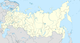
Podkamennaya Tunguska is a rural locality in Borsky Selsoviet of Turukhansky District in Krasnoyarsk Krai, Russia, located at the confluence of the Podkamennaya Tunguska and Yenisei Rivers on the Yenisei River's side opposite to the settlement of Bor and the Podkamennaya Tunguska Airport.

Tyukhtetsky District is an administrative and municipal district (raion), one of the forty-three in Krasnoyarsk Krai, Russia. It is located in the southwest of the krai and borders with Yeniseysky District in the north, Birilyussky and Bolsheuluysky Districts in the east, Bogotolsky District in the south, and with Kemerovo and Tomsk Oblasts in the west. The area of the district is 9,339 square kilometers (3,606 sq mi). Its administrative center is the rural locality of Tyukhtet. Population: 8,858 (2010 Census); 10,386 ; 12,814 (1989 Census). The population of Tyukhtet accounts for 54.1% of the district's total population.

Kedrovy is an urban locality in Yemelyanovsky District of Krasnoyarsk Krai, Russia, located 50 kilometers (31 mi) from Krasnoyarsk, the administrative center of the krai. Population: 4,692 (2010 Census); 5,223.

Solnechny is a closed urban locality in Krasnoyarsk Krai, Russia. As of the 2010 Census, its population was 10,384.

KrasAvia is a scheduled and charter passenger airline based in Krasnoyarsk, Russia. It was established in 1956 as Turin Airline before being renamed Evenkia Avia in 2002 and KrasAvia in 2007. It is Russia's largest regional carrier, with a fleet of 44 aircraft and helicopters. The airline is owned by the administration of the Krasnoyarsk region.
Kazachinsky (masculine), Kazachinskaya (feminine), or Kazachinskoye (neuter) may refer to:
