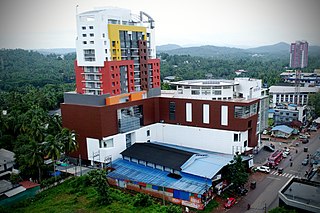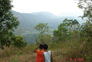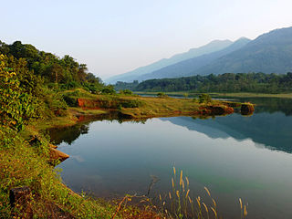
Manjeri is a major town and municipality in Malappuram district, Kerala, India. It is the fourth-most populous municipality in state. It is situated 23 kilometres (14 mi) southeast to Karipur International Airport and 13 kilometres (8.1 mi) northeast to Malappuram, the district headquarters, and forms a part of Malappuram metropolitan area. It is one of the major commercial towns under the Malappuram urban agglomeration and serves as the headquarters of Eranad Taluk. Manjeri Municipality is a Local Self Government Institution with a jurisdiction of three villages namely Manjeri, Payyanad, and Narukara.
Murickassery is a major market and educational centre in the Idukki district of Kerala state, South India. This is a village of migrant farmers and migrants has been developing as an important centre of Idukki. Various spice products provide the life blood for this village and market. Murickassery is situated in Vathikkudy Grama Panchayath.Cheruthony is the nearst town.

Thalayolaparambu is a town situated in Kottayam district in Kerala, India. Spanning over an area of 19.3 square kilometres with a population of 22,571 people, this mini-town is home to some of the well-known personalities such as the former Chief minister of Travancore-Cochin A. J. John, Anaparambil, the late Malayalam novelist/writer Vaikom Muhammed Basheer, the former Chief Justice of India K. G. Balakrishnan. Thalayolaparambu also hosts the major market established during the administration of Velu Thampi Dalawa, and is one of those few Keralite markets that still retains its old-world charm till date.

Peralasseri is a census town and Panchayat headquarters in Kannur district in the Indian state of Kerala, situated on the Kannur-Kuthuparamba State Highway 38 (Kerala), 12 km from Kannur city, on the bank of Anjarakandy river.

Parathode is a town located in the Idukki district in the Indian state of Kerala. This town is in Konnathady village, which is located in a valley surrounded by hills. The town's name originates from the Malayalam words "para" (rock) and "thode". The valley is split by a river, which has an abundance of archaeological evidence from Neolithic civilizations. Burial urns, swords, pottery, and other artifacts have been unearthed and suggest that an ancient civilization once lived there.
Kodungoor is a town in Kottayam District, Kerala, India.
Puthenkurish is a town in Ernakulam district in the Indian state of Kerala near Kolenchery town en route to Muvattupuzha. It is a part of the Greater Cochin area. Puthencruz is one of the fastest developing villages in Ernakulam district. Puthencruz plays a pivotal role in connecting different smaller villages and other surrounding towns to Ernakulam as it lies in the outer ring of Ernakulam City. Puthencruz is rapidly developing into a city and will be at the pivot of expansion of the Ernakulam municipal area.

Ezhumattoor is a village in Pathanamthitta district in the state of Kerala, India.It Is Part Of Thiruvalla Constituency.It has 27.89 km2 area,it is divided into 14 wards for administrative purpose,it was formed by a government Order on 16 January 1952.

is a Grama Panchayat & village in Thrissur district in the state of Kerala, India.

Omassery is a town in Kozhikode district, Kerala, India and it is a junction between Thiruvambady, Thamarassery, Mukkam, Koduvally, Kodenchery and Kattangal. Omassery is located 29 kilometers southeast of Kozhikode in the eastern part of Kerala; better known as Malabar. Omassery is a fast developing place and is well connected to the other parts of the state. Besides that, it is known as the gateway to the hill ranges of Western Ghats in Malabar.
Anikkadavu is a small village formerly a part of Coimbatore Rural District, India, but now in Tiruppur District which belongs to Udumalpet taluk. The name Anikkadavu derived from the ancient word Anai Kadavu which means that it was the path of elephants used to cross this region long long ago.
Kudappanakunnu is the headquarters of Thiruvananthapuram district in the Indian state of Kerala.

Muttom is a rural area in Idukki district in the Indian state of Kerala. This place is 66 km away from Cochin. Geographically this place is part of Midland or Idanad region of Kerala.
Patrame is a small, rural panchayat village on the left (east) bank of the Netravati River in Karnataka, India. Administratively, it is under Belthangady taluk, Dakshina Kannada district, Karnataka. Patrame is the only village in its gram panchayat. The village of Patrame is 26 km from its taluk headquarters Belthangady, and 8 km by road from Dharmasthala.
Valakom is a fastest growing town located on Kerala State highway One, in the Kollam district of Kerala, India, with population 17928. It lies within Kottarakkara municipal town, Ummannoor and edamulackal Panchayat.
Gunadal is a panchayat village in the state of Karnataka, India. Administratively it is under Bijapur Taluka of Bijapur district, Karnataka. Located in the far southwestern corner of the district, Gunadal is nearly 45 km by road from the district headquarters, the city of Bijapur. In Gunadal there is a Government Ayurvedic Hospital, Government Veterinary Hospital, Post Office, Police Station and gram panchayat headquarters.
Kambagi is a panchayat village in the southern state of Karnataka, India. Administratively it is under Vijayapur Taluk of Vijayapur District, Karnataka. It is nearly 40 kilometres (25 mi) from district headquarters, the city of Vijayapur, Karnataka. Kambagi has Government Primary HealthCare Center, Post Office, Bank of India and Gram Panchayat offices.

Thattamala is a neighbourhood situated at the southeast border of Kollam city in state of Kerala, India. It is situated at National Highways – NH 66. Kerala Police have identified Thattamala as one of the traffic black spots in the state.

Chungakkunnu is a small town in Kannur district of Kerala State, India. It is located on the bank of river Bavali between Kelakam town and Hindu Pilgrim center Kottiyoor. Chungakkunnu was a famous place for settlement during Malabar Migration. More than 2000 migrated families still live here. And it is well known for its timber merchants. Most of the people depend on agriculture for their livelihood. Rubber, Coconut, Cashew, and Black pepper are main crops cultivated here.
Madaria is a village in Gola Block and Tehsil (sub-district) of Gorakhpur district in the Indian State of Uttar Pradesh. The total geographical area of village is 75.21 hectares. The village has 247 households. The village has its Gram Panchayat and Post Office. The native language is Hindi. Madaria is located 61.1 km from Gorakhpur and 7 km from sub-district headquarters Gola Bazar.


