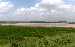
Coastal Andhra, is a region in the state of Andhra Pradesh, India. This region was part of Madras State before 1953 and Andhra State from 1953 to 1956. According to the 2011 census, it has an area of 95,442 square kilometres (36,850 sq mi) which is 57.99% of the total state area and a population of 34,193,868 which is 69.20% of Andhra Pradesh state population. This area includes the coastal districts of Andhra Pradesh on the Coromandel Coast between the Eastern Ghats and the Bay of Bengal, from the northern border with Odisha to Pulicat lake of South.

Rayalaseema is a geographic region in the Indian state of Andhra Pradesh. It comprises four southern districts of the state namely, Anantapur, Chittoor, Kadapa and Kurnool. As of 2011 census of India, the region with four districts had a population of 15,184,908 and covers an area of 67,526 km2 (26,072 sq mi).

Kurnool is the headquarters of Kurnool district in the Indian state of Andhra Pradesh. The city is often referred as The Gateway of Rayalaseema. It was the capital of Andhra State from 1 October 1953 to 31 October 1956. As of 2011 census, it is the fifth most populous city in the state with a population of 460,184.

Yemmiganur is a town in Kurnool district of the Indian state of Andhra Pradesh. It is located in Yemmiganur mandal of Adoni revenue division.

Kurnool District is one of the 13 districts in the state of Andhra Pradesh, India. The district is located in the west-central part of the state and is bounded by Mahabubnagar district of Telangana in the north, Raichur district of Karnataka in the northwest, Bellary district of Karnataka in the west, Ananthapur district in the south, YSR Kadapa district in the South East and Prakasham district in the east. The city of Kurnool is the headquarters of the district. It has a population of 4,053,463 of which 28.35% were urban as of 2011. The district is the 10th largest district in the country and the second-largest district in the state, accounting for 17,658 square kilometres (6,818 sq mi).

Acharya N. G. Ranga Agricultural University (ANGRAU) is a public agricultural university with its headquarters at the village Lam, Guntur City.

Vinukonda is a town in Guntur district of the Indian state of Andhra Pradesh. It is a municipality and the headquarters of Vinukonda mandal and administered under Narasaraopet revenue division.

Nandikotkur is a town and mandal in Kurnool district of Andhra Pradesh, India.

Dhone or Dronachalam is a town in Kurnool district of the Indian state of Andhra Pradesh. It is a Municipality located in Dhone mandal.

Andhra Pradesh lies between 12°41' and 19.07°N latitude and 77° and 84°40'E longitude, and is bordered by Telangana, Chhattisgarh, and Orissa in the north, the Bay of Bengal in the East, Tamil Nadu to the south and Karnataka to the west. Among the other states, which are situated on the country's coastal area, Andhra Pradesh has got a coastline of around 974 km, which gives it the 2nd longest coastline in the nation. Two major rivers, the Godavari and the Krishna run across the state. A small enclave 12 sq mi (30 km²), the Yanam district of Puducherry, lies in the Godavari Delta in the north east of the state. The state includes the eastern part of Deccan plateau as well as a considerable part of the Eastern Ghats.
Atmakur or Athmakur may refer to:

Pandurangapuram or Panduranga Puram is a village in Kurnool district, Andhra Pradesh, India. It should not be confused with the village of that name in Khammam district as well as near the bapatla, guntur district.

Amaravati is the de facto capital city of the Indian state of Andhra Pradesh. The planned city is located on the southern banks of the Krishna river in Guntur district, within the Andhra Pradesh Capital Region, being built on a 217 sq km riverfront designed to have 51% of green spaces and 10% of water bodies. The word "Amaravati" derives from the historical Amaravathi village, the ancient capital of the Satavahana dynasty. The foundation stone was laid on 22 October 2015, at Uddandarayunipalem area by the Prime Minister, Narendra Modi. The metropolitan area of Guntur and Vijayawada are the major conurbations of Amaravati.

Macherla mandal is one of the 57 mandals in Guntur district of the Indian state of Andhra Pradesh. It is under the administration of Gurazala revenue division and the headquarters are located at Macherla. The mandal is bounded by Rentachintala, Durgi and Veldurthi mandals and a portion of the mandal also borders the state of Telangana.

Andhra Pradesh Southern Power Distribution Company Limited or APSPDCL is the Electricity Distribution company owned by the Government of Andhra Pradesh for the Eight Southern Districts of Andhra Pradesh.
This page is based on this
Wikipedia article Text is available under the
CC BY-SA 4.0 license; additional terms may apply.
Images, videos and audio are available under their respective licenses.


