
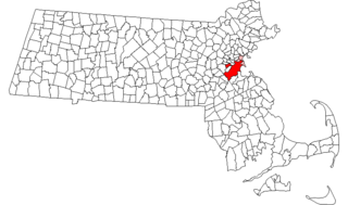
The Leather District is a neighborhood of Boston near South Street, between the Financial District and Chinatown. The Leather District is a tightly defined area bounded by Kneeland Street to the south, Essex Street to the north, Atlantic Avenue to the east and Lincoln Street to the west. It is so named due to the dominance of the leather industry in the late 19th century.

The Newtonville Historic District is a historic district in the village of Newtonville, in Newton, Massachusetts. The district encompasses the southern portion of the village's business district, as well as surrounding residential areas. It was listed on the National Register of Historic Places in 1986, and enlarged in 1990.
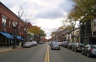
Downtown Melrose is the central business district of Melrose, Massachusetts. It is known for its nineteenth century Victorian architecture and its many small family-owned stores. Downtown Melrose is generally classified as the area on Main Street from Grove Street to Essex/Upham Streets. Part of the area, running on Main Street just northeast of the junction with Upham and Essex Streets, is included in the Melrose Town Center Historic District, which was added to the National Register of Historic Places on April 1, 1982. This district encompasses seven buildings, including city hall, the main fire station, Memorial Hall, the Coolidge School, and the Baptist and Methodist churches.

The Codman Square District is a historic district in the Dorchester neighborhood of Boston, Massachusetts. It consists of four of the most prominent properties facing the main Codman Square intersection, where Talbot Avenue and Washington Street cross. The area has a long history as a major civic center in Dorchester, and is now one of the large neighborhood's major commercial hubs. The properties in the district include the 1806 Congregational Church, the 1904 Codman Square branch of the Boston Public Library, the former Girls Latin Academy building, and the Lithgow Building, a commercial brick structure at the southeast corner of the junction that was built in 1899.

The North High Street Historic District is a historic district encompassing part of the downtown area of Holyoke, Massachusetts. When first added to the National Register of Historic Places in 1986, the district encompassed North High Street, between Dwight and Lyman Streets. This part of High Street was built between 1850 and 1885, and is lined with masonry buildings in Italianate and Second Empire styles. In 1992 the district was extended southward, adding three blocks of High Street between Dwight and Essex Streets. This expansions encompasses the growth of Holyoke during the height of its commercial success, between 1880 and 1930; it also includes the separately-listed Holyoke City Hall. The district was extended a third time, in 2008, adding a complex of three buildings at Dwight and Maple Streets that now houses the Holyoke Health Center.
The Central Square Historic District is a historic district encompassing the Central Square area of downtown Lynn, Massachusetts. The area is at the confluence of a number of city streets, and includes buildings that border on Central Avenue, Willow Street, Munroe Street, Lake Street, Almont Street. It is a small part of Lynn's "Burned District", a large area of the downtown that was destroyed by fire in 1889. One of the first buildings built after the fire, the Bergengren Block, stands at the corner of Union Street and Central Square. It also includes the Mowers' Block, listed on the National Register in 1982.

The Forge Village Historic District of Westford, Massachusetts encompasses one of the town's historic 19th century mill villages. The focal point of the district is the mill complex of the Abbot Worsted Company, around which the village expanded after its founding in 1854. Prior to its founding the area was the site of a number of blacksmithies and iron forging operations, and was the site of a fulling mill in the 18th century. The center of the district is at the junction of East and West Prescott Streets with Pleasant Street, radiating away to ballfields on West Prescott, Abbot Street at Pleasant, and just beyond Orchard Street on East Prescott. Worker housing occupies a number of adjacent streets in the area.

The Graniteville Historic District of Westford, Massachusetts encompasses one of the town's historic 19th century industrial villages. The area was, until the arrival of the railroad in 1847, primarily known for its granite quarries. The railroad's arrival prompted the construction of an industrial mill by Charles G. Sargent, and the area developed rapidly thereafter. A significant amount of housing stock, as well as civic institutional buildings, were built during the second half of the 19th century. The district is bounded on the east by River Street and on the south by Bridge Street and North Main Street. The western edge of the district runs just before North Main Street's junction with West Street, northward and then eastward to encompass a number of quarry sites, before meeting North Main Street at River Street.
The Woburn Street Historic District of Reading, Massachusetts encompasses a two-block section of late 19th century upper-class housing. The 10-acre (4.0 ha) extends along Woburn Street from Summer Street to Temple Street, and includes sixteen houses on well-proportioned lots along an attractive tree-lined section of the street. The historic district was listed on the National Register of Historic Places in 1985.

The Common Historic District is a historic district encompassing the civic and institutional heart of Reading, Massachusetts. The district is centered on the town common, at the intersection of Main and Salem Streets. The common has been communally owned since at least 1737, with the original burying ground to the north. In 1769 the area's first meeting house was built, giving the area a sense of identity separate from portions of Reading that would later be set off as Wakefield and North Reading. Since then the area has become a focal point for religious and civic institutions in the town.

The Samuel Bancroft House is a historic house in Reading, Massachusetts. With an estimated construction date of 1748, it is one of the town's older surviving houses, and one of a small number from the late colonial period. It was listed on the National Register of Historic Places in 1984.

The Common District encompasses the main civic center of Wakefield, Massachusetts. It is centered on the historic town common, just south of Lake Quannapowitt, which was laid in 1644, when it became the heart of Old Reading. The area was separated from Reading as South Reading in 1818, and renamed Wakefield in 1868. The 25 acre district includes the buildings that line the common on Common Street and Main Street, which include the town hall, public library, YMCA, and several churches. It was listed on the National Register of Historic Places in 1990.

Highland Heights–Stevens' Subdivision Historic District is a residential historic district located in Highland Park, Michigan along five east-west streets: Farrand Park, McLean Street, Colorado Street, Rhode Island Street, and Massachusetts Street, between Woodward Avenue on the west and Oakland Avenue on the east. The district was listed on the National Register of Historic Places in 1988.

The Central Square Historic District is a historic district encompassing much of the central business district of Stoneham, Massachusetts. It includes the town's largest concentration of 19th and early-20th century commercial architecture, in an area that developed in importance as a commercial center after the construction of the Andover-Medford Turnpike. The district was added to the National Register of Historic Places in 1990.

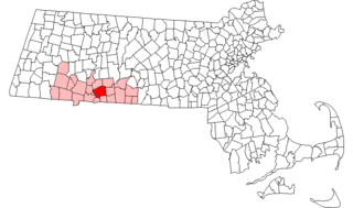
The Lincoln Estate–Elm Park Historic District is an expansive residential area in northwestern Worcester, Massachusetts. It is centered on Cedar and William Streets, and includes properties on adjacent streets. The area was developed beginning in the late 1830s by former Governor of Massachusetts Levi Lincoln, Jr., a Worcester native who had inherited land in the area. The district was divided and developed by Lincoln until his death, and then by his heirs, and became a popular location for homes of Worcester's wealthy and elite, many of which were designed by architects.

Wakefield Park Historic District is a residential historic district encompassing a portion of a late-19th/early-20th century planned development in western Wakefield, Massachusetts. The district encompasses sixteen properties on 8 acres (3.2 ha) of land out of the approximately 100 acres (40 ha) that comprised the original development. Most of the properties in the district are on Park Avenue, with a few located on immediately adjacent streets.
This is a list of the National Register of Historic Places listings in Methuen, Massachusetts.
This is a list of the National Register of Historic Places listings in Springfield, Massachusetts.
Boston, Massachusetts is home to a large number of listings on the National Register of Historic Places. This list encompasses those locations that are located south of the Massachusetts Turnpike. See National Register of Historic Places listings in northern Boston for listings north of the Turnpike. Properties and districts located elsewhere in Suffolk County's other three municipalities are also listed separately.


