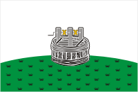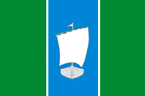
Vologda Oblast is a federal subject of Russia. Its administrative center is Vologda. Population: 1,202,444. The largest city is Cherepovets, the home of the Severstal metallurgical plant, the largest industrial enterprise in the oblast.

Kadnikov is a town in Sokolsky District of Vologda Oblast, Russia, located on the bank of the Sodima River, 43 kilometers (27 mi) southeast of Vologda, the administrative center of the oblast. Population: 4,796 (2010 Census); 5,362 (2002 Census); 5,312 (1989 Census).
Administratively, Vologda Oblast is divided into four cities and towns of oblast significance and twenty-six districts.

Nikolsk is a town and the administrative center of Nikolsky District in Vologda Oblast, Russia, located on the right bank of the Yug River. Population: 8,511 (2010 Census); 8,649 (2002 Census); 8,574 (1989 Census).

Gryazovets is a town and the administrative center of Gryazovetsky District in Vologda Oblast, Russia, located on the Rzhavka River, 47 kilometers (29 mi) south of Vologda, the administrative center of the oblast. Population: 15,528 (2010 Census); 16,172 (2002 Census); 16,424 (1989 Census).
Within the framework of administrative divisions, Arkhangelsk Oblast is divided into six cities and towns of oblast significance, twenty-one districts, and two island territories. Besides, Mirny is a town under the federal government management.

Archangelgorod Governorate, or the Government of Archangelgorod, was an administrative division of the Tsardom of Russia and then the Russian Empire, which existed from 1708 until 1780. Its seat was in Archangel. The governorate was located in the north of the Russian Empire and bordered Siberia Governorate in the east, Kazan Governorate in the southeast, Moscow and Ingermanland Governorates in the southwest, Sweden in the west, and Norway in north-west. In the north, the governorate was limited by the White and Barents Seas.

Kolsky Uyezd was an administrative division of the Tsardom of Russia and later of the Russian Empire.

The coat of arms was granted to the town of Kola, as well as to other towns of Vologda Viceroyalty, by the October 13 [O.S. October 2], 1780 decree (ukase) of Catherine II "On the coat of arms of Vologda Viceroyalty".
Umbskaya Volost was an administrative division of the Novgorod Republic and later of the Grand Duchy of Moscow, Tsardom of Russia, the Russian Empire, and the Russian SFSR. Its seat was in Umba.
Varzuzhskaya Volost was an administrative division of the Novgorod Republic and later of the Grand Duchy of Moscow, Tsardom of Russia, and the Russian Empire. Its seat was in Varzuga.
Vologda Governorate was an administrative division of the Russian Empire and the Russian SFSR, which existed from 1796 until 1929. Its administrative center was in the city of Vologda. The governorate was located in the north of Russian Empire.

Gryazovetsky District is an administrative and municipal district (raion), one of the twenty-six in Vologda Oblast, Russia. It is located in the south of the oblast and borders with Mezhdurechensky District in the north, Soligalichsky and Buysky Districts of Kostroma Oblast in the east, Lyubimsky and Pervomaysky Districts of Yaroslavl Oblast in the south, Poshekhonsky District, also of Yaroslavl Oblast, in the southeast, and with Vologodsky District in the northwest. The area of the district is 5,030 square kilometers (1,940 sq mi). Its administrative center is the town of Gryazovets. Population: 36,820 (2010 Census); 41,644 ; 47,136 (1989 Census). The population of Gryazovets accounts for 42.2% of the district's total population.

Kharovsky District is an administrative and municipal district (raion), one of the twenty-six in Vologda Oblast, Russia. It is located in the center of the oblast and borders with Vozhegodsky District in the north, Syamzhensky District in the east, Sokolsky District in the south, and with Ust-Kubinsky District in the west. The area of the district is 3,600 square kilometers (1,400 sq mi). Its administrative center is the town of Kharovsk. Population: 16,622 (2010 Census); 20,576 ; 25,219 (1989 Census). The population of Kharovsk accounts for 60.6% of the district's total population.

Mezhdurechensky District is an administrative and municipal district (raion), one of the twenty-six in Vologda Oblast, Russia. It is located in the center of the oblast and borders with Sokolsky District in the north, Totemsky District in the northeast, Soligalichsky District of Kostroma Oblast in the southeast, Gryazovetsky District in the south, and with Vologodsky District in the west. The area of the district is 3,600 square kilometers (1,400 sq mi). Its administrative center is the rural locality of Shuyskoye. District's population: 6,112 (2010 Census); 7,641 ; 9,361 (1989 Census). The population of Shuyskoye accounts for 36.8% of the district's total population. As of 2010, Mezhdurechensky District had the lowest population among all the districts of Vologda Oblast.

Sheksninsky District is an administrative and municipal district (raion), one of the twenty-six in Vologda Oblast, Russia. It is located in the center of the oblast and borders with Kirillovsky District in the north, Vologodsky District in the east, Poshekhonsky District of Yaroslavl Oblast in the south, and with Cherepovetsky District in the west. The area of the district is 2,500 square kilometers (970 sq mi). Its administrative center is the urban locality of Sheksna. Population: 33,375 (2010 Census); 36,007 ; 34,679 (1989 Census). The population of Sheksna accounts for 62.8% of the district's total population.

Verkhovazhsky District is an administrative and municipal district (raion), one of the twenty-six in Vologda Oblast, Russia. It is located in the north of the oblast and borders with Velsky District of Arkhangelsk Oblast in the north, Ustyansky District of Arkhangelsk Oblast in the northeast, Tarnogsky Districts in the east, Totemsky District in the south, Syamzhensky District in the southwest, Vozhegodsky District in the west, and with Konoshsky District of Arkhangelsk Oblast in the northwest. The area of the district is 4,260 square kilometers (1,640 sq mi). Its administrative center is the rural locality of Verkhovazhye. District's population: 13,898 (2010 Census); 16,346 ; 18,560 (1989 Census). The population of Verkhovazhye accounts for 36.2% of the district's total population.
Novgorod Viceroyalty was an administrative division of the Russian Empire, which existed in 1776–1796. The seat of the Viceroyalty was located in Novgorod.
Polovinka is the name of several rural localities in Russia.


