Opalenica is a town in Nowy Tomyśl County, Greater Poland Voivodeship, Poland, with 9,861 inhabitants (2007).
Mełno-Cukrownia is a village in the administrative district of Gmina Gruta, within Grudziądz County, Kuyavian-Pomeranian Voivodeship, in north-central Poland.
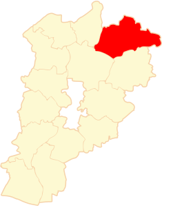
Łakno is a village in the administrative district of Gmina Chodecz, within Włocławek County, Kuyavian-Pomeranian Voivodeship, in north-central Poland.
Kłóbka-Nowy Młyn is a village in the administrative district of Gmina Lubień Kujawski, within Włocławek County, Kuyavian-Pomeranian Voivodeship, in north-central Poland.
Anusin is a village in the administrative district of Gmina Nurzec-Stacja, within Siemiatycze County, Podlaskie Voivodeship, in north-eastern Poland, close to the border with Belarus.

Mieczysławów is a village in the administrative district of Gmina Krzyżanów, within Kutno County, Łódź Voivodeship, in central Poland. It lies approximately 3 kilometres (2 mi) west of Krzyżanów, 7 km (4 mi) south-east of Kutno, and 44 km (27 mi) north of the regional capital Łódź.
Patoki is a village in the administrative district of Gmina Widawa, within Łask County, Łódź Voivodeship, in central Poland. It lies approximately 8 kilometres (5 mi) east of Widawa, 17 km (11 mi) south of Łask, and 48 km (30 mi) south-west of the regional capital Łódź.
Dąbrówka is a village in the administrative district of Gmina Wola Krzysztoporska, within Piotrków County, Łódź Voivodeship, in central Poland.
Świątki is a village in the administrative district of Gmina Klonowa, within Sieradz County, Łódź Voivodeship, in central Poland. It lies approximately 3 kilometres (2 mi) north-west of Klonowa, 31 km (19 mi) south-west of Sieradz, and 84 km (52 mi) south-west of the regional capital Łódź.
Kresy is a village in the administrative district of Gmina Złoczew, within Sieradz County, Łódź Voivodeship, in central Poland.
Poręby is a village in the administrative district of Gmina Mokrsko, within Wieluń County, Łódź Voivodeship, in central Poland. It lies approximately 4 kilometres (2 mi) south-west of Mokrsko, 13 km (8 mi) south-west of Wieluń, and 101 km (63 mi) south-west of the regional capital Łódź.
Lipiny is a village in the administrative district of Gmina Glinojeck, within Ciechanów County, Masovian Voivodeship, in east-central Poland. It lies approximately 9 kilometres (6 mi) east of Glinojeck, 17 km (11 mi) south-west of Ciechanów, and 77 km (48 mi) north-west of Warsaw.
Stare Grochale is a village in the administrative district of Gmina Leoncin, within Nowy Dwór Mazowiecki County, Masovian Voivodeship, in east-central Poland.
Czarna Wieś is a village in the administrative district of Gmina Pionki, within Radom County, Masovian Voivodeship, in east-central Poland.
Mołomotki-Dwór is a village in the administrative district of Gmina Repki, within Sokołów County, Masovian Voivodeship, in east-central Poland.
Podrogów is a village in the administrative district of Gmina Sokołów Podlaski, within Sokołów County, Masovian Voivodeship, in east-central Poland. It lies approximately 4 kilometres (2 mi) east of Sokołów Podlaski and 92 km (57 mi) east of Warsaw.
Lipiny is a village in the administrative district of Gmina Zabrodzie, within Wyszków County, Masovian Voivodeship, in east-central Poland. It lies approximately 4 kilometres (2 mi) south-east of Zabrodzie, 13 km (8 mi) south of Wyszków, and 42 km (26 mi) north-east of Warsaw.

Nowa Wioska is a village in the administrative district of Gmina Lubrza, within Świebodzin County, Lubusz Voivodeship, in western Poland. It lies approximately 2 kilometres (1 mi) south of Lubrza, 8 km (5 mi) north-west of Świebodzin, 40 km (25 mi) north of Zielona Góra, and 51 km (32 mi) south of Gorzów Wielkopolski.
Malichów is a village in the administrative district of Gmina Dobrodzień, within Olesno County, Opole Voivodeship, in south-western Poland. It lies approximately 6 kilometres (4 mi) north of Dobrodzień, 12 km (7 mi) south of Olesno, and 38 km (24 mi) east of the regional capital Opole.
Kaliska is a village in the administrative district of Gmina Lubichowo, within Starogard County, Pomeranian Voivodeship, in northern Poland. It lies approximately 1 kilometre (1 mi) east of Lubichowo, 14 km (9 mi) south-west of Starogard Gdański, and 57 km (35 mi) south of the regional capital Gdańsk.