Waterfall, New South Wales

Last updated

Waterfall
Sydney,  New South Wales
Waterfall Bushfire Station.JPG
Waterfall Bushfire Station
Waterfall, New South Wales
Population522 (2021 census) [1]
Established1887
Postcode(s) 2233
Elevation230 m (755 ft)
Location
LGA(s) Sutherland Shire
State electorate(s) Heathcote
Federal division(s) Hughes
Suburbs around Waterfall:
Heathcote Audley
Heathcote National Park Waterfall Royal National Park
Helensburgh
M1 Princes Motorway, view south from Waterfall onramp Waterfall F6 Southern Freeway.JPG
M1 Princes Motorway, view south from Waterfall onramp

Waterfall is a small suburb in southern Sydney, in the state of New South Wales, Australia. It is 40 kilometres south of the Sydney central business district in the Sutherland Shire. It is the southernmost suburb of Sydney in the eastern corridor, on the Princes Highway, bordering Helensburgh.

Contents

Geography

Waterfall is bordered to the north by the suburb of Heathcote, with Engadine further north; by The Royal National Park to the east; and by Heathcote National Park to the west. Helensburgh is the next town, traveling south. Waterfall marks the southern border of the Sutherland Shire. It is approximately 230 metres above sea level.

Waterfall has only seven streets. The bushland gives the small suburb a natural surrounding and walking tracks lead from it into the neighbouring national parks. To the west is a dammed lake and behind it is Mount Westmacott.

History

Waterfall began in 1884 as a railway construction workers' camp and staging point for the construction of the South Coast Railway between Sydney and Wollongong in the late 19th century. The site was the last point where the railway alignment and Illawarra Road (now Princes Highway) were in close proximity. A large number of railway construction workers were needed for the extensive excavation and tunnelling works beyond Waterfall to the south. It is the site of the highest point on the line, with a steep rising gradient at one end, and a falling gradient at the other end, and sidings were provided in both directions to allow freight wagons to be stowed and shunted. A reservoir was built nearby and water pumped to the railway to re-water steam trains after their ascent. The original Waterfalls railway station opened in 1886. This railway station, railway buildings and houses were located 600m to the south of the present station and the school opened nearby. As rail traffic and facilities grew, the railway was duplicated and a larger, permanent settlement became established.

Waterfall derived its name either from the waterfalls close to the railway station or from steam trains re-watering or making their 'fall' for water. A South Waterfall existed until 1914. McKell Avenue, the southern border of the Royal National Park, was originally called Waterfall Road. [2]

The Waterfall State Sanatorium was established in 1909 for the treatment of tuberculosis patients, some of whom were forcibly quarantined. Later, the facility was used for quarantine treatment during the influenza pandemic. The facility had its own cemetery. Later still, it became the Garrawarra Hospital and Garrawarra Centre age care facility. Construction of Woronora Dam, southwest of Waterfall, from 1927, contributed to the growth of the settlement. A nudist community was established to the southwest of the settlement. A Boy Scout camp was built on a Crown lease to the west of the settlement. In 1973 Australia's first Community Advanced Driver Training Centre was opened in Waterfall but closed a few years later. [3]

Bushfires have been a recurrent danger and destroyed Waterfall houses. On 3 November 1980, five volunteer firefighters were killed by a fireball that engulfed them and their truck on the Uloola track just east of the settlement.

The Waterfall train collision on 20 December 1994 involved two S-set electric trains which collided at low speed in the early hours of the morning during a shunting procedure at Waterfall station in the south of Sydney. Both trains were empty of passengers. Carriages jack-knifed in spectacular fashion onto the platform, causing demolition of a concrete ramp to the overbridge and part of the station canopy.

The Waterfall train disaster on 31 January 2003 involved an interurban train service operated by unit G7, which crashed just past Waterfall. The cause of G7's crash was determined to be the heart attack of the driver and a failure of the safety equipment and the guard to stop the train. [4]

Heritage listings

Waterfall has a number of heritage-listed sites, including:

Population

In the 2016 Census, there were 494 people in Waterfall. 85.4% of people were born in Australia and 91.3% of people only spoke English at home. The most common responses for religion were No Religion 29.6% and Anglican 28.2%. [6]

Transport

Waterfall is the last suburb heading south on the Princes Highway before it leads into the Princes Motorway (formerly known as the F6 freeway) to the city of Wollongong.

Waterfall railway station is the terminus for the Sydney Trains suburban Illawarra railway line. However, some trains do terminate one stop further on at Helensburgh. Waterfall is also a stop on the NSW TrainLink South Coast Line, with platform 1 to Sydney terminal, platform 2 to Port Kembla, Dapto and Kiama.

Education

Its local primary school has only two rooms which have kindergarten to 2nd class in one room, and 3rd class to 6th class in another.

Tourism

Waterfall is connected by a pair of hiking trails, the Couranga and Lake Cooloomba, which lead through vast tracts of bushland within two national parks.

Related Research Articles

<span class="mw-page-title-main">Heathcote National Park</span> Protected area in New South Wales, Australia

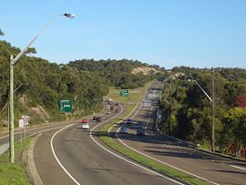
Heathcote National Park is a protected national park that is located in the southern area of Sydney, New South Wales in eastern Australia, and is situated on Dharawal country. The 2,679-hectare (6,620-acre) national park is situated approximately 35 kilometres (22 mi) southwest of the Sydney central business district, west of the Illawarra railway line, the Princes Highway and Motorway, and the suburbs of Heathcote and Waterfall.

<span class="mw-page-title-main">Sutherland, New South Wales</span> City in New South Wales, Australia

Sutherland is a city in southern Sydney, in the state of New South Wales, Australia. Sutherland is located 26 kilometres south of the Sydney central business district and is the administrative centre for the local government area of the Sutherland Shire.

<span class="mw-page-title-main">Eastern Suburbs & Illawarra Line</span> Rail service in Sydney, New South Wales,Australia

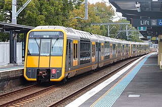
The Eastern Suburbs & Illawarra Line is a commuter railway line on the Sydney Trains network in the eastern and southern suburbs of Sydney. The line was constructed in the 1880s to Wollongong to take advantage of agricultural and mining potentials in the Illawarra area. In March 1926, it became the first railway in New South Wales to run electric train services.

<span class="mw-page-title-main">Sutherland Shire</span> Local government area in New South Wales, Australia

Sutherland Shire is a local government area in the southern region of Sydney, in the state of New South Wales, Australia. The Sutherland Shire is located just south of the Sydney CBD, and comprises an area of 370 square kilometres (140 sq mi) and as at the 2016 census and has an estimated population of 218,464. The Sutherland Shire is colloquially known as "The Shire" which has been featured in several reality television series.

<span class="mw-page-title-main">Yarrawarrah</span> Suburb of Sydney, New South Wales, Australia

Yarrawarrah is a suburb in southern Sydney, in the state of New South Wales, Australia 32 kilometres south of the Sydney central business district, in the local government area of the Sutherland Shire.

<span class="mw-page-title-main">South Coast railway line, New South Wales</span> Railway line in New South Wales, Australia

The South Coast Railway is a commuter and goods railway line from Sydney to Wollongong and Bomaderry in New South Wales, Australia. Beginning at the Illawarra Junction, the line services the Illawarra and South Coast regions of New South Wales.

<span class="mw-page-title-main">Loftus railway station, Sydney</span> Railway station in Sydney, New South Wales, Australia

Loftus railway station is located on the Illawarra line, serving the Sydney suburb of Loftus. It is served by Sydney Trains T4 line services and limited NSW TrainLink South Coast line services.

<span class="mw-page-title-main">South Coast Line</span> Rail service in New South Wales, Australia

The South Coast Line (SCO) is an intercity rail service operated by NSW TrainLink that services the Illawarra region of New South Wales, Australia. The service runs from Central, and runs the entire length of the eponymous South Coast railway line to Bomaderry. The service also runs along the Eastern Suburbs railway line at peak hours and the Port Kembla railway line to Port Kembla. It is operated with NSW TrainLink H sets and Sydney Trains T sets, with Endeavour railcars operating the service on the non-electrified line between Kiama and Bomaderry.

<span class="mw-page-title-main">Barden Ridge, New South Wales</span> Suburb of Sydney, New South Wales, Australia

Barden Ridge is a suburb in southern Sydney, in the state of New South Wales, Australia. Barden Ridge is located 29 kilometres south of the Sydney central business district in the local government area of the Sutherland Shire. Barden Ridge is colloquially known to locals as 'The Ridge'.

<span class="mw-page-title-main">Woronora</span> Suburb of Sydney, New South Wales, Australia

Woronora is a suburb in southern Sydney, in the state of New South Wales, Australia. Woronora is located 27 kilometres south of the Sydney central business district, in the local government area of the Sutherland Shire. Woronora Heights is a separate suburb, to the south-west.

<span class="mw-page-title-main">Loftus, New South Wales</span> Suburb of Sydney, New South Wales, Australia

Loftus is a suburb, in southern Sydney, in the state of New South Wales, Australia. Loftus is 29 kilometres south of the Sydney central business district, in the local government area of the Sutherland Shire.

<span class="mw-page-title-main">Hacking River</span> River in Sydney, New South Wales, Australia

The Hacking River is a watercourse that is located in the Southern Sydney region of New South Wales in Australia. For thousands of years traditional owners called the river Deeban, however the colonial settlers renamed the river after Henry Hacking, a British seaman who killed Pemulwuy and was a pilot at Port Jackson in colonial New South Wales.

<span class="mw-page-title-main">Engadine, New South Wales</span> Suburb of Sydney, New South Wales, Australia

Engadine is a suburb in southern Sydney, in the state of New South Wales, Australia. Engadine is located 33 kilometres (21 mi) south of the Sydney central business district, in the local government area of the Sutherland Shire.

<span class="mw-page-title-main">Bardwell Park, New South Wales</span> Suburb of Sydney, New South Wales, Australia

Bardwell Park is a suburb in southern Sydney, in the state of New South Wales, Australia. The suburb is located 12 kilometres south-west of the Sydney central business district and is part of the St George area. Bardwell Park is in the local government area of the Bayside Council. Bardwell Valley is a separate suburb, to the east.

<span class="mw-page-title-main">Heathcote, New South Wales</span> Suburb of Sydney, New South Wales, Australia

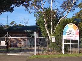
Heathcote is a suburb of Sydney in the state of New South Wales, Australia. The suburb is located 36 km south of the Sydney central business district in the Sutherland Shire of Southern Sydney. Heathcote is bordered by Engadine to the north and Waterfall to the south. It is bounded by The Royal National Park to the east, and Heathcote National Park to the west.

<span class="mw-page-title-main">Sutherland railway station</span> Railway station in Sydney, New South Wales, Australia

Sutherland railway station is located on the Illawarra line, serving the Sydney suburb of Sutherland. It is served by Sydney Trains T4 line services and NSW TrainLink South Coast line services.

<span class="mw-page-title-main">Helensburgh railway station</span> Railway station in New South Wales, Australia

Helensburgh railway station is a heritage-listed railway station located on the South Coast railway line in New South Wales, Australia. It serves the town of Helensburgh. It was added to the New South Wales State Heritage Register on 2 April 1999.

<span class="mw-page-title-main">Woronora River</span> River in New South Wales

The Woronora River is a perennial river of the Sydney Basin, located in the Sutherland Shire local government area of Greater Metropolitan Sydney, approximately 22 kilometres (14 mi) south of the Sydney central business district, in New South Wales, Australia.

<span class="mw-page-title-main">Helensburgh, New South Wales</span> Suburb of Sydney, New South Wales, Australia

Helensburgh is a small town, located 45 kilometres (28 mi) south of Sydney and 35 kilometres (22 mi) north of Wollongong and north and above the Illawarra escarpment and region. Helensburgh is in the Wollongong City Council local government area. It is surrounded by bushland reserves adjacent to the southern end of the Royal National Park and Garawarra State Conservation Area and the Woronora reservoir water catchment is to its west.

Heathcote Hall is a heritage-listed private residence at 1-21 Dillwynnia Grove, Heathcote, Sutherland Shire, New South Wales, Australia. It was designed by Thomas Rowe and built by Abel Harber. It is also known as Heathcote Hall and Grounds; and Bottle Forest. The property is privately owned. It was added to the New South Wales State Heritage Register on 2 April 1999.

References

  1. %22%5Bhttps://abs.gov.au/census/find-census-data/quickstats/2021/SAL14200%20Australian%20Bureau%20of%20Statistics%5D
  2. History of Sutherland Shire Placenames
  3. "War on Road Deaths in New Driving Experiment", The Sydney Morning Herald, p. 13, 26 August 1973, retrieved 11 May 2014
  4. "newspaper article", New Straits Times, pp. B21, 1 February 2003, retrieved 11 May 2014
  5. "Woronora Dam". New South Wales State Heritage Register . Department of Planning & Environment. H01378. Retrieved 18 May 2018. CC BY icon.svg Text is licensed by State of New South Wales (Department of Planning and Environment) under CC-BY 4.0 licence .
  6. Australian Bureau of Statistics (27 June 2017). "Waterfall (State Suburb)". 2016 Census QuickStats. Retrieved 16 May 2018. OOjs UI icon edit-ltr-progressive.svg

34°08′S151°00′E / 34.133°S 151.000°E / -34.133; 151.000

2021 Census