Watervliet, Michigan | |
---|---|
Coordinates: 42°11′11″N86°15′39″W / 42.18639°N 86.26083°W | |
Country | United States |
State | Michigan |
County | Berrien |
Government | |
• Mayor | Deah Muth [1] |
Area | |
• Total | 1.21 sq mi (3.14 km2) |
• Land | 1.18 sq mi (3.06 km2) |
• Water | 0.03 sq mi (0.09 km2) |
Elevation | 646 ft (197 m) |
Population (2020) | |
• Total | 1,669 |
• Density | 1,414.41/sq mi (546.10/km2) |
Time zone | UTC-5 (Eastern (EST)) |
• Summer (DST) | UTC-4 (EDT) |
ZIP code(s) | 49098 |
Area code | 269 |
FIPS code | 26-84500 [3] |
GNIS feature ID | 1615862 [4] |
Website | www |
Watervliet is a city in Berrien County in the U.S. state of Michigan. Located in the northeastern part of the county, the population was 1,735 at the 2010 census, down from 1,843 at the 2000 census. Mostly a rural farming community, the name comes from the Dutch for "where the waters meet." The city is surrounded by Watervliet Charter Township but is administered autonomously.
According to the United States Census Bureau, the city has a total area of 1.23 square miles (3.19 km2), of which 1.19 square miles (3.08 km2) is land and 0.04 square miles (0.10 km2) is water. [5]
In 1905, John Olsen and Maud Nelson moved here where they established a women's baseball team. Both of them had experience in the game. The "Cherokee Indian Baseball Team" set out in its Pullman car in the same year complete with an electric light facility, a grand stand and a 12 by 1200 foot fence. Nelson who was born in Italy was on the team. She was billed by her husband, Olsen, as the undisputed women's champion pitcher of the world. [6]
Census | Pop. | Note | %± |
---|---|---|---|
1880 | 179 | — | |
1900 | 717 | — | |
1910 | 728 | 1.5% | |
1920 | 1,073 | 47.4% | |
1930 | 1,207 | 12.5% | |
1940 | 1,193 | −1.2% | |
1950 | 1,327 | 11.2% | |
1960 | 1,818 | 37.0% | |
1970 | 2,059 | 13.3% | |
1980 | 1,867 | −9.3% | |
1990 | 1,867 | 0.0% | |
2000 | 1,843 | −1.3% | |
2010 | 1,735 | −5.9% | |
2020 | 1,669 | −3.8% | |
U.S. Decennial Census [7] |
As of the census [8] of 2010, there were 1,735 people, 677 households, and 448 families living in the city. The population density was 1,458.0 inhabitants per square mile (562.9/km2). There were 752 housing units at an average density of 631.9 per square mile (244.0/km2). The racial makeup of the city was 94.3% White, 1.0% African American, 0.8% Native American, 0.2% Asian, 1.0% from other races, and 2.7% from two or more races. Hispanic or Latino of any race were 3.9% of the population.
There were 677 households, of which 38.1% had children under the age of 18 living with them, 43.7% were married couples living together, 14.8% had a female householder with no husband present, 7.7% had a male householder with no wife present, and 33.8% were non-families. 28.7% of all households were made up of individuals, and 13.5% had someone living alone who was 65 years of age or older. The average household size was 2.55 and the average family size was 3.11.
The median age in the city was 35.8 years. 27.9% of residents were under the age of 18; 8.2% were between the ages of 18 and 24; 26.1% were from 25 to 44; 26.2% were from 45 to 64; and 11.6% were 65 years of age or older. The gender makeup of the city was 47.9% male and 52.1% female.
As of the census [3] of 2000, there were 1,843 people, 719 households, and 473 families living in the city. The population density was 1,495.9 inhabitants per square mile (577.6/km2). There were 760 housing units at an average density of 616.9 per square mile (238.2/km2). The racial makeup of the city was 97.40% White, 0.33% African American, 0.22% Native American, 0.49% Asian, 0.38% from other races, and 1.19% from two or more races. Hispanic or Latino of any race were 1.09% of the population.
There were 719 households, out of which 36.0% had children under the age of 18 living with them, 44.6% were married couples living together, 15.9% had a female householder with no husband present, and 34.2% were non-families. 28.5% of all households were made up of individuals, and 16.0% had someone living alone who was 65 years of age or older. The average household size was 2.55 and the average family size was 3.09.
In the city, the population was spread out, with 29.0% under the age of 18, 8.0% from 18 to 24, 30.3% from 25 to 44, 19.2% from 45 to 64, and 13.6% who were 65 years of age or older. The median age was 35 years. For every 100 females, there were 88.8 males. For every 100 females age 18 and over, there were 83.6 males.
The median income for a household in the city was $38,681, and the median income for a family was $42,391. Males had a median income of $37,500 versus $21,250 for females. The per capita income for the city was $16,691. About 3.8% of families and 6.9% of the population were below the poverty line, including 6.9% of those under age 18 and 11.5% of those age 65 or over.
Watervliet is home to six schools and the Watervliet School District. The six schools are as follows:
Ford City is a census-designated place (CDP) in Kern County, California, United States. Ford City is located 1 mile (1.61 km) north of Taft, at an elevation of 892 feet (272 m). The population was 4,348 at the 2020 census, up from 4,278 at the 2010 census. It is immediately north of Taft, between the huge Midway-Sunset Oil Field to the southwest, and the almost exhausted Buena Vista Oil Field to the northeast. State Route 119 passes east of town from its junction with SR 33 to the south.
Eagle is a city in Ada County, Idaho, United States, 10 miles (16 km) northwest of Boise. The population was 30,346 at the 2020 census.
Middleton is a city in Canyon County, Idaho, United States. The population amounted to 9,091 at the 2021 census estimate, up from 5,524 at the 2010 census and 2,978 in 2000. It is part of the Boise City–Nampa, Idaho Metropolitan Statistical Area.
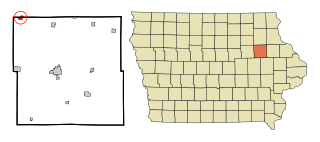
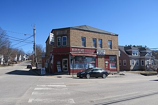
Fairbank is a city in Buchanan and Fayette counties in the U.S. state of Iowa. The population was 1,111 at the time of the 2020 census.
Deerfield is a city in Kearny County, Kansas, United States. As of the 2020 census, the population of the city was 711. It is located along Highway 50.
Sabattus is a town in Androscoggin County, Maine, United States. The population was 5,044 at the 2020 census. It is included in both the Lewiston-Auburn, Maine Metropolitan Statistical Area and the Lewiston-Auburn, Maine Metropolitan New England City and Town Area. The town was formerly known as "Webster", and changed its name to "Sabattus" in 1971, in honor of a former Anasagunticook Indian chief. The village of Sabattus is in the northwestern corner of the town, at the outlet of Sabattus Pond.
Coloma Charter Township is a charter township of Berrien County in the U.S. state of Michigan. The population was 5,020 at the 2010 census. The city of Coloma lies within the township.
Watervliet Charter Township is a charter township of Berrien County in the U.S. state of Michigan. The population was 3,102 at the 2010 census.
Olivet is a city in Eaton County in the U.S. state of Michigan. The population was 1,605 at the 2010 census. Olivet College is located in the city.
Sylvan Lake is a city in Oakland County in the U.S. state of Michigan. A northern suburb of Detroit, Sylvan Lake is located roughly 26 miles (41.8 km) from downtown Detroit, and borders Pontiac to the east. As of the 2010 census, the city had a population of 1,720. With a land area of 0.51 square miles (1.32 km2), Sylvan Lake is the fourth-smallest city by land area in the state after Clarkston, Petersburg, and neighboring Keego Harbor.
Lake Winnebago is a city in Cass County, Missouri, United States. The population was 1,131 at the 2010 census. It is part of the Kansas City metropolitan area.
Grandview is a city in Jackson County, Missouri, United States. The population was 24,475 at the 2010 census. It is part of the Kansas City metropolitan area.
Unionville is a city in Putnam County, Missouri, United States. The population was 1,735 at the 2020 census. It is the county seat of Putnam County.
Chappell is a city and county seat of Deuel County, Nebraska, United States. The population was 929 at the 2010 census.
Buxton is a city in Traill County, North Dakota, United States. The population was 348 at the 2020 census. Buxton was founded in 1880. Today, it has become a bedroom community for the nearby Greater Grand Forks metropolitan area.
Sunnyside is a former census-designated place in Clackamas County in the U.S. state of Oregon. Located in the Portland metropolitan area along Interstate 205, the population was 6,791 at the 2000 census. The area was not recorded as a distinct place for the 2010 census.
King City is a city in Washington County, Oregon, United States. Its name was picked arbitrarily by the Tualatin Development Company, Inc., which used a royalty theme in naming the city streets. The population was 3,111 at the 2010 census. Fire protection and EMS services are provided through Tualatin Valley Fire and Rescue.
Northwest St. Louis is an unorganized territory in Saint Louis County, Minnesota, United States. The population was 306 at the 2000 census.
Clearwater is a city in Stearns and Wright counties in the U.S. state of Minnesota. The population was 1,922 at the 2020 census. Most of the city lies within Wright County.
Mogadore is a village in Portage and Summit counties in the U.S. state of Ohio. The population was 3,811 at the 2020 census. A suburb of Akron, it is part of the Akron metropolitan area.