Waumandee, Wisconsin

Last updated

Waumandee, Wisconsin
WIMap-doton-Waumandee.png
Location of Waumandee, Wisconsin
Coordinates: 44°16′56″N91°42′51″W / 44.28222°N 91.71417°W / 44.28222; -91.71417
Country Flag of the United States.svg  United States
State Flag of Wisconsin.svg  Wisconsin
County Buffalo
Area
  Total43.8 sq mi (113.4 km2)
  Land43.5 sq mi (112.7 km2)
  Water0.3 sq mi (0.7 km2)
Elevation
[1]
823 ft (251 m)
Population
 (2010)
  Total472
  Density11/sq mi (4.2/km2)
Time zone UTC-6 (Central (CST))
  Summer (DST) UTC-5 (CDT)
Area code 608
FIPS code 55-84325 [2]
GNIS feature ID1584373 [1]

Waumandee is a town in Buffalo County in the U.S. state of Wisconsin. The population was 472 at the 2010 census. [3] The census-designated place of Waumandee is located in the town. The ghost town that was Anchorage is located in the town.

Contents

Etymology

The name Waumandee is an anglicization of the Dakota word waŋbdi, meaning "war eagle." [4] The town was most likely named for a Santee Dakota village leader known as both "War Eagle" and "Black Dog" who signed the First Treaty of Prairie du Chien in 1825 under the name "Wa-man-de-tun-ka." [5]

Geography

Waumandee is located south of the center of Buffalo County. According to the United States Census Bureau, the town has a total area of 43.8 square miles (113.4 km2), of which 43.5 square miles (112.7 km2) is land and 0.27 square miles (0.7 km2), or 0.58%, is water. [3]

Demographics

As of the census [2] of 2000, there were 515 people, 181 households, and 131 families residing in the town. The population density was 11.8 people per square mile (4.5/km2). There were 198 housing units at an average density of 4.5 per square mile (1.7/km2). The racial makeup of the town was 98.64% White, 0.78% Native American, 0.58% from other races. Hispanic or Latino of any race were 0.97% of the population.

There were 181 households, out of which 38.1% had children under the age of 18 living with them, 64.1% were married couples living together, 5.5% had a female householder with no husband present, and 27.1% were non-families. 23.8% of all households were made up of individuals, and 11.6% had someone living alone who was 65 years of age or older. The average household size was 2.85 and the average family size was 3.36.

In the town, the population was spread out, with 30.3% under the age of 18, 8.3% from 18 to 24, 28.5% from 25 to 44, 19.8% from 45 to 64, and 13.0% who were 65 years of age or older. The median age was 35 years. For every 100 females, there were 101.2 males. For every 100 females age 18 and over, there were 100.6 males.

The median income for a household in the town was $38,375, and the median income for a family was $48,250. Males had a median income of $26,250 versus $21,964 for females. The per capita income for the town was $17,214. About 3.0% of families and 5.8% of the population were below the poverty line, including 10.5% of those under age 18 and 3.3% of those age 65 or over.

Buildings and structures

Notable people

Related Research Articles

<span class="mw-page-title-main">Thaxton, Mississippi</span> Town in Mississippi, United States

Thaxton is a town in Pontotoc County, Mississippi, United States. The population was 643 at the 2010 census.

<span class="mw-page-title-main">Buffalo, North Dakota</span> City in North Dakota, United States

Buffalo is a city in Cass County, North Dakota, United States. The population was 195 at the 2020 census. Buffalo was founded in 1878.

<span class="mw-page-title-main">Buffalo Gap, South Dakota</span> Town in South Dakota, United States

Buffalo Gap is a town in Custer County, South Dakota, United States. The population was 131 at the 2020 census.

<span class="mw-page-title-main">Dimock, South Dakota</span> Town in South Dakota, United States

Dimock is a town in Hutchinson County, South Dakota, United States. The population was 137 at the 2020 census.

<span class="mw-page-title-main">Buffalo City, Wisconsin</span> City in Wisconsin, United States

Buffalo City is a city in Buffalo County in the U.S. state of Wisconsin. The population was 1,023 at the 2010 census.

<span class="mw-page-title-main">Canton, Wisconsin</span> Town in Wisconsin, United States

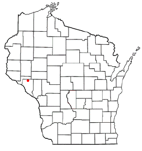
Canton is a town in Buffalo County in the U.S. state of Wisconsin. The population was 305 at the 2010 census. The ghost town of Springdale was located in the town.

<span class="mw-page-title-main">Fountain City, Wisconsin</span> City in Wisconsin, United States

Fountain City is a small city bordering the Mississippi River in Buffalo County, Wisconsin, United States.

<span class="mw-page-title-main">Glencoe, Wisconsin</span> Town in Wisconsin, United States

Glencoe is a town in Buffalo County in the U.S. state of Wisconsin. The population was 485 at the 2010 census. The unincorporated community of Glencoe is located in the town.

<span class="mw-page-title-main">Lincoln, Buffalo County, Wisconsin</span> Town in Wisconsin, United States

Lincoln is a town in Buffalo County in the U.S. state of Wisconsin. The population was 162 at the 2010 census. The unincorporated communities of Cream and Praag are located in the town.

<span class="mw-page-title-main">Modena, Wisconsin</span> Town in Wisconsin, United States

Modena is a town in Buffalo County in the U.S. state of Wisconsin. The population was 354 at the 2010 census. The unincorporated community of Urne is also located partially in the town.

<span class="mw-page-title-main">Montana, Wisconsin</span> Town in Wisconsin, United States

Montana is a town in Buffalo County in the U.S. state of Wisconsin. The population was 284 at the 2010 census. The community of Montana is located in the town.

<span class="mw-page-title-main">Naples, Wisconsin</span> Town in Wisconsin, United States

Naples is a town in Buffalo County in the U.S. state of Wisconsin. The population was 697 at the 2020 census.

<span class="mw-page-title-main">Levis, Wisconsin</span> Town in Wisconsin, United States

Levis is a town in Clark County in the U.S. state of Wisconsin. The population was 504 at the 2000 census.

<span class="mw-page-title-main">Price, Wisconsin</span> Town in Wisconsin, United States

Price is a town in Langlade County, Wisconsin, United States. The population was 228 at the 2010 census. The unincorporated communities of Bryant and Sherry Junction and the ghost town of Kent are located in the town. The Bryant post office covers the entire town.

<span class="mw-page-title-main">Osseo, Wisconsin</span> City in Wisconsin, United States

Osseo is a city located in Trempealeau County, Wisconsin, at the confluence of the North and South Forks of the Buffalo River. The population was 1,701 at the 2010 census.

<span class="mw-page-title-main">Dakota, Wisconsin</span> Town in Wisconsin, United States

Dakota is a town, as well as an unincorporated community in Waushara County, Wisconsin, United States. The town took its name from the community of the same name, which was platted for the community's first postmaster, Chapin M. Seeley, in 1853. It was likely named for the Dakota Territory which was in the news at the time. The unincorporated community of Bannerman is also located in the town. Bannerman was originally named Bannerman Junction in 1901 as a stop on the Chicago & Northwestern Railroad. It was named for William and John Bannerman, two Scottish men who owned the area's granite company.

Alma is a town in Buffalo County in the U.S. state of Wisconsin. The population was 297 at the 2010 census. The city of Alma is located along the western town line. The unincorporated community of Tell is located in the town.

Mondovi is a town in Buffalo County in the U.S. state of Wisconsin. The population was 469 at the 2010 census. The city of Mondovi is located mostly within the town.

Nelson is a town in Buffalo County in the U.S. state of Wisconsin. The population was 571 at the 2010 census. The village of Nelson is located within the town. The unincorporated communities of Misha Mokwa and Trevino are located in the town. The unincorporated community of Urne is located partially in the town.

Colfax is a town in Dunn County, Wisconsin, United States. The population was 909 at the 2000 census.

References

  1. 1 2 "US Board on Geographic Names". United States Geological Survey. October 25, 2007. Retrieved January 31, 2008.
  2. 1 2 "U.S. Census website". United States Census Bureau . Retrieved January 31, 2008.
  3. 1 2 "Geographic Identifiers: 2010 Demographic Profile Data (G001): Waumandee town, Buffalo County, Wisconsin". U.S. Census Bureau, American Factfinder. Archived from the original on February 12, 2020. Retrieved May 21, 2014.
  4. Knudson, Nicolette; Snow, Jody; Canku, Clifford (2011). Beginning Dakota - Tokaheya Dakota Iapi Kin: 24 Language and Grammar Lessons with Glossaries. Minnesota Historical Society. p. 111. ISBN   978-0-87351-780-5.
  5. Vogel, Virgil J. (1991). Indian names on Wisconsin's map. Madison, Wis. : University of Wisconsin Press. ISBN   978-0-299-12980-4 . Retrieved July 27, 2022.

44°18′11″N91°42′21″W / 44.30306°N 91.70583°W / 44.30306; -91.70583