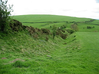
Offa's Dyke is a large linear earthwork that roughly follows the current border between England and Wales. The structure is named after Offa, the Anglo-Saxon king of Mercia from AD 757 until 796, who is traditionally believed to have ordered its construction. Although its precise original purpose is debated, it delineated the border between Anglian Mercia and the Welsh kingdom of Powys.

A levee, dike, dyke, embankment, floodbank or stopbank is an elongated naturally occurring ridge or artificially constructed fill or wall, which regulates water levels. It is usually earthen and often parallel to the course of a river in its floodplain or along low-lying coastlines.

The Delta Works is a series of construction projects in the southwest of the Netherlands to protect a large area of land around the Rhine-Meuse-Scheldt delta from the sea. The works consist of dams, sluices, locks, dykes, levees, and storm surge barriers located in the provinces of South Holland and Zeeland.

Beemster[ˈbeːmstər](listen) is a municipality in the Netherlands, in the province of North Holland. Also, the Beemster is the first so-called polder in the Netherlands that was reclaimed from a lake, the water being extracted out of the lake by windmills. The Beemster Polder was dried during the period 1609 through 1612. It has preserved intact its well-ordered landscape of fields, roads, canals, dykes and settlements, laid out in accordance with classical and Renaissance planning principles. A grid of canals parallels the grid of roads in the Beemster. The grids are offset: the larger feeder canals are offset by approximately one kilometer from the larger roads.

Flamborough Head is a promontory, 8 miles (13 km) long on the Yorkshire coast of England, between the Filey and Bridlington bays of the North Sea. It is a chalk headland, with sheer white cliffs. The cliff top has two standing lighthouse towers, the oldest dating from 1669 and Flamborough Head Lighthouse built in 1806. The older lighthouse was designated a Grade II* listed building in 1952 and is now recorded in the National Heritage List for England, maintained by Historic England. The cliffs provide nesting sites for many thousands of seabirds, and are of international significance for their geology.
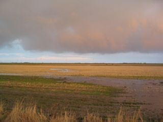
A koog or groden is a type of polder found on the North Sea coast of Germany that is established by the construction of dykes enclosing the land which is then drained to form marshland. This type of land reclamation is also used along rivers. In general, a koog is protected by embankments known as dykes (Deiche).

Land reclamation, usually known as reclamation, and also known as land fill, is the process of creating new land from oceans, riverbeds, or lake beds. The land reclaimed is known as reclamation ground or land fill.

The Long Mynd is a heath and moorland plateau that forms part of the Shropshire Hills in Shropshire, England. The high ground, which is designated as an Area of Outstanding Natural Beauty, lies between the Stiperstones range to the west and the Stretton Hills and Wenlock Edge to the east. Much of it is owned and managed by the National Trust.
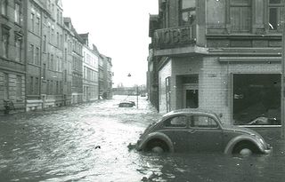
The North Sea flood of 1962 was a natural disaster affecting mainly the coastal regions of Germany and in particular the city of Hamburg in the night from 16 February to 17 February 1962. In total, the homes of about 60,000 people were destroyed, and the death toll amounted to 315 in Hamburg. In addition, three people were killed in the United Kingdom by high winds, which damaged around 175,000 houses in the worst affected city, Sheffield.
Marina South is a planning area located within the Central Area of the Central Region of Singapore. It is largely home to Gardens by the Bay as well as the Marina Barrage. The name has also been used to refer to the larger peninsula the planning area is situated on, which encompasses the planning areas of Straits View and a portion of the Downtown Core.

Malltraeth (origin: Mall is a small village in the southwest of Anglesey, in the community of Bodorgan. It is now at the end of a large bay, which used to extend much further inland, almost creating a second sea strait in the area.

Kalvebod Fælled, also known as Vestamager, takes up roughly one fourth of the island of Amager near Copenhagen, Denmark.
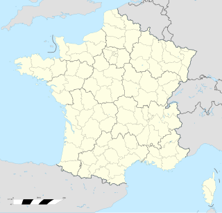
Ault is a commune in the Somme department in Hauts-de-France in northern France.
Baalhoek is a hamlet in the Dutch province of Zeeland. It is located in the municipality of Hulst, about 5 km east of Kloosterzande on the dyke of the Westerschelde.
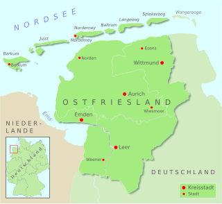
The Leybucht is the second largest bay in East Frisia in northwest Germany after the Dollart. The Jade Bight is larger than both, but belongs historically to Oldenburg.

Leybuchtpolder is part of the borough of Norden in East Frisia on Germany's North Sea coast and was an independent municipality until 1972. Leybuchtpolder is geologically the most recent of Norden's parishes and has 461 inhabitants. Between 1947 and 1950 the polder was finally reclaimed from the North Sea, when the almost 5 km long Störtebeker Dyke was completed. A monument stands on the spot where the dyke was closed. Administratively Leybuchtpolder is the second most recent parish after Tidofeld, which did not become a separate parish until 1996.

The Bay of Meldorf also called Meldorf Bay, is a bay on the coast of the North German state of Schleswig-Holstein, which forms part of the Heligoland Bight.
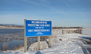
The Wellington Dyke is an agricultural dyke in Kings County, Nova Scotia protecting over 3,000 acres (12 km2) of farmland along the Canard River between the communities of Starr's Point and Canard in Nova Scotia, Canada. Built by local farmers, it was begun in 1817 and completed in 1825. Today the dyke is owned by the Department of Agriculture of Nova Scotia in partnership with the farmers of the Wellington Marsh Body.

The Marneslenk (Dutch), or Marneslinke (Frisian), or Marne estuary, was a former estuary in western Friesland south of Harlingen, now reclaimed to be farmland. It formed around the year 300 AD, when rising sea levels also enlarged the Almere lake to the southwest, and formed the Middelzee to the east. The Marneslenk had its mouth on the Vlie and stretched southeasterly to the area of Tirns and then headed east to the Middelzee. Between 1100 and 1300 AD the watercourse was reclaimed and turned into fields by the construction of dykes. One such dyke is the Pingjumer Gulden Halsband. The Bedelaarsvaart (Bidlersfeart) and Harnzerfeartis are what remains of this watercourse nowadays.


